Filters
Date Range
Types
Contacts
Categories
Tag Types
Tag Schemes
|
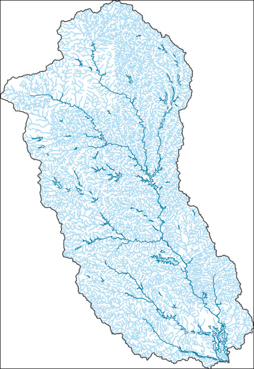
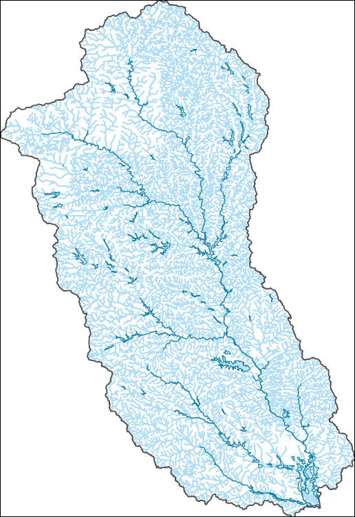
The National Hydrography Dataset (NHD) is a feature-based database that interconnects and uniquely identifies the stream segments or reaches that make up the nation's surface water drainage system. NHD data was originally developed at 1:100,000-scale and exists at that scale for the whole country. This high-resolution NHD, generally developed at 1:24,000/1:12,000 scale, adds detail to the original 1:100,000-scale NHD. (Data for Alaska, Puerto Rico and the Virgin Islands was developed at high-resolution, not 1:100,000 scale.) Local resolution NHD is being developed where partners and data exist. The NHD contains reach codes for networked features, flow direction, names, and centerline representations for areal water...
Tags: Administrative watershed units,
Administrative watershed units,
Area of Complex Channels,
Area to be submerged,
Basin, All tags...
Basin,
Bay/Inlet,
Bibb,
Boundaries,
Boundary,
Bridge,
Butts,
Canal/Ditch,
Clayton,
Coastline,
Connector,
Crawford,
Dam/Weir,
DeKalb,
Downloadable Data,
Drainage areas for surface water,
Drainageway,
Esri Shapefile nan,
Estuary,
Flow direction network,
Flume,
ForeShore,
Fulton,
GA,
Gaging Station,
Gate,
Georgia,
Gwinnett,
HU-8,
HU-8 Subbasin,
HU10,
HU12,
HU14,
HU16,
HU2,
HU4,
HU6,
HU8,
HU8_03070103,
HUC,
Hazard Zone,
Henry,
Houston,
Hydrographic,
Hydrography,
Hydrography,
Hydrography,
Hydrologic Unit Code,
Hydrologic Units,
Ice mass,
Inundation Area,
Jasper,
Jones,
Lamar,
Levee,
Line,
Lock Chamber,
Marsh,
Monroe,
National Hydrography Dataset (NHD),
National Hydrography Dataset (NHD) Best Resolution,
National Hydrography Dataset (NHD) Best Resolution,
Newton,
Nonearthen Shore,
Orthoimage,
Peach,
Playa,
Point,
PointEvent,
Pond,
Rapids,
Rapids,
Reach,
Reach code,
Reef,
Region,
Reservoir,
Rock,
Rockdale,
Sea/Ocean,
Shapefile,
Sink/Rise,
Sounding Datum Line,
Spalding,
Special Use Zone,
Special Use Zone Limit,
Spillway,
Stream,
Stream/River,
Sub-basin,
Sub-region,
Subbasin,
Submerged Stream,
Subregion,
Subwatershed,
Surface water systems,
Swamp,
Topographic,
Tunnel,
Twiggs,
US,
Underground Conduit,
United States,
Upson,
WBD,
WBD,
Wall,
Walton,
Wash,
Water Intake Outflow,
Waterfall,
Watershed,
Watershed Boundaries,
Watershed Boundary Dataset,
Watershed Boundary Dataset,
Well,
artificial path,
boundaries,
dams,
drainage systems and characteristics,
inlandWaters,
lakes,
ngda,
rivers, Fewer tags
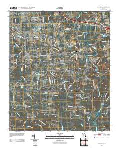
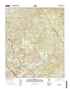
Layered GeoPDF 7.5 Minute Quadrangle Map. Layers of geospatial data include orthoimagery, roads, grids, geographic names, elevation contours, hydrography, and other selected map features.
Tags: 7.5 x 7.5 minute,
Downloadable Data,
EarthCover,
GeoPDF,
Georgia, All tags...
Imagery and Base Maps,
Map,
Newton,
Porterdale, GA,
Rockdale,
U.S. National Grid,
US,
US Topo,
US Topo Historical,
United States,
contour,
geographic names,
hydrography,
imageryBaseMapsEarthCover,
orthoimage,
topographic,
transportation, Fewer tags
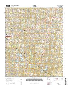
Layered GeoPDF 7.5 Minute Quadrangle Map. Layers of geospatial data include orthoimagery, roads, grids, geographic names, elevation contours, hydrography, and other selected map features.
Tags: 7.5 x 7.5 minute,
DeKalb,
Downloadable Data,
EarthCover,
GeoPDF, All tags...
Georgia,
Gwinnett,
Imagery and Base Maps,
Map,
Public Land Survey System,
Rockdale,
Snellville, GA,
U.S. National Grid,
US,
US Topo,
US Topo Historical,
United States,
boundary,
contour,
geographic names,
hydrography,
imageryBaseMapsEarthCover,
orthoimage,
structures,
topographic,
transportation,
woodland, Fewer tags
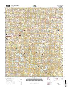
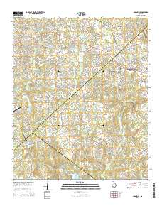
Layered geospatial PDF Map. Layers of geospatial data include orthoimagery, roads, grids, geographic names, elevation contours, hydrography, and other selected map features.
Tags: 7.5 x 7.5 minute,
DeKalb,
Downloadable Data,
EarthCover,
GeoPDF, All tags...
Georgia,
Gwinnett,
Imagery and Base Maps,
Map,
Public Land Survey System,
Rockdale,
Snellville, GA,
U.S. National Grid,
US,
US Topo,
US Topo Historical,
United States,
boundary,
contour,
geographic names,
hydrography,
imageryBaseMapsEarthCover,
orthoimage,
structures,
topographic,
transportation,
woodland, Fewer tags
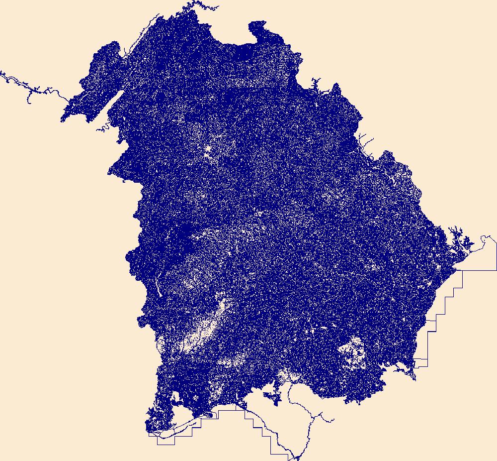
The National Hydrography Dataset (NHD) is a feature-based database that interconnects and uniquely identifies the stream segments or reaches that make up the nation's surface water drainage system. NHD data was originally developed at 1:100,000-scale and exists at that scale for the whole country. This high-resolution NHD, generally developed at 1:24,000/1:12,000 scale, adds detail to the original 1:100,000-scale NHD. (Data for Alaska, Puerto Rico and the Virgin Islands was developed at high-resolution, not 1:100,000 scale.) Local resolution NHD is being developed where partners and data exist. The NHD contains reach codes for networked features, flow direction, names, and centerline representations for areal water...
Tags: Administrative watershed units,
Administrative watershed units,
Appling,
Area of Complex Channels,
Area to be submerged, All tags...
Atkinson,
Bacon,
Baker,
Baldwin,
Banks,
Barrow,
Bartow,
Basin,
Basin,
Bay/Inlet,
Ben Hill,
Berrien,
Bibb,
Bleckley,
Boundaries,
Boundary,
Brantley,
Bridge,
Brooks,
Bryan,
Bulloch,
Burke,
Butts,
Calhoun,
Camden,
Canal/Ditch,
Candler,
Carroll,
Catoosa,
Charlton,
Chatham,
Chattahoochee,
Chattooga,
Cherokee,
Clarke,
Clay,
Clayton,
Clinch,
Coastline,
Cobb,
Coffee,
Colquitt,
Columbia,
Connector,
Cook,
Coweta,
Crawford,
Crisp,
Dade,
Dam/Weir,
Dawson,
DeKalb,
Decatur,
Dodge,
Dooly,
Dougherty,
Douglas,
Downloadable Data,
Drainage areas for surface water,
Drainageway,
Early,
Echols,
Effingham,
Elbert,
Emanuel,
Esri Shapefile nan,
Estuary,
Evans,
Fannin,
Fayette,
Flow direction network,
Floyd,
Flume,
ForeShore,
Forsyth,
Franklin,
Fulton,
GA,
Gaging Station,
Gate,
Georgia,
Gilmer,
Glascock,
Glynn,
Gordon,
Grady,
Greene,
Gwinnett,
HU10,
HU12,
HU14,
HU16,
HU2,
HU4,
HU6,
HU8,
HUC,
Habersham,
Hall,
Hancock,
Haralson,
Harris,
Hart,
Hazard Zone,
Heard,
Henry,
Houston,
Hydrographic,
Hydrography,
Hydrography,
Hydrography,
Hydrologic Unit Code,
Hydrologic Units,
Ice mass,
Inundation Area,
Irwin,
Jackson,
Jasper,
Jeff Davis,
Jefferson,
Jenkins,
Johnson,
Jones,
Lamar,
Lanier,
Laurens,
Lee,
Levee,
Liberty,
Lincoln,
Line,
Lock Chamber,
Long,
Lowndes,
Lumpkin,
Macon,
Madison,
Marion,
Marsh,
McDuffie,
McIntosh,
Meriwether,
Miller,
Mitchell,
Monroe,
Montgomery,
Morgan,
Murray,
Muscogee,
National Hydrography Dataset (NHD),
National Hydrography Dataset (NHD) Best Resolution,
National Hydrography Dataset (NHD) Best Resolution,
Newton,
Nonearthen Shore,
Oconee,
Oglethorpe,
Orthoimage,
Paulding,
Peach,
Pickens,
Pierce,
Pike,
Playa,
Point,
PointEvent,
Polk,
Pond,
Pulaski,
Putnam,
Quitman,
Rabun,
Randolph,
Rapids,
Rapids,
Reach,
Reach code,
Reef,
Region,
Reservoir,
Richmond,
Rock,
Rockdale,
Schley,
Screven,
Sea/Ocean,
Seminole,
Shapefile,
Sink/Rise,
Sounding Datum Line,
Spalding,
Special Use Zone,
Special Use Zone Limit,
Spillway,
State,
State,
State_Georgia,
Stephens,
Stewart,
Stream,
Stream/River,
Sub-basin,
Sub-region,
Subbasin,
Submerged Stream,
Subregion,
Subwatershed,
Sumter,
Surface water systems,
Swamp,
Talbot,
Taliaferro,
Tattnall,
Taylor,
Telfair,
Terrell,
Thomas,
Tift,
Toombs,
Topographic,
Towns,
Treutlen,
Troup,
Tunnel,
Turner,
Twiggs,
US,
Underground Conduit,
Union,
United States,
Upson,
WBD,
WBD,
Walker,
Wall,
Walton,
Ware,
Warren,
Wash,
Washington,
Water Intake Outflow,
Waterfall,
Watershed,
Watershed Boundaries,
Watershed Boundary Dataset,
Watershed Boundary Dataset,
Wayne,
Webster,
Well,
Wheeler,
White,
Whitfield,
Wilcox,
Wilkes,
Wilkinson,
Worth,
artificial path,
boundaries,
dams,
drainage systems and characteristics,
inlandWaters,
lakes,
ngda,
rivers, Fewer tags
Layered geospatial PDF Map. Layers of geospatial data include orthoimagery, roads, grids, geographic names, elevation contours, hydrography, and other selected map features.
Tags: 7.5 x 7.5 minute,
Clayton,
Downloadable Data,
EarthCover,
GeoPDF, All tags...
Georgia,
Henry,
Imagery and Base Maps,
Map,
Public Land Survey System,
Rockdale,
Stockbridge, GA,
U.S. National Grid,
US,
US Topo,
US Topo Historical,
United States,
boundary,
contour,
geographic names,
hydrography,
imageryBaseMapsEarthCover,
orthoimage,
structures,
topographic,
transportation,
woodland, Fewer tags
Layered GeoPDF 7.5 Minute Quadrangle Map. Layers of geospatial data include orthoimagery, roads, grids, geographic names, elevation contours, hydrography, and other selected map features.
Tags: 7.5 x 7.5 minute,
Downloadable Data,
EarthCover,
GeoPDF,
Georgia, All tags...
Gwinnett,
Imagery and Base Maps,
Loganville, GA,
Map,
Public Land Survey System,
Rockdale,
U.S. National Grid,
US,
US Topo,
US Topo Historical,
United States,
Walton,
boundary,
contour,
geographic names,
hydrography,
imageryBaseMapsEarthCover,
orthoimage,
structures,
topographic,
transportation,
woodland, Fewer tags
The Geographic Names Information System (GNIS) is the Federal standard for geographic nomenclature. The U.S. Geological Survey developed the GNIS for the U.S. Board on Geographic Names, a Federal inter-agency body chartered by public law to maintain uniform feature name usage throughout the Government and to promulgate standard names to the public. The GNIS is the official repository of domestic geographic names data; the official vehicle for geographic names use by all departments of the Federal Government; and the source for applying geographic names to Federal electronic and printed products of all types.
Tags: Antarctica,
Antarctica,
Appling,
Atkinson,
BGN, All tags...
Bacon,
Baker,
Baldwin,
Banks,
Barrow,
Bartow,
Ben Hill,
Berrien,
Bibb,
Bleckley,
Board on Geographic Names,
Borough,
Brantley,
Brooks,
Bryan,
Bulloch,
Burke,
Butts,
Calhoun,
Camden,
Candler,
Carroll,
Catoosa,
Census Area,
Charlton,
Chatham,
Chattahoochee,
Chattooga,
Cherokee,
Clarke,
Clay,
Clayton,
Clinch,
Cobb,
Coffee,
Colquitt,
Columbia,
Commonwealth,
Cook,
County,
Coweta,
Crawford,
Crisp,
Dade,
Dawson,
DeKalb,
Decatur,
District,
Dodge,
Dooly,
Dougherty,
Douglas,
Downloadable Data,
Early,
Echols,
Effingham,
Elbert,
Emanuel,
Esri File GeoDatabase 10,
Evans,
Fannin,
Fayette,
Feature class,
Feature coordinates,
Feature county,
Feature description,
Feature designation,
Feature history,
Feature indentification,
Feature name,
Feature state,
FileGDB,
Floyd,
Forsyth,
Franklin,
Fulton,
GA,
GNIS,
Geographic Names,
Geographic Names Full Model,
Geographic Names Information System,
Geographic feature,
Geographic name,
Geographical feature,
Geographical name,
Georgia,
Gilmer,
Glascock,
Glynn,
Gordon,
Grady,
Greene,
Gwinnett,
Habersham,
Hall,
Hancock,
Haralson,
Harris,
Hart,
Heard,
Henry,
Houston,
Irwin,
Jackson,
Jasper,
Jeff Davis,
Jefferson,
Jenkins,
Johnson,
Jones,
Lamar,
Lanier,
Laurens,
Lee,
Liberty,
Lincoln,
Long,
Lowndes,
Lumpkin,
Macon,
Madison,
Marion,
McDuffie,
McIntosh,
Meriwether,
Miller,
Mitchell,
Monroe,
Montgomery,
Morgan,
Municipio,
Murray,
Muscogee,
National Geographic Names Information System (GNIS),
National Geographic Names Information System (GNIS),
Newton,
Oconee,
Official feature name,
Oglethorpe,
Outlying Area,
Parish,
Paulding,
Peach,
Pickens,
Pierce,
Pike,
Place name,
Polk,
Populated Place,
Pulaski,
Putnam,
Quitman,
Rabun,
Randolph,
Richmond,
Rockdale,
Schley,
Screven,
Seminole,
Spalding,
State,
Stephens,
Stewart,
Sumter,
Talbot,
Taliaferro,
Tattnall,
Taylor,
Telfair,
Terrell,
Territories,
Territory,
Thomas,
Tift,
Toombs,
Topographic Map,
Towns,
Treutlen,
Troup,
Turner,
Twiggs,
U.S. Board on Geographic Names,
U.S. Geological Survey,
US,
USA,
USBGN,
USGS,
Union,
United States,
United States,
United States,
Upson,
Variant name,
Walker,
Walton,
Ware,
Warren,
Washington,
Wayne,
Webster,
Wheeler,
White,
Whitfield,
Wilcox,
Wilkes,
Wilkinson,
Worth,
antarctic,
database,
economy,
environment,
feature,
gazetteer,
geographic,
geographic names,
geographical,
geography,
geospatial,
imageryBaseMapsEarthCover,
inlandWaters,
location,
map,
name,
place,
placename,
society,
structure,
topographic map,
toponymy, Fewer tags

The Geographic Names Information System (GNIS) is the Federal standard for geographic nomenclature. The U.S. Geological Survey developed the GNIS for the U.S. Board on Geographic Names, a Federal inter-agency body chartered by public law to maintain uniform feature name usage throughout the Government and to promulgate standard names to the public. The GNIS is the official repository of domestic geographic names data; the official vehicle for geographic names use by all departments of the Federal Government; and the source for applying geographic names to Federal electronic and printed products of all types.
Tags: Antarctica,
Antarctica,
Appling,
Atkinson,
BGN, All tags...
Bacon,
Baker,
Baldwin,
Banks,
Barrow,
Bartow,
Ben Hill,
Berrien,
Bibb,
Bleckley,
Board on Geographic Names,
Borough,
Brantley,
Brooks,
Bryan,
Bulloch,
Burke,
Butts,
Calhoun,
Camden,
Candler,
Carroll,
Catoosa,
Census Area,
Charlton,
Chatham,
Chattahoochee,
Chattooga,
Cherokee,
Clarke,
Clay,
Clayton,
Clinch,
Cobb,
Coffee,
Colquitt,
Columbia,
Commonwealth,
Cook,
County,
Coweta,
Crawford,
Crisp,
Dade,
Dawson,
DeKalb,
Decatur,
District,
Dodge,
Dooly,
Dougherty,
Douglas,
Downloadable Data,
Early,
Echols,
Effingham,
Elbert,
Emanuel,
Evans,
Fannin,
Fayette,
Feature class,
Feature coordinates,
Feature county,
Feature description,
Feature designation,
Feature history,
Feature indentification,
Feature name,
Feature state,
Floyd,
Forsyth,
Franklin,
Fulton,
GA,
GNIS,
Geographic Names,
Geographic Names Domestic Names,
Geographic Names Information System,
Geographic feature,
Geographic name,
Geographical feature,
Geographical name,
Georgia,
Gilmer,
Glascock,
Glynn,
Gordon,
Grady,
Greene,
Gwinnett,
Habersham,
Hall,
Hancock,
Haralson,
Harris,
Hart,
Heard,
Henry,
Houston,
Irwin,
Jackson,
Jasper,
Jeff Davis,
Jefferson,
Jenkins,
Johnson,
Jones,
Lamar,
Lanier,
Laurens,
Lee,
Liberty,
Lincoln,
Long,
Lowndes,
Lumpkin,
Macon,
Madison,
Marion,
McDuffie,
McIntosh,
Meriwether,
Miller,
Mitchell,
Monroe,
Montgomery,
Morgan,
Municipio,
Murray,
Muscogee,
National Geographic Names Information System (GNIS),
National Geographic Names Information System (GNIS),
Newton,
Oconee,
Official feature name,
Oglethorpe,
Outlying Area,
Parish,
Paulding,
Peach,
Pickens,
Pierce,
Pike,
Place name,
Polk,
Populated Place,
Pulaski,
Putnam,
Quitman,
Rabun,
Randolph,
Richmond,
Rockdale,
Schley,
Screven,
Seminole,
Spalding,
State,
Stephens,
Stewart,
Sumter,
TXT (pipes),
Talbot,
Taliaferro,
Tattnall,
Taylor,
Telfair,
Terrell,
Territories,
Territory,
Thomas,
Tift,
Toombs,
Topographic Map,
Towns,
Treutlen,
Troup,
Turner,
Twiggs,
U.S. Board on Geographic Names,
U.S. Geological Survey,
US,
USA,
USBGN,
USGS,
UTF-8 Pipe Delimited Text File nan,
Union,
United States,
United States,
United States,
Upson,
Variant name,
Walker,
Walton,
Ware,
Warren,
Washington,
Wayne,
Webster,
Wheeler,
White,
Whitfield,
Wilcox,
Wilkes,
Wilkinson,
Worth,
antarctic,
database,
economy,
environment,
feature,
gazetteer,
geographic,
geographic names,
geographical,
geography,
geospatial,
imageryBaseMapsEarthCover,
inlandWaters,
location,
map,
name,
place,
placename,
society,
structure,
topographic map,
toponymy, Fewer tags
The National Hydrography Dataset (NHD) is a feature-based database that interconnects and uniquely identifies the stream segments or reaches that make up the nation's surface water drainage system. NHD data was originally developed at 1:100,000-scale and exists at that scale for the whole country. This high-resolution NHD, generally developed at 1:24,000/1:12,000 scale, adds detail to the original 1:100,000-scale NHD. (Data for Alaska, Puerto Rico and the Virgin Islands was developed at high-resolution, not 1:100,000 scale.) Local resolution NHD is being developed where partners and data exist. The NHD contains reach codes for networked features, flow direction, names, and centerline representations for areal water...
Tags: Administrative watershed units,
Administrative watershed units,
Appling,
Area of Complex Channels,
Area to be submerged, All tags...
Atkinson,
Bacon,
Baker,
Baldwin,
Banks,
Barrow,
Basin,
Basin,
Bay/Inlet,
Ben Hill,
Bibb,
Bleckley,
Boundaries,
Boundary,
Brantley,
Bridge,
Butts,
Camden,
Canal/Ditch,
Candler,
Charlton,
Clarke,
Clayton,
Clinch,
Coastline,
Coffee,
Columbia,
Connector,
Crawford,
Dam/Weir,
DeKalb,
Dodge,
Dooly,
Downloadable Data,
Drainage areas for surface water,
Drainageway,
Duval,
Emanuel,
Estuary,
Evans,
FL,
Florida,
Flow direction network,
Flume,
ForeShore,
Fulton,
GA,
Gaging Station,
Gate,
GeoPackage,
Georgia,
Glynn,
Greene,
Gwinnett,
HU-4,
HU-4 Subregion,
HU10,
HU12,
HU14,
HU16,
HU2,
HU4,
HU4_0307,
HU6,
HU8,
HUC,
Hall,
Hancock,
Hazard Zone,
Henry,
Houston,
Hydrographic,
Hydrography,
Hydrography,
Hydrography,
Hydrologic Unit Code,
Hydrologic Units,
Ice mass,
Inundation Area,
Irwin,
Jackson,
Jasper,
Jeff Davis,
Jefferson,
Johnson,
Jones,
Lamar,
Laurens,
Levee,
Liberty,
Line,
Lock Chamber,
Long,
Macon,
Madison,
Marsh,
McIntosh,
Monroe,
Montgomery,
Morgan,
Nassau,
National Hydrography Dataset (NHD),
National Hydrography Dataset (NHD) Best Resolution,
National Hydrography Dataset (NHD) Best Resolution,
Newton,
Nonearthen Shore,
Oconee,
Oglethorpe,
Open Geospatial Consortium GeoPackage 1.2,
Orthoimage,
Peach,
Pierce,
Playa,
Point,
PointEvent,
Pond,
Pulaski,
Putnam,
Rapids,
Rapids,
Reach,
Reach code,
Reef,
Region,
Reservoir,
Rock,
Rockdale,
Sea/Ocean,
Sink/Rise,
Sounding Datum Line,
Spalding,
Special Use Zone,
Special Use Zone Limit,
Spillway,
Stream,
Stream/River,
Sub-basin,
Sub-region,
Subbasin,
Submerged Stream,
Subregion,
Subwatershed,
Surface water systems,
Swamp,
Taliaferro,
Tattnall,
Telfair,
Toombs,
Topographic,
Treutlen,
Tunnel,
Twiggs,
US,
Underground Conduit,
Union,
United States,
Upson,
WBD,
WBD,
Wall,
Walton,
Ware,
Wash,
Washington,
Water Intake Outflow,
Waterfall,
Watershed,
Watershed Boundaries,
Watershed Boundary Dataset,
Watershed Boundary Dataset,
Wayne,
Well,
Wheeler,
Wilcox,
Wilkinson,
artificial path,
boundaries,
dams,
drainage systems and characteristics,
inlandWaters,
lakes,
ngda,
rivers, Fewer tags

A Turner Designs C3 submersible fluorometer was deployed in the Brandon Road Lock chamber (BRLD) near Rockdale, Illinois, to measure Rhodamine WT dye concentrations during a U.S. Geological Survey dye study conducted on October 20, 2015. The lock chamber at BRLD was dyed with 4 liters of Rhodamine WT dye during a routine filling procedure. Measurements of dye concentration profiles were collected at 15 stations in the lock chamber and capture the three-dimensional distribution of the dye in the chamber after filling, after the lock was emptied, and after a 17-minute flushing operation of the lock. A series of five taglines and rope and pulley systems were used to position the fluorometer at each station to avoid...
Types: Citation;
Tags: Brandon Road Lock and Dam,
Des Plaines River,
Dye,
Illinois,
Lock exchange, All tags...
Rockdale,
Tracer,
USGS Science Data Catalog (SDC),
Water Resources,
Will County, Fewer tags
Layered geospatial PDF Map. Layers of geospatial data include orthoimagery, roads, grids, geographic names, elevation contours, hydrography, and other selected map features.
Tags: 7.5 x 7.5 minute,
Downloadable Data,
EarthCover,
GeoPDF,
Georgia, All tags...
Imagery and Base Maps,
Map,
Newton,
Porterdale, GA,
Public Land Survey System,
Rockdale,
U.S. National Grid,
US,
US Topo,
US Topo Historical,
United States,
boundary,
contour,
geographic names,
hydrography,
imageryBaseMapsEarthCover,
orthoimage,
structures,
topographic,
transportation,
woodland, Fewer tags

Water velocities were measured in the lock chamber of Brandon Road Lock on the Des Plaines River at river mile 286 on December 10, 2014 using a Teledyne RDI Rio Grande 600 kHz acoustic Doppler current profiler (ADCP). The data were georeferenced with a differential GPS receiver with submeter accuracy. These velocity measurements were collected in support of the US Army Corps of Engineers Great Lakes and Mississippi River Interbasin Study (GLMRIS). Data were processed using the Velocity Mapping Toolbox (Parsons and others, 2013) to derive temporally- and spatially-averaged water velocity values. Parsons, D. R., Jackson, P. R., Czuba, J. A., Engel, F. L., Rhoads, B. L., Oberg, K. A., Best, J. L., Mueller, D. S.,...

An Insitu Level Troll 500 was deployed in the Brandon Road Lock chamber (BRLD) near Rockdale, Illinois between 12:09 Central Daylight Time (CDT) on October 19, 2015 and 14:57 CDT October 21, 2015 to monitor water-surface elevation in the lock chamber during a U.S. Geological Survey dye study conducted on October 20, 2015. The duration of the deployment included a day prior to and a day following the dye study to capture the lock operations leading up to and following the dye study. The instrument was deployed within conduit placed inside the ladder well near the 500-foot station on the right wall of the lock chamber (when looking downstream). At the time of deployment, the Level Troll was calibrated to the water...
Types: Citation;
Tags: Brandon Road Lock and Dam,
Des Plaines River,
Dye,
Illinois,
Lock exchange, All tags...
Rockdale,
Tracer,
USGS Science Data Catalog (SDC),
Water Resources,
Water surface elevation,
Will County, Fewer tags
USGS Historical Quadrangle in GeoPDF.
Tags: 7.5 x 7.5 minute,
Downloadable Data,
GeoPDF,
GeoTIFF,
Historical Topographic Maps, All tags...
Historical Topographic Maps 7.5 x 7.5 Minute Map Series,
Map,
Rockdale,
WI,
imageryBaseMapsEarthCover, Fewer tags
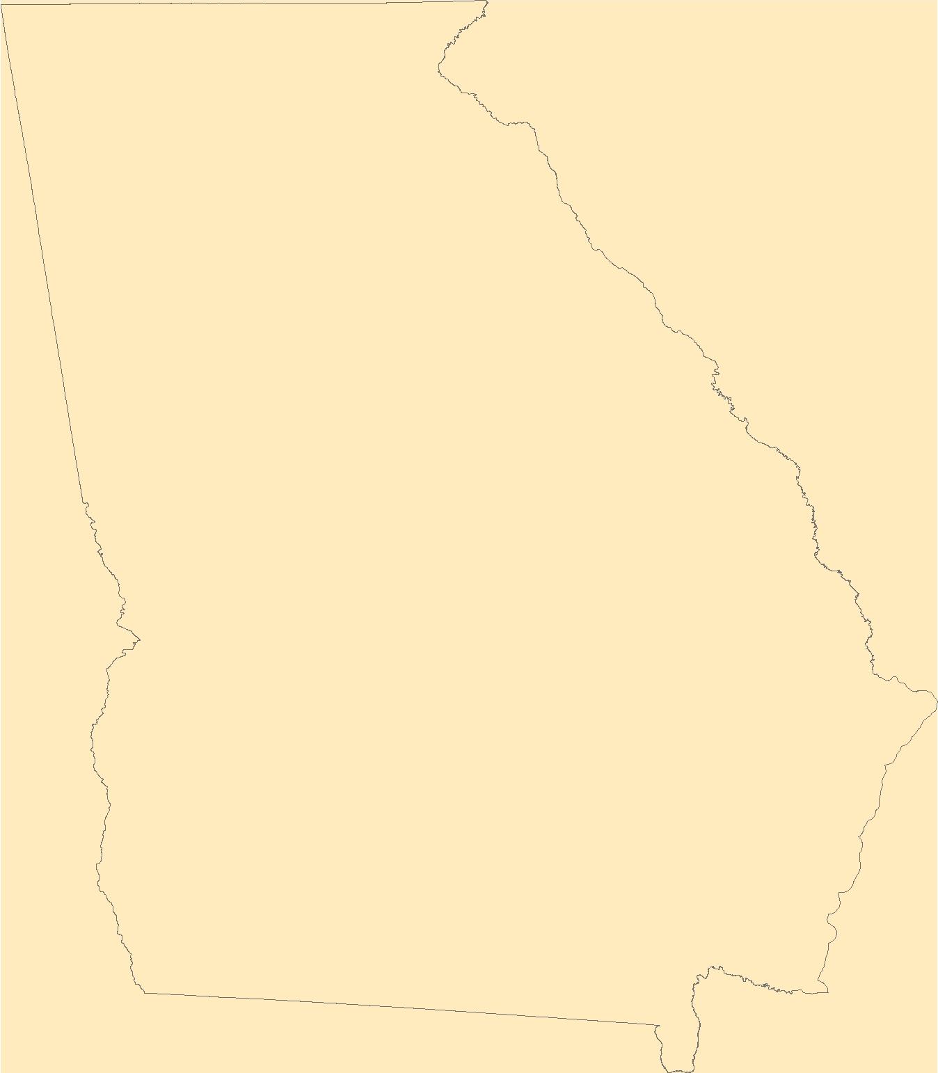
Geospatial data is comprised of government boundaries.
Types: Citation;
Tags: Appling,
Atkinson,
Bacon,
Baker,
Baldwin, All tags...
Banks,
Barrow,
Bartow,
Ben Hill,
Berrien,
Bibb,
Bleckley,
Boundaries,
Brantley,
Brooks,
Bryan,
Bulloch,
Burke,
Butts,
Calhoun,
Camden,
Candler,
Carroll,
Catoosa,
Charlton,
Chatham,
Chattahoochee,
Chattooga,
Cherokee,
Clarke,
Clay,
Clayton,
Clinch,
Cobb,
Coffee,
Colquitt,
Columbia,
Cook,
County or Equivalent,
Coweta,
Crawford,
Crisp,
Dade,
Dawson,
DeKalb,
Decatur,
Dodge,
Dooly,
Dougherty,
Douglas,
Downloadable Data,
Early,
Echols,
Effingham,
Elbert,
Emanuel,
Esri File GeoDatabase 10,
Evans,
Fannin,
Fayette,
FileGDB,
Floyd,
Forsyth,
Franklin,
Fulton,
GA,
Georgia,
Gilmer,
Glascock,
Glynn,
Gordon,
Grady,
Greene,
Gwinnett,
Habersham,
Hall,
Hancock,
Haralson,
Harris,
Hart,
Heard,
Henry,
Houston,
Incorporated Place,
Irwin,
Jackson,
Jasper,
Jeff Davis,
Jefferson,
Jenkins,
Johnson,
Jones,
Jurisdictional,
Lamar,
Lanier,
Laurens,
Lee,
Liberty,
Lincoln,
Long,
Lowndes,
Lumpkin,
Macon,
Madison,
Marion,
McDuffie,
McIntosh,
Meriwether,
Miller,
Minor Civil Division,
Mitchell,
Monroe,
Montgomery,
Morgan,
Murray,
Muscogee,
National Boundary Dataset (NBD),
National Boundary Dataset (NBD),
Native American Area,
Newton,
Oconee,
Oglethorpe,
PLSS First Division,
PLSS Special Survey,
PLSS Township,
Paulding,
Peach,
Pickens,
Pierce,
Pike,
Polk,
Public Land Survey System,
Pulaski,
Putnam,
Quitman,
Rabun,
Randolph,
Reserve,
Richmond,
Rockdale,
Schley,
Screven,
Seminole,
Spalding,
State,
State,
State or Territory,
Stephens,
Stewart,
Sumter,
Talbot,
Taliaferro,
Tattnall,
Taylor,
Telfair,
Terrell,
Thomas,
Tift,
Toombs,
Towns,
Treutlen,
Troup,
Turner,
Twiggs,
U.S. National Grid,
US,
Unincorporated Place,
Union,
United States,
Upson,
Walker,
Walton,
Ware,
Warren,
Washington,
Wayne,
Webster,
Wheeler,
White,
Whitfield,
Wilcox,
Wilkes,
Wilkinson,
Worth,
boundaries,
boundary,
cadastral surveys,
geographic names,
land ownership,
land use maps,
legal land descriptions,
political and administrative boundaries,
zoning maps, Fewer tags
The National Hydrography Dataset (NHD) is a feature-based database that interconnects and uniquely identifies the stream segments or reaches that make up the nation's surface water drainage system. NHD data was originally developed at 1:100,000-scale and exists at that scale for the whole country. This high-resolution NHD, generally developed at 1:24,000/1:12,000 scale, adds detail to the original 1:100,000-scale NHD. (Data for Alaska, Puerto Rico and the Virgin Islands was developed at high-resolution, not 1:100,000 scale.) Local resolution NHD is being developed where partners and data exist. The NHD contains reach codes for networked features, flow direction, names, and centerline representations for areal water...
Tags: Administrative watershed units,
Administrative watershed units,
Area of Complex Channels,
Area to be submerged,
Basin, All tags...
Basin,
Bay/Inlet,
Bibb,
Boundaries,
Boundary,
Bridge,
Butts,
Canal/Ditch,
Clayton,
Coastline,
Connector,
Crawford,
Dam/Weir,
DeKalb,
Downloadable Data,
Drainage areas for surface water,
Drainageway,
Esri File GeoDatabase 10,
Estuary,
FileGDB,
Flow direction network,
Flume,
ForeShore,
Fulton,
GA,
Gaging Station,
Gate,
Georgia,
Gwinnett,
HU-8,
HU-8 Subbasin,
HU10,
HU12,
HU14,
HU16,
HU2,
HU4,
HU6,
HU8,
HU8_03070103,
HUC,
Hazard Zone,
Henry,
Houston,
Hydrographic,
Hydrography,
Hydrography,
Hydrography,
Hydrologic Unit Code,
Hydrologic Units,
Ice mass,
Inundation Area,
Jasper,
Jones,
Lamar,
Levee,
Line,
Lock Chamber,
Marsh,
Monroe,
National Hydrography Dataset (NHD),
National Hydrography Dataset (NHD) Best Resolution,
National Hydrography Dataset (NHD) Best Resolution,
Newton,
Nonearthen Shore,
Orthoimage,
Peach,
Playa,
Point,
PointEvent,
Pond,
Rapids,
Rapids,
Reach,
Reach code,
Reef,
Region,
Reservoir,
Rock,
Rockdale,
Sea/Ocean,
Sink/Rise,
Sounding Datum Line,
Spalding,
Special Use Zone,
Special Use Zone Limit,
Spillway,
Stream,
Stream/River,
Sub-basin,
Sub-region,
Subbasin,
Submerged Stream,
Subregion,
Subwatershed,
Surface water systems,
Swamp,
Topographic,
Tunnel,
Twiggs,
US,
Underground Conduit,
United States,
Upson,
WBD,
WBD,
Wall,
Walton,
Wash,
Water Intake Outflow,
Waterfall,
Watershed,
Watershed Boundaries,
Watershed Boundary Dataset,
Watershed Boundary Dataset,
Well,
artificial path,
boundaries,
dams,
drainage systems and characteristics,
inlandWaters,
lakes,
ngda,
rivers, Fewer tags
|
|

