Filters: Tags: Rocky Mountain National Park (X)
215 results (15ms)|
Filters
Contacts
(Less)
|
The data include measurements of chlorophyll a and algal stoichiometry from benthic algae collected from Sky Pond, Rocky Mountain National Park, Colorado, in 2015-2017; results of nutrient diffusion experiments in Sky Pond including chlorophyll a and other pigments to identify chlorophytes, bacillariophytes, and myxomycetes, and results of a laboratory incubation using benthic chlorophytes to identify ecosystem responses (nitrogen uptake, net primary productivity, ecosystem respiration, net ecosystem productivity, and dissolved organic carbon production) under nutrient and temperature treatments.
Categories: Data;
Tags: Colorado,
Rocky Mountain,
Rocky Mountain National Park,
USGS Science Data Catalog (SDC),
algae,
Comma-separated values (.csv) files containing data related to a National-scale assessment of mercury bioaccumulation in the US National Parks using dragonfly larvae as biosentinels through a citizen science framework.
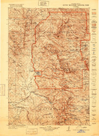
USGS Historical Quadrangle in GeoPDF.
Album caption: Rocky Mountain National Park, Colorado. Medicine Bow Mountains as seen from the trail east of Poudre Lakes (panorama with number 1194). W.T. Lee. August 23, 1916.
Categories: Image;
Types: Map Service,
OGC WFS Layer,
OGC WMS Layer,
OGC WMS Service;
Tags: Lee, W.T. Collection,
National Parks,
Photographers,
Rocky Mountain National Park,
Rocky Mountain National Park,
Album caption: Rocky Mountain National Park, Colorado. The crest of the Dakota sandstone where this sandstone stands vertical near the plaster mill west of Loveland, Colorado. W.T. Lee, July 23, 1916.
Categories: Image;
Types: Map Service,
OGC WFS Layer,
OGC WMS Layer,
OGC WMS Service;
Tags: Larimer County, Colorado,
Lee, W.T. Collection,
Photographers,
Rocky Mountain National Park,
photo print
Album caption and index card: Grand Lake, Middle Park. [Rocky Mountain National Park] Colorado. 1874.
Categories: Image;
Types: Map Service,
OGC WFS Layer,
OGC WMS Layer,
OGC WMS Service;
Tags: Expeditions,
Grand County, Colorado,
Hayden Survey,
Jackson, W.H. 1874 Series,
Jackson, W.H. Collection,
Album caption: A. The Roaring River, looking upstream from the Endovalley Road. Rocky Mountain National Park. Larimer County, Colorado. 1978. Publsihed as figrue 16-A in the U.S. Geological Survey Professional paper 1369. 1986.
Categories: Image;
Types: Map Service,
OGC WFS Layer,
OGC WMS Layer,
OGC WMS Service;
Tags: Jarrett, R.D. Collection,
Larimer County, Colorado,
National Parks,
Photographers,
Rocky Mountain National Park,
Album caption: Rocky Mountain National Park, Colorado. View from Horseshoe Park up Fall River, showing the glacial valley with the melting basin of the ancient glacier in the foreground. W.T. Lee. July 7, 1916.
Categories: Image;
Types: Map Service,
OGC WFS Layer,
OGC WMS Layer,
OGC WMS Service;
Tags: Lee, W.T. Collection,
National Parks,
Photographers,
Rocky Mountain National Park,
Rocky Mountain National Park,
Album caption: Album caption: Rocky Mountain National Park, Colorado. High Drive - view over Horseshoe Park to Ypsilon Mountain. W.T. Lee. August 26, 1916.
Categories: Image;
Types: Map Service,
OGC WFS Layer,
OGC WMS Layer,
OGC WMS Service;
Tags: Lee, W.T. Collection,
National Parks,
Photographers,
Rocky Mountain National Park,
Rocky Mountain National Park,
Rocky Mountain National Park, Colorado. Falls above Grand Lake. 1874. U.S. Geological and Geographical Survey of the Territories (Hayden Survey).
Categories: Image;
Types: Map Service,
OGC WFS Layer,
OGC WMS Layer,
OGC WMS Service;
Tags: Four Great Surveys of the West,
Hayden Survey,
Jackson, W.H. Collection,
National Parks,
Pioneer Photographers,
Album caption: Rocky Mountain National Park, Colorado. Looking down into The Chasm from the saddle between Longs Peak and Mount Lady Washington, showing Chasm Lake, the glacial gorge, and the lateral moraine of Mills Glacier. W.T. Lee. July 21, 1916.
Categories: Image;
Types: Map Service,
OGC WFS Layer,
OGC WMS Layer,
OGC WMS Service;
Tags: Glaciers,
Lee, W.T. Collection,
Mills Glacier,
National Parks,
Photographers,
Album caption: Rocky Mountain National Park, Colorado. View eastward from The Chasm down the gorge of Mills Glacier, showing the lateral moraines. W.T. Lee. July 22, 1916.
Categories: Image;
Types: Map Service,
OGC WFS Layer,
OGC WMS Layer,
OGC WMS Service;
Tags: Glaciers,
Lee, W.T. Collection,
Mills Glacier,
National Parks,
Photographers,
Album caption: Rocky Mountain National Park, Colorado. Longs Peak trail. Longs Peak from Cabin Rock on the Twin Sisters - shows The Chasm and Mills Moraine, consisting of glacier material derived from The Chasm (with single lens). W.T. Lee. July 27, 1916. Published as Plate 5-B in U.S. Geological Survey Bulletin 730-A.
Categories: Image;
Types: Map Service,
OGC WFS Layer,
OGC WMS Layer,
OGC WMS Service;
Tags: Lee, W.T. Collection,
National Parks,
Photographers,
Rocky Mountain National Park,
Rocky Mountain National Park,
Album caption: Rocky Mountain National Park, Colorado, picture by the Union Pacific Railroad, 1913, Continental Divide, showing the road between Estes Park and Moraine Park. Here is some of the most beautiful scenery in the world, within four miles of the Stanley Hotel and the village. The moraine from which the park gets its name is situated but a mile from Moraine Park. Bierstadt Lake, Bartholf Park and Mary's Lake are attractions in this vicinity. Note: Whenever this photograph is reproduced, it must have stated immediately beneath the reproduction: "Courtesy of the Union Pacific Railroad." Handwritten notes on album caption: Longs Peak quad, Larimer County, Colo. No index card.
Categories: Image;
Types: Map Service,
OGC WFS Layer,
OGC WMS Layer,
OGC WMS Service;
Tags: Larimer County, Colorado,
National Park,
Photographers,
Rocky Mountain National Park,
Topography A,
Album caption: Proposed Rocky Mountain (Estes) National Park, Colorado. The Longs Peak "Spur." Picture by R.B. Marshall, Chief Geographer, 1912. Handwritten notes on album caption: Longs Peak quad., Larimer County No index card Note on photograph: Negative destroyed by authority of administrative geologist
Categories: Image;
Types: Map Service,
OGC WFS Layer,
OGC WMS Layer,
OGC WMS Service;
Tags: Larimer County, Colorado,
Marshall, Robert B. Collection,
National Park,
Photographers,
Rocky Mountain National Park,
Album caption: Proposed Rocky Mountain (Estes) National Park, Colorado. Along the proposed road over Tombstone Ridge. Picture by R.B. Marshall, Chief Geographer, 1912. Handwritten notes on album caption: Longs Peak quad., Larimer County No index card
Categories: Image;
Types: Map Service,
OGC WFS Layer,
OGC WMS Layer,
OGC WMS Service;
Tags: Larimer County, Colorado,
Marshall, Robert B. Collection,
National Park,
Photographers,
Rocky Mountain National Park,
Album caption: Proposed Rocky Mountain (Estes) National Park, Colorado; tourists climbing to the top of the Continental Divide, from Corona (Rollins Pass) on the Moffat Road. Picture by R.B. Marshall, Chief Geographer. 1912. Handwritten notes on album caption: James Peak quad., Colorado Index card: Continental Divide at Corona. Grand County, Colorado. 1912.
Categories: Image;
Types: Map Service,
OGC WFS Layer,
OGC WMS Layer,
OGC WMS Service;
Tags: Grand County, Colorado,
Marshall, Robert B. Collection,
National Parks,
Photographers,
Rocky Mountain National Park,
Album caption and index card: Proposed Rocky Mountain (Estes) National Park, Colorado. Automobile route along Tombstone Ridge. Elevation about 12,000 feet. Picture by R.B. Marshall, Chief Geographer, 1912. Handwritten notes on album caption: Longs Peak quad., Larimer County
Categories: Image;
Types: Map Service,
OGC WFS Layer,
OGC WMS Layer,
OGC WMS Service;
Tags: Larimer County, Colorado,
Marshall, Robert B. Collection,
National Park,
Photographers,
Rocky Mountain National Park,
Andrews Meadow in the Loch Vale watershed, Rocky Mountain National Park. Sample Collection: Englemann spruce (Picea engelmannii) living on slopes surrounding and at the edge of Andrews meadow (Latitude 40˚ 17’ 24” N, Longitude 105˚ 40’ 01” W NAD83). At the time of collection, the climate-sensitive upland P. engelmannii trees were growing on well-drained slopes above the meadow. Seventeen trees, two cores per tree when possible, were collected using a 5mm-diameter increment borer. During sample collection, diameter at breast height (DBH) was also measured. These cores were processed following standard dendrochronological methods. The annual (TW) and earlywood (EW) ring-widths of each core were measured to 0.001mm...
We investigate herein the hypothesis that there is a significant relationship between bed particle mobility and benthic invertebrate abundance in the gravel-bed channel of the upper Colorado River in Rocky Mountain National Park. A large diversion channel called the Grand Ditch normally diverts a significant portion (?50%) of the annual snowmelt runoff from the watershed northward out of the basin. In May 2003, a ?30-m section of the ditch was breached, contributing substantially to the magnitude and duration of discharge in the Colorado River until the ditch breach was repaired in July of that year. As a result, all grain sizes in the river channel were mobilized, which contrasted sharply with the minimal gravel...
Categories: Publication;
Types: Citation,
Journal Citation;
Tags: River Research and Applications,
Rocky Mountain National Park,
benthic invertebrate,
disturbance,
hydrology,
|

|
