Filters: Tags: Rocky Mountain National Park (X)
215 results (57ms)|
Filters
Date Range
Extensions Types
Contacts
Categories Tag Types
|
Album caption: Rocky Mountain Nationa Park, Colorado. View of a snow bank high in the side of Fall River Canyon and the long threadlike stream supplied by the melting snow. W.T. Lee. July 4, 1916.
Categories: Image;
Types: Map Service,
OGC WFS Layer,
OGC WMS Layer,
OGC WMS Service;
Tags: Lee, W.T. Collection,
National Parks,
Photographers,
Rocky Mountain National Park,
Rocky Mountain National Park,
Album caption and index card: Rocky Mountain National Park, Colorado, picture by the Union Pacific Railroad, 1913. Big Thompson River in Estes Park, Long's Peak in the background. It was long thought that this magnificent mountain could not be climbed. From this particular point of view its grandeur is most impressive. Note: Whenever this photograph is reproduced, it must have stated immediately beneath the reproduction: "Courtesy of Union Pacific Railroad." Handwritten notes on album caption: Long's Peak quad., Larimer County, Colo.
Categories: Image;
Types: Map Service,
OGC WFS Layer,
OGC WMS Layer,
OGC WMS Service;
Tags: Larimer County, Colorado,
National Park,
Rocky Mountain National Park,
Topography A,
photo print
Rocky Mountain National Park, Colorado. Cascades at the foot of Round Top Mountain. Here the Colorado River is a brook, falling down the mountain in a continuous series of cascades and falls. This one is about 50 feet high. 1874. U.S. Geological and Geographical Survey of the Territories (Hayden Survey).
Categories: Image;
Types: Map Service,
OGC WFS Layer,
OGC WMS Layer,
OGC WMS Service;
Tags: Four Great Surveys of the West,
Hayden Survey,
Jackson, W.H. Collection,
National Parks,
Pioneer Photographers,
Album caption: Rocky Mountain National Park, Colorado. View of the head of Glacier Gorge, as seen from Keyhole Ridge - slope of Longs Peak at left; Black Lake and Shelf Lake in center, and Mills Lake at extreme right. Photo by Frank W. Byerly. Permission to use given to W.T. Lee. 1916. Note: Panorama scanned in two parts. Both parts attached to this photo record.
Categories: Image;
Types: Map Service,
OGC WFS Layer,
OGC WMS Layer,
OGC WMS Service;
Tags: National Parks,
Rocky Mountain National Park,
Rocky Mountain National Park,
panorama,
photo print
Album caption. Rocky Mountain National Park, Colorado. Flattop trail - view westward from Dream Lake, up the glacial gorge. W.T. Lee, August 1, 1916.
Categories: Image;
Types: Map Service,
OGC WFS Layer,
OGC WMS Layer,
OGC WMS Service;
Tags: Lee, W.T. Collection,
National Parks,
Photographers,
Rocky Mountain National Park,
Rocky Mountain National Park,
Album cpation: Rocky Mountain National Park, Colorado. Longs Peak trail. The trail makers working at timberline. W.T. Lee. July 22, 1916.
Categories: Image;
Types: Map Service,
OGC WFS Layer,
OGC WMS Layer,
OGC WMS Service;
Tags: Lee, W.T. Collection,
National Parks,
Photographers,
Rocky Mountain National Park,
Rocky Mountain National Park,
Album caption: Rocky Mountain National Park, Colorado. Loch vale and Glacier Gorge. Rapids at the mouth of Loch Vale as seen from trail. W.T. Lee. August 3, 1916.
Categories: Image;
Types: Map Service,
OGC WFS Layer,
OGC WMS Layer,
OGC WMS Service;
Tags: Lee, W.T. Collection,
National Parks,
Photographers,
Rocky Mountain National Park,
Rocky Mountain National Park,
Album caption and index card: Grand Lake, Middle Park. [Rocky Mountain National Park] Colorado. 1874.
Categories: Image;
Types: Map Service,
OGC WFS Layer,
OGC WMS Layer,
OGC WMS Service;
Tags: Expeditions,
Grand County, Colorado,
Hayden Survey,
Jackson, W.H. 1874 Series,
Jackson, W.H. Collection,
Album caption: Rocky Mountain National Park, Colorado. Trees at timberline on Longs Peak trail. They are all inclined toward the east, away from the prevailing westerly wind, and many of the trunks are stripped of bark on west side. They grow where they are protected in winter, but snow drifted among the boulders. (The scale - the camera box is 6 inches wide.) W.T Lee. July 23, 1916.
Categories: Image;
Types: Map Service,
OGC WFS Layer,
OGC WMS Layer,
OGC WMS Service;
Tags: Lee, W.T. Collection,
National Parks,
Photographers,
Rocky Mountain National Park,
Rocky Mountain National Park,
Album caption: Rocky Mountain National Park, Colorado. Medicine Bow mountains as seen from the trail east of Poudre Lakes. W.T. Lee. August 23, 1916. Note: This photograph is a composite of Lee's photographs 1194 and 1195. Never Summer Range from trail east of Poudre lakes. Rocky Mountain National Park. Larimer County, Colorado. August 23, 1916.
Categories: Image;
Types: Map Service,
OGC WFS Layer,
OGC WMS Layer,
OGC WMS Service;
Tags: Lee, W.T. Collection,
National Parks,
Photographers,
Rocky Mountain National Park,
Rocky Mountain National Park,
The U.S. Geological Survey has operated the Precipitation Chemistry Quality Assurance (PCQA) Project to evaluate and document the data quality for the National Atmospheric Deposition Program (NADP) for 40 years. The PCQA is primarily focused on data quality for the NADP National Trends Network (NTN) and Mercury Deposition Network (MDN). The PCQA implements programs to evaluate the variability and bias of NADP data. The programs are described in several USGS reports: 1. See, R.B., Willoughby, T.C., and Brooks, M.H., 1990. Programs and analytical methods for the U.S. Geological Survey Acid Rain Quality Assurance Project: U.S. Geological Water-Resources Investigations Report 90-4029. 2. Latysh, N.E., and Wetherbee,...
This dataset was collected to build on past and ongoing monitoring and research efforts within Colorado’s Rocky Mountain National Park (RMNP). Specifically, the data were collected to test the hypothesis that reductions in canopy cover due to natural disturbances (i.e. wildfire and beetle kill) result in increases in water temperature, or the longitudinal thermal gradient of a stream. Data values include stream temperature paired with light intensity data, and air temperature data to determine the influence of riparian canopy condition and longitudinal warming across a 1 km reach. Two control streams were selected: Ouzel Creek, which has virtually no riparian canopy due to a previous wildfire; and Hunters Creek,...
Categories: Data;
Types: Map Service,
OGC WFS Layer,
OGC WMS Layer,
OGC WMS Service;
Tags: Aquatic Biology,
Aquatic Biology,
Bowen Gulch,
Climatology,
Colorado,
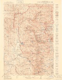
USGS Historical Quadrangle in GeoPDF.
Album caption: Rocky Mountain National Park. Panorama of Estes Park and mountains surrounding it, as seen from Prospect Mountain. Photograph by Frank W. Byerly. Permission to use given to W.T. Lee. 1916. Note: Panorama scanned in two parts. Both attached to this photo record.
Categories: Image;
Types: Map Service,
OGC WFS Layer,
OGC WMS Layer,
OGC WMS Service;
Tags: Lee, W.T. Collection,
National Parks,
Rocky Mountain National Park,
Rocky Mountain National Park,
panorama,
Album caption: Rocky Mountain National Park, Colorado. Odessa Lake, as seen from the top of Sheep Mountain. W.T. Lee. July 9, 1916.
Categories: Image;
Types: Map Service,
OGC WFS Layer,
OGC WMS Layer,
OGC WMS Service;
Tags: Lee, W.T. Collection,
National Parks,
Photographers,
Rocky Mountain National Park,
Rocky Mountain National Park,
Album caption: Rocky Mountain National Park, Colorado. Copeland Mountain as seen from Copeland Lake, looking up St. Vrain Valley. W.T. Lee. July 29, 1916.
Categories: Image;
Types: Map Service,
OGC WFS Layer,
OGC WMS Layer,
OGC WMS Service;
Tags: Lee, W.T. Collection,
National Parks,
Photographers,
Rocky Mountain National Park,
Rocky Mountain National Park,
Album caption and index card: Rocky Mountain National Park, Colorado, picture by the Union Pacific Railroad, 1913, Sheep Lake, Horseshoe Park, up Fall River Canyon. Another of the wonderful Estes Park lakes. These waters are clear as crystal and reflect the snowy peaks in their depths. Sheep Lake is a favorite. Note: Whenever this photograph is reproduced, it must have state immediately beneath the reproduction: "Courtesy of the Union Pacific Railroad." Handwritten notes on album caption: Long's Peak quad., Larimer County.
Categories: Image;
Types: Map Service,
OGC WFS Layer,
OGC WMS Layer,
OGC WMS Service;
Tags: Larimer County, Colorado,
National Park,
Rocky Mountain National Park,
Topography A,
photo print
Album caption: Rocky Mountain National Park, Colorado, picture by the Union Pacific Railroad, 1913. Another view of Big Thompson Canyon. In spots such as this fancy suggests that "Here the Titans used to play." The picture also shows the seething, boiling waters of the Big Thompson River, and along its banks parties of happy fishermen are encountered. Note: Whenever this photograph is reproduced, it must have state immediately beneath the reproduction: "Courtesy of the Union Pacific Railroad." Handwritten notes on album caption: Long's Peak quad., Larimer County. No index card.
Categories: Image;
Types: Map Service,
OGC WFS Layer,
OGC WMS Layer,
OGC WMS Service;
Tags: Larimer County, Colorado,
National Park,
Rocky Mountain National Park,
Topography A,
photo print
Album caption: Proposed Rocky Mountain (Estes) National Park, Colorado. The Trail of the Lonesome Pine. Longs Peak, looking south from east end of proposed road over Tombstone Ridge. Picture by R.B. Marshall, Chief Geographer, 1912. Handwritten notes on album caption: Longs Peak quad., Larimer County No index card Note on photograph: Negative destroyed by authority of administrative geologist
Categories: Image;
Types: Map Service,
OGC WFS Layer,
OGC WMS Layer,
OGC WMS Service;
Tags: Larimer County, Colorado,
Marshall, Robert B. Collection,
National Park,
Photographers,
Rocky Mountain National Park,
Album caption: Proposed Rocky Mountain (Estes) National Park, Colorado; "The Moffat Road," near Coronoa, on the summit of the Continental Divide. Picture by R.B. Marshall, Chief Geographer. 1912. Handwritten notes on album caption: James Peak quad., Colorado No index card
Categories: Image;
Types: Map Service,
OGC WFS Layer,
OGC WMS Layer,
OGC WMS Service;
Tags: Marshall, Robert B. Collection,
National Park,
Photographers,
Rocky Mountain National Park,
Topography A,
|

|
