Filters: Tags: Rocky Mountain National Park (X)
215 results (185ms)|
Filters
Date Range
Extensions Types
Contacts
Categories Tag Types
|
Album caption: Rocky Mountain National Park, Colorado. Rapids east of Copeland Lake where the St. Vrain River descends over the terminal moraine of the ancient glacier which once filled this valley. W.T. Lee, July 28, 1916,
Categories: Image;
Tags: Lee, W.T. Collection,
National Parks,
Photographers,
Rocky Mountain National Park,
Rocky Mountain National Park,
Album caption: Proposed Rocky Mountain (Estes) National Park, Colorado. Fantastic clouds around Longs Peak. Picture by R.B. Marshall, Chief Geographer, 1912. Handwritten notes on album caption: Longs Peak quad., Larimer County No index card Note on photograph: Negative destroyed by authority of administrative geologist
Categories: Image;
Types: Map Service,
OGC WFS Layer,
OGC WMS Layer,
OGC WMS Service;
Tags: Larimer County, Colorado,
Marshall, Robert B. Collection,
National Park,
Photographers,
Rocky Mountain National Park,
Album caption: Proposed Rocky Mountain (Estes) National Park, Colorado. Club house on north shore, Grand Lake. Picture by R.B. Marshall, Chief Geographer, 1912. Handwritten notes on album caption: Grand Lake quad., Grand County Index card: Club house at north shore of Grand Lake. Grand County, Colorado. 1912.
Categories: Image;
Types: Map Service,
OGC WFS Layer,
OGC WMS Layer,
OGC WMS Service;
Tags: Grand County, Colorado,
Marshall, Robert B. Collection,
Photographers,
Rocky Mountain National Park,
Topography A,
Long's Peak from Estes Park. Rocky Mountain National Park. Boulder and Larimer Counties, Colorado. 1873. (Similar to Jackson, W.H. 998)
Categories: Image;
Types: Map Service,
OGC WFS Layer,
OGC WMS Layer,
OGC WMS Service;
Tags: Boulder County, Colorado,
Four Great Surveys of the West,
Hayden Survey,
Jackson, W.H. Collection,
Larimer County, Colorado,
Album caption: Rocky Mountain National Park, Colorado. An ice smoothed surface in Glacier Gorge, with scattered glacial boulders and balanced rocks. W.T. Lee. August 3, 1916.
Categories: Image;
Types: Map Service,
OGC WFS Layer,
OGC WMS Layer,
OGC WMS Service;
Tags: Glaciers,
Lee, W.T. Collection,
National Parks,
Photographers,
Rocky Mountain National Park,
Rocky Mountain National Park, Colorado. Longs Peak, viewed from the lower end of Estes Park. 1873. U.S. Geological and Geographical Survey of the Territories (Hayden Survey).
Categories: Image;
Types: Map Service,
OGC WFS Layer,
OGC WMS Layer,
OGC WMS Service;
Tags: Four Great Surveys of the West,
Hayden Survey,
Jackson, W.H. Collection,
National Parks,
Pioneer Photographers,
Rocky Mountain National Park, Colorado. Never Summer Mountains, west of the north fork of the Colorado River, viewed from Specimen Mountain, down The Crater. August 23, 1916.
Categories: Image;
Types: Map Service,
OGC WFS Layer,
OGC WMS Layer,
OGC WMS Service;
Tags: Lee, W.T. Collection,
National Parks,
Photographers,
Rocky Mountain National Park,
photo print
Album caption: Rocky Mountain National Park, Colorado. View of the Medicine Bow Mountains looking westward from the trail south of Poudre Lakes. W.T. Lee. July 4, 1916. Note: Panorama with Rocky Mountain National Park photo 981a (RMNP00981a).
Categories: Image;
Types: Map Service,
OGC WFS Layer,
OGC WMS Layer,
OGC WMS Service;
Tags: Lee, W.T. Collection,
National Parks,
Photographers,
Rocky Mountain National Park,
Rocky Mountain National Park,
Album caption: Rocks in St. Vrain Valley smoothed by the anicent glacier that once filled this valley. Rocky Mountain National Park, Colorado. W.T. Lee. July 28, 1916.
Categories: Image;
Types: Map Service,
OGC WFS Layer,
OGC WMS Layer,
OGC WMS Service;
Tags: Lee, W.T. Collection,
National Parks,
Photographers,
Rocky Mountain National Park,
Rocky Mountain National Park,
This beaver house on Mill Creek was abandoned because the pond was drained.
Categories: Image;
Types: Map Service,
OGC WFS Layer,
OGC WMS Layer,
OGC WMS Service;
Tags: Larimer County, Colorado,
Lee, W.T. Collection,
National Parks,
Photographers,
Rocky Mountain National Park,
Rocky Mountain National Park, Colorado. The Notch on Longs Peak. Photo by E.A. Mills.
Categories: Image;
Types: Map Service,
OGC WFS Layer,
OGC WMS Layer,
OGC WMS Service;
Tags: Lee, W.T. Collection,
National Parks,
Photographers,
Rocky Mountain National Park,
photo print
Comma-separated values (.csv) file containing data related to mercury and biogeochemical parameters in surface water and aquatic sediment collected from U.S. National Parks in 2014-2015.
This dataset includes two files, 1) site -specific covariates including the presence of predators (fish), disease (Batrachochytrium dendrobatidis [Bd] - amphibian chytrid fungus), and permanence (ephemeral or permanent) of sites in Rocky Mountain National Park, Colorado. The dataset was analyzed for planned publication of a manuscript in Population Ecology, Crockett, J., E. Muths and L.L. Bailey authors. and 2) site-specific covariates for additional sites in Colorado (including those in file 1) noting the presence of toad breeding, snowpack values, Bd, permanence and elevation that are analyzed for a second planned publication by Crockett et al.
Categories: Data;
Tags: Colorado,
Rocky Mountain National Park,
USGS Science Data Catalog (SDC),
biota,
boreal toad,
The resilience of willow (Salix monticola Bebb, Salix geyeriana Anderss., Salix planifolia Pursh) stems released from intense elk (Cervus elaphus) browsing in Rocky Mountain National Park, Colorado, was quantified in 1998 with a retrospective study that compared biomass, number, and length of segments on willow stems located inside (protected) and outside (browsed) elk exclosures. Segment biomass increased each year after protection by about 3?12 g year?1 on browsed stems and 10?27 g year?1 on protected stems. The number of segments on stems was similar for browsed and protected stems in the first 2 years after exclusion but differed in the next 3 years, when they increased exponentially on protected stems. Nearly...
Categories: Publication;
Types: Citation,
Journal Citation;
Tags: Cervus elaphus,
Rangeland Ecology & Management,
Rocky Mountain National Park,
Salix,
Society for Range Management,
To identify potential constraints on willow (Salix spp.) seedling establishment in montane riparian communities in Rocky Mountain National Park, Colorado, USA we established a controlled experiment to examine the effects of soil texture and elevation above river stage on willow seedling survival. We followed seedling survival rates over two summers in paired course- and fine-textured plots established at three elevations on study area point bars. Patterns of seedling survival changed over the course of the study, and after two growing seasons, greater seedling survival rates were observed in fine-textured plots and plots occurring at high and intermediate elevations. Our results indicate that both soil water availability...
Categories: Publication;
Types: Citation,
Journal Citation;
Tags: Rocky Mountain National Park,
Salix,
The Society of Wetland Scientists,
Wetlands,
desiccation,
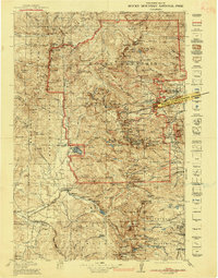
USGS Historical Quadrangle in GeoPDF.
Album caption: Rocky Mountain National Park, Colorado. A balanced rock left on an ice-smoothed surface when the glacier melted from The Chasm. W.T. Lee. July 23, 1916.
Categories: Image;
Types: Map Service,
OGC WFS Layer,
OGC WMS Layer,
OGC WMS Service;
Tags: Lee, W.T. Collection,
National Parks,
Photographers,
Rocky Mountain National Park,
Rocky Mountain National Park,
Rocky Mountain National Park, Colorado. Bighorn sheep in a snow bank. Photo by E.A. Mills.
Categories: Image;
Types: Map Service,
OGC WFS Layer,
OGC WMS Layer,
OGC WMS Service;
Tags: Lee, W.T. Collection,
National Parks,
Photographers,
Rocky Mountain National Park,
photo print
Longs Peak from Prospect Mountain. Rocky Mountain National Park. Larimer County, Colorado. 1873.
Categories: Image;
Types: Map Service,
OGC WFS Layer,
OGC WMS Layer,
OGC WMS Service;
Tags: Four Great Surveys of the West,
Jackson, W.H. Collection,
Larimer County, Colorado,
National Parks,
Pioneer Photographers,
Album caption: "Kamp Komfort" at Bear Lake. Rocky Mountain National Park, Colorado. W.T. Lee. August 3, 1916.
Categories: Image;
Types: Map Service,
OGC WFS Layer,
OGC WMS Layer,
OGC WMS Service;
Tags: Lee, W.T. Collection,
National Parks,
Photographers,
Rocky Mountain National Park,
Rocky Mountain National Park,
|

|
