Filters: Tags: Sandwich (X)
61 results (77ms)|
Filters
|
This U.S. Geological Survey (USGS) data release provides a comprehensive dataset of water-quality results, physical-parameter measurements, hydrologic measurements, and site information collected to study the nature and extent of water quality along groundwater flow paths adjacent to glacial-kettle lakes on Cape Cod, Massachusetts. Water-quality samples were collected in 2003, 2005, and 2012 through 2018 in and near seven kettle lakes located on western Cape Cod, with most of the data collected in 2015-2017 from Ashumet Pond, which is located in the towns of Falmouth and Mashpee. Data were also collected at other lakes to compare the lake-specific influences of geochemistry and hydrology on the downgradient groundwater...
Tracking changes in bulk electrical conductivity (EC) during tracer tests in saturated sediments allows for direct observation of both mobile and less-mobile pore space exchange dynamics. Electrode arrays made up of four stainless steel rods (insulated with the exception of exposed 0.5 cm tips) were installed vertically at depths of interest and apparent electrical resistivity data (the inverse of bulk EC) were collected using a Wenner configuration with an AGI SuperSting R8 meter. The Bulk EC data are described and listed within the files below. Controlled, downward flow experiments were conducted in Dual-domain porosity apparatus (DDPA). Downward flow rates ranged from 1.2 to 1.4 m/d in DDPA1 and at 1 m/d, 3 m/d,...

USGS Historical Quadrangle in GeoPDF.
Groundwater, surface-water, sediment, and associated quality-control samples were collected downgradient from a former fire training area and wastewater infiltration beds on Cape Cod, Massachusetts and analyzed for per- and polyfluoroalkyl substances (PFAS). Samples were collected between July 2016 and February 2019 following U.S. Geological Survey protocols. Field parameters reported include temperature, pH, specific conductance, and dissolved oxygen. Samples were analyzed for chloride, bromide, nitrate, sulfate, and dissolved organic carbon. PFAS samples were extracted using offline solid phase extraction and were analyzed for 24 PFAS at Harvard University using liquid chromatography-tandem mass spectrometry (LC-MS/MS)....
Low-altitude (30-120 meters above ground level) digital images of Town Neck Beach in Sandwich, Massachusetts, were obtained with a series of cameras mounted on small unmanned aerial systems (UAS, also known as a drone). Imagery was collected at close to low tide on five days to observe changes in beach and dune morphology. The images were geolocated by using the single-frequency geographic positioning system aboard the UAS. Ground control points (GCPs) were established by using temporary targets on the ground, which were located by using a real-time kinematic global navigation satellite system (RTK-GNSS) base station and rovers. The GCPs can be used as constraints during photogrammetric processing. Transect points...
Low-altitude (30-120 meters above ground level) digital images of Town Neck Beach in Sandwich, Massachusetts, were obtained with a series of cameras mounted on small unmanned aerial systems (UAS, also known as a drone). Imagery was collected at close to low tide on five days to observe changes in beach and dune morphology. The images were geolocated by using the single-frequency geographic positioning system aboard the UAS. Ground control points (GCPs) were established by using temporary targets on the ground, which were located by using a real-time kinematic global navigation satellite system (RTK-GNSS) base station and rovers. The GCPs can be used as constraints during photogrammetric processing. Transect points...
Low-altitude (80-100 meters above ground level) digital images of Town Neck Beach in Sandwich, Massachusetts, were obtained from a camera mounted on a small unmanned aerial system (UAS; also known as a drone). Imagery was collected at close to low tide on seven days to observe changes in beach and dune morphology. The images were geolocated by using the single-frequency geographic positioning system aboard the UAS. Ground control points (GCPs) were established by using temporary targets on the ground, which were located by using a real-time kinematic global navigation satellite system (RTK-GNSS) base station and rovers. The GCPs can be used as constraints during photogrammetric processing. Transect points were collected...
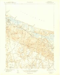
USGS Historical Quadrangle in GeoPDF.

The U.S. Geological Survey, in cooperation with the Town of Barnstable, Massachusetts, modified an existing numerical, steady-state regional MODFLOW-2005 groundwater-flow model to evaluate changes in water levels from a reference condition (2015) for nine pumping and wastewater return flow scenarios prepared by the Hyannis Water System. The three-dimensional, steady-state groundwater-flow model used to simulate water level changes is a modified and recalibrated version of an existing model that was used to simulate the potential effects of sea-level rise on groundwater levels of the Sagamore and Monomoy freshwater lenses of the Cape Cod aquifer (Walter and others, 2016) (https://doi.org/10.3133/sir20165058). Two...
Low-altitude (30-120 meters above ground level) digital images of Town Neck Beach in Sandwich, Massachusetts, were obtained with a series of cameras mounted on small unmanned aerial systems (UAS, also known as a drone). Imagery was collected at close to low tide on five days to observe changes in beach and dune morphology. The images were geolocated by using the single-frequency geographic positioning system aboard the UAS. Ground control points (GCPs) were established by using temporary targets on the ground, which were located by using a real-time kinematic global navigation satellite system (RTK-GNSS) base station and rovers. The GCPs can be used as constraints during photogrammetric processing. Transect points...
Geophysical and geological survey data were collected off Town Neck Beach in Sandwich, Massachusetts, in May and July 2016. Approximately 130 linear kilometers of subbottom (seismic-reflection) and 234-kilohertz interferometric sonar (bathymetric and backscatter) data were collected along with sediment samples, sea floor photographs, and (or) video at 26 sites within the geophysical survey area. Sediment grab samples were collected at 19 of the 26 sampling sites and video and (or) photographic imagery of the sea floor were taken at all 26 sites. These survey data are used to characterize the sea floor by identifying sediment-texture, seabed morphology, and underlying geologic structure and stratigraphy. Data collected...
Categories: Data;
Types: Downloadable,
GeoTIFF,
Map Service,
Raster;
Tags: Atlantic Ocean,
CMGP,
Cape Cod Bay,
Coastal and Marine Geology Program,
GeoTIFF,
The Massachusetts Office of Coastal Zone Management (CZM) launched the Shoreline Change Project in 1989 to identify erosion-prone areas of the Massachusetts coast. Seventy-six maps were produced in 1997 depicting a statistical analysis of shoreline change on ocean-facing shorelines from the mid-1800s to 1978 using multiple data sources. In 2001, a 1994 shoreline was added. More recently, in cooperation with CZM, the U.S. Geological Survey (USGS) delineated a new shoreline for Massachusetts using color aerial ortho-imagery from 2008 to 2009 and topographic lidar data collected in 2007. This update included a marsh shoreline, which was defined to be the tonal difference between low- and high-marsh seen in ortho-photos....
Categories: Data;
Types: Downloadable,
Map Service,
OGC WFS Layer,
OGC WMS Layer,
Shapefile;
Tags: Bourne,
CMGP,
Chatham,
Coastal and Marine Geology Program,
Duxbury,
Surface water, pore water, pond bottom sediments, and groundwater were sampled within and downgradient from five groundwater flow-through ponds that ranged from oligotrophic to eutrophic in Cape Cod, Massachusetts during different seasons from 2015 – 2018. The sampled ponds included Ashumet, Santuit, Snake, Shubael, and Longs. Pore water was collected between 15 to 100 cm below the pond bottoms on the upgradient and downgradient sides of the ponds. Groundwater was collected on the downgradient side where the pond water recharges the groundwater resulting in a “pond shadow”. Within the pond shadow, groundwater is under the direct influence of surface water. The pond shadows were sampled vertically and at various...

USGS Historical Quadrangle in GeoPDF.
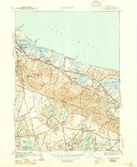
USGS Historical Quadrangle in GeoPDF.

USGS Historical Quadrangle in GeoPDF.
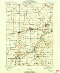
USGS Historical Quadrangle in GeoPDF.
Geophysical and geological survey data were collected off Town Neck Beach in Sandwich, Massachusetts, in May and July 2016. Approximately 130 linear kilometers of subbottom (seismic-reflection) and 234-kilohertz interferometric sonar (bathymetric and backscatter) data were collected along with sediment samples, sea floor photographs, and (or) video at 26 sites within the geophysical survey area. Sediment grab samples were collected at 19 of the 26 sampling sites and video and (or) photographic imagery of the sea floor were taken at all 26 sites. These survey data are used to characterize the sea floor by identifying sediment-texture, seabed morphology, and underlying geologic structure and stratigraphy. Data collected...
Categories: Data;
Types: Downloadable,
Map Service,
OGC WFS Layer,
OGC WMS Layer,
Shapefile;
Tags: Atlantic Ocean,
CMGP,
Cape Cod Bay,
Coastal and Marine Geology Program,
Gulf of Maine,
Low-altitude (80-100 meters above ground level) digital images of Town Neck Beach in Sandwich, Massachusetts, were obtained from a camera mounted on a small unmanned aerial system (UAS; also known as a drone). Imagery was collected at close to low tide on seven days to observe changes in beach and dune morphology. The images were geolocated by using the single-frequency geographic positioning system aboard the UAS. Ground control points (GCPs) were established by using temporary targets on the ground, which were located by using a real-time kinematic global navigation satellite system (RTK-GNSS) base station and rovers. The GCPs can be used as constraints during photogrammetric processing. Transect points were collected...
Low-altitude (30-120 meters above ground level) digital images of Town Neck Beach in Sandwich, Massachusetts, were obtained with a series of cameras mounted on small unmanned aerial systems (UAS, also known as a drone). Imagery was collected at close to low tide on five days to observe changes in beach and dune morphology. The images were geolocated by using the single-frequency geographic positioning system aboard the UAS. Ground control points (GCPs) were established by using temporary targets on the ground, which were located by using a real-time kinematic global navigation satellite system (RTK-GNSS) base station and rovers. The GCPs can be used as constraints during photogrammetric processing. Transect points...
|

|
