Filters: Tags: Scenic (X)
22 results (83ms)|
Filters
Date Range
Extensions (Less) Types (Less)
Contacts (Less)
Categories (Less) Tag Types
|
This map shows all the places conservation elements. Some of the places included exhibit high biodiversity or ecological and cultural value. This map also shows other managed areas from the Protected Areas Database, as well as those that are excluded. Associated input datasets are also included; they relate to biodiversity, special areas, and development. These data are provided by Bureau of Land Management (BLM) "as is" and may contain errors or omissions. The User assumes the entire risk associated with its use of these data and bears all responsibility in determining whether these data are fit for the User's intended use. These data may not have the accuracy, resolution, completeness, timeliness, or other characteristics...

USGS Historical Quadrangle in GeoPDF.
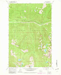
USGS Historical Quadrangle in GeoPDF.

USGS Historical Quadrangle in GeoPDF.
These data depict the National Hydrography Dataset Plus Version 2.1 (NHDPlusV2.1) flowline representation of the National Wild and Scenic Rivers System throughout the conterminous United States as of 2018. U.S. Forest Service geospatial data on National Wild and Scenic River segments (USFS WSR Segment) from 3/1/2016 were joined to the NHDPlusV2.1 to create the Wild and Scenic Rivers 2018 Linked to the NHDPlusV2.1 (wsr_nhdpv2.1) data. To ensure these data correctly represented the NHDPlusV2.1 flowline delineation of the National Wild and Scenic Rivers System, each wsr_nhdpv2.1 river segment was examined against the USFS WSR Segment data to check for duplication and/or omission of Wild and Scenic River segments. Spatial...
Categories: Data;
Types: Map Service,
OGC WFS Layer,
OGC WMS Layer,
OGC WMS Service;
Tags: Alabama,
Arizona,
Arkansas,
California,
Colorado,
This is an aggregate national dataset describing the geographic boundaries of the ACEC within the BLM managed public lands. The designated ACECs are "areas within the public lands where special management attention is required to protect and prevent irreparable damage to important historic, cultural, or scenic values, fish and wildlife resources or other natural systems of processes, or to protect life and safety from natural hazards."
Types: Downloadable;
Tags: ACEC,
Areas of Critical Environmental Concern,
BLM,
Biological,
Bureau of Land Management,
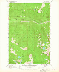
USGS Historical Quadrangle in GeoPDF.
USGS Historical Quadrangle in GeoPDF.

The USGS Transportation service from The National Map (TNM) is based on TIGER/Line data provided through U.S. Census Bureau and supplemented with HERE road data to create tile cache base maps. Some of the TIGER/Line data includes limited corrections done by USGS. Transportation data consists of roads, railroads, trails, airports, and other features associated with the transport of people or commerce. The data include the name or route designator, classification, and location. Transportation data support general mapping and geographic information system technology analysis for applications such as traffic safety, congestion mitigation, disaster planning, and emergency response. The National Map transportation data...
Categories: Data;
Types: ArcGIS REST Map Service,
Map Service;
Tags: 4WD,
NGP-TNM,
Overlay Map Service,
REST,
Transportation,
River segments representing the National Wild and Scenic River System for Alaska
Originally developed by the USGS National Atlas for the 2000 publication of the National Wild and Scenic River System (NWSRS). These Alaska data accompany the CONUS National Wild and Scenic River System data.
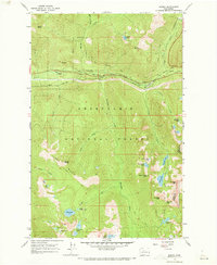
USGS Historical Quadrangle in GeoPDF.
Data represents segments of the National Wild and Scenic River System. This is a national dataset that was clipped by WyGISC to the Wyoming Boundaries, additionally a web link to additional river data was included
This metadata is for all coverages associated with the vegetation land cover and land use geospatial database for Badlands National Park and surrounding areas. The project is authorized as part of the USGS/NPS Vegetation Mapping Program http://www.usgs.gov/core_science_systems/csas/vip/index.html. The program is being administered by the Biological Resources Division (BRD) of the United States Geological Survey (USGS). The USGS/BRD is responsible for overall management and oversight of all ongoing mapping efforts. This mapping effort was performed by the US Bureau of Reclamation's (USBR) Remote Sensing and GIS Group, Technical Service Center, Denver, CO. The vegetation mapping program is part of a larger Inventory...
This dataset constitutes the spatial boundaries for Visual Resource Inventory Class (CLASS) polygons and respective relative ratings (Class I, II, III, or IV) for visual resource values across the area being inventoried. These inventory classes represent the relative value of the visual resources. Classes I and II being the most valued, Class III representing a moderate value, and Class IV being of least value. BLM administered lands are placed into the inventory classes based on the overlay of three spatial data sets; visual appeal of a tract of land (scenic quality), the amount of public concern for scenic quality (visual sensitivity), and whether the tract of land is visible from travel routes or observation...
This polygon feature class shows the spatial extent and boundaries of Areas of Critical Environmental Concern that have become officially designated by the BLM. These polygon features were previously in a pre-designated status (i.e. being considered as areas to be eventually designated as official ACEC designated polygonst). Once these polygon feature left the Pre-Designated phase (transitioned from a Considered to Designated status), they were removed from the ACEC Pre-designated polygon feature class and placed in this ACEC Designated polygon feature class. This dataset is a subset of the official national dataset, containing features and attributes intended for public release and has been optimized for online...
USGS Historical Quadrangle in GeoPDF.

Historic image LS_0060 is part of the 'DGMR lantern slides' collection; the topic area is 'Scenic'. Location is unknown (none). The image has the following description: 'Mountain .' The image was scanned from a lantern slide as part of the USGS NGGDPP deliverable for 2017-2018. The physical location is 900 Natural Resources Dr., Ste 400, Charlottesville, VA 22903. Library. The author is DGMR. The image is dated unknown.
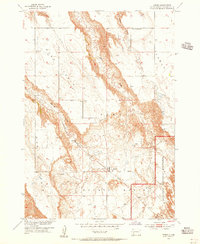
USGS Historical Quadrangle in GeoPDF.
This map shows all the places conservation elements. Some of the places included exhibit high biodiversity or ecological and cultural value. This map also shows other managed areas from the Protected Areas Database, as well as those that are excluded. Associated input datasets are also included; they relate to biodiversity, special areas, and development. These data are provided by Bureau of Land Management (BLM) "as is" and may contain errors or omissions. The User assumes the entire risk associated with its use of these data and bears all responsibility in determining whether these data are fit for the User's intended use. These data may not have the accuracy, resolution, completeness, timeliness, or other characteristics...
|

|
