Filters: Tags: Seattle (X)
26 results (119ms)|
Filters
Date Range
Types Contacts
Categories Tag Types Tag Schemes |
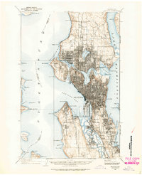
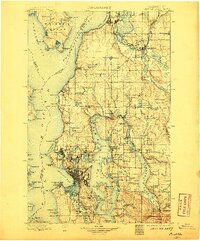
USGS Historical Quadrangle in GeoPDF.
A time-lapse camera was used to document periodic reactivation of a complex landslide on a steep coastal bluff in Mukilteo, Washington. This landslide is one of four monitoring sites initiated by the U.S Geological Survey to investigate hill-slope hydrology and landslide hazards affecting the railway corridor along the eastern shore of Puget Sound between the cities of Seattle and Everett (Mirus et al., 2016; Smith et al. 2017). The camera was installed in the crown of the landslide above the main scarp facing roughly North, with a field of view that includes the head of the landslide body and a minor scarp below. The attached file ‘CameraLocation.PNG’ provides an overview figure of the landslide and the camera’s...
A hydrologic monitoring network was installed to investigate landslide hazards affecting the railway corridor along the eastern shore of Puget Sound between Seattle and Everett, near Mukilteo, Washington. During the summer of 2015, the U.S. Geological Survey installed instrumentation at four sites to measure rainfall and air temperature every 15 minutes. Two of the four sites are installed on contrasting coastal bluffs, one landslide scarred and one vegetated. At these two sites, in addition to rainfall and air temperature, volumetric water content, pore pressure, soil suction, soil temperature (via hydrologic instrumentation), and barometric pressure were measured every 15 minutes. The instrumentation was designed...
The data support a study that surveyed the spatial and temporal distribution of salmon eDNA in Seattle urban creeks, Washington, 2018 - 2020. The metadata represent qPCR quantification cycle (Cq) values for Chinook salmon, coho salmon, and coastal cutthroat trout assays performed on water samples collected on specific days at specific sites on Thornton Creek, Taylor Creek, and Mapes Creek, which are tributaries of Lake Washington within Seattle city limits. The metadata also includes latitude and longitude for each site and Y-intercept and slope for each assay run.

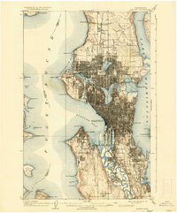
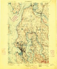
USGS Historical Quadrangle in GeoPDF.
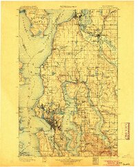
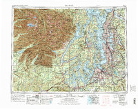
USGS Historical Quadrangle in GeoPDF.

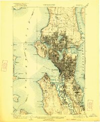
USGS Historical Quadrangle in GeoPDF.
USGS Historical Quadrangle in GeoPDF.
USGS Historical Quadrangle in GeoPDF.
High-resolution multichannel boomer seismic-reflection data were collected by the U.S. Geological Survey and the University of Washington in February of 2017 east of Seattle in Lake Washington, Washington. Data were collected aboard University of Washington’s R/V Clifford A. Barnes during USGS field activity 2017-612-FA using an Applied Acoustics triple plate S-Boom sound source and recorded on a 24 channel Geometrics digital hydrophone streamer. Sub-bottom acoustic penetration spans several hundreds of meters and is variable by location.

USGS Historical Quadrangle in GeoPDF.

USGS Historical Quadrangle in GeoPDF.
USGS Historical Quadrangle in GeoPDF.

USGS Historical Quadrangle in GeoPDF.
USGS Historical Quadrangle in GeoPDF.
USGS Historical Quadrangle in GeoPDF.
High-resolution chirp sub-bottom data were collected by the U.S. Geological Survey in April 2011 south of Bainbridge Island and west of Seattle in Puget Sound, Washington. Data were collected aboard the R/V Karluk during field activity K0211PS using an Edgetech SB-512i sub-bottom profiler. Sub-bottom acoustic penetration spans several tens of meters and is variable by location.
Data used for analysis described in the publication titled "Shallow-Landslide Hazard Map of Seattle, Washington" (available at https://pubs.usgs.gov/of/2006/1139/). The data consisted of a digital slope map derived from recent Light Detection and Ranging (LIDAR) imagery of Seattle, recent digital geologic mapping, and shear-strength test data for the geologic units in the surrounding area. The combination of these data layers within a Geographic Information System (GIS) platform allowed the preparation of a shallow landslide hazard map for the entire city of Seattle.
Spring viremia of carp virus (SVCV, species Carp sprivivirus), is considered one of the most lethal freshwater pathogens of cyprinid fish. Common carp Cyprinus carpio L. and koi C. carpio koi are the most susceptible host fish species. The virus was formally described in the 1960's after outbreaks occurred in carp species on the European continent, but there has been a global expansion of SVCV primarily in Asia and North America. Genetic typing of the SVCV isolates separates them into four genogroups correlated with geographic origin: Ia (Asia), Ib and Ic (Eastern Europe), and Id (Central Europe). In this study we compare the virulence of eight SVCV strains including representatives of each genogroup: Ia (20040741,...
Categories: Data;
Tags: Aquatic Biology,
King County,
Seattle,
USGS Science Data Catalog (SDC),
Washington,

USGS Historical Quadrangle in GeoPDF.
|

|
