Filters
Date Range
Contacts
Categories
Tag Types
Tag Schemes
|

Mineral-resources personnel from the Alaska Division of Geological & Geophysical Surveys carried out a geological field survey, including mapping and sampling northeast of Fairbanks in the Circle A-4, A-5, B-4, and B-5 quadrangles, Alaska from May 31 to June 28, 2007. The fieldwork provides basic information critical to building an understanding of Alaska geology and is part of an integrated program of airborne geophysical surveys followed by geological mapping. During 2007, 128 rock samples were collected for geochemical trace-element analysis, and 44 rock samples were collected for whole rock (major- and minor-oxide) analysis. Petrogenetically important trace-elements will be analyzed in a subsequent study to...
Tags: Alaska, State of,
Chatanika River,
Circle Quadrangle,
Crooked Creek,
Deep Creek, All tags...
Fairbanks North Star Borough,
Faith Creek,
Frozenfoot Creek,
Geochemistry,
Glacier Pup,
Harrington Fork Birch Creek,
Hope Creek,
Idaho Creek,
Major Oxides,
McManus Creek,
Montana Creek,
Polar Creek,
Pool Creek,
Ruby Creek,
Ryan, Mount,
STATEMAP Project,
Smith Creek,
Sourdough Camp,
Sourdough Creek,
Steese Highway,
Stream Sediments,
Tough Luck Creek,
Trace Metals,
geoscientificInformation, Fewer tags

The White Mountains airborne magnetic and radiometric geophysical survey covers parts of the Livengood, Circle, and Fairbanks quadrangles 25 kilometers north of Fairbanks, Alaska. Magnetic and radiometric data were collected with a fixed-wing aircraft June 30 to August 22, 2021 by MPX Geophysics LTD. A total of 36,933 line kilometers were collected covering 13,423 square kilometers. The magnetometer was mounted to a rear-facing fixed boom (tail stinger). The radiometric crystals were located in the cabin of the aircraft. The White Mountains survey was flown with a line spacing of 400 meters (m) and a mean ground clearance of 270 m. The data, as well as additional metadata, are available from the DGGS website: http://doi.org/10.14509/30756....
Categories: Data;
Tags: Aeromagnetic,
Aeromagnetic Data,
Aeromagnetic Map,
Aeromagnetic Survey,
Aggie Creek, All tags...
Airborne Geophysical Survey,
Alabam Creek,
Albert Creek,
Alder Creek,
American Creek,
Amy Creek,
Amy Dome,
Analytic Signal,
Any Creek,
Bachelor Creek,
Backman Creek,
Bear Creek,
Beaver Creek,
Beckman Creek,
Belle Creek,
Belt Creek,
Berry Creek,
Big Creek,
Birch Creek,
Bonanza Creek,
Boston Creek,
Boulder Creek,
Bridge Creek,
Brigham Creek,
Brooks Creek,
Brown Lake,
Bull Creek,
Buster Creek,
Butte Creek,
Cache Creek,
Cache Mountain,
Cache Mountain Creek,
California Creek,
Camp Creek,
Captain Creek,
Caribou Creek,
Cascaden Ridge,
Champion Creek,
Charity Creek,
Chatanika,
Chatanika River,
Checkerman Creek,
Circle Mining District,
Cleary Creek,
Colorado Creek,
Convert Creek,
Cora Creek,
Crater Creek,
Cripple Creek,
Crooked Creek,
Cushman Creek,
DGGS,
Deadwood Creek,
Deep Creek,
Dexter Creek,
Discovery Creek,
Dome Creek,
Dominion Creek,
Dora Creek,
Duncan Creek,
Eagle Creek,
Erickson Creek,
Ester Creek,
Exploration,
Fairbanks Mining District,
Fish Creek,
Flat Creek,
Fossil Creek,
Franklin Creek,
Geologic,
Geology,
Geophysical Map,
Geophysical Survey,
Geophysics,
Geophysics Search Tag,
Georgie Creek,
Gertrude Creek,
Glacier Creek,
Globe Creek,
Goldstream Creek,
Gridded Data,
Grouse Creek,
Gunnison Creek,
Halfmoon Creek,
Hastings Creek,
Hayes Creek,
Haystack Mountain,
Heine Creek,
Hess Creek,
Homestake Creek,
Hope Creek,
Idaho Creek,
Independence Creek,
Isabell Creek,
Jefferson Creek,
Juniper Creek,
Kokomo Creek,
Last Chance Creek,
Lillan Creek,
Lillian Creek,
Lime Peak,
Line Data,
Livengood,
Livengood Creek,
Livengood Dome,
Long Creek,
Loper Creek,
Lost Creek,
Lost Horizon Creek,
Lost Horse Creek,
Louis Creek,
Lucille Creek,
Lucky Creek,
Lulu Creek,
Magnetic Data,
Magnetic Survey,
Magnetics,
Mammoth Creek,
Martin Creek,
Mascot Creek,
Mastodon Creek,
Miller Creek,
Mineral Resources,
Money Knob,
Montana Creek,
Monti Cristo Creek,
Moose Creek,
Mount Prindle,
Mount Schwatka,
Murphy Creek,
Murray Creek,
Myrtle Creek,
Nome Creek,
Noodor Dome,
Old Chatanika,
Olive Creek,
Olnes Pond,
Ophir Creek,
Our Creek,
Patterson Creek,
Paystreak Creek,
Pedro Creek,
Perhaps Creek,
Pilot Bluff,
Pilot Creek,
Pinnell Mountain,
Poker Creek,
Poker Flat,
Porcupine Creek,
Preacher Creek,
Ptarmigan Creek,
Quartz Creek,
Rampart Mining District,
Ranney Hollow,
Ready Bullion Creek,
Remote Sensing,
Richardson Creek,
Rock Creek,
Rosebud Creek,
Roy Creek,
Ruby Creek,
Rusty Gold Creek,
Ruth Creek,
Sand Creek,
Sargent Creek,
Seal Island,
Sheep Creek,
Shorty Creek,
Shovel Creek,
Silver Creek,
Slate Creek,
Slope Creek,
Snowshoe Creek,
Sourdough Creek,
Spruce Creek,
Squaw Creek,
Steel Creek,
Sumner Creek,
Swamp Saddle,
Table Mountain,
Table Top Mountain,
Tatalina River,
Tatalina Road House,
Tolovana Hot Springs,
Tolovana Hot Springs Dome,
Tolovana Mining District,
Tolovana River,
Trail Creek,
Treasure Creek,
Troublesome Creek,
Twelvemile Creek,
Twelvemile Summit,
Twin Creek,
USGS Science Data Catalog (SDC),
Vadine Creek,
Vault Creek,
Victoria Creek,
Victoria Mountain,
Vigor Creek,
Warren Creek,
Washington Creek,
Wedgewood Creek,
Westover Creek,
White Mountains,
Wickersham Creek,
Wickersham Dome,
Wilber Creek,
Wildcat Creek,
Willow Creek,
Wilson Creek,
Windy Creek,
Windy Gap,
Winter Creek,
Wolf Creek,
Wonder Creek,
Yellow Creek,
Zephyr Creek,
geoscientificInformation, Fewer tags
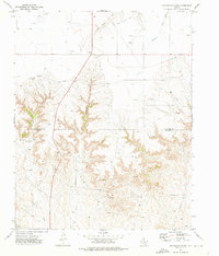
USGS Historical Quadrangle in GeoPDF.
Tags: 7.5 x 7.5 minute,
Downloadable Data,
GeoPDF,
GeoTIFF,
Historical Topographic Maps, All tags...
Historical Topographic Maps 7.5 x 7.5 Minute Map Series,
Map,
Sourdough Creek,
TX,
imageryBaseMapsEarthCover, Fewer tags
|
|

