Filters: Tags: Starved Rock (X)
12 results (37ms)|
Filters
Date Range
Extensions Types Contacts
Categories Tag Types Tag Schemes |
Using high-resolution sonar technologies with geographic information systems (GIS) and object based image analysis, benthic characteristics of the Illinois River have been interpreted to support Asian carp research, monitoring, and control. The study plan consisted of data collection and analysis of the Brandon, Dresden, Starved Rock, Marseilles, Peoria, La Grange, and Alton reaches of the Illinois River. Reaches with larger aquatic areas (Peoria, La Grange and Alton), had areas prioritized for data collection and analysis.
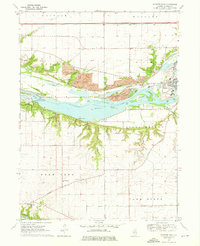
USGS Historical Quadrangle in GeoPDF.
The Fluvial Egg Drift Simulator (FluEgg) estimates bighead, silver, and grass carp egg and larval drift in rivers using species-specific egg developmental data combined with user-supplied hydraulic inputs (Garcia and others, 2013; Domanski, 2020). This data release contains results from 240 FluEgg 4.1.0 simulations of bighead carp eggs in the Illinois River under steady flow conditions. The data release also contains the hydraulic inputs used in the FluEgg simulations and a KML file of the centerline that represents the model domain. FluEgg simulations were run for all combinations of four spawning locations, six water temperatures, and ten steady flow conditions. Each simulation included 5,000 bighead carp eggs,...
The U.S. Army Corps of Engineers' Upper Mississippi River Restoration (UMRR) Program Long Term Resource Monitoring (LTRM) element has overseen the collection, processing, and serving of bathymetric data since 1989. A systemic data collection for the Upper Mississippi River System (UMRS) was completed in 2010. Water depth in aquatic systems is important for describing the physical characteristics of a river. Bathymetric maps are used for conducting spatial inventories of the aquatic habitat and detecting bed and elevation changes due to sedimentation. Bathymetric data is widely used, specifically for studies of water level management alternatives, modeling navigation impacts and hydraulic conditions, and environmental...
Categories: Data;
Types: Citation,
Downloadable,
Map Service,
OGC WFS Layer,
OGC WMS Layer,
Shapefile;
Tags: Illinois,
Illinois River,
Illinois Waterway,
LIDAR,
Starved Rock,
Using high-resolution sonar technologies with geographic information systems (GIS) and object based image analysis, benthic characteristics of the Illinois River have been interpreted to support Asian carp research, monitoring, and control. The study plan consisted of data collection and analysis of the Brandon, Dresden, Starved Rock, Marseilles, Peoria, La Grange, and Alton reaches of the Illinois River. Reaches with larger aquatic areas (Peoria, La Grange, and Alton), had areas prioritized for data collection and analysis.
Separate data for floodplain elevation and bathymetry were collected on the Upper Mississippi River System (UMRS) by the US Army Corps of Engineers (USACE), Upper Mississippi River Restoration (UMRR) Program. While many information needs can be met by using these data separately, in many cases seamless elevation data across the river and its floodplain are needed. This seamless elevation surface was generated by merging lidar (i.e., floodplain elevation) and bathymetry data. Merging the data required special processing in the areas of transition between the two sources of data.
Categories: Data;
Types: Citation,
Downloadable,
GeoTIFF,
Map Service,
Raster;
Tags: Illinois,
Illinois River,
Starved Rock,
Upper Mississippi River,
bathymetry,
Using high-resolution sonar technologies with geographic information systems (GIS) and object based image analysis, benthic characteristics of the Illinois River have been interpreted to support Asian carp research, monitoring, and control. The study plan consisted of data collection and analysis of the Brandon, Dresden, Starved Rock, Marseilles, Peoria, La Grange, and Alton reaches of the Illinois River. Reaches with larger aquatic areas (Peoria, La Grange and Alton), had areas prioritized for data collection and analysis.
Using high-resolution sonar technologies with geographic information systems (GIS) and object based image analysis, benthic characteristics of the Illinois River have been interpreted to support Asian carp research, monitoring, and control. The study plan consisted of data collection and analysis of the Brandon, Dresden, Starved Rock, Marseilles, Peoria, La Grange, and Alton reaches of the Illinois River. Reaches with larger aquatic areas (Peoria, La Grange, and Alton), had areas prioritized for data collection and analysis.
Using high-resolution sonar technologies with geographic information systems (GIS) and object based image analysis, benthic characteristics of the Illinois River have been interpreted to support Asian carp research, monitoring, and control. The study plan consisted of data collection and analysis of the Brandon, Dresden, Starved Rock, Marseilles, Peoria, La Grange, and Alton reaches of the Illinois River. Reaches with larger aquatic areas (Peoria, La Grange, and Alton), had areas prioritized for data collection and analysis.
Using high-resolution sonar technologies with geographic information systems (GIS) and object based image analysis, benthic characteristics of the Illinois River have been interpreted to support Asian carp research, monitoring, and control. The study plan consisted of data collection and analysis of the Brandon, Dresden, Starved Rock, Marseilles, Peoria, La Grange, and Alton reaches of the Illinois River. Reaches with larger aquatic areas (Peoria, La Grange, and Alton), had areas prioritized for data collection and analysis.
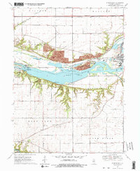
USGS Historical Quadrangle in GeoPDF.
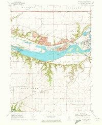
USGS Historical Quadrangle in GeoPDF.
|

|
