Filters
Date Range
Types
Contacts
Categories
Tag Types
Tag Schemes
|

A view of the mill's leach tank with a truck dumping material and a conveyor in the background.
Categories: Data;
Tags: 1950s,
Aguila - 15 Min,
Arizona,
Dataset,
Harquahala Mts. physiographic area, All tags...
Maricopa,
Mill, Manganese,
Stewart,
T5N R9W Sec 3 SE,
United States,
conveying systems,
geoscientificInformation,
image collections,
mining,
photographic prints,
trucks, Fewer tags

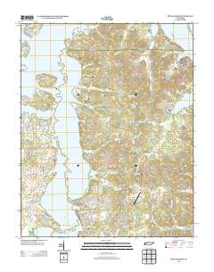
This location is part of the Arizona Mineral Industry Location System (AzMILS), an inventory of mineral occurences, prospects and mine locations in Arizona. Maricopa157 is located in T5N R9W Sec 3 SE in the Aguila - 15 Min quad. This collection consists of various reports, maps, records and related materials acquired by the Arizona Department of Mines and Mineral Resources regarding mining properties in Arizona. Information was obtained by various means, including the property owners, exploration companies, consultants, verbal interviews, field visits, newspapers and publications. Some sections may be redacted for copyright. Please see the access statement.
Categories: Data;
Tags: 1950s,
1960s,
1980s,
Aguila - 15 Min,
Arizona, All tags...
Dataset,
Harquahala Mts. physiographic area,
Maricopa,
Mill, Manganese,
Stewart,
T5N R9W Sec 3 SE,
United States,
clippings,
geoscientificInformation,
maps and atlases,
metallic ores,
milling and smelting,
mineral resources,
reports, Fewer tags

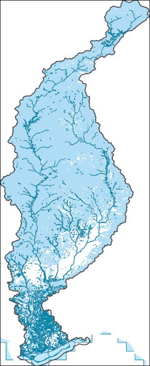
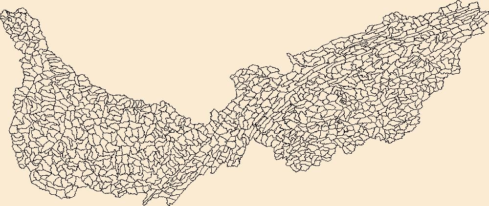
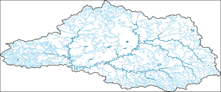
The Watershed Boundary Dataset (WBD) is a comprehensive aggregated collection of hydrologic unit data consistent with the national criteria for delineation and resolution. It defines the areal extent of surface water drainage to a point except in coastal or lake front areas where there could be multiple outlets as stated by the "Federal Standards and Procedures for the National Watershed Boundary Dataset (WBD)" "Standard" (https://pubs.usgs.gov/tm/11/a3/). Watershed boundaries are determined solely upon science-based hydrologic principles, not favoring any administrative boundaries or special projects, nor particular program or agency. This dataset represents the hydrologic unit boundaries to the 12-digit (6th level)...
Tags: 10-digit,
12-digit,
14-digit,
16-digit,
2-digit, All tags...
4-digit,
6-digit,
8-digit,
AL,
Abbeville,
Aiken,
Alabama,
Alachua,
Alamance,
Alexander,
Alleghany,
Allendale,
Anderson,
Anson,
Appling,
Appomattox,
Ashe,
Atkinson,
Attala,
Autauga,
Avery,
Bacon,
Baker,
Baldwin,
Bamberg,
Banks,
Barbour,
Barnwell,
Barrow,
Bartow,
Basin,
Bay,
Beaufort,
Bedford,
Ben Hill,
Berkeley,
Berrien,
Bertie,
Bibb,
Bladen,
Bleckley,
Blount,
Botetourt,
Bradford,
Bradley,
Brantley,
Brevard,
Brooks,
Broward,
Brunswick,
Bryan,
Bulloch,
Bullock,
Buncombe,
Burke,
Butler,
Butts,
Cabarrus,
Caldwell,
Calhoun,
Camden,
Campbell,
Candler,
Carroll,
Carteret,
Caswell,
Catawba,
Chambers,
Charleston,
Charlotte,
Charlton,
Chatham,
Chattahoochee,
Chattooga,
Cherokee,
Chesapeake,
Chester,
Chesterfield,
Chickasaw,
Chilton,
Choctaw,
Chowan,
Citrus,
Clarendon,
Clarke,
Clay,
Clayton,
Cleburne,
Cleveland,
Clinch,
Cobb,
Coffee,
Colleton,
Collier,
Colquitt,
Columbia,
Columbus,
Conecuh,
Cook,
Coosa,
Copiah,
Covington,
Coweta,
Craig,
Craven,
Crawford,
Crenshaw,
Crisp,
Cullman,
Cumberland,
Currituck,
Dade,
Dale,
Dallas,
Danville,
Dare,
Darlington,
Davidson,
Davie,
Dawson,
DeKalb,
DeSoto,
Decatur,
Dillon,
Dinwiddie,
Dixie,
Dodge,
Dooly,
Dorchester,
Dougherty,
Douglas,
Downloadable Data,
Duplin,
Durham,
Duval,
Early,
Echols,
Edgecombe,
Edgefield,
Effingham,
Elbert,
Elmore,
Emanuel,
Emporia,
Escambia,
Esri File GeoDatabase 10,
Etowah,
Evans,
FL,
Fairfield,
Fannin,
Fayette,
FileGDB,
Flagler,
Florence,
Florida,
Floyd,
Forrest,
Forsyth,
Franklin,
Fulton,
GA,
Gadsden,
Gaston,
Gates,
Geneva,
George,
Georgetown,
Georgia,
Gilchrist,
Gilmer,
Glades,
Glascock,
Glynn,
Gordon,
Grady,
Granville,
Grayson,
Greene,
Greensville,
Greenville,
Greenwood,
Guilford,
Gulf,
Gwinnett,
HU-2,
HU-2 Region,
HU2_03,
HUC,
Habersham,
Hale,
Halifax,
Hall,
Hamilton,
Hampton,
Hancock,
Haralson,
Hardee,
Harnett,
Harris,
Harrison,
Hart,
Heard,
Henderson,
Hendry,
Henry,
Hernando,
Hertford,
Highlands,
Hillsborough,
Hinds,
Hoke,
Holmes,
Horry,
Houston,
Hyde,
Hydrography,
Hydrologic Unit Code,
Hydrologic Units,
Indian River,
Iredell,
Irwin,
Isle of Wight,
Itawamba,
Jackson,
Jasper,
Jeff Davis,
Jefferson,
Jefferson Davis,
Jenkins,
Johnson,
Johnston,
Jones,
Kemper,
Kershaw,
LA,
Lafayette,
Lake,
Lamar,
Lancaster,
Lanier,
Lauderdale,
Laurens,
Lawrence,
Leake,
Lee,
Lenoir,
Leon,
Levy,
Lexington,
Liberty,
Lincoln,
Long,
Louisiana,
Lowndes,
Lumpkin,
Lunenburg,
MS,
Macon,
Madison,
Manatee,
Marengo,
Marion,
Marlboro,
Marshall,
Martin,
Martinsville,
McCormick,
McDowell,
McDuffie,
McIntosh,
Mecklenburg,
Meriwether,
Miami-Dade,
Miller,
Mississippi,
Mitchell,
Mobile,
Monroe,
Montgomery,
Moore,
Morgan,
Murray,
Muscogee,
NC,
Nash,
Nassau,
National Watershed Boundary Dataset (WBD),
National Watershed Boundary Dataset (WBD),
Neshoba,
New Hanover,
Newberry,
Newton,
North Carolina,
Northampton,
Nottoway,
Noxubee,
Oconee,
Oglethorpe,
Okaloosa,
Okeechobee,
Oktibbeha,
Onslow,
Orange,
Orangeburg,
Osceola,
Palm Beach,
Pamlico,
Pasco,
Pasquotank,
Patrick,
Paulding,
Peach,
Pearl River,
Pender,
Perquimans,
Perry,
Person,
Petersburg,
Pickens,
Pierce,
Pike,
Pinellas,
Pitt,
Pittsylvania,
Polk,
Pontotoc,
Prentiss,
Prince Edward,
Prince George,
Pulaski,
Putnam,
Quitman,
Rabun,
Randolph,
Rankin,
Region,
Richland,
Richmond,
Roanoke,
Robeson,
Rockdale,
Rockingham,
Rowan,
Russell,
Rutherford,
SC,
Salem,
Saluda,
Sampson,
Santa Rosa,
Sarasota,
Schley,
Scotland,
Scott,
Screven,
Seminole,
Shelby,
Simpson,
Smith,
South Carolina,
Southampton,
Spalding,
Spartanburg,
St. Bernard,
St. Clair,
St. Johns,
St. Lucie,
St. Tammany,
Stanly,
Stephens,
Stewart,
Stokes,
Stone,
Sub-basin,
Sub-region,
Subwatershed,
Suffolk,
Sumter,
Surry,
Sussex,
Suwannee,
TN,
Talbot,
Taliaferro,
Talladega,
Tallapoosa,
Tangipahoa,
Tattnall,
Taylor,
Telfair,
Tennessee,
Terrell,
Thomas,
Tift,
Tippah,
Tishomingo,
Toombs,
Towns,
Transylvania,
Treutlen,
Troup,
Turner,
Tuscaloosa,
Twiggs,
Tyrrell,
US,
Union,
United States,
Upson,
VA,
Vance,
Virginia,
Virginia Beach,
Volusia,
WBD,
Wake,
Wakulla,
Walker,
Walthall,
Walton,
Ware,
Warren,
Washington,
Watauga,
Watershed,
Watershed Boundary Dataset,
Wayne,
Webster,
Wheeler,
White,
Whitfield,
Wilcox,
Wilkes,
Wilkinson,
Williamsburg,
Wilson,
Winston,
Worth,
Yadkin,
Yancey,
York,
inlandWaters, Fewer tags
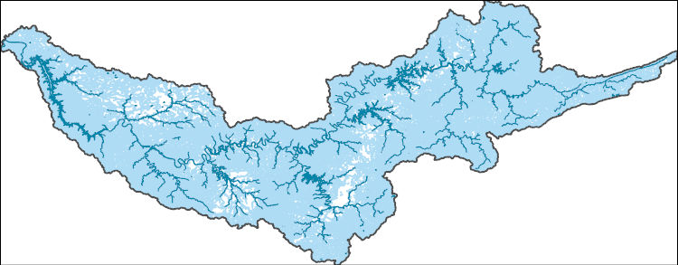
The National Hydrography Dataset (NHD) is a feature-based database that interconnects and uniquely identifies the stream segments or reaches that make up the nation's surface water drainage system. NHD data was originally developed at 1:100,000-scale and exists at that scale for the whole country. This high-resolution NHD, generally developed at 1:24,000/1:12,000 scale, adds detail to the original 1:100,000-scale NHD. (Data for Alaska, Puerto Rico and the Virgin Islands was developed at high-resolution, not 1:100,000 scale.) Local resolution NHD is being developed where partners and data exist. The NHD contains reach codes for networked features, flow direction, names, and centerline representations for areal water...
Tags: AL,
Administrative watershed units,
Administrative watershed units,
Alabama,
Area of Complex Channels, All tags...
Area to be submerged,
Baker,
Banks,
Barbour,
Basin,
Basin,
Bay,
Bay/Inlet,
Boundaries,
Boundary,
Bridge,
Bullock,
Calhoun,
Canal/Ditch,
Carroll,
Chambers,
Chattahoochee,
Cherokee,
Clay,
Clayton,
Coastline,
Cobb,
Colquitt,
Connector,
Coweta,
Crawford,
Crisp,
Dale,
Dam/Weir,
Dawson,
DeKalb,
Decatur,
Dooly,
Dougherty,
Douglas,
Downloadable Data,
Drainage areas for surface water,
Drainageway,
Early,
Esri Shapefile nan,
Estuary,
FL,
Fayette,
Florida,
Flow direction network,
Flume,
ForeShore,
Forsyth,
Franklin,
Fulton,
GA,
Gadsden,
Gaging Station,
Gate,
Geneva,
Georgia,
Grady,
Gulf,
Gwinnett,
HU-4,
HU-4 Subregion,
HU10,
HU12,
HU14,
HU16,
HU2,
HU4,
HU4_0313,
HU6,
HU8,
HUC,
Habersham,
Hall,
Harris,
Hazard Zone,
Heard,
Henry,
Houston,
Hydrographic,
Hydrography,
Hydrography,
Hydrography,
Hydrologic Unit Code,
Hydrologic Units,
Ice mass,
Inundation Area,
Jackson,
Lamar,
Lee,
Levee,
Liberty,
Line,
Lock Chamber,
Lumpkin,
Macon,
Marion,
Marsh,
Meriwether,
Miller,
Mitchell,
Monroe,
Muscogee,
National Hydrography Dataset (NHD),
National Hydrography Dataset (NHD) Best Resolution,
National Hydrography Dataset (NHD) Best Resolution,
Nonearthen Shore,
Orthoimage,
Paulding,
Peach,
Pike,
Playa,
Point,
PointEvent,
Pond,
Quitman,
Rabun,
Randolph,
Rapids,
Rapids,
Reach,
Reach code,
Reef,
Region,
Reservoir,
Rock,
Russell,
Schley,
Sea/Ocean,
Seminole,
Shapefile,
Sink/Rise,
Sounding Datum Line,
Spalding,
Special Use Zone,
Special Use Zone Limit,
Spillway,
Stewart,
Stream,
Stream/River,
Sub-basin,
Sub-region,
Subbasin,
Submerged Stream,
Subregion,
Subwatershed,
Sumter,
Surface water systems,
Swamp,
Talbot,
Taylor,
Terrell,
Topographic,
Towns,
Troup,
Tunnel,
Turner,
US,
Underground Conduit,
Union,
United States,
Upson,
WBD,
WBD,
Wakulla,
Wall,
Wash,
Washington,
Water Intake Outflow,
Waterfall,
Watershed,
Watershed Boundaries,
Watershed Boundary Dataset,
Watershed Boundary Dataset,
Webster,
Well,
White,
Worth,
artificial path,
boundaries,
dams,
drainage systems and characteristics,
inlandWaters,
lakes,
ngda,
rivers, Fewer tags
The National Hydrography Dataset (NHD) is a feature-based database that interconnects and uniquely identifies the stream segments or reaches that make up the nation's surface water drainage system. NHD data was originally developed at 1:100,000-scale and exists at that scale for the whole country. This high-resolution NHD, generally developed at 1:24,000/1:12,000 scale, adds detail to the original 1:100,000-scale NHD. (Data for Alaska, Puerto Rico and the Virgin Islands was developed at high-resolution, not 1:100,000 scale.) Local resolution NHD is being developed where partners and data exist. The NHD contains reach codes for networked features, flow direction, names, and centerline representations for areal water...
Tags: Adair,
Administrative watershed units,
Administrative watershed units,
Anderson,
Area of Complex Channels, All tags...
Area to be submerged,
Basin,
Basin,
Bay/Inlet,
Bedford,
Bell,
Bledsoe,
Boundaries,
Boundary,
Bridge,
Caldwell,
Campbell,
Canal/Ditch,
Cannon,
Casey,
Cheatham,
Christian,
Claiborne,
Clay,
Clinton,
Coastline,
Coffee,
Connector,
Crittenden,
Cumberland,
Dam/Weir,
Davidson,
DeKalb,
Dickson,
Downloadable Data,
Drainage areas for surface water,
Drainageway,
Esri Shapefile nan,
Estuary,
Fentress,
Flow direction network,
Flume,
ForeShore,
Gaging Station,
Garrard,
Gate,
Grundy,
HU-4,
HU-4 Subregion,
HU10,
HU12,
HU14,
HU16,
HU2,
HU4,
HU4_0513,
HU6,
HU8,
HUC,
Harlan,
Hazard Zone,
Hickman,
Houston,
Humphreys,
Hydrographic,
Hydrography,
Hydrography,
Hydrography,
Hydrologic Unit Code,
Hydrologic Units,
Ice mass,
Inundation Area,
Jackson,
KY,
Kentucky,
Knox,
Laurel,
Lee,
Leslie,
Letcher,
Levee,
Lincoln,
Line,
Livingston,
Lock Chamber,
Logan,
Lyon,
Macon,
Madison,
Marion,
Marsh,
McCreary,
Metcalfe,
Monroe,
Montgomery,
Morgan,
National Hydrography Dataset (NHD),
National Hydrography Dataset (NHD) Best Resolution,
National Hydrography Dataset (NHD) Best Resolution,
Nonearthen Shore,
Orthoimage,
Overton,
Pickett,
Playa,
Point,
PointEvent,
Pond,
Pulaski,
Putnam,
Rapids,
Rapids,
Reach,
Reach code,
Reef,
Region,
Reservoir,
Robertson,
Rock,
Rockcastle,
Russell,
Rutherford,
Scott,
Sea/Ocean,
Sequatchie,
Shapefile,
Simpson,
Sink/Rise,
Smith,
Sounding Datum Line,
Special Use Zone,
Special Use Zone Limit,
Spillway,
Stewart,
Stream,
Stream/River,
Sub-basin,
Sub-region,
Subbasin,
Submerged Stream,
Subregion,
Subwatershed,
Sumner,
Surface water systems,
Swamp,
TN,
Tennessee,
Todd,
Topographic,
Trigg,
Trousdale,
Tunnel,
US,
Underground Conduit,
United States,
VA,
Van Buren,
Virginia,
WBD,
WBD,
Wall,
Warren,
Wash,
Water Intake Outflow,
Waterfall,
Watershed,
Watershed Boundaries,
Watershed Boundary Dataset,
Watershed Boundary Dataset,
Wayne,
Well,
White,
Whitley,
Williamson,
Wilson,
Wise,
artificial path,
boundaries,
dams,
drainage systems and characteristics,
inlandWaters,
lakes,
ngda,
rivers, Fewer tags
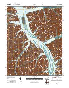
Layered GeoPDF 7.5 Minute Quadrangle Map. Layers of geospatial data include orthoimagery, roads, grids, geographic names, elevation contours, hydrography, and other selected map features.
Tags: 7.5 x 7.5 minute,
Downloadable Data,
EarthCover,
GeoPDF,
Imagery and Base Maps, All tags...
Map,
Montgomery,
Needmore, TN,
Public Land Survey System,
Stewart,
Tennessee,
U.S. National Grid,
US,
US Topo,
US Topo Historical,
United States,
boundary,
contour,
geographic names,
hydrography,
imageryBaseMapsEarthCover,
orthoimage,
structures,
topographic,
transportation,
woodland, Fewer tags
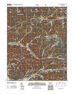
Layered GeoPDF 7.5 Minute Quadrangle Map. Layers of geospatial data include orthoimagery, roads, grids, geographic names, elevation contours, hydrography, and other selected map features.
Tags: 7.5 x 7.5 minute,
Bumpus Mills, TN,
Downloadable Data,
EarthCover,
GeoPDF, All tags...
Imagery and Base Maps,
Map,
Stewart,
Tennessee,
U.S. National Grid,
US,
US Topo,
US Topo Historical,
United States,
contour,
geographic names,
hydrography,
orthoimage,
topographic,
transportation, Fewer tags
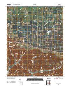
Layered GeoPDF 7.5 Minute Quadrangle Map. Layers of geospatial data include orthoimagery, roads, grids, geographic names, elevation contours, hydrography, and other selected map features.
Tags: 7.5 x 7.5 minute,
Downloadable Data,
EarthCover,
GeoPDF,
Imagery and Base Maps, All tags...
Kentucky,
Linton, KY-TN,
Map,
Stewart,
Tennessee,
Trigg,
U.S. National Grid,
US,
US Topo,
US Topo Historical,
United States,
contour,
geographic names,
hydrography,
orthoimage,
topographic,
transportation, Fewer tags
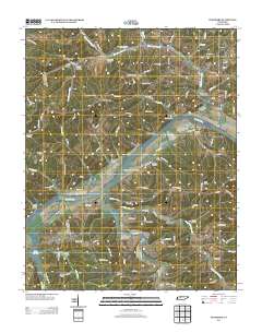
Layered GeoPDF 7.5 Minute Quadrangle Map. Layers of geospatial data include orthoimagery, roads, grids, geographic names, elevation contours, hydrography, and other selected map features.
Tags: 7.5 x 7.5 minute,
Downloadable Data,
EarthCover,
GeoPDF,
Imagery and Base Maps, All tags...
Map,
Standing Rock, TN,
Stewart,
Tennessee,
U.S. National Grid,
US,
US Topo,
US Topo Historical,
United States,
contour,
geographic names,
hydrography,
orthoimage,
topographic,
transportation, Fewer tags

Sequoia National Park, California. Unusually deep Indian pit near Redwood Meadow (cleaned out). Seated on the edge of the pit is Colonel George W. Stewart of Visalia, who has made a special study of these prehistoric cavities. 1925.

Sequoia National Park, California. Valhalla, viewed from Hesitation Point. Mount Stewart on the left. Circa 1935.
Layered GeoPDF 7.5 Minute Quadrangle Map. Layers of geospatial data include orthoimagery, roads, grids, geographic names, elevation contours, hydrography, and other selected map features.
Tags: 7.5 x 7.5 minute,
Downloadable Data,
EarthCover,
GeoPDF,
Imagery and Base Maps, All tags...
Indian Mound, TN,
Map,
Montgomery,
Stewart,
Tennessee,
U.S. National Grid,
US,
US Topo,
US Topo Historical,
United States,
contour,
geographic names,
hydrography,
orthoimage,
topographic,
transportation, Fewer tags
Layered GeoPDF 7.5 Minute Quadrangle Map. Layers of geospatial data include orthoimagery, roads, grids, geographic names, elevation contours, hydrography, and other selected map features.
Tags: 7.5 x 7.5 minute,
Downloadable Data,
EarthCover,
GeoPDF,
Imagery and Base Maps, All tags...
Map,
Montgomery,
Needmore, TN,
Public Land Survey System,
Stewart,
Tennessee,
U.S. National Grid,
US,
US Topo,
US Topo Historical,
United States,
boundary,
contour,
geographic names,
hydrography,
imageryBaseMapsEarthCover,
orthoimage,
structures,
topographic,
transportation,
woodland, Fewer tags
Layered GeoPDF 7.5 Minute Quadrangle Map. Layers of geospatial data include orthoimagery, roads, grids, geographic names, elevation contours, hydrography, and other selected map features.
Tags: 7.5 x 7.5 minute,
Benton,
Downloadable Data,
EarthCover,
GeoPDF, All tags...
Henry,
Imagery and Base Maps,
Map,
Poplar Creek, TN,
Public Land Survey System,
Stewart,
Tennessee,
U.S. National Grid,
US,
US Topo,
US Topo Historical,
United States,
boundary,
contour,
geographic names,
hydrography,
imageryBaseMapsEarthCover,
orthoimage,
structures,
topographic,
transportation,
woodland, Fewer tags
USGS Historical Quadrangle in GeoPDF.
Tags: 7.5 x 7.5 minute,
Downloadable Data,
GeoPDF,
GeoTIFF,
Historical Topographic Maps, All tags...
Historical Topographic Maps 7.5 x 7.5 Minute Map Series,
MS,
Map,
Stewart,
imageryBaseMapsEarthCover, Fewer tags
USGS Historical Quadrangle in GeoPDF.
Tags: 7.5 x 7.5 minute,
Downloadable Data,
GeoPDF,
GeoTIFF,
Historical Topographic Maps, All tags...
Historical Topographic Maps 7.5 x 7.5 Minute Map Series,
Map,
OH,
Stewart,
imageryBaseMapsEarthCover, Fewer tags

The Watershed Boundary Dataset (WBD) is a comprehensive aggregated collection of hydrologic unit data consistent with the national criteria for delineation and resolution. It defines the areal extent of surface water drainage to a point except in coastal or lake front areas where there could be multiple outlets as stated by the "Federal Standards and Procedures for the National Watershed Boundary Dataset (WBD)" "Standard" (https://pubs.usgs.gov/tm/11/a3/). Watershed boundaries are determined solely upon science-based hydrologic principles, not favoring any administrative boundaries or special projects, nor particular program or agency. This dataset represents the hydrologic unit boundaries to the 12-digit (6th level)...
Tags: 10-digit,
12-digit,
14-digit,
16-digit,
2-digit, All tags...
4-digit,
6-digit,
8-digit,
AL,
Alabama,
Alcorn,
Anderson,
Ashe,
Avery,
Basin,
Bedford,
Bell,
Benton,
Bland,
Bledsoe,
Blount,
Bradley,
Bristol,
Buchanan,
Buncombe,
Caldwell,
Calloway,
Campbell,
Cannon,
Carroll,
Carter,
Catoosa,
Cherokee,
Chester,
Claiborne,
Clay,
Cocke,
Coffee,
Colbert,
Cullman,
Cumberland,
Dade,
DeKalb,
Decatur,
Dickenson,
Dickson,
Downloadable Data,
Etowah,
Fannin,
Fentress,
Franklin,
GA,
GeoPackage,
Georgia,
Giles,
Gilmer,
Graham,
Grainger,
Graves,
Grayson,
Greene,
Greenville,
Grundy,
HU-2,
HU-2 Region,
HU2_06,
HUC,
Habersham,
Hamblen,
Hamilton,
Hancock,
Hardin,
Harlan,
Hawkins,
Haywood,
Henderson,
Henry,
Hickman,
Houston,
Humphreys,
Hydrography,
Hydrologic Unit Code,
Hydrologic Units,
Itawamba,
Jackson,
Jefferson,
Johnson,
KY,
Kentucky,
Knox,
Lauderdale,
Lawrence,
Lee,
Letcher,
Lewis,
Limestone,
Lincoln,
Livingston,
Loudon,
Lumpkin,
Lyon,
MS,
Macon,
Madison,
Marion,
Marshall,
Maury,
McCracken,
McDowell,
McMinn,
McNairy,
Meigs,
Mississippi,
Mitchell,
Monroe,
Moore,
Morgan,
NC,
National Watershed Boundary Dataset (WBD),
National Watershed Boundary Dataset (WBD),
North Carolina,
Norton,
Open Geospatial Consortium GeoPackage 1.2,
Perry,
Pickens,
Polk,
Prentiss,
Putnam,
Rabun,
Region,
Rhea,
Roane,
Russell,
Rutherford,
SC,
Scott,
Sequatchie,
Sevier,
Smyth,
South Carolina,
Stewart,
Sub-basin,
Sub-region,
Subwatershed,
Sullivan,
Swain,
TN,
Tazewell,
Tennessee,
Tishomingo,
Towns,
Transylvania,
Trigg,
US,
Unicoi,
Union,
United States,
VA,
Van Buren,
Virginia,
WBD,
WV,
Walker,
Washington,
Watauga,
Watershed,
Watershed Boundary Dataset,
Wayne,
West Virginia,
White,
Whitfield,
Williamson,
Winston,
Wise,
Wythe,
Yancey,
inlandWaters, Fewer tags

The Watershed Boundary Dataset (WBD) is a comprehensive aggregated collection of hydrologic unit data consistent with the national criteria for delineation and resolution. It defines the areal extent of surface water drainage to a point except in coastal or lake front areas where there could be multiple outlets as stated by the "Federal Standards and Procedures for the National Watershed Boundary Dataset (WBD)" "Standard" (https://pubs.usgs.gov/tm/11/a3/). Watershed boundaries are determined solely upon science-based hydrologic principles, not favoring any administrative boundaries or special projects, nor particular program or agency. This dataset represents the hydrologic unit boundaries to the 12-digit (6th level)...
Tags: 10-digit,
12-digit,
14-digit,
16-digit,
2-digit, All tags...
4-digit,
6-digit,
8-digit,
AL,
Alabama,
Alcorn,
Anderson,
Ashe,
Avery,
Basin,
Bedford,
Bell,
Benton,
Bland,
Bledsoe,
Blount,
Bradley,
Bristol,
Buchanan,
Buncombe,
Caldwell,
Calloway,
Campbell,
Cannon,
Carroll,
Carter,
Catoosa,
Cherokee,
Chester,
Claiborne,
Clay,
Cocke,
Coffee,
Colbert,
Cullman,
Cumberland,
Dade,
DeKalb,
Decatur,
Dickenson,
Dickson,
Downloadable Data,
Esri Shapefile nan,
Etowah,
Fannin,
Fentress,
Franklin,
GA,
Georgia,
Giles,
Gilmer,
Graham,
Grainger,
Graves,
Grayson,
Greene,
Greenville,
Grundy,
HU-2,
HU-2 Region,
HU2_06,
HUC,
Habersham,
Hamblen,
Hamilton,
Hancock,
Hardin,
Harlan,
Hawkins,
Haywood,
Henderson,
Henry,
Hickman,
Houston,
Humphreys,
Hydrography,
Hydrologic Unit Code,
Hydrologic Units,
Itawamba,
Jackson,
Jefferson,
Johnson,
KY,
Kentucky,
Knox,
Lauderdale,
Lawrence,
Lee,
Letcher,
Lewis,
Limestone,
Lincoln,
Livingston,
Loudon,
Lumpkin,
Lyon,
MS,
Macon,
Madison,
Marion,
Marshall,
Maury,
McCracken,
McDowell,
McMinn,
McNairy,
Meigs,
Mississippi,
Mitchell,
Monroe,
Moore,
Morgan,
NC,
National Watershed Boundary Dataset (WBD),
National Watershed Boundary Dataset (WBD),
North Carolina,
Norton,
Perry,
Pickens,
Polk,
Prentiss,
Putnam,
Rabun,
Region,
Rhea,
Roane,
Russell,
Rutherford,
SC,
Scott,
Sequatchie,
Sevier,
Shapefile,
Smyth,
South Carolina,
Stewart,
Sub-basin,
Sub-region,
Subwatershed,
Sullivan,
Swain,
TN,
Tazewell,
Tennessee,
Tishomingo,
Towns,
Transylvania,
Trigg,
US,
Unicoi,
Union,
United States,
VA,
Van Buren,
Virginia,
WBD,
WV,
Walker,
Washington,
Watauga,
Watershed,
Watershed Boundary Dataset,
Wayne,
West Virginia,
White,
Whitfield,
Williamson,
Winston,
Wise,
Wythe,
Yancey,
inlandWaters, Fewer tags
The Watershed Boundary Dataset (WBD) is a comprehensive aggregated collection of hydrologic unit data consistent with the national criteria for delineation and resolution. It defines the areal extent of surface water drainage to a point except in coastal or lake front areas where there could be multiple outlets as stated by the "Federal Standards and Procedures for the National Watershed Boundary Dataset (WBD)" "Standard" (https://pubs.usgs.gov/tm/11/a3/). Watershed boundaries are determined solely upon science-based hydrologic principles, not favoring any administrative boundaries or special projects, nor particular program or agency. This dataset represents the hydrologic unit boundaries to the 12-digit (6th level)...
Tags: 10-digit,
12-digit,
14-digit,
16-digit,
2-digit, All tags...
4-digit,
6-digit,
8-digit,
AL,
Alabama,
Alcorn,
Anderson,
Ashe,
Avery,
Basin,
Bedford,
Bell,
Benton,
Bland,
Bledsoe,
Blount,
Bradley,
Bristol,
Buchanan,
Buncombe,
Caldwell,
Calloway,
Campbell,
Cannon,
Carroll,
Carter,
Catoosa,
Cherokee,
Chester,
Claiborne,
Clay,
Cocke,
Coffee,
Colbert,
Cullman,
Cumberland,
Dade,
DeKalb,
Decatur,
Dickenson,
Dickson,
Downloadable Data,
Esri File GeoDatabase 10,
Etowah,
Fannin,
Fentress,
FileGDB,
Franklin,
GA,
Georgia,
Giles,
Gilmer,
Graham,
Grainger,
Graves,
Grayson,
Greene,
Greenville,
Grundy,
HU-2,
HU-2 Region,
HU2_06,
HUC,
Habersham,
Hamblen,
Hamilton,
Hancock,
Hardin,
Harlan,
Hawkins,
Haywood,
Henderson,
Henry,
Hickman,
Houston,
Humphreys,
Hydrography,
Hydrologic Unit Code,
Hydrologic Units,
Itawamba,
Jackson,
Jefferson,
Johnson,
KY,
Kentucky,
Knox,
Lauderdale,
Lawrence,
Lee,
Letcher,
Lewis,
Limestone,
Lincoln,
Livingston,
Loudon,
Lumpkin,
Lyon,
MS,
Macon,
Madison,
Marion,
Marshall,
Maury,
McCracken,
McDowell,
McMinn,
McNairy,
Meigs,
Mississippi,
Mitchell,
Monroe,
Moore,
Morgan,
NC,
National Watershed Boundary Dataset (WBD),
National Watershed Boundary Dataset (WBD),
North Carolina,
Norton,
Perry,
Pickens,
Polk,
Prentiss,
Putnam,
Rabun,
Region,
Rhea,
Roane,
Russell,
Rutherford,
SC,
Scott,
Sequatchie,
Sevier,
Smyth,
South Carolina,
Stewart,
Sub-basin,
Sub-region,
Subwatershed,
Sullivan,
Swain,
TN,
Tazewell,
Tennessee,
Tishomingo,
Towns,
Transylvania,
Trigg,
US,
Unicoi,
Union,
United States,
VA,
Van Buren,
Virginia,
WBD,
WV,
Walker,
Washington,
Watauga,
Watershed,
Watershed Boundary Dataset,
Wayne,
West Virginia,
White,
Whitfield,
Williamson,
Winston,
Wise,
Wythe,
Yancey,
inlandWaters, Fewer tags
The National Hydrography Dataset (NHD) is a feature-based database that interconnects and uniquely identifies the stream segments or reaches that make up the nation's surface water drainage system. NHD data was originally developed at 1:100,000-scale and exists at that scale for the whole country. This high-resolution NHD, generally developed at 1:24,000/1:12,000 scale, adds detail to the original 1:100,000-scale NHD. (Data for Alaska, Puerto Rico and the Virgin Islands was developed at high-resolution, not 1:100,000 scale.) Local resolution NHD is being developed where partners and data exist. The NHD contains reach codes for networked features, flow direction, names, and centerline representations for areal water...
Tags: Administrative watershed units,
Administrative watershed units,
Area of Complex Channels,
Area to be submerged,
Basin, All tags...
Basin,
Bay/Inlet,
Boundaries,
Boundary,
Bridge,
Canal/Ditch,
Cheatham,
Christian,
Coastline,
Connector,
Dam/Weir,
Davidson,
Downloadable Data,
Drainage areas for surface water,
Drainageway,
Estuary,
Flow direction network,
Flume,
ForeShore,
Gaging Station,
Gate,
GeoPackage,
HU-8,
HU-8 Subbasin,
HU10,
HU12,
HU14,
HU16,
HU2,
HU4,
HU6,
HU8,
HU8_05130206,
HUC,
Hazard Zone,
Hydrographic,
Hydrography,
Hydrography,
Hydrography,
Hydrologic Unit Code,
Hydrologic Units,
Ice mass,
Inundation Area,
KY,
Kentucky,
Levee,
Line,
Lock Chamber,
Logan,
Marsh,
Montgomery,
National Hydrography Dataset (NHD),
National Hydrography Dataset (NHD) Best Resolution,
National Hydrography Dataset (NHD) Best Resolution,
Nonearthen Shore,
Open Geospatial Consortium GeoPackage 1.2,
Orthoimage,
Playa,
Point,
PointEvent,
Pond,
Rapids,
Rapids,
Reach,
Reach code,
Reef,
Region,
Reservoir,
Robertson,
Rock,
Sea/Ocean,
Simpson,
Sink/Rise,
Sounding Datum Line,
Special Use Zone,
Special Use Zone Limit,
Spillway,
Stewart,
Stream,
Stream/River,
Sub-basin,
Sub-region,
Subbasin,
Submerged Stream,
Subregion,
Subwatershed,
Sumner,
Surface water systems,
Swamp,
TN,
Tennessee,
Todd,
Topographic,
Trigg,
Tunnel,
US,
Underground Conduit,
United States,
WBD,
WBD,
Wall,
Wash,
Water Intake Outflow,
Waterfall,
Watershed,
Watershed Boundaries,
Watershed Boundary Dataset,
Watershed Boundary Dataset,
Well,
artificial path,
boundaries,
dams,
drainage systems and characteristics,
inlandWaters,
lakes,
ngda,
rivers, Fewer tags
|
|

