|
|
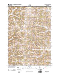
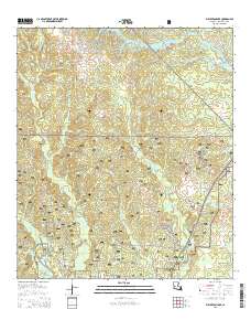
Layered GeoPDF 7.5 Minute Quadrangle Map. Layers of geospatial data include orthoimagery, roads, grids, geographic names, elevation contours, hydrography, and other selected map features.
Tags: 7.5 x 7.5 minute,
Downloadable Data,
EarthCover,
GeoPDF,
Imagery and Base Maps, All tags...
Map,
Monroe,
Public Land Survey System,
Trippville, WI,
U.S. National Grid,
US,
US Topo,
US Topo Historical,
United States,
Vernon,
Wisconsin,
boundary,
contour,
geographic names,
hydrography,
imageryBaseMapsEarthCover,
orthoimage,
structures,
topographic,
transportation,
woodland, Fewer tags
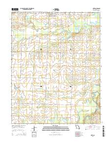
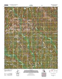
Layered GeoPDF 7.5 Minute Quadrangle Map. Layers of geospatial data include orthoimagery, roads, grids, geographic names, elevation contours, hydrography, and other selected map features.
Tags: 7.5 x 7.5 minute,
Downloadable Data,
EarthCover,
GeoPDF,
Imagery and Base Maps, All tags...
Map,
Metz, MO,
Missouri,
Public Land Survey System,
U.S. National Grid,
US,
US Topo,
US Topo Historical,
United States,
Vernon,
boundary,
contour,
geographic names,
hydrography,
imageryBaseMapsEarthCover,
orthoimage,
structures,
topographic,
transportation,
woodland, Fewer tags
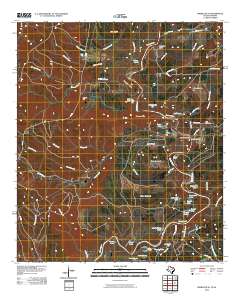
Layered GeoPDF 7.5 Minute Quadrangle Map. Layers of geospatial data include orthoimagery, roads, grids, geographic names, elevation contours, hydrography, and other selected map features.
Tags: 7.5 x 7.5 minute,
Downloadable Data,
EarthCover,
GeoPDF,
Imagery and Base Maps, All tags...
Louisiana,
Map,
Newton,
Texas,
U.S. National Grid,
US,
US Topo,
US Topo Historical,
United States,
Vernon,
Wiergate SE, TX-LA,
contour,
geographic names,
hydrography,
orthoimage,
topographic,
transportation, Fewer tags
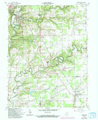
USGS Historical Quadrangle in GeoPDF.
Tags: 7.5 x 7.5 minute,
Downloadable Data,
GeoPDF,
GeoTIFF,
Historical Topographic Maps, All tags...
Historical Topographic Maps 7.5 x 7.5 Minute Map Series,
IN,
Map,
Vernon,
imageryBaseMapsEarthCover, Fewer tags
The Watershed Boundary Dataset (WBD) is a comprehensive aggregated collection of hydrologic unit data consistent with the national criteria for delineation and resolution. It defines the areal extent of surface water drainage to a point except in coastal or lake front areas where there could be multiple outlets as stated by the "Federal Standards and Procedures for the National Watershed Boundary Dataset (WBD)" "Standard" (https://pubs.usgs.gov/tm/11/a3/). Watershed boundaries are determined solely upon science-based hydrologic principles, not favoring any administrative boundaries or special projects, nor particular program or agency. This dataset represents the hydrologic unit boundaries to the 12-digit (6th level)...
Tags: 10-digit,
12-digit,
14-digit,
16-digit,
2-digit, All tags...
4-digit,
6-digit,
8-digit,
Anderson,
Andrews,
Angelina,
Aransas,
Archer,
Atascosa,
Austin,
Bailey,
Bandera,
Basin,
Bastrop,
Baylor,
Beauregard,
Bee,
Bell,
Bexar,
Blanco,
Borden,
Bosque,
Brazoria,
Brazos,
Brooks,
Brown,
Burleson,
Burnet,
Caddo,
Calcasieu,
Caldwell,
Calhoun,
Callahan,
Cameron,
Castro,
Chambers,
Chaves,
Cherokee,
Clay,
Cochran,
Coke,
Coleman,
Collin,
Colorado,
Comal,
Comanche,
Concho,
Cooke,
Coryell,
Crockett,
Crosby,
Curry,
Dallas,
Dawson,
De Soto,
DeWitt,
Denton,
Dickens,
Dimmit,
Downloadable Data,
Duval,
Eastland,
Ector,
Edwards,
Ellis,
Erath,
Falls,
Fannin,
Fayette,
Fisher,
Floyd,
Fort Bend,
Franklin,
Freestone,
Frio,
Gaines,
Galveston,
Garza,
GeoPackage,
Gillespie,
Glasscock,
Goliad,
Gonzales,
Grayson,
Gregg,
Grimes,
Guadalupe,
HU-2,
HU-2 Region,
HU2_12,
HUC,
Hale,
Hamilton,
Hardin,
Harris,
Harrison,
Haskell,
Hays,
Henderson,
Hidalgo,
Hill,
Hockley,
Hood,
Hopkins,
Houston,
Howard,
Hunt,
Hydrography,
Hydrologic Unit Code,
Hydrologic Units,
Irion,
Jack,
Jackson,
Jasper,
Jefferson,
Jim Hogg,
Jim Wells,
Johnson,
Jones,
Karnes,
Kaufman,
Kendall,
Kenedy,
Kent,
Kerr,
Kimble,
King,
Kinney,
Kleberg,
Knox,
LA,
La Salle,
Lamb,
Lampasas,
Lavaca,
Lea,
Lee,
Leon,
Liberty,
Limestone,
Live Oak,
Llano,
Louisiana,
Lubbock,
Lynn,
Madison,
Martin,
Mason,
Matagorda,
Maverick,
McCulloch,
McLennan,
McMullen,
Medina,
Menard,
Midland,
Milam,
Mills,
Mitchell,
Montague,
Montgomery,
NM,
Nacogdoches,
Natchitoches,
National Watershed Boundary Dataset (WBD),
National Watershed Boundary Dataset (WBD),
Navarro,
New Mexico,
Newton,
Nolan,
Nueces,
Open Geospatial Consortium GeoPackage 1.2,
Orange,
Palo Pinto,
Panola,
Parker,
Parmer,
Polk,
Rains,
Reagan,
Real,
Refugio,
Region,
Robertson,
Rockwall,
Roosevelt,
Runnels,
Rusk,
Sabine,
San Augustine,
San Jacinto,
San Patricio,
San Saba,
Schleicher,
Scurry,
Shackelford,
Shelby,
Smith,
Somervell,
Starr,
Stephens,
Sterling,
Stonewall,
Sub-basin,
Sub-region,
Subwatershed,
Sutton,
Swisher,
TX,
Tarrant,
Taylor,
Terry,
Texas,
Throckmorton,
Tom Green,
Travis,
Trinity,
Tyler,
US,
United States,
Upshur,
Upton,
Uvalde,
Van Zandt,
Vernon,
Victoria,
WBD,
Walker,
Waller,
Washington,
Watershed,
Watershed Boundary Dataset,
Webb,
Wharton,
Willacy,
Williamson,
Wilson,
Winkler,
Wise,
Wood,
Yoakum,
Young,
Zavala,
inlandWaters, Fewer tags
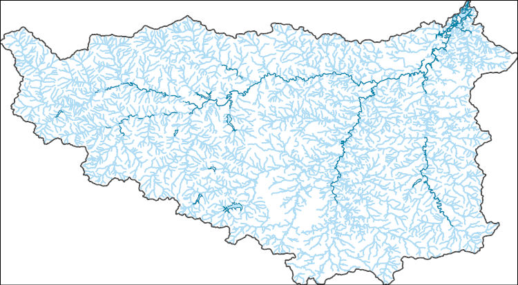
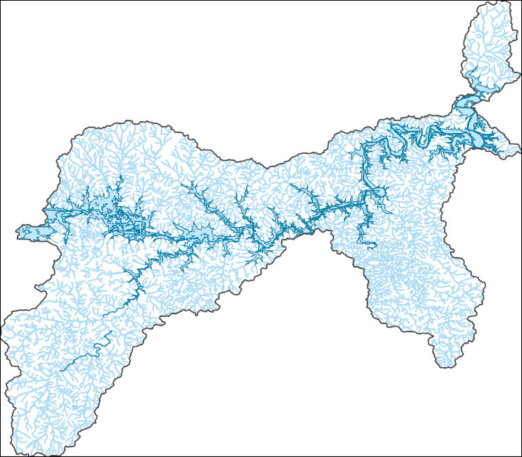
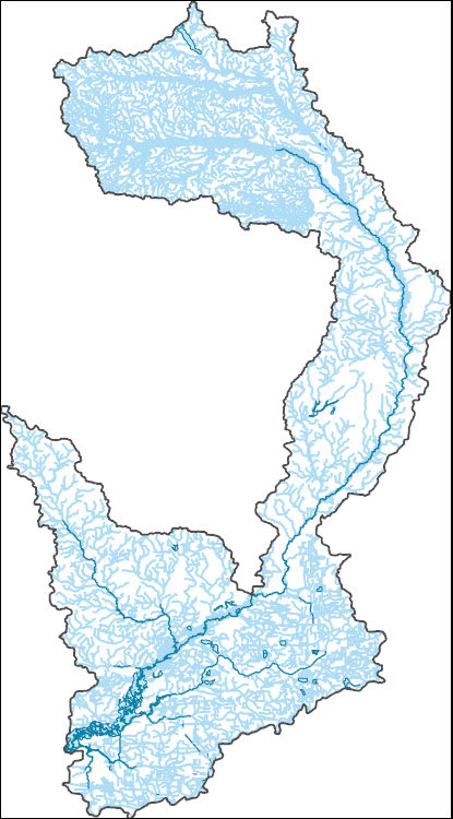
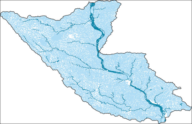
The National Hydrography Dataset (NHD) is a feature-based database that interconnects and uniquely identifies the stream segments or reaches that make up the nation's surface water drainage system. NHD data was originally developed at 1:100,000-scale and exists at that scale for the whole country. This high-resolution NHD, generally developed at 1:24,000/1:12,000 scale, adds detail to the original 1:100,000-scale NHD. (Data for Alaska, Puerto Rico and the Virgin Islands was developed at high-resolution, not 1:100,000 scale.) Local resolution NHD is being developed where partners and data exist. The NHD contains reach codes for networked features, flow direction, names, and centerline representations for areal water...
Tags: Administrative watershed units,
Administrative watershed units,
Area of Complex Channels,
Area to be submerged,
Basin, All tags...
Basin,
Bay/Inlet,
Boundaries,
Boundary,
Bridge,
Canal/Ditch,
Coastline,
Columbia,
Connector,
Crawford,
Dam/Weir,
Dane,
Downloadable Data,
Drainage areas for surface water,
Drainageway,
Esri Shapefile nan,
Estuary,
Flow direction network,
Flume,
ForeShore,
Gaging Station,
Gate,
Grant,
HU-8,
HU-8 Subbasin,
HU10,
HU12,
HU14,
HU16,
HU2,
HU4,
HU6,
HU8,
HU8_07070005,
HUC,
Hazard Zone,
Hydrographic,
Hydrography,
Hydrography,
Hydrography,
Hydrologic Unit Code,
Hydrologic Units,
Ice mass,
Inundation Area,
Iowa,
Levee,
Line,
Lock Chamber,
Marsh,
National Hydrography Dataset (NHD),
National Hydrography Dataset (NHD) Best Resolution,
National Hydrography Dataset (NHD) Best Resolution,
Nonearthen Shore,
Orthoimage,
Playa,
Point,
PointEvent,
Pond,
Rapids,
Rapids,
Reach,
Reach code,
Reef,
Region,
Reservoir,
Richland,
Rock,
Sauk,
Sea/Ocean,
Shapefile,
Sink/Rise,
Sounding Datum Line,
Special Use Zone,
Special Use Zone Limit,
Spillway,
Stream,
Stream/River,
Sub-basin,
Sub-region,
Subbasin,
Submerged Stream,
Subregion,
Subwatershed,
Surface water systems,
Swamp,
Topographic,
Tunnel,
US,
Underground Conduit,
United States,
Vernon,
WBD,
WBD,
WI,
Wall,
Wash,
Water Intake Outflow,
Waterfall,
Watershed,
Watershed Boundaries,
Watershed Boundary Dataset,
Watershed Boundary Dataset,
Well,
Wisconsin,
artificial path,
boundaries,
dams,
drainage systems and characteristics,
inlandWaters,
lakes,
ngda,
rivers, Fewer tags
The National Hydrography Dataset (NHD) is a feature-based database that interconnects and uniquely identifies the stream segments or reaches that make up the nation's surface water drainage system. NHD data was originally developed at 1:100,000-scale and exists at that scale for the whole country. This high-resolution NHD, generally developed at 1:24,000/1:12,000 scale, adds detail to the original 1:100,000-scale NHD. (Data for Alaska, Puerto Rico and the Virgin Islands was developed at high-resolution, not 1:100,000 scale.) Local resolution NHD is being developed where partners and data exist. The NHD contains reach codes for networked features, flow direction, names, and centerline representations for areal water...
Tags: AR,
Administrative watershed units,
Administrative watershed units,
Area of Complex Channels,
Area to be submerged, All tags...
Arkansas,
Atoka,
Basin,
Basin,
Bay/Inlet,
Bienville,
Bossier,
Boundaries,
Boundary,
Bowie,
Bridge,
Bryan,
Caddo,
Camp,
Canal/Ditch,
Cass,
Choctaw,
Claiborne,
Coal,
Coastline,
Columbia,
Connector,
Dam/Weir,
De Soto,
Delta,
Downloadable Data,
Drainage areas for surface water,
Drainageway,
Esri File GeoDatabase 10,
Estuary,
Fannin,
FileGDB,
Flow direction network,
Flume,
ForeShore,
Franklin,
Gaging Station,
Gate,
Grant,
Grayson,
Gregg,
HU-4,
HU-4 Subregion,
HU10,
HU12,
HU14,
HU16,
HU2,
HU4,
HU4_1114,
HU6,
HU8,
HUC,
Harrison,
Hazard Zone,
Hempstead,
Hopkins,
Howard,
Hughes,
Hunt,
Hydrographic,
Hydrography,
Hydrography,
Hydrography,
Hydrologic Unit Code,
Hydrologic Units,
Ice mass,
Inundation Area,
Johnston,
LA,
Lafayette,
Lamar,
Latimer,
Le Flore,
Levee,
Lincoln,
Line,
Little River,
Lock Chamber,
Louisiana,
Marion,
Marsh,
McCurtain,
Miller,
Morris,
Murray,
Natchitoches,
National Hydrography Dataset (NHD),
National Hydrography Dataset (NHD) Best Resolution,
National Hydrography Dataset (NHD) Best Resolution,
Nevada,
Nonearthen Shore,
OK,
Oklahoma,
Orthoimage,
Panola,
Pike,
Pittsburg,
Playa,
Point,
PointEvent,
Polk,
Pond,
Pontotoc,
Pushmataha,
Rapides,
Rapids,
Rapids,
Reach,
Reach code,
Red River,
Reef,
Region,
Reservoir,
Rock,
Sabine,
Sea/Ocean,
Sevier,
Sink/Rise,
Sounding Datum Line,
Special Use Zone,
Special Use Zone Limit,
Spillway,
Stream,
Stream/River,
Sub-basin,
Sub-region,
Subbasin,
Submerged Stream,
Subregion,
Subwatershed,
Surface water systems,
Swamp,
TX,
Texas,
Titus,
Topographic,
Tunnel,
US,
Underground Conduit,
United States,
Upshur,
Vernon,
WBD,
WBD,
Wall,
Wash,
Water Intake Outflow,
Waterfall,
Watershed,
Watershed Boundaries,
Watershed Boundary Dataset,
Watershed Boundary Dataset,
Webster,
Well,
Winn,
Wood,
artificial path,
boundaries,
dams,
drainage systems and characteristics,
inlandWaters,
lakes,
ngda,
rivers, Fewer tags
The National Hydrography Dataset (NHD) is a feature-based database that interconnects and uniquely identifies the stream segments or reaches that make up the nation's surface water drainage system. NHD data was originally developed at 1:100,000-scale and exists at that scale for the whole country. This high-resolution NHD, generally developed at 1:24,000/1:12,000 scale, adds detail to the original 1:100,000-scale NHD. (Data for Alaska, Puerto Rico and the Virgin Islands was developed at high-resolution, not 1:100,000 scale.) Local resolution NHD is being developed where partners and data exist. The NHD contains reach codes for networked features, flow direction, names, and centerline representations for areal water...
Tags: Adair,
Administrative watershed units,
Administrative watershed units,
Andrew,
Area of Complex Channels, All tags...
Area to be submerged,
Atchison,
Audrain,
Barry,
Barton,
Basin,
Basin,
Bates,
Bay/Inlet,
Benton,
Bollinger,
Boone,
Boundaries,
Boundary,
Bridge,
Buchanan,
Butler,
Caldwell,
Callaway,
Camden,
Canal/Ditch,
Cape Girardeau,
Carroll,
Carter,
Cass,
Cedar,
Chariton,
Christian,
Clark,
Clay,
Clinton,
Coastline,
Cole,
Connector,
Cooper,
Crawford,
Dade,
Dallas,
Dam/Weir,
Daviess,
DeKalb,
Dent,
Douglas,
Downloadable Data,
Drainage areas for surface water,
Drainageway,
Dunklin,
Esri File GeoDatabase 10,
Estuary,
FileGDB,
Flow direction network,
Flume,
ForeShore,
Franklin,
Gaging Station,
Gasconade,
Gate,
Gentry,
Greene,
Grundy,
HU10,
HU12,
HU14,
HU16,
HU2,
HU4,
HU6,
HU8,
HUC,
Harrison,
Hazard Zone,
Henry,
Hickory,
Holt,
Howard,
Howell,
Hydrographic,
Hydrography,
Hydrography,
Hydrography,
Hydrologic Unit Code,
Hydrologic Units,
Ice mass,
Inundation Area,
Iron,
Jackson,
Jasper,
Jefferson,
Johnson,
Knox,
Laclede,
Lafayette,
Lawrence,
Levee,
Lewis,
Lincoln,
Line,
Linn,
Livingston,
Lock Chamber,
MO,
Macon,
Madison,
Maries,
Marion,
Marsh,
McDonald,
Mercer,
Miller,
Mississippi,
Missouri,
Moniteau,
Monroe,
Montgomery,
Morgan,
National Hydrography Dataset (NHD),
National Hydrography Dataset (NHD) Best Resolution,
National Hydrography Dataset (NHD) Best Resolution,
New Madrid,
Newton,
Nodaway,
Nonearthen Shore,
Oregon,
Orthoimage,
Osage,
Ozark,
Pemiscot,
Perry,
Pettis,
Phelps,
Pike,
Platte,
Playa,
Point,
PointEvent,
Polk,
Pond,
Pulaski,
Putnam,
Ralls,
Randolph,
Rapids,
Rapids,
Ray,
Reach,
Reach code,
Reef,
Region,
Reservoir,
Reynolds,
Ripley,
Rock,
Saline,
Schuyler,
Scotland,
Scott,
Sea/Ocean,
Shannon,
Shelby,
Sink/Rise,
Sounding Datum Line,
Special Use Zone,
Special Use Zone Limit,
Spillway,
St. Charles,
St. Clair,
St. Francois,
St. Louis,
State,
State,
State_Missouri,
Ste. Genevieve,
Stoddard,
Stone,
Stream,
Stream/River,
Sub-basin,
Sub-region,
Subbasin,
Submerged Stream,
Subregion,
Subwatershed,
Sullivan,
Surface water systems,
Swamp,
Taney,
Texas,
Topographic,
Tunnel,
US,
Underground Conduit,
United States,
Vernon,
WBD,
WBD,
Wall,
Warren,
Wash,
Washington,
Water Intake Outflow,
Waterfall,
Watershed,
Watershed Boundaries,
Watershed Boundary Dataset,
Watershed Boundary Dataset,
Wayne,
Webster,
Well,
Worth,
Wright,
artificial path,
boundaries,
dams,
drainage systems and characteristics,
inlandWaters,
lakes,
ngda,
rivers, Fewer tags
The National Hydrography Dataset (NHD) is a feature-based database that interconnects and uniquely identifies the stream segments or reaches that make up the nation's surface water drainage system. NHD data was originally developed at 1:100,000-scale and exists at that scale for the whole country. This high-resolution NHD, generally developed at 1:24,000/1:12,000 scale, adds detail to the original 1:100,000-scale NHD. (Data for Alaska, Puerto Rico and the Virgin Islands was developed at high-resolution, not 1:100,000 scale.) Local resolution NHD is being developed where partners and data exist. The NHD contains reach codes for networked features, flow direction, names, and centerline representations for areal water...
Tags: Administrative watershed units,
Administrative watershed units,
Allen,
Area of Complex Channels,
Area to be submerged, All tags...
Barton,
Basin,
Basin,
Bay/Inlet,
Boundaries,
Boundary,
Bourbon,
Bridge,
Canal/Ditch,
Coastline,
Connector,
Crawford,
Dam/Weir,
Downloadable Data,
Drainage areas for surface water,
Drainageway,
Esri File GeoDatabase 10,
Estuary,
FileGDB,
Flow direction network,
Flume,
ForeShore,
Gaging Station,
Gate,
HU-8,
HU-8 Subbasin,
HU10,
HU12,
HU14,
HU16,
HU2,
HU4,
HU6,
HU8,
HU8_10290104,
HUC,
Hazard Zone,
Hydrographic,
Hydrography,
Hydrography,
Hydrography,
Hydrologic Unit Code,
Hydrologic Units,
Ice mass,
Inundation Area,
KS,
Kansas,
Levee,
Line,
Lock Chamber,
MO,
Marsh,
Missouri,
National Hydrography Dataset (NHD),
National Hydrography Dataset (NHD) Best Resolution,
National Hydrography Dataset (NHD) Best Resolution,
Nonearthen Shore,
Orthoimage,
Playa,
Point,
PointEvent,
Pond,
Rapids,
Rapids,
Reach,
Reach code,
Reef,
Region,
Reservoir,
Rock,
Sea/Ocean,
Sink/Rise,
Sounding Datum Line,
Special Use Zone,
Special Use Zone Limit,
Spillway,
Stream,
Stream/River,
Sub-basin,
Sub-region,
Subbasin,
Submerged Stream,
Subregion,
Subwatershed,
Surface water systems,
Swamp,
Topographic,
Tunnel,
US,
Underground Conduit,
United States,
Vernon,
WBD,
WBD,
Wall,
Wash,
Water Intake Outflow,
Waterfall,
Watershed,
Watershed Boundaries,
Watershed Boundary Dataset,
Watershed Boundary Dataset,
Well,
artificial path,
boundaries,
dams,
drainage systems and characteristics,
inlandWaters,
lakes,
ngda,
rivers, Fewer tags
The National Hydrography Dataset (NHD) is a feature-based database that interconnects and uniquely identifies the stream segments or reaches that make up the nation's surface water drainage system. NHD data was originally developed at 1:100,000-scale and exists at that scale for the whole country. This high-resolution NHD, generally developed at 1:24,000/1:12,000 scale, adds detail to the original 1:100,000-scale NHD. (Data for Alaska, Puerto Rico and the Virgin Islands was developed at high-resolution, not 1:100,000 scale.) Local resolution NHD is being developed where partners and data exist. The NHD contains reach codes for networked features, flow direction, names, and centerline representations for areal water...
Tags: Administrative watershed units,
Administrative watershed units,
Area of Complex Channels,
Area to be submerged,
Barton, All tags...
Basin,
Basin,
Bates,
Bay/Inlet,
Benton,
Boundaries,
Boundary,
Bridge,
Canal/Ditch,
Cedar,
Coastline,
Connector,
Dam/Weir,
Downloadable Data,
Drainage areas for surface water,
Drainageway,
Estuary,
Flow direction network,
Flume,
ForeShore,
Gaging Station,
Gate,
GeoPackage,
HU-8,
HU-8 Subbasin,
HU10,
HU12,
HU14,
HU16,
HU2,
HU4,
HU6,
HU8,
HU8_10290105,
HUC,
Hazard Zone,
Henry,
Hickory,
Hydrographic,
Hydrography,
Hydrography,
Hydrography,
Hydrologic Unit Code,
Hydrologic Units,
Ice mass,
Inundation Area,
Levee,
Line,
Lock Chamber,
MO,
Marsh,
Missouri,
National Hydrography Dataset (NHD),
National Hydrography Dataset (NHD) Best Resolution,
National Hydrography Dataset (NHD) Best Resolution,
Nonearthen Shore,
Open Geospatial Consortium GeoPackage 1.2,
Orthoimage,
Playa,
Point,
PointEvent,
Polk,
Pond,
Rapids,
Rapids,
Reach,
Reach code,
Reef,
Region,
Reservoir,
Rock,
Sea/Ocean,
Sink/Rise,
Sounding Datum Line,
Special Use Zone,
Special Use Zone Limit,
Spillway,
St. Clair,
Stream,
Stream/River,
Sub-basin,
Sub-region,
Subbasin,
Submerged Stream,
Subregion,
Subwatershed,
Surface water systems,
Swamp,
Topographic,
Tunnel,
US,
Underground Conduit,
United States,
Vernon,
WBD,
WBD,
Wall,
Wash,
Water Intake Outflow,
Waterfall,
Watershed,
Watershed Boundaries,
Watershed Boundary Dataset,
Watershed Boundary Dataset,
Well,
artificial path,
boundaries,
dams,
drainage systems and characteristics,
inlandWaters,
lakes,
ngda,
rivers, Fewer tags
The National Hydrography Dataset (NHD) is a feature-based database that interconnects and uniquely identifies the stream segments or reaches that make up the nation's surface water drainage system. NHD data was originally developed at 1:100,000-scale and exists at that scale for the whole country. This high-resolution NHD, generally developed at 1:24,000/1:12,000 scale, adds detail to the original 1:100,000-scale NHD. (Data for Alaska, Puerto Rico and the Virgin Islands was developed at high-resolution, not 1:100,000 scale.) Local resolution NHD is being developed where partners and data exist. The NHD contains reach codes for networked features, flow direction, names, and centerline representations for areal water...
Tags: Administrative watershed units,
Administrative watershed units,
Allen,
Area of Complex Channels,
Area to be submerged, All tags...
Basin,
Basin,
Bay/Inlet,
Beauregard,
Boundaries,
Boundary,
Bridge,
Calcasieu,
Canal/Ditch,
Coastline,
Connector,
Dam/Weir,
Downloadable Data,
Drainage areas for surface water,
Drainageway,
Esri Shapefile nan,
Estuary,
Flow direction network,
Flume,
ForeShore,
Gaging Station,
Gate,
HU-8,
HU-8 Subbasin,
HU10,
HU12,
HU14,
HU16,
HU2,
HU4,
HU6,
HU8,
HU8_08080203,
HUC,
Hazard Zone,
Hydrographic,
Hydrography,
Hydrography,
Hydrography,
Hydrologic Unit Code,
Hydrologic Units,
Ice mass,
Inundation Area,
Jefferson Davis,
LA,
Levee,
Line,
Lock Chamber,
Louisiana,
Marsh,
Natchitoches,
National Hydrography Dataset (NHD),
National Hydrography Dataset (NHD) Best Resolution,
National Hydrography Dataset (NHD) Best Resolution,
Nonearthen Shore,
Orthoimage,
Playa,
Point,
PointEvent,
Pond,
Rapides,
Rapids,
Rapids,
Reach,
Reach code,
Reef,
Region,
Reservoir,
Rock,
Sea/Ocean,
Shapefile,
Sink/Rise,
Sounding Datum Line,
Special Use Zone,
Special Use Zone Limit,
Spillway,
Stream,
Stream/River,
Sub-basin,
Sub-region,
Subbasin,
Submerged Stream,
Subregion,
Subwatershed,
Surface water systems,
Swamp,
Topographic,
Tunnel,
US,
Underground Conduit,
United States,
Vernon,
WBD,
WBD,
Wall,
Wash,
Water Intake Outflow,
Waterfall,
Watershed,
Watershed Boundaries,
Watershed Boundary Dataset,
Watershed Boundary Dataset,
Well,
artificial path,
boundaries,
dams,
drainage systems and characteristics,
inlandWaters,
lakes,
ngda,
rivers, Fewer tags
The National Hydrography Dataset (NHD) is a feature-based database that interconnects and uniquely identifies the stream segments or reaches that make up the nation's surface water drainage system. NHD data was originally developed at 1:100,000-scale and exists at that scale for the whole country. This high-resolution NHD, generally developed at 1:24,000/1:12,000 scale, adds detail to the original 1:100,000-scale NHD. (Data for Alaska, Puerto Rico and the Virgin Islands was developed at high-resolution, not 1:100,000 scale.) Local resolution NHD is being developed where partners and data exist. The NHD contains reach codes for networked features, flow direction, names, and centerline representations for areal water...
Tags: Administrative watershed units,
Administrative watershed units,
Allamakee,
Area of Complex Channels,
Area to be submerged, All tags...
Basin,
Basin,
Bay/Inlet,
Boundaries,
Boundary,
Bridge,
Buchanan,
Canal/Ditch,
Carroll,
Chickasaw,
Clayton,
Clinton,
Coastline,
Connector,
Crawford,
Dam/Weir,
Delaware,
Downloadable Data,
Drainage areas for surface water,
Drainageway,
Dubuque,
Estuary,
Fayette,
Fillmore,
Flow direction network,
Flume,
ForeShore,
Gaging Station,
Gate,
GeoPackage,
Grant,
HU-4,
HU-4 Subregion,
HU10,
HU12,
HU14,
HU16,
HU2,
HU4,
HU4_0706,
HU6,
HU8,
HUC,
Hazard Zone,
Houston,
Howard,
Hydrographic,
Hydrography,
Hydrography,
Hydrography,
Hydrologic Unit Code,
Hydrologic Units,
IA,
IL,
Ice mass,
Illinois,
Inundation Area,
Iowa,
Iowa,
Jackson,
Jo Daviess,
Jones,
La Crosse,
Lafayette,
Levee,
Line,
Linn,
Lock Chamber,
MN,
Marsh,
Minnesota,
Mitchell,
Monroe,
Mower,
National Hydrography Dataset (NHD),
National Hydrography Dataset (NHD) Best Resolution,
National Hydrography Dataset (NHD) Best Resolution,
Nonearthen Shore,
Open Geospatial Consortium GeoPackage 1.2,
Orthoimage,
Playa,
Point,
PointEvent,
Pond,
Rapids,
Rapids,
Reach,
Reach code,
Reef,
Region,
Reservoir,
Rock,
Sea/Ocean,
Sink/Rise,
Sounding Datum Line,
Special Use Zone,
Special Use Zone Limit,
Spillway,
Stephenson,
Stream,
Stream/River,
Sub-basin,
Sub-region,
Subbasin,
Submerged Stream,
Subregion,
Subwatershed,
Surface water systems,
Swamp,
Topographic,
Tunnel,
US,
Underground Conduit,
United States,
Vernon,
WBD,
WBD,
WI,
Wall,
Wash,
Water Intake Outflow,
Waterfall,
Watershed,
Watershed Boundaries,
Watershed Boundary Dataset,
Watershed Boundary Dataset,
Well,
Whiteside,
Winneshiek,
Wisconsin,
artificial path,
boundaries,
dams,
drainage systems and characteristics,
inlandWaters,
lakes,
ngda,
rivers, Fewer tags
The Watershed Boundary Dataset (WBD) is a comprehensive aggregated collection of hydrologic unit data consistent with the national criteria for delineation and resolution. It defines the areal extent of surface water drainage to a point except in coastal or lake front areas where there could be multiple outlets as stated by the "Federal Standards and Procedures for the National Watershed Boundary Dataset (WBD)" "Standard" (https://pubs.usgs.gov/tm/11/a3/). Watershed boundaries are determined solely upon science-based hydrologic principles, not favoring any administrative boundaries or special projects, nor particular program or agency. This dataset represents the hydrologic unit boundaries to the 12-digit (6th level)...
Tags: 10-digit,
12-digit,
14-digit,
16-digit,
2-digit, All tags...
4-digit,
6-digit,
8-digit,
Adair,
Adams,
Albany,
Allen,
Anderson,
Andrew,
Antelope,
Appanoose,
Arapahoe,
Arthur,
Atchison,
Audrain,
Audubon,
Aurora,
Banner,
Barnes,
Barton,
Basin,
Bates,
Beadle,
Beaverhead,
Bennett,
Benton,
Big Horn,
Billings,
Blaine,
Bon Homme,
Boone,
Boulder,
Bourbon,
Bowman,
Box Butte,
Boyd,
Broadwater,
Brookings,
Broomfield,
Brown,
Brule,
Buchanan,
Buena Vista,
Buffalo,
Burke,
Burleigh,
Burt,
Butler,
Butte,
CO,
Caldwell,
Callaway,
Camden,
Campbell,
Carbon,
Carroll,
Carter,
Cascade,
Cass,
Cedar,
Chaffee,
Chariton,
Charles Mix,
Chase,
Cherokee,
Cherry,
Cheyenne,
Chouteau,
Christian,
Clark,
Clarke,
Clay,
Clear Creek,
Clinton,
Cloud,
Codington,
Coffey,
Cole,
Colfax,
Colorado,
Converse,
Cooper,
Corson,
Crawford,
Crook,
Cuming,
Custer,
Dade,
Dakota,
Dallas,
Daniels,
Daviess,
Davis,
Davison,
Dawes,
Dawson,
Day,
DeKalb,
Decatur,
Deer Lodge,
Dent,
Denver,
Deuel,
Dewey,
Dickey,
Dickinson,
Divide,
Dixon,
Dodge,
Doniphan,
Douglas,
Downloadable Data,
Dundy,
Dunn,
Eddy,
Edmunds,
El Paso,
Elbert,
Ellis,
Ellsworth,
Emmet,
Emmons,
Esri File GeoDatabase 10,
Fall River,
Fallon,
Faulk,
Fergus,
FileGDB,
Fillmore,
Flathead,
Foster,
Franklin,
Fremont,
Frontier,
Furnas,
Gage,
Gallatin,
Garden,
Garfield,
Gasconade,
Geary,
Gentry,
Gilpin,
Glacier,
Golden Valley,
Goshen,
Gosper,
Gove,
Graham,
Grand,
Granite,
Grant,
Greeley,
Greene,
Gregory,
Grundy,
Guthrie,
HU-2,
HU-2 Region,
HU2_10,
HUC,
Haakon,
Hall,
Hamilton,
Hamlin,
Hand,
Hanson,
Harding,
Harlan,
Harrison,
Hayes,
Henry,
Hettinger,
Hickory,
Hill,
Hitchcock,
Holt,
Hooker,
Hot Springs,
Howard,
Howell,
Hughes,
Hutchinson,
Hyde,
Hydrography,
Hydrologic Unit Code,
Hydrologic Units,
IA,
ID,
Ida,
Idaho,
Iowa,
Jackson,
Jefferson,
Jerauld,
Jewell,
Johnson,
Jones,
Judith Basin,
KS,
Kansas,
Kearney,
Keith,
Keya Paha,
Kidder,
Kimball,
Kingsbury,
Kit Carson,
Knox,
LaMoure,
Laclede,
Lafayette,
Lake,
Lancaster,
Lane,
Laramie,
Larimer,
Lawrence,
Leavenworth,
Lemhi,
Lewis and Clark,
Liberty,
Lincoln,
Linn,
Livingston,
Logan,
Loup,
Lucas,
Lyman,
Lyon,
MN,
MO,
MT,
Macon,
Madison,
Maries,
Marion,
Marshall,
McCone,
McCook,
McHenry,
McIntosh,
McKenzie,
McLean,
McPherson,
Meade,
Meagher,
Mellette,
Mercer,
Merrick,
Miami,
Miller,
Mills,
Miner,
Minnehaha,
Minnesota,
Missouri,
Mitchell,
Moniteau,
Monona,
Monroe,
Montana,
Montgomery,
Moody,
Morgan,
Morrill,
Morris,
Morton,
Mountrail,
Murray,
Musselshell,
ND,
NE,
Nance,
National Watershed Boundary Dataset (WBD),
National Watershed Boundary Dataset (WBD),
Natrona,
Nebraska,
Nemaha,
Ness,
Niobrara,
Nobles,
Nodaway,
North Dakota,
Norton,
Nuckolls,
O'Brien,
Oglala Lakota,
Oliver,
Osage,
Osborne,
Osceola,
Otoe,
Ottawa,
Page,
Palo Alto,
Park,
Pawnee,
Pennington,
Perkins,
Petroleum,
Pettis,
Phelps,
Phillips,
Pierce,
Pipestone,
Platte,
Plymouth,
Polk,
Pondera,
Pottawatomie,
Pottawattamie,
Potter,
Powder River,
Powell,
Prairie,
Pulaski,
Putnam,
Randolph,
Ransom,
Ravalli,
Rawlins,
Ray,
Red Willow,
Region,
Republic,
Rice,
Richardson,
Richland,
Riley,
Ringgold,
Roberts,
Rock,
Rooks,
Roosevelt,
Rosebud,
Routt,
Rush,
Russell,
SD,
Sac,
Saline,
Sanborn,
Sargent,
Sarpy,
Saunders,
Schuyler,
Scott,
Scotts Bluff,
Sedgwick,
Seward,
Shawnee,
Shelby,
Sheridan,
Sherman,
Silver Bow,
Sioux,
Slope,
Smith,
South Dakota,
Spink,
St. Charles,
St. Clair,
St. Louis,
Stanley,
Stanton,
Stark,
Stillwater,
Stutsman,
Sub-basin,
Sub-region,
Sublette,
Subwatershed,
Sullivan,
Sully,
Summit,
Sweet Grass,
Sweetwater,
Taylor,
Teller,
Teton,
Texas,
Thayer,
Thomas,
Thurston,
Todd,
Toole,
Treasure,
Trego,
Tripp,
Turner,
US,
Union,
United States,
Valley,
Vernon,
WBD,
WY,
Wabaunsee,
Wallace,
Walworth,
Ward,
Warren,
Washakie,
Washington,
Watershed,
Watershed Boundary Dataset,
Wayne,
Webster,
Weld,
Wells,
Weston,
Wheatland,
Wheeler,
Wibaux,
Wichita,
Williams,
Woodbury,
Worth,
Wright,
Wyandotte,
Wyoming,
Yankton,
Yellowstone,
York,
Yuma,
Ziebach,
inlandWaters, Fewer tags
Geospatial data includes structures and other selected map features.
Tags: Acadia,
Allen,
Ascension,
Assumption,
Avoyelles, All tags...
Beauregard,
Bienville,
Bossier,
Caddo,
Calcasieu,
Caldwell,
Cameron,
Campground,
Catahoula,
Claiborne,
College / University,
Concordia,
Courthouse,
De Soto,
Downloadable Data,
East Baton Rouge,
East Carroll,
East Feliciana,
Esri File GeoDatabase 10,
Evangeline,
FileGDB,
Fire Station/ EMS Station,
Franklin,
Grant,
Hospital/Medical Center,
Iberia,
Iberville,
Information Center,
Jackson,
Jefferson,
Jefferson Davis,
LA,
LaSalle,
Lafayette,
Lafourche,
Law Enforcement,
Lincoln,
Livingston,
Louisiana,
Madison,
Morehouse,
Natchitoches,
National Structures Dataset (NSD),
National Structures Dataset (NSD),
Orleans,
Ouachita,
Plaquemines,
Pointe Coupee,
Post Office,
Prison/ Correctional Facility,
Rapides,
Red River,
Richland,
Sabine,
School,
School:Elementary,
School:High School,
School:Middle School,
St. Bernard,
St. Charles,
St. Helena,
St. James,
St. John the Baptist,
St. Landry,
St. Martin,
St. Mary,
St. Tammany,
State,
State,
State Capitol,
Structures,
Tangipahoa,
Technical School,
Tensas,
Terrebonne,
Town Hall,
Trade School,
Trailhead,
US,
Union,
United States,
Vermilion,
Vernon,
Visitor Center,
Washington,
Webster,
West Baton Rouge,
West Carroll,
West Feliciana,
Winn,
structure, Fewer tags
Geospatial data includes structures and other selected map features.
Tags: Adams,
Ashland,
Barron,
Bayfield,
Brown, All tags...
Buffalo,
Burnett,
Calumet,
Campground,
Chippewa,
Clark,
College / University,
Columbia,
Courthouse,
Crawford,
Dane,
Dodge,
Door,
Douglas,
Downloadable Data,
Dunn,
Eau Claire,
Esri File GeoDatabase 10,
FileGDB,
Fire Station/ EMS Station,
Florence,
Fond du Lac,
Forest,
Grant,
Green,
Green Lake,
Hospital/Medical Center,
Information Center,
Iowa,
Iron,
Jackson,
Jefferson,
Juneau,
Kenosha,
Kewaunee,
La Crosse,
Lafayette,
Langlade,
Law Enforcement,
Lincoln,
Manitowoc,
Marathon,
Marinette,
Marquette,
Menominee,
Milwaukee,
Monroe,
National Structures Dataset (NSD),
National Structures Dataset (NSD),
Oconto,
Oneida,
Outagamie,
Ozaukee,
Pepin,
Pierce,
Polk,
Portage,
Post Office,
Price,
Prison/ Correctional Facility,
Racine,
Richland,
Rock,
Rusk,
Sauk,
Sawyer,
School,
School:Elementary,
School:High School,
School:Middle School,
Shawano,
Sheboygan,
St. Croix,
State,
State,
State Capitol,
Structures,
Taylor,
Technical School,
Town Hall,
Trade School,
Trailhead,
Trempealeau,
US,
United States,
Vernon,
Vilas,
Visitor Center,
WI,
Walworth,
Washburn,
Washington,
Waukesha,
Waupaca,
Waushara,
Winnebago,
Wisconsin,
Wood,
structure, Fewer tags
Geospatial data is comprised of government boundaries.
Tags: Adams,
Ashland,
Barron,
Bayfield,
Boundaries, All tags...
Brown,
Buffalo,
Burnett,
Calumet,
Chippewa,
Clark,
Columbia,
County or Equivalent,
Crawford,
Dane,
Dodge,
Door,
Douglas,
Downloadable Data,
Dunn,
Eau Claire,
Esri Shapefile nan,
Florence,
Fond du Lac,
Forest,
Grant,
Green,
Green Lake,
Incorporated Place,
Iowa,
Iron,
Jackson,
Jefferson,
Juneau,
Jurisdictional,
Kenosha,
Kewaunee,
La Crosse,
Lafayette,
Langlade,
Lincoln,
Manitowoc,
Marathon,
Marinette,
Marquette,
Menominee,
Milwaukee,
Minor Civil Division,
Monroe,
National Boundary Dataset (NBD),
National Boundary Dataset (NBD),
Native American Area,
Oconto,
Oneida,
Outagamie,
Ozaukee,
PLSS First Division,
PLSS Special Survey,
PLSS Township,
Pepin,
Pierce,
Polk,
Portage,
Price,
Public Land Survey System,
Racine,
Reserve,
Richland,
Rock,
Rusk,
Sauk,
Sawyer,
Shapefile,
Shawano,
Sheboygan,
St. Croix,
State,
State,
State or Territory,
Taylor,
Trempealeau,
U.S. National Grid,
US,
Unincorporated Place,
United States,
Vernon,
Vilas,
WI,
Walworth,
Washburn,
Washington,
Waukesha,
Waupaca,
Waushara,
Winnebago,
Wisconsin,
Wood,
boundaries,
boundary,
cadastral surveys,
geographic names,
land ownership,
land use maps,
legal land descriptions,
political and administrative boundaries,
zoning maps, Fewer tags

This dataset includes the magnetotelluric (MT) sounding data collected in 2003 along a north-south profile west of Tooele, Utah. It is important to know whether major mining districts in the Northern Nevada Gold Province are underlain by rocks of the Archean Wyoming craton, which are known to contain orogenic gold deposits, or by accreted rocks of the Paleoproterozoic Mojave province. It is also important to know the location and orientation of the Archean/Proterozoic suture zone between these provinces as well as major basement structures within these terranes because they may influence subsequent patterns of sedimentation, deformation, magmatism, and hydrothermal activity. This study was funded by the U.S. Geological...
Tags: Archean Wyoming craton,
CGGSC,
Cedar Mountains,
Crustal Geophysics and Geochemistry Science Center,
Dugway Proving Grounds, All tags...
Electromagnetic surveying,
GPS measurement,
Geophysics,
Gold Deposits,
Gold Mining,
Great Basin,
Great Salt Lake,
Great Salt Lake Desert,
Lakeside Mountains,
Lakeside Valley,
MRP,
MT,
Magnetic field (earth),
Magnetic surveying,
Mineral Resources Program,
Mojave province,
Northern Nevada Gold Province,
Onaqui Mountains,
Sheeprock Mountains,
Simpson Mountains,
Skull Valley,
Skull Valley Reservation,
Stansbury Mountains,
Tooele,
Tooele Army Depot,
Tooele County,
Uinta National Forest,
Utah,
Utah Test and Training Range,
Vernon,
Wasatch National Forest,
apparent resistivity,
aquifer,
deformation,
geoscientificinformation,
hydrothermal activity,
impedance,
impedance phase,
impedance strike,
localized mineralization,
magmatism,
magnetotelluric,
regional fluid flow,
sedimentation,
sounding,
suture zone,
tipper, Fewer tags

ADMMR map collection: Martin and Saytah Vanadium Mines, Navajo Reservation, Apache County; 1 in. to 400 feet; 16 x 9 in.
Categories: Data;
Tags: Apache County,
Arizona,
Black Rock Point metallic mineral dist.,
Carrizo Mts. physiographic area,
Dataset, All tags...
Martin Ms 3703,
Saytah,
T40N R28E Sec 13 W2,
Toh Atin Mesa - 15 Min,
United States,
Uranium,
Vanadium,
Vernon,
geologic maps,
geoscientificInformation,
maps and atlases,
mineral resources,
plans,
sections, Fewer tags
Layered GeoPDF 7.5 Minute Quadrangle Map. Layers of geospatial data include orthoimagery, roads, grids, geographic names, elevation contours, hydrography, and other selected map features.
Tags: 7.5 x 7.5 minute,
Downloadable Data,
EarthCover,
Fullerton Lake, LA,
GeoPDF, All tags...
Imagery and Base Maps,
Louisiana,
Map,
Public Land Survey System,
U.S. National Grid,
US,
US Topo,
US Topo Historical,
United States,
Vernon,
boundary,
contour,
geographic names,
hydrography,
imageryBaseMapsEarthCover,
orthoimage,
structures,
topographic,
transportation,
woodland, Fewer tags
Layered GeoPDF 7.5 Minute Quadrangle Map. Layers of geospatial data include orthoimagery, roads, grids, geographic names, elevation contours, hydrography, and other selected map features.
Tags: 7.5 x 7.5 minute,
Birds Creek, LA,
Downloadable Data,
EarthCover,
GeoPDF, All tags...
Imagery and Base Maps,
Louisiana,
Map,
U.S. National Grid,
US,
US Topo,
US Topo Historical,
United States,
Vernon,
contour,
geographic names,
hydrography,
imageryBaseMapsEarthCover,
orthoimage,
structures,
topographic,
transportation, Fewer tags
|
|

