Filters: Tags: Victorville (X)
18 results (220ms)|
Filters
Date Range
Types Contacts
Categories Tag Types Tag Schemes |
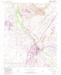
USGS Historical Quadrangle in GeoPDF.
USGS Historical Quadrangle in GeoPDF.
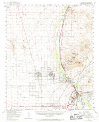
USGS Historical Quadrangle in GeoPDF.
This data release contains numerical U- and Th-isotopic data used to calculate uranium-series age estimates and initial 234U/238U activity ratios for samples of carbonate-rich clast coatings, oncoidal tufa rinds, calcite-replaced rhizoliths, carbonate nodules, and ostracod shells from sites associated with different lake levels of paleo Lake Manix near Barsow, CA. In addition, measured U concentrations and 234U/238U activity ratios for modern streamflow in the Mojave River and shallow groundwater from wells along the course of the Mojave River and nearby vicinity are included to help define the uranium-isotope composition of water that likely supplied paleolakes. Electronic data included herein support age interpretations...
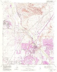
USGS Historical Quadrangle in GeoPDF.

USGS Historical Quadrangle in GeoPDF.
These data on the concentrations of 27 selected elements were collected using a field portable (handheld) X-ray fluorescence (pXRF) instrument (Groover and Izbicki, 2016) equipped with a 4-watt Ta/Au X-ray tube on samples of 1) surficial alluvium, 2) rock, and 3) archived core material and drill cuttings from monitoring wells across an approximately 14,300 square kilometer area in the western part of the Mojave Desert, between 60 to 210 kilometers (km) northeast of Los Angeles, California. These samples were measured using a pXRF as part of a regional-scale investigation of naturally-occurring trace elements (including arsenic, chromium, and uranium) dissolved in groundwater (Groover and Izbicki, 2018), and a local-scale...
Types: Map Service,
OGC WFS Layer,
OGC WMS Layer,
OGC WMS Service;
Tags: Arsenic,
Barstow,
California (CA),
Chromium,
El Mirage,
Synthetic aperture radar (SAR) data from the European Space Agency's (ESA) Sentinel-1A satellite were acquired for this study from the Alaska Satellite Facility (ASF) and used to generate spatially detailed land-surface deformation maps (interferograms) for the Mojave River and Morongo groundwater basins during 2014–19 using InSAR methods.
USGS Historical Quadrangle in GeoPDF.
USGS Historical Quadrangle in GeoPDF.
USGS Historical Quadrangle in GeoPDF.
USGS Historical Quadrangle in GeoPDF.
These data were collected using field portable (handheld) X-ray fluorescence (pXRF) equipped with a 4-watt Ta/Au X-ray tube. Samples of surficial alluvium, rock, and archived drill cuttings from monitoring wells in the western part of the Mojave Desert, 60 to 210 kilometers (km) northeast of Los Angeles, California, were measured using as part of an investigation of naturally-occurring trace elements dissolved in groundwater. Surficial alluvium samples were collected from small stream channels draining distinct geologic units, or from previously mapped river deposits, and generally consisted of silt, sand, and granules to small pebbles. Twigs and other detritus were removed prior to measurement. Rocks were collected...
USGS Historical Quadrangle in GeoPDF.
USGS Historical Quadrangle in GeoPDF.
These data were collected using field portable (handheld) X-ray fluorescence (pXRF) equipped with a 4-watt Ta/Au X-ray tube on two National Institute of Standards and Technology (NIST) certified standard reference materials 2710a and 2711a, a U.S. Geological Survey (USGS) certified standard reference material BHVO-2, and a silicon dioxide blank. These quality assurance data were collected as part of detailed pXRF studies in Hinkley and Water Valleys, 140 kilometers (km) northeast of Los Angeles, California, and as part of a regional geochemical survey in the western Mojave Desert, between 60 to 210 km northeast of Los Angeles. Measurements on National Institute of Standards and Technology (NIST) and U.S. Geological...
USGS Historical Quadrangle in GeoPDF.
USGS Historical Quadrangle in GeoPDF.
|

|
