Filters: Tags: Water levels (X) > Types: Shapefile (X)
18 results (36ms)|
Filters
Date Range
Extensions Types Contacts
Categories Tag Types Tag Schemes
|
Statistical analyses and maps representing mean, high, and low water-level conditions in the surface water and groundwater of Miami-Dade County were made by the U.S. Geological Survey, in cooperation with the Miami-Dade County Department of Regulatory and Economic Resources, to help inform decisions necessary for urban planning and development. Sixteen maps were created that show contours of (1) the mean of daily water levels at each site during October and May for the 2000-2009 water years; (2) the 25th, 50th, and 75th percentiles of the daily water levels at each site during October and May and for all months during 2000-2009; and (3) the differences between mean October and May water levels, as well as the differences...
Categories: Data;
Types: Downloadable,
Map Service,
OGC WFS Layer,
OGC WMS Layer,
Shapefile;
Tags: Biscayne Bay,
Biscayne aquifer,
Florida,
Florida Bay,
Miami-Dade County,
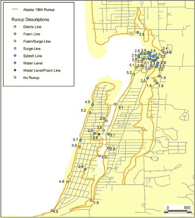
This data set is a point shapefile representing observations of inundation and water levels from the Alaska 1964 event obtained by Tom Horning (1997). The geospatial dataset were derived from a spreadsheet provided by Bruce Jaffe.
Categories: Data;
Types: Citation,
Downloadable,
Map Service,
OGC WFS Layer,
OGC WMS Layer,
Shapefile;
Tags: Oregon,
Seaside, Oregon,
USA,
observations,
tsunami inundation,
The U.S. Geological Survey (USGS) is providing a point feature class containing a compilation of geologic well records (n=221) obtained from: 1) previous U.S. Geological Survey groundwater investigations, 2) the U.S. Geological Survey's National Water Information System (NWIS), 3) the New York State Department of Environmental Conservation (NYSDEC) Water Well Contractor Program, and 4) the New York State Department of Transportation (NYSDOT). The wells are located within the Binghamton East 1:24,000 quadrangle of south-central Broome County, New York, 2014-2020. The shapefile was created and intended for use with geographic information system (GIS) software. A companion report, USGS Scientific Investigations Report...
Categories: Data;
Types: Downloadable,
Map Service,
OGC WFS Layer,
OGC WMS Layer,
Shapefile;
Tags: Aquifer Mapping,
Basin & Hydrogeologic Characterization,
Broome County,
Conklin,
Kirkwood,
Statistical analyses and maps representing mean, high, and low water-level conditions in the surface water and groundwater of Miami-Dade County were made by the U.S. Geological Survey, in cooperation with the Miami-Dade County Department of Regulatory and Economic Resources, to help inform decisions necessary for urban planning and development. Sixteen maps were created that show contours of (1) the mean of daily water levels at each site during October and May for the 2000-2009 water years; (2) the 25th, 50th, and 75th percentiles of the daily water levels at each site during October and May and for all months during 2000-2009; and (3) the differences between mean October and May water levels, as well as the differences...
Categories: Data;
Types: Downloadable,
Map Service,
OGC WFS Layer,
OGC WMS Layer,
Shapefile;
Tags: Biscayne Bay,
Biscayne aquifer,
Florida,
Florida Bay,
Miami-Dade County,
|

|
