Filters
Date Range
Extensions
Types
Contacts
Categories
Tag Types
Tag Schemes
|
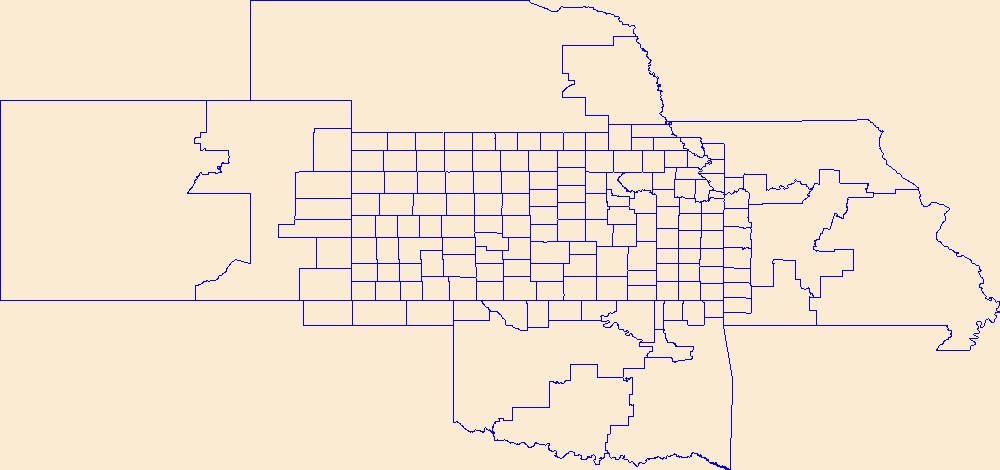
Geospatial data is comprised of government boundaries.
Tags: Allen,
Anderson,
Atchison,
Barber,
Barton, All tags...
Boundaries,
Bourbon,
Brown,
Butler,
Chase,
Chautauqua,
Cherokee,
Cheyenne,
Clark,
Clay,
Cloud,
Coffey,
Comanche,
County or Equivalent,
Cowley,
Crawford,
Decatur,
Dickinson,
Doniphan,
Douglas,
Downloadable Data,
Edwards,
Elk,
Ellis,
Ellsworth,
Finney,
Ford,
Franklin,
Geary,
GeoPackage,
Gove,
Graham,
Grant,
Gray,
Greeley,
Greenwood,
Hamilton,
Harper,
Harvey,
Haskell,
Hodgeman,
Incorporated Place,
Jackson,
Jefferson,
Jewell,
Johnson,
Jurisdictional,
KS,
Kansas,
Kearny,
Kingman,
Kiowa,
Labette,
Lane,
Leavenworth,
Lincoln,
Linn,
Logan,
Lyon,
Marion,
Marshall,
McPherson,
Meade,
Miami,
Minor Civil Division,
Mitchell,
Montgomery,
Morris,
Morton,
National Boundary Dataset (NBD),
National Boundary Dataset (NBD),
Native American Area,
Nemaha,
Neosho,
Ness,
Norton,
Open Geospatial Consortium GeoPackage 1.2,
Osage,
Osborne,
Ottawa,
PLSS First Division,
PLSS Special Survey,
PLSS Township,
Pawnee,
Phillips,
Pottawatomie,
Pratt,
Public Land Survey System,
Rawlins,
Reno,
Republic,
Reserve,
Rice,
Riley,
Rooks,
Rush,
Russell,
Saline,
Scott,
Sedgwick,
Seward,
Shawnee,
Sheridan,
Sherman,
Smith,
Stafford,
Stanton,
State,
State,
State or Territory,
Stevens,
Sumner,
Thomas,
Trego,
U.S. National Grid,
US,
Unincorporated Place,
United States,
Wabaunsee,
Wallace,
Washington,
Wichita,
Wilson,
Woodson,
Wyandotte,
boundaries,
boundary,
cadastral surveys,
geographic names,
land ownership,
land use maps,
legal land descriptions,
political and administrative boundaries,
zoning maps, Fewer tags
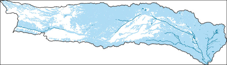
The National Hydrography Dataset (NHD) is a feature-based database that interconnects and uniquely identifies the stream segments or reaches that make up the nation's surface water drainage system. NHD data was originally developed at 1:100,000-scale and exists at that scale for the whole country. This high-resolution NHD, generally developed at 1:24,000/1:12,000 scale, adds detail to the original 1:100,000-scale NHD. (Data for Alaska, Puerto Rico and the Virgin Islands was developed at high-resolution, not 1:100,000 scale.) Local resolution NHD is being developed where partners and data exist. The NHD contains reach codes for networked features, flow direction, names, and centerline representations for areal water...
Tags: Administrative watershed units,
Administrative watershed units,
Area of Complex Channels,
Area to be submerged,
Barton, All tags...
Basin,
Basin,
Bay/Inlet,
Boundaries,
Boundary,
Bridge,
Butler,
CO,
Canal/Ditch,
Chase,
Cheyenne,
Clark,
Coastline,
Colorado,
Connector,
Cowley,
Dam/Weir,
Downloadable Data,
Drainage areas for surface water,
Drainageway,
Edwards,
Ellsworth,
Esri File GeoDatabase 10,
Estuary,
FileGDB,
Finney,
Flow direction network,
Flume,
Ford,
ForeShore,
Gaging Station,
Gate,
Grant,
Gray,
Greeley,
Greenwood,
HU-4,
HU-4 Subregion,
HU10,
HU12,
HU14,
HU16,
HU2,
HU4,
HU4_1103,
HU6,
HU8,
HUC,
Hamilton,
Harvey,
Haskell,
Hazard Zone,
Hodgeman,
Hydrographic,
Hydrography,
Hydrography,
Hydrography,
Hydrologic Unit Code,
Hydrologic Units,
Ice mass,
Inundation Area,
KS,
Kansas,
Kearny,
Kingman,
Kiowa,
Lane,
Levee,
Line,
Lock Chamber,
Marion,
Marsh,
McPherson,
National Hydrography Dataset (NHD),
National Hydrography Dataset (NHD) Best Resolution,
National Hydrography Dataset (NHD) Best Resolution,
Ness,
Nonearthen Shore,
Orthoimage,
Pawnee,
Playa,
Point,
PointEvent,
Pond,
Pratt,
Prowers,
Rapids,
Rapids,
Reach,
Reach code,
Reef,
Region,
Reno,
Reservoir,
Rice,
Rock,
Rush,
Scott,
Sea/Ocean,
Sedgwick,
Sink/Rise,
Sounding Datum Line,
Special Use Zone,
Special Use Zone Limit,
Spillway,
Stafford,
Stream,
Stream/River,
Sub-basin,
Sub-region,
Subbasin,
Submerged Stream,
Subregion,
Subwatershed,
Sumner,
Surface water systems,
Swamp,
Topographic,
Tunnel,
US,
Underground Conduit,
United States,
WBD,
WBD,
Wall,
Wash,
Water Intake Outflow,
Waterfall,
Watershed,
Watershed Boundaries,
Watershed Boundary Dataset,
Watershed Boundary Dataset,
Well,
Wichita,
artificial path,
boundaries,
dams,
drainage systems and characteristics,
inlandWaters,
lakes,
ngda,
rivers, Fewer tags
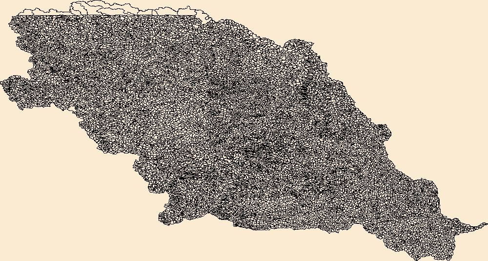
The Watershed Boundary Dataset (WBD) is a comprehensive aggregated collection of hydrologic unit data consistent with the national criteria for delineation and resolution. It defines the areal extent of surface water drainage to a point except in coastal or lake front areas where there could be multiple outlets as stated by the "Federal Standards and Procedures for the National Watershed Boundary Dataset (WBD)" "Standard" (https://pubs.usgs.gov/tm/11/a3/). Watershed boundaries are determined solely upon science-based hydrologic principles, not favoring any administrative boundaries or special projects, nor particular program or agency. This dataset represents the hydrologic unit boundaries to the 12-digit (6th level)...
Tags: 10-digit,
12-digit,
14-digit,
16-digit,
2-digit, All tags...
4-digit,
6-digit,
8-digit,
Adair,
Adams,
Albany,
Allen,
Anderson,
Andrew,
Antelope,
Appanoose,
Arapahoe,
Arthur,
Atchison,
Audrain,
Audubon,
Aurora,
Banner,
Barnes,
Barton,
Basin,
Bates,
Beadle,
Beaverhead,
Bennett,
Benton,
Big Horn,
Billings,
Blaine,
Bon Homme,
Boone,
Boulder,
Bourbon,
Bowman,
Box Butte,
Boyd,
Broadwater,
Brookings,
Broomfield,
Brown,
Brule,
Buchanan,
Buena Vista,
Buffalo,
Burke,
Burleigh,
Burt,
Butler,
Butte,
CO,
Caldwell,
Callaway,
Camden,
Campbell,
Carbon,
Carroll,
Carter,
Cascade,
Cass,
Cedar,
Chaffee,
Chariton,
Charles Mix,
Chase,
Cherokee,
Cherry,
Cheyenne,
Chouteau,
Christian,
Clark,
Clarke,
Clay,
Clear Creek,
Clinton,
Cloud,
Codington,
Coffey,
Cole,
Colfax,
Colorado,
Converse,
Cooper,
Corson,
Crawford,
Crook,
Cuming,
Custer,
Dade,
Dakota,
Dallas,
Daniels,
Daviess,
Davis,
Davison,
Dawes,
Dawson,
Day,
DeKalb,
Decatur,
Deer Lodge,
Dent,
Denver,
Deuel,
Dewey,
Dickey,
Dickinson,
Divide,
Dixon,
Dodge,
Doniphan,
Douglas,
Downloadable Data,
Dundy,
Dunn,
Eddy,
Edmunds,
El Paso,
Elbert,
Ellis,
Ellsworth,
Emmet,
Emmons,
Esri Shapefile nan,
Fall River,
Fallon,
Faulk,
Fergus,
Fillmore,
Flathead,
Foster,
Franklin,
Fremont,
Frontier,
Furnas,
Gage,
Gallatin,
Garden,
Garfield,
Gasconade,
Geary,
Gentry,
Gilpin,
Glacier,
Golden Valley,
Goshen,
Gosper,
Gove,
Graham,
Grand,
Granite,
Grant,
Greeley,
Greene,
Gregory,
Grundy,
Guthrie,
HU-2,
HU-2 Region,
HU2_10,
HUC,
Haakon,
Hall,
Hamilton,
Hamlin,
Hand,
Hanson,
Harding,
Harlan,
Harrison,
Hayes,
Henry,
Hettinger,
Hickory,
Hill,
Hitchcock,
Holt,
Hooker,
Hot Springs,
Howard,
Howell,
Hughes,
Hutchinson,
Hyde,
Hydrography,
Hydrologic Unit Code,
Hydrologic Units,
IA,
ID,
Ida,
Idaho,
Iowa,
Jackson,
Jefferson,
Jerauld,
Jewell,
Johnson,
Jones,
Judith Basin,
KS,
Kansas,
Kearney,
Keith,
Keya Paha,
Kidder,
Kimball,
Kingsbury,
Kit Carson,
Knox,
LaMoure,
Laclede,
Lafayette,
Lake,
Lancaster,
Lane,
Laramie,
Larimer,
Lawrence,
Leavenworth,
Lemhi,
Lewis and Clark,
Liberty,
Lincoln,
Linn,
Livingston,
Logan,
Loup,
Lucas,
Lyman,
Lyon,
MN,
MO,
MT,
Macon,
Madison,
Maries,
Marion,
Marshall,
McCone,
McCook,
McHenry,
McIntosh,
McKenzie,
McLean,
McPherson,
Meade,
Meagher,
Mellette,
Mercer,
Merrick,
Miami,
Miller,
Mills,
Miner,
Minnehaha,
Minnesota,
Missouri,
Mitchell,
Moniteau,
Monona,
Monroe,
Montana,
Montgomery,
Moody,
Morgan,
Morrill,
Morris,
Morton,
Mountrail,
Murray,
Musselshell,
ND,
NE,
Nance,
National Watershed Boundary Dataset (WBD),
National Watershed Boundary Dataset (WBD),
Natrona,
Nebraska,
Nemaha,
Ness,
Niobrara,
Nobles,
Nodaway,
North Dakota,
Norton,
Nuckolls,
O'Brien,
Oglala Lakota,
Oliver,
Osage,
Osborne,
Osceola,
Otoe,
Ottawa,
Page,
Palo Alto,
Park,
Pawnee,
Pennington,
Perkins,
Petroleum,
Pettis,
Phelps,
Phillips,
Pierce,
Pipestone,
Platte,
Plymouth,
Polk,
Pondera,
Pottawatomie,
Pottawattamie,
Potter,
Powder River,
Powell,
Prairie,
Pulaski,
Putnam,
Randolph,
Ransom,
Ravalli,
Rawlins,
Ray,
Red Willow,
Region,
Republic,
Rice,
Richardson,
Richland,
Riley,
Ringgold,
Roberts,
Rock,
Rooks,
Roosevelt,
Rosebud,
Routt,
Rush,
Russell,
SD,
Sac,
Saline,
Sanborn,
Sargent,
Sarpy,
Saunders,
Schuyler,
Scott,
Scotts Bluff,
Sedgwick,
Seward,
Shapefile,
Shawnee,
Shelby,
Sheridan,
Sherman,
Silver Bow,
Sioux,
Slope,
Smith,
South Dakota,
Spink,
St. Charles,
St. Clair,
St. Louis,
Stanley,
Stanton,
Stark,
Stillwater,
Stutsman,
Sub-basin,
Sub-region,
Sublette,
Subwatershed,
Sullivan,
Sully,
Summit,
Sweet Grass,
Sweetwater,
Taylor,
Teller,
Teton,
Texas,
Thayer,
Thomas,
Thurston,
Todd,
Toole,
Treasure,
Trego,
Tripp,
Turner,
US,
Union,
United States,
Valley,
Vernon,
WBD,
WY,
Wabaunsee,
Wallace,
Walworth,
Ward,
Warren,
Washakie,
Washington,
Watershed,
Watershed Boundary Dataset,
Wayne,
Webster,
Weld,
Wells,
Weston,
Wheatland,
Wheeler,
Wibaux,
Wichita,
Williams,
Woodbury,
Worth,
Wright,
Wyandotte,
Wyoming,
Yankton,
Yellowstone,
York,
Yuma,
Ziebach,
inlandWaters, Fewer tags

This dataset is the result of measurements of groundwater levels in the Equus Beds aquifer near Wichita, Kansas, in January 2016. Potentiometric surfaces are interpolated for the shallow and deep parts of the aquifer, and rasters of the potentiometric surfaces are included in this data release. Wells were classified as being screened in the shallow or deep parts of the aquifer based on station name (some wells have a layer identifier in the station name) or, if no indication of aquifer layer was given in the station name, based on the depth of the well; wells with depths less than 80 feet below land surface were classified as shallow and wells with depths of 80 feet or deeper were classified as deep. Contours with...
Categories: Data;
Types: Citation,
Downloadable,
Map Service,
OGC WFS Layer,
OGC WMS Layer,
Shapefile;
Tags: Arkansas River,
Bentley,
Burrton,
Equus Beds aquifer,
Halstead, All tags...
Harvey County,
High Plains aquifer,
Kansas,
Kisiwa Creek,
Little Arkansas River,
Sedgwick,
Sedgwick County,
Wichita,
aquifer,
groundwater,
groundwater level,
hydrology,
water-level altitude, Fewer tags
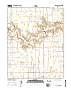
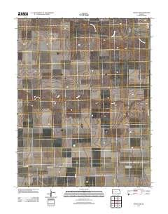
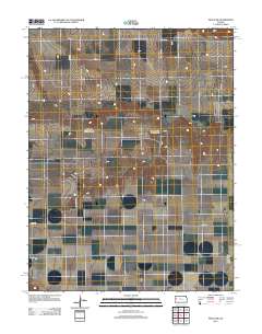
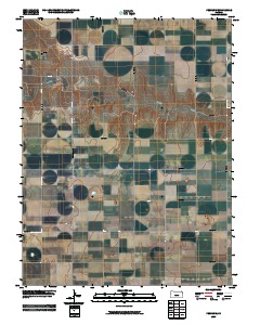
Layered GeoPDF 7.5 Minute Quadrangle Map. Layers of geospatial data include orthoimagery, roads, grids, geographic names, elevation contours, hydrography, and other selected map features.
Tags: 7.5 x 7.5 minute,
Downloadable Data,
EarthCover,
GeoPDF,
Imagery and Base Maps, All tags...
Map,
Texas,
U.S. National Grid,
US,
US Topo,
US Topo Historical,
United States,
Wichita,
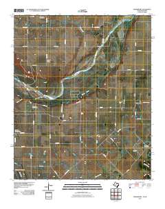
Wichita Falls West, TX,
contour,
geographic names,
hydrography,
orthoimage,
topographic,
transportation, Fewer tags
Layered GeoPDF 7.5 Minute Quadrangle Map. Layers of geospatial data include orthoimagery, roads, grids, geographic names, elevation contours, hydrography, and other selected map features.
Tags: 7.5 x 7.5 minute,
Archer,
Downloadable Data,
EarthCover,
GeoPDF, All tags...
Holliday, TX,
Imagery and Base Maps,
Map,
Public Land Survey System,
Texas,
U.S. National Grid,
US,
US Topo,
US Topo Historical,
United States,
Wichita,
boundary,
contour,
geographic names,
hydrography,
imageryBaseMapsEarthCover,
orthoimage,
structures,
topographic,
transportation,
woodland, Fewer tags
Layered GeoPDF 7.5 Minute Quadrangle Map. Layers of geospatial data include orthoimagery, roads, grids, geographic names, elevation contours, hydrography, and other selected map features.
Tags: 7.5 x 7.5 minute,
Downloadable Data,
EarthCover,
GeoPDF,
Imagery and Base Maps, All tags...
Iowa Park, TX,
Map,
Texas,
U.S. National Grid,
US,
US Topo,
US Topo Historical,
United States,
Wichita,
contour,
geographic names,
hydrography,
orthoimage,
topographic,
transportation, Fewer tags
Layered GeoPDF 7.5 Minute Quadrangle Map. Layers of geospatial data include orthoimagery, roads, grids, geographic names, elevation contours, hydrography, and other selected map features.
Tags: 7.5 x 7.5 minute,
Downloadable Data,
EarthCover,
GeoPDF,
Imagery and Base Maps, All tags...
Iowa Park, TX,
Map,
Public Land Survey System,
Texas,
U.S. National Grid,
US,
US Topo,
US Topo Historical,
United States,
Wichita,
boundary,
contour,
geographic names,
hydrography,
imageryBaseMapsEarthCover,
orthoimage,
structures,
topographic,
transportation,
woodland, Fewer tags
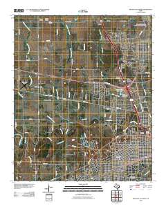
Layered GeoPDF 7.5 Minute Quadrangle Map. Layers of geospatial data include orthoimagery, roads, grids, geographic names, elevation contours, hydrography, and other selected map features.
Tags: 7.5 x 7.5 minute,
Coronado Cemetery, KS,
Downloadable Data,
EarthCover,
GeoPDF, All tags...
Imagery and Base Maps,
Kansas,
Map,
Public Land Survey System,
U.S. National Grid,
US,
US Topo,
US Topo Historical,
United States,
Wichita,
boundary,
contour,
geographic names,
hydrography,
imageryBaseMapsEarthCover,
orthoimage,
structures,
topographic,
transportation,
woodland, Fewer tags
Layered GeoPDF 7.5 Minute Quadrangle Map. Layers of geospatial data include orthoimagery, roads, grids, geographic names, elevation contours, hydrography, and other selected map features.
Tags: 7.5 x 7.5 minute,
Downloadable Data,
EarthCover,
GeoPDF,
Imagery and Base Maps, All tags...
Kansas,
Kearny,
Map,
Modoc SW, KS,
Public Land Survey System,
Scott,
U.S. National Grid,
US,
US Topo,
US Topo Historical,
United States,
Wichita,
boundary,
contour,
geographic names,
hydrography,
imageryBaseMapsEarthCover,
orthoimage,
structures,
topographic,
transportation,
woodland, Fewer tags
Layered GeoPDF 7.5 Minute Quadrangle Map. Layers of geospatial data include orthoimagery, roads, grids, geographic names, elevation contours, hydrography, and other selected map features.
Tags: 7.5 x 7.5 minute,
Downloadable Data,
EarthCover,
GeoPDF,
Imagery and Base Maps, All tags...
Kansas,
Logan,
Map,
Pence NW, KS,
Public Land Survey System,
Scott,
U.S. National Grid,
US,
US Topo,
US Topo Historical,
United States,
Wichita,
boundary,
contour,
geographic names,
hydrography,
imageryBaseMapsEarthCover,
orthoimage,
structures,
topographic,
transportation,
woodland, Fewer tags
Layered GeoPFD 7.5 Minute Quadrangle Map. Layers of geospatial data include orthoimagery, roads, grids, geographic names, elevation contours, hydrography, and other selected map features.
Tags: 7.5 x 7.5 minute,
Downloadable Data,
EarthCover,
GeoPDF,
Imagery and Base Maps, All tags...
Kansas,
Map,
Pence SW, KS,
Scott,
U.S. National Grid,
US,
US Topo,
US Topo Historical,
United States,
Wichita,
contour,
geographic names,
hydrography,
orthoimage,
topographic,
transportation, Fewer tags
Layered GeoPFD 7.5 Minute Quadrangle Map. Layers of geospatial data include orthoimagery, roads, grids, geographic names, elevation contours, hydrography, and other selected map features.
Tags: 7.5 x 7.5 minute,
Downloadable Data,
EarthCover,
GeoPDF,
Greeley, All tags...
Imagery and Base Maps,
Kansas,
Map,
Selkirk, KS,
U.S. National Grid,
US,
US Topo,
US Topo Historical,
United States,
Wichita,
contour,
geographic names,
hydrography,
orthoimage,
topographic,
transportation, Fewer tags
Layered GeoPFD 7.5 Minute Quadrangle Map. Layers of geospatial data include orthoimagery, roads, grids, geographic names, elevation contours, hydrography, and other selected map features.
Tags: 7.5 x 7.5 minute,
Downloadable Data,
EarthCover,
GeoPDF,
Imagery and Base Maps, All tags...
Kansas,
Logan,
Map,
South of Twin Butte, KS,
U.S. National Grid,
US,
US Topo,
US Topo Historical,
United States,
Wichita,
contour,
geographic names,
hydrography,
orthoimage,
topographic,
transportation, Fewer tags
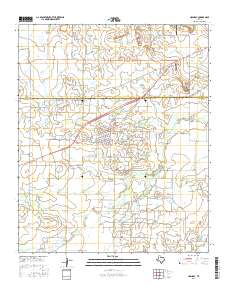
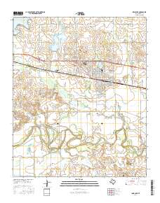
Layered GeoPDF 7.5 Minute Quadrangle Map. Layers of geospatial data include orthoimagery, roads, grids, geographic names, elevation contours, hydrography, and other selected map features.
Tags: 7.5 x 7.5 minute,
Cotton,
Devol, OK-TX,
Downloadable Data,
EarthCover, All tags...
GeoPDF,
Imagery and Base Maps,
Map,
Oklahoma,
Public Land Survey System,
Texas,
Tillman,
U.S. National Grid,
US,
US Topo,
US Topo Historical,
United States,
Wichita,
boundary,
contour,
geographic names,
hydrography,
imageryBaseMapsEarthCover,
orthoimage,
structures,
topographic,
transportation,
woodland, Fewer tags
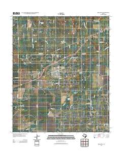
Layered GeoPDF 7.5 Minute Quadrangle Map. Layers of geospatial data include orthoimagery, roads, grids, geographic names, elevation contours, hydrography, and other selected map features.
Tags: 7.5 x 7.5 minute,
Downloadable Data,
EarthCover,
GeoPDF,
Imagery and Base Maps, All tags...
Map,
Oklahoma,
Public Land Survey System,
Sunshine Hill, TX-OK,
Texas,
Tillman,
U.S. National Grid,
US,
US Topo,
US Topo Historical,
United States,
Wichita,
boundary,
contour,
geographic names,
hydrography,
imageryBaseMapsEarthCover,
orthoimage,
structures,
topographic,
transportation,
woodland, Fewer tags
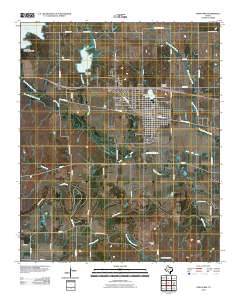
Layered GeoPDF 7.5 Minute Quadrangle Map. Layers of geospatial data include orthoimagery, roads, grids, geographic names, elevation contours, hydrography, and other selected map features.
Tags: 7.5 x 7.5 minute,
Clay,
Downloadable Data,
EarthCover,
GeoPDF, All tags...
Imagery and Base Maps,
Map,
Oklahoma,
Texas,
Thornberry, TX-OK,
U.S. National Grid,
US,
US Topo,
US Topo Historical,
United States,
Wichita,
contour,
geographic names,
hydrography,
orthoimage,
topographic,
transportation, Fewer tags
Geospatial data includes structures and other selected map features.
Tags: Allen,
Anderson,
Atchison,
Barber,
Barton, All tags...
Bourbon,
Brown,
Butler,
Campground,
Chase,
Chautauqua,
Cherokee,
Cheyenne,
Clark,
Clay,
Cloud,
Coffey,
College / University,
Comanche,
Courthouse,
Cowley,
Crawford,
Decatur,
Dickinson,
Doniphan,
Douglas,
Downloadable Data,
Edwards,
Elk,
Ellis,
Ellsworth,
Esri File GeoDatabase 10,
FileGDB,
Finney,
Fire Station/ EMS Station,
Ford,
Franklin,
Geary,
Gove,
Graham,
Grant,
Gray,
Greeley,
Greenwood,
Hamilton,
Harper,
Harvey,
Haskell,
Hodgeman,
Hospital/Medical Center,
Information Center,
Jackson,
Jefferson,
Jewell,
Johnson,
KS,
Kansas,
Kearny,
Kingman,
Kiowa,
Labette,
Lane,
Law Enforcement,
Leavenworth,
Lincoln,
Linn,
Logan,
Lyon,
Marion,
Marshall,
McPherson,
Meade,
Miami,
Mitchell,
Montgomery,
Morris,
Morton,
National Structures Dataset (NSD),
National Structures Dataset (NSD),
Nemaha,
Neosho,
Ness,
Norton,
Osage,
Osborne,
Ottawa,
Pawnee,
Phillips,
Post Office,
Pottawatomie,
Pratt,
Prison/ Correctional Facility,
Rawlins,
Reno,
Republic,
Rice,
Riley,
Rooks,
Rush,
Russell,
Saline,
School,
School:Elementary,
School:High School,
School:Middle School,
Scott,
Sedgwick,
Seward,
Shawnee,
Sheridan,
Sherman,
Smith,
Stafford,
Stanton,
State,
State,
State Capitol,
Stevens,
Structures,
Sumner,
Technical School,
Thomas,
Town Hall,
Trade School,
Trailhead,
Trego,
US,
United States,
Visitor Center,
Wabaunsee,
Wallace,
Washington,
Wichita,
Wilson,
Woodson,
Wyandotte,
structure, Fewer tags
The Geographic Names Information System (GNIS) is the Federal standard for geographic nomenclature. The U.S. Geological Survey developed the GNIS for the U.S. Board on Geographic Names, a Federal inter-agency body chartered by public law to maintain uniform feature name usage throughout the Government and to promulgate standard names to the public. The GNIS is the official repository of domestic geographic names data; the official vehicle for geographic names use by all departments of the Federal Government; and the source for applying geographic names to Federal electronic and printed products of all types.
Tags: Anderson,
Andrews,
Angelina,
Antarctica,
Antarctica, All tags...
Aransas,
Archer,
Armstrong,
Atascosa,
Austin,
BGN,
Bailey,
Bandera,
Bastrop,
Baylor,
Bee,
Bell,
Bexar,
Blanco,
Board on Geographic Names,
Borden,
Borough,
Bosque,
Bowie,
Brazoria,
Brazos,
Brewster,
Briscoe,
Brooks,
Brown,
Burleson,
Burnet,
Caldwell,
Calhoun,
Callahan,
Cameron,
Camp,
Carson,
Cass,
Castro,
Census Area,
Chambers,
Cherokee,
Childress,
Clay,
Cochran,
Coke,
Coleman,
Collin,
Collingsworth,
Colorado,
Comal,
Comanche,
Commonwealth,
Concho,
Cooke,
Coryell,
Cottle,
County,
Crane,
Crockett,
Crosby,
Culberson,
Dallam,
Dallas,
Dawson,
DeWitt,
Deaf Smith,
Delta,
Denton,
Dickens,
Dimmit,
District,
Donley,
Downloadable Data,
Duval,
Eastland,
Ector,
Edwards,
El Paso,
Ellis,
Erath,
Esri File GeoDatabase 10,
Falls,
Fannin,
Fayette,
Feature class,
Feature coordinates,
Feature county,
Feature description,
Feature designation,
Feature history,
Feature indentification,
Feature name,
Feature state,
FileGDB,
Fisher,
Floyd,
Foard,
Fort Bend,
Franklin,
Freestone,
Frio,
GNIS,
Gaines,
Galveston,
Garza,
Geographic Names,
Geographic Names Full Model,
Geographic Names Information System,
Geographic feature,
Geographic name,
Geographical feature,
Geographical name,
Gillespie,
Glasscock,
Goliad,
Gonzales,
Gray,
Grayson,
Gregg,
Grimes,
Guadalupe,
Hale,
Hall,
Hamilton,
Hansford,
Hardeman,
Hardin,
Harris,
Harrison,
Hartley,
Haskell,
Hays,
Hemphill,
Henderson,
Hidalgo,
Hill,
Hockley,
Hood,
Hopkins,
Houston,
Howard,
Hudspeth,
Hunt,
Hutchinson,
Irion,
Jack,
Jackson,
Jasper,
Jeff Davis,
Jefferson,
Jim Hogg,
Jim Wells,
Johnson,
Jones,
Karnes,
Kaufman,
Kendall,
Kenedy,
Kent,
Kerr,
Kimble,
King,
Kinney,
Kleberg,
Knox,
La Salle,
Lamar,
Lamb,
Lampasas,
Lavaca,
Lee,
Leon,
Liberty,
Limestone,
Lipscomb,
Live Oak,
Llano,
Loving,
Lubbock,
Lynn,
Madison,
Marion,
Martin,
Mason,
Matagorda,
Maverick,
McCulloch,
McLennan,
McMullen,
Medina,
Menard,
Midland,
Milam,
Mills,
Mitchell,
Montague,
Montgomery,
Moore,
Morris,
Motley,
Municipio,
Nacogdoches,
National Geographic Names Information System (GNIS),
National Geographic Names Information System (GNIS),
Navarro,
Newton,
Nolan,
Nueces,
Ochiltree,
Official feature name,
Oldham,
Orange,
Outlying Area,
Palo Pinto,
Panola,
Parish,
Parker,
Parmer,
Pecos,
Place name,
Polk,
Populated Place,
Potter,
Presidio,
Rains,
Randall,
Reagan,
Real,
Red River,
Reeves,
Refugio,
Roberts,
Robertson,
Rockwall,
Runnels,
Rusk,
Sabine,
San Augustine,
San Jacinto,
San Patricio,
San Saba,
Schleicher,
Scurry,
Shackelford,
Shelby,
Sherman,
Smith,
Somervell,
Starr,
State,
Stephens,
Sterling,
Stonewall,
Sutton,
Swisher,
TX,
Tarrant,
Taylor,
Terrell,
Territories,
Territory,
Terry,
Texas,
Throckmorton,
Titus,
Tom Green,
Topographic Map,
Travis,
Trinity,
Tyler,
U.S. Board on Geographic Names,
U.S. Geological Survey,
US,
USA,
USBGN,
USGS,
United States,
United States,
United States,
Upshur,
Upton,
Uvalde,
Val Verde,
Van Zandt,
Variant name,
Victoria,
Walker,
Waller,
Ward,
Washington,
Webb,
Wharton,
Wheeler,
Wichita,
Wilbarger,
Willacy,
Williamson,
Wilson,
Winkler,
Wise,
Wood,
Yoakum,
Young,
Zapata,
Zavala,
antarctic,
database,
economy,
environment,
feature,
gazetteer,
geographic,
geographic names,
geographical,
geography,
geospatial,
imageryBaseMapsEarthCover,
inlandWaters,
location,
map,
name,
place,
placename,
society,
structure,
topographic map,
toponymy, Fewer tags
|
|

