Filters: Tags: Wisconsin (X) > Date Range: {"choice":"year"} (X)
687 results (32ms)|
Filters
Date Types (for Date Range)
Types Contacts
Categories Tag Types
|
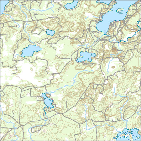
Layers of geospatial data include contours, boundaries, land cover, hydrography, roads, transportation, geographic names, structures, and other selected map features.
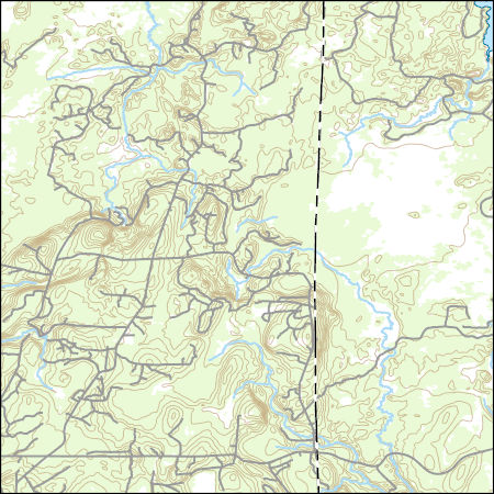
Layers of geospatial data include contours, boundaries, land cover, hydrography, roads, transportation, geographic names, structures, and other selected map features.
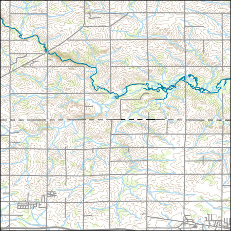
Layers of geospatial data include contours, boundaries, land cover, hydrography, roads, transportation, geographic names, structures, and other selected map features.
Layers of geospatial data include contours, boundaries, land cover, hydrography, roads, transportation, geographic names, structures, and other selected map features.
Layers of geospatial data include contours, boundaries, land cover, hydrography, roads, transportation, geographic names, structures, and other selected map features.
Layers of geospatial data include contours, boundaries, land cover, hydrography, roads, transportation, geographic names, structures, and other selected map features.
Layers of geospatial data include contours, boundaries, land cover, hydrography, roads, transportation, geographic names, structures, and other selected map features.
Types: Citation;
Tags: 7.5 x 7.5 minute,
7_5_Min,
Combined Vector,
Combined Vector,
Combined Vector,
Layers of geospatial data include contours, boundaries, land cover, hydrography, roads, transportation, geographic names, structures, and other selected map features.
Types: Citation;
Tags: 7.5 x 7.5 minute,
7_5_Min,
Combined Vector,
Combined Vector,
Combined Vector,
Layers of geospatial data include contours, boundaries, land cover, hydrography, roads, transportation, geographic names, structures, and other selected map features.
Types: Citation;
Tags: 7.5 x 7.5 minute,
7_5_Min,
Combined Vector,
Combined Vector,
Combined Vector,
Layers of geospatial data include contours, boundaries, land cover, hydrography, roads, transportation, geographic names, structures, and other selected map features.
Types: Citation;
Tags: 7.5 x 7.5 minute,
7_5_Min,
Combined Vector,
Combined Vector,
Combined Vector,
Layers of geospatial data include contours, boundaries, land cover, hydrography, roads, transportation, geographic names, structures, and other selected map features.
Types: Citation;
Tags: 7.5 x 7.5 minute,
7_5_Min,
Combined Vector,
Combined Vector,
Combined Vector,
This dataset is part of the U.S. Geological Survey (USGS) Great Lakes Coastal Wetland Restoration Assessment (GLCWRA) initiative. These data represent the flowline network in the Green Bay Restoration Assessment (GBRA). It is attributed with the number of disconnections (e.g., road crossings) between the reach and Lake Ontario. The more road crossings on a flowline the more disconnected that area is from the lake and the less suitable it will be for restoration. These data help identify the condition of hydrologic separation between potential restoration areas and Lake Ontario. Low numbers represent fewer disconnections, such as culverts, between the reach and the water body requiring no flow network modification...

USGS National Boundary Dataset (NBD) in Wisconsin State or Territory (published 20240215) GeoPackage
Geospatial data is comprised of government boundaries.
The U.S. Army Corps of Engineers' Upper Mississippi River Restoration (UMRR) program, through its Long Term Resource Monitoring (LTRM) element, collected aerial imagery of the systemic Upper Mississippi River System (UMRS) during the summer of 2020. A Land Cover/Land Use (LCU) spatial database was developed based on the 2020 aerial imagery, which adds a fourth systemic-wide database to the existing 1989, 2000, and 2010/11 LCU databases. While a crosswalk was used to update the 1989 LCU database (originally developed using a different classification system), the 2000, 2010/11, and 2020 LCU databases share the same classification, making them directly comparable from a classification standpoint. Furthermore, protocols...
Categories: Data;
Types: Downloadable,
Map Service,
OGC WFS Layer,
OGC WMS Layer,
Shapefile;
Tags: Iowa,
USGS-EMA-LOW-MR Landscape Ecology,
USGS-EMA-LOW-PL Mississippi River,
Wisconsin,
aquatic vegetation,
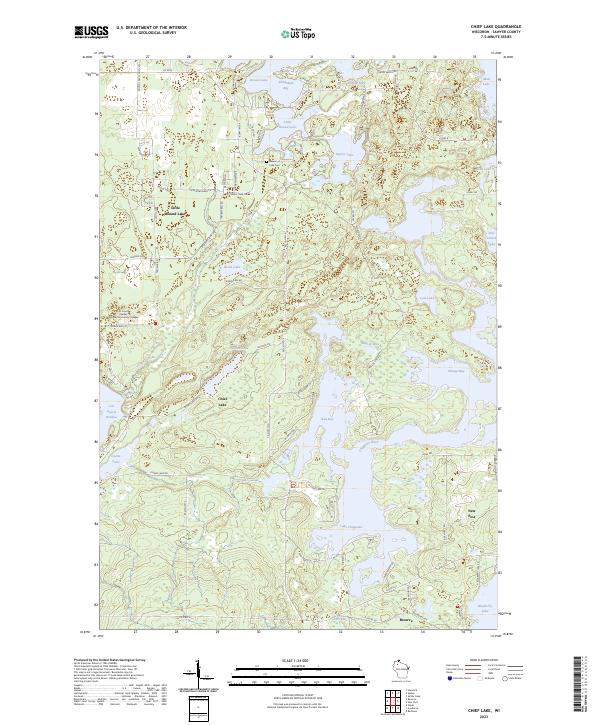
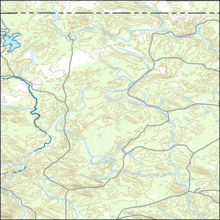
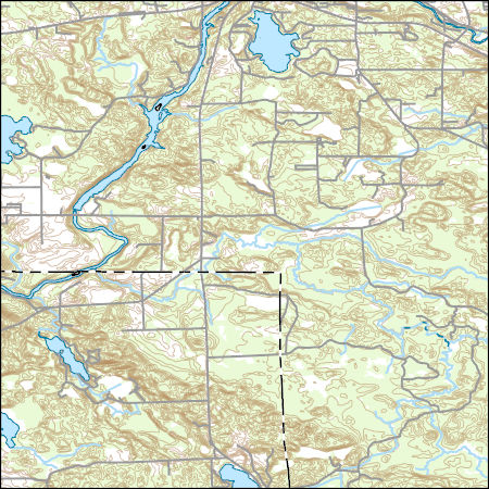
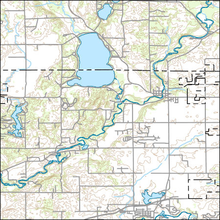
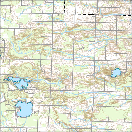
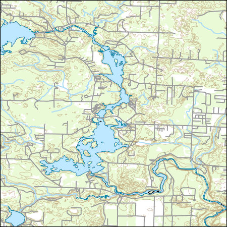
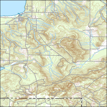
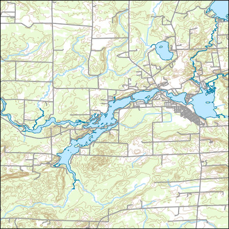
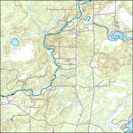
Layered geospatial PDF 7.5 Minute Quadrangle Map. Layers of geospatial data include orthoimagery, roads, grids, geographic names, elevation contours, hydrography, and other selected map features. This map is derived from GIS (geospatial information system) data. It represents a repackaging of GIS data in traditional map form, not creation of new information. The geospatial data in this map are from selected National Map data holdings and other government sources.
Grouse: These data on sharp-tailed grouse survival times are provided for individuals wanting to run an age-period survival analysis. Entry and exit times are expressed in integer days from the start of the study. Entry age and exit age expressed in integer days are also included. Data are structured to implement survival analysis. White-tailed Deer: These data on white-tailed deer survival times are provided for individuals wanting to run an age-period survival analysis. Entry and exit times are expressed in integer weeks from the start of the study. Entry age and exit age expressed in integer weeks are also included. Data are structured to implement survival analysis. Only adult female individuals that were chronic-wasting...
Categories: Data;
Tags: USGS Science Data Catalog (SDC),
Wildlife Biology,
Wisconsin,
utilitiesCommunication

The Geographic Names Information System (GNIS) is the Federal standard for geographic nomenclature. The U.S. Geological Survey developed the GNIS for the U.S. Board on Geographic Names, a Federal inter-agency body chartered by public law to maintain uniform feature name usage throughout the Government and to promulgate standard names to the public. The GNIS is the official repository of domestic geographic names data; the official vehicle for geographic names use by all departments of the Federal Government; and the source for applying geographic names to Federal electronic and printed products of all types.

This data release contains three groundwater-flow models of northeastern Wisconsin, USA, that were developed with differing levels of complexity to provide a framework for subsequent evaluations of the effects of process-based model complexity on estimates of groundwater age distributions for withdrawal wells and streams. Preliminary assessments, which focused on the effects of model complexity on simulated water levels in the glacial aquifer system, illustrate that simulation of vertical gradients using multiple model layers improves simulated heads more in relatively low-permeability units than in high-permeability units. Moreover, simulation of heterogeneous hydraulic conductivity fields in both coarse-grained...

A new groundwater flow model for western Chippewa County, Wisconsin has been developed by the Wisconsin Geological and Natural History Survey (WGNHS) and the U.S. Geological Survey (USGS). An analytic element GFLOW model was constructed and calibrated to generate hydraulic boundary conditions for the perimeter of the more detailed three-dimensional MODFLOW-NWT model. This three-dimensional model uses the USGS MODFLOW-NWT finite difference code, a standalone version of MODFLOW-2005 that incorporates the Newton (NWT) solver. The model conceptualizes the hydrogeology of western Chippewa County as a six-layer system which includes several hydrostratigraphic units. The model explicitly simulates groundwater-surface-water...

A GFLOW model was constructed of the Park Falls Unit as part of a larger study of the Chequamegon-Nicolet National Forest. The model supports the goals of the project by providing improved characterization of the groundwater/surface-water system and a tool to evaluate the sensitivity of hydrologic flows and temperature to future climate and land use changes.
|

|
