Filters
Date Range
Contacts
Categories
Tag Types
Tag Schemes
|

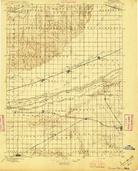
USGS Historical Quadrangle in GeoPDF.
Tags: 30 x 30 minute,
Downloadable Data,
GeoPDF,
GeoTIFF,
Historical Topographic Maps, All tags...
Historical Topographic Maps 30 x 30 Minute Map Series,
Map,
NE,
Wood River,
imageryBaseMapsEarthCover, Fewer tags

The Yukon-Tanana Upland airborne magnetic geophysical data merge provides a merged raster grid of magnetic data for the Yukon-Tanana Upland (YTU), Alaska. This dataset provides a regionally consistent magnetic grid while retaining as much detail as possible of the originating data by leveling all the region's magnetic grids to one another. This 100-m cell-size magnetic grid of the YTU will assist in evaluating the region's geologic structure, geologic processes, tectonic evolution, and mineral resource potential. The grid was compiled from previous studies published by the Alaska Division of Geological & Geophysical Surveys (DGGS).
Tags: Aeromagnetic Survey,
Airborne Geophysical Survey,
Alaska Division of Geological & Geophysical Surveys,
Alcan,
Badger, All tags...
Big Delta,
Black Mining District,
Bonnifield Mining District,
Central,
Charley River,
Charlieskin Village,
Chatanika,
Chatanika River,
Chena Hot Springs,
Chena River,
Chickaloon,
Chicken,
Chisana Mining District,
Chisana River,
Circle Hot Springs,
Circle Mining District,
College,
DGGS,
Dalton Highway,
Delta Junction,
Delta River,
Delta River Mining District,
Dot Lake,
Dot Lake Village,
Dry Creek,
Eagle,
Eagle Mining District,
Earth Mapping Resources Initiative,
EarthMRI,
Elliot Highway,
Ester,
Eureka,
Fairbanks,
Fairbanks Mining District,
Flume Creek,
Fortymile River,
Fox,
GEMSC,
Geology, Energy & Minerals Science Center,
Gerstle River,
Goodpaster Mining District,
Goodpaster River,
Harding Lake,
Healy Lake,
Healy River,
Hot Springs Mining District,
Johnson River,
Kalukna River,
Kantishna Mining District,
Kantishna River,
Kathakne,
Kechumstuk,
Ladue River,
Little Chena River,
Livengood,
MRP,
Manley Hot Springs,
Mansfield Village,
Miller House,
Mineral Resources,
Minerals Resources Program,
Minto,
Moose Creek,
Nabesna River,
Nabesna Village,
North Pole,
Northway,
Northway Junction,
Northway Village,
Pleasant Valley,
Rampart Mining District,
Richardson,
Richardson Highway,
Robertson River,
Salcha River,
Seventymile River,
Sixtymile River,
Tanacross,
Tanana River,
Tatalina River,
Tatlanika River,
Taylor Highway,
Tetlin Junction,
Tetlin River,
Tofty,
Tok,
Tok Mining District,
Tok River,
Tolovana,
Tolovana Mining District,
Tolovana River,
Totatlanika River,
Two Rivers,
U.S. Geological Survey,
USGS,
USGS Science Data Catalog (SDC),
Volkmar River,
Wood River,
Yukon River,
Zitziana River,
geoscientificInformation, Fewer tags
|
|
