Filters
Date Range
Extensions
Types
Contacts
Categories
Tag Types
Tag Schemes
|
Categories: Publication;
Types: Citation;
Tags: Climate data,
Forests,
Landscapes,
North Central CASC,
Plants, All tags...
Rivers, Streams and Lakes,
Seed dispersal phenology,
Snowpack/snowmelt,
South Platte River Basin,
Streamflow hydrology,
Water, Coasts and Ice,
Wildlife and Plants,
cottonwood,
riparian vegetation,
willow, Fewer tags
USGS Historical Quadrangle in GeoPDF.
Tags: 7.5 x 7.5 minute,
AL,
Cottonwood,
Downloadable Data,
GeoPDF, All tags...
GeoTIFF,
Historical Topographic Maps,
Historical Topographic Maps 7.5 x 7.5 Minute Map Series,
Map,
imageryBaseMapsEarthCover, Fewer tags
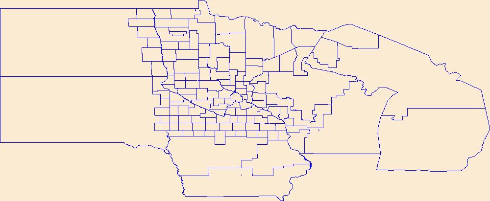
Geospatial data is comprised of government boundaries.
Types: Citation;
Tags: Aitkin,
Anoka,
Becker,
Beltrami,
Benton, All tags...
Big Stone,
Blue Earth,
Boundaries,
Brown,
Carlton,
Carver,
Cass,
Chippewa,
Chisago,
Clay,
Clearwater,
Cook,
Cottonwood,
County or Equivalent,
Crow Wing,
Dakota,
Dodge,
Douglas,
Downloadable Data,
Esri File GeoDatabase 10,
Faribault,
FileGDB,
Fillmore,
Freeborn,
Goodhue,
Grant,
Hennepin,
Houston,
Hubbard,
Incorporated Place,
Isanti,
Itasca,
Jackson,
Jurisdictional,
Kanabec,
Kandiyohi,
Kittson,
Koochiching,
Lac qui Parle,
Lake,
Lake of the Woods,
Le Sueur,
Lincoln,
Lyon,
MN,
Mahnomen,
Marshall,
Martin,
McLeod,
Meeker,
Mille Lacs,
Minnesota,
Minor Civil Division,
Morrison,
Mower,
Murray,
National Boundary Dataset (NBD),
National Boundary Dataset (NBD),
Native American Area,
Nicollet,
Nobles,
Norman,
Olmsted,
Otter Tail,
PLSS First Division,
PLSS Special Survey,
PLSS Township,
Pennington,
Pine,
Pipestone,
Polk,
Pope,
Public Land Survey System,
Ramsey,
Red Lake,
Redwood,
Renville,
Reserve,
Rice,
Rock,
Roseau,
Scott,
Sherburne,
Sibley,
St. Louis,
State,
State,
State or Territory,
Stearns,
Steele,
Stevens,
Swift,
Todd,
Traverse,
U.S. National Grid,
US,
Unincorporated Place,
United States,
Wabasha,
Wadena,
Waseca,
Washington,
Watonwan,
Wilkin,
Winona,
Wright,
Yellow Medicine,
boundaries,
boundary,
cadastral surveys,
geographic names,
land ownership,
land use maps,
legal land descriptions,
political and administrative boundaries,
zoning maps, Fewer tags
Geospatial data includes structures and other selected map features.
Tags: Aitkin,
Anoka,
Becker,
Beltrami,
Benton, All tags...
Big Stone,
Blue Earth,
Brown,
Campground,
Carlton,
Carver,
Cass,
Chippewa,
Chisago,
Clay,
Clearwater,
College / University,
Cook,
Cottonwood,
Courthouse,
Crow Wing,
Dakota,
Dodge,
Douglas,
Downloadable Data,
Esri Shapefile nan,
Faribault,
Fillmore,
Fire Station/ EMS Station,
Freeborn,
Goodhue,
Grant,
Hennepin,
Hospital/Medical Center,
Houston,
Hubbard,
Information Center,
Isanti,
Itasca,
Jackson,
Kanabec,
Kandiyohi,
Kittson,
Koochiching,
Lac qui Parle,
Lake,
Lake of the Woods,
Law Enforcement,
Le Sueur,
Lincoln,
Lyon,
MN,
Mahnomen,
Marshall,
Martin,
McLeod,
Meeker,
Mille Lacs,
Minnesota,
Morrison,
Mower,
Murray,
National Structures Dataset (NSD),
National Structures Dataset (NSD),
Nicollet,
Nobles,
Norman,
Olmsted,
Otter Tail,
Pennington,
Pine,
Pipestone,
Polk,
Pope,
Post Office,
Prison/ Correctional Facility,
Ramsey,
Red Lake,
Redwood,
Renville,
Rice,
Rock,
Roseau,
School,
School:Elementary,
School:High School,
School:Middle School,
Scott,
Shapefile,
Sherburne,
Sibley,
St. Louis,
State,
State,
State Capitol,
Stearns,
Steele,
Stevens,
Structures,
Swift,
Technical School,
Todd,
Town Hall,
Trade School,
Trailhead,
Traverse,
US,
United States,
Visitor Center,
Wabasha,
Wadena,
Waseca,
Washington,
Watonwan,
Wilkin,
Winona,
Wright,
Yellow Medicine,
structure, Fewer tags

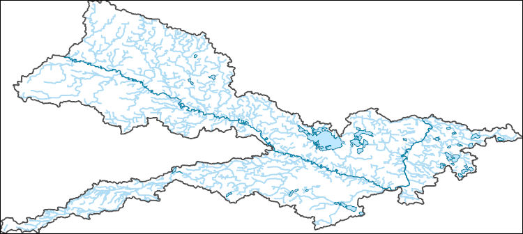
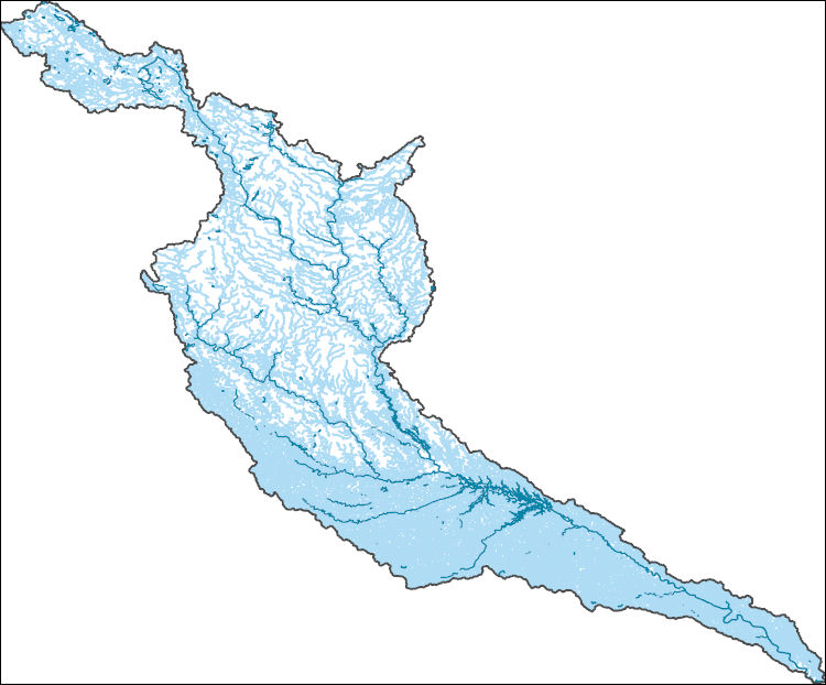
The National Hydrography Dataset (NHD) is a feature-based database that interconnects and uniquely identifies the stream segments or reaches that make up the nation's surface water drainage system. NHD data was originally developed at 1:100,000-scale and exists at that scale for the whole country. This high-resolution NHD, generally developed at 1:24,000/1:12,000 scale, adds detail to the original 1:100,000-scale NHD. (Data for Alaska, Puerto Rico and the Virgin Islands was developed at high-resolution, not 1:100,000 scale.) Local resolution NHD is being developed where partners and data exist. The NHD contains reach codes for networked features, flow direction, names, and centerline representations for areal water...
Tags: Administrative watershed units,
Administrative watershed units,
Area of Complex Channels,
Area to be submerged,
Basin, All tags...
Basin,
Bay/Inlet,
Blue Earth,
Boundaries,
Boundary,
Bridge,
Brown,
Canal/Ditch,
Coastline,
Connector,
Cottonwood,
Dam/Weir,
Downloadable Data,
Drainage areas for surface water,
Drainageway,
Estuary,
Flow direction network,
Flume,
ForeShore,
Gaging Station,
Gate,
GeoPackage,
HU-8,
HU-8 Subbasin,
HU10,
HU12,
HU14,
HU16,
HU2,
HU4,
HU6,
HU8,
HU8_07020007,
HUC,
Hazard Zone,
Hydrographic,
Hydrography,
Hydrography,
Hydrography,
Hydrologic Unit Code,
Hydrologic Units,
Ice mass,
Inundation Area,
Le Sueur,
Levee,
Line,
Lock Chamber,
MN,
Marsh,
Minnesota,
National Hydrography Dataset (NHD),
National Hydrography Dataset (NHD) Best Resolution,
National Hydrography Dataset (NHD) Best Resolution,
Nicollet,
Nonearthen Shore,
Open Geospatial Consortium GeoPackage 1.2,
Orthoimage,
Playa,
Point,
PointEvent,
Pond,
Rapids,
Rapids,
Reach,
Reach code,
Redwood,
Reef,
Region,
Renville,
Reservoir,
Rock,
Sea/Ocean,
Sibley,
Sink/Rise,
Sounding Datum Line,
Special Use Zone,
Special Use Zone Limit,
Spillway,
Stream,
Stream/River,
Sub-basin,
Sub-region,
Subbasin,
Submerged Stream,
Subregion,
Subwatershed,
Surface water systems,
Swamp,
Topographic,
Tunnel,
US,
Underground Conduit,
United States,
WBD,
WBD,
Wall,
Wash,
Water Intake Outflow,
Waterfall,
Watershed,
Watershed Boundaries,
Watershed Boundary Dataset,
Watershed Boundary Dataset,
Watonwan,
Well,
artificial path,
boundaries,
dams,
drainage systems and characteristics,
inlandWaters,
lakes,
ngda,
rivers, Fewer tags
Layered geospatial PDF Map. Layers of geospatial data include orthoimagery, roads, grids, geographic names, elevation contours, hydrography, and other selected map features.
Tags: 7.5 x 7.5 minute,
Cottonwood,
Downloadable Data,
EarthCover,
GeoPDF, All tags...
Heron Lake NE, MN,
Imagery and Base Maps,
Map,
Minnesota,
Public Land Survey System,
U.S. National Grid,
US,
US Topo,
US Topo Historical,
United States,
boundary,
contour,
geographic names,
hydrography,
imageryBaseMapsEarthCover,
orthoimage,
structures,
topographic,
transportation,
woodland, Fewer tags
Layered geospatial PDF Map. Layers of geospatial data include orthoimagery, roads, grids, geographic names, elevation contours, hydrography, and other selected map features.
Tags: 7.5 x 7.5 minute,
Brown,
Cottonwood,
Downloadable Data,
EarthCover, All tags...
GeoPDF,
Imagery and Base Maps,
Map,
Minnesota,
Public Land Survey System,
Redwood,
Sanborn NE, MN,
U.S. National Grid,
US,
US Topo,
US Topo Historical,
United States,
boundary,
contour,
geographic names,
hydrography,
imageryBaseMapsEarthCover,
orthoimage,
structures,
topographic,
transportation,
woodland, Fewer tags
Layered geospatial PDF Map. Layers of geospatial data include orthoimagery, roads, grids, geographic names, elevation contours, hydrography, and other selected map features.
Tags: 7.5 x 7.5 minute,
Brown,
Comfrey, MN,
Cottonwood,
Downloadable Data, All tags...
EarthCover,
GeoPDF,
Imagery and Base Maps,
Map,
Minnesota,
Public Land Survey System,
U.S. National Grid,
US,
US Topo,
US Topo Historical,
United States,
boundary,
contour,
geographic names,
hydrography,
imageryBaseMapsEarthCover,
orthoimage,
structures,
topographic,
transportation,
woodland, Fewer tags
Layered GeoPDF 7.5 Minute Quadrangle Map. Layers of geospatial data include orthoimagery, roads, grids, geographic names, elevation contours, hydrography, and other selected map features.
Tags: 7.5 x 7.5 minute,
Cottonwood,
Downloadable Data,
EarthCover,
GeoPDF, All tags...
Imagery and Base Maps,
Map,
Minnesota,
Murray,
U.S. National Grid,
US,
US Topo,
US Topo Historical,
United States,
Westbrook, MN,
contour,
geographic names,
hydrography,
imageryBaseMapsEarthCover,
orthoimage,
topographic,
transportation, Fewer tags
Layered GeoPDF 7.5 Minute Quadrangle Map. Layers of geospatial data include orthoimagery, roads, grids, geographic names, elevation contours, hydrography, and other selected map features.
Tags: 7.5 x 7.5 minute,
Cottonwood,
Downloadable Data,
EarthCover,
GeoPDF, All tags...
Imagery and Base Maps,
Map,
Minnesota,
Murray,
Public Land Survey System,
U.S. National Grid,
US,
US Topo,
US Topo Historical,
United States,
Westbrook, MN,
boundary,
contour,
geographic names,
hydrography,
imageryBaseMapsEarthCover,
orthoimage,
structures,
topographic,
transportation,
woodland, Fewer tags
Layered geospatial PDF Map. Layers of geospatial data include orthoimagery, roads, grids, geographic names, elevation contours, hydrography, and other selected map features.
Tags: 7.5 x 7.5 minute,
Cottonwood,
Downloadable Data,
EarthCover,
GeoPDF, All tags...
Imagery and Base Maps,
Jackson,
Map,
Minnesota,
Public Land Survey System,
U.S. National Grid,
US,
US Topo,
US Topo Historical,
United States,
Wilder, MN,
boundary,
contour,
geographic names,
hydrography,
imageryBaseMapsEarthCover,
orthoimage,
structures,
topographic,
transportation,
woodland, Fewer tags
Layered GeoPDF 7.5 Minute Quadrangle Map. Layers of geospatial data include orthoimagery, roads, grids, geographic names, elevation contours, hydrography, and other selected map features.
Tags: 7.5 x 7.5 minute,
Cottonwood,
Downloadable Data,
EarthCover,
GeoPDF, All tags...
Imagery and Base Maps,
Lamberton, MN,
Map,
Minnesota,
Redwood,
U.S. National Grid,
US,
US Topo,
US Topo Historical,
United States,
contour,
geographic names,
hydrography,
imageryBaseMapsEarthCover,
orthoimage,
topographic,
transportation, Fewer tags
Layered GeoPDF 7.5 Minute Quadrangle Map. Layers of geospatial data include orthoimagery, roads, grids, geographic names, elevation contours, hydrography, and other selected map features.
Tags: 7.5 x 7.5 minute,
Cottonwood,
Downloadable Data,
EarthCover,
GeoPDF, All tags...
Imagery and Base Maps,
Jackson,
Map,
Martin,
Minnesota,
Mountain Lake SE, MN,
Public Land Survey System,
U.S. National Grid,
US,
US Topo,
US Topo Historical,
United States,
Watonwan,
boundary,
contour,
geographic names,
hydrography,
imageryBaseMapsEarthCover,
orthoimage,
structures,
topographic,
transportation,
woodland, Fewer tags

In the drier, mid- and low-elevation portions of the Southern Rockies LCC, Fremont cottonwood represents the only native vegetation of tall stature, and cottonwood-dominated woodlands provide critical habitat for a large array of neotropical migratory birds and other animals. These woodlands likely dominated alluvial reaches of all streams where a snowmelt-driven spring flood was the major factor driving geomorphic and vegetation dynamics. These woodlands were also among the first habitats to undergo transformation as the regions land and water resources were developed.The PI coauthored a paper (Andersen et al. 2007) on assessing the amount of native Fremont cottonwood forest remaining on floodplains in 26 subbasins...
Categories: Data,
Project;
Types: GeoTIFF,
Map Service,
OGC WFS Layer,
OGC WMS Layer,
OGC WMS Service,
Raster;
Tags: AZ-01,
AZ-04,
Applications and Tools,
Arizona,
CO-02, All tags...
CO-03,
CO-05,
Colorado,
Colorado River Basin,
Conservation NGOs,
Datasets/Database,
Decision Support,
Federal resource managers,
Four Corners,
GIS,
Green River Basin,
Informing Conservation Delivery,
LCC,
LCC Network Science Catalog,
NM-01,
NM-02,
NM-03,
New Mexico,
Project,
SRLCC,
SRLCC,
State agencies,
Streamflows,
UT-01,
UT-02,
UT-03,
Upper Colorado River Basin,
Utah,
completed,
cottonwood,
cottonwood,
floodplain,
floodplain,
floodplain,
fremont cottonwood,
fremont cottonwood,
land cover,
land cover,
land use,
land use,
stand dynamics,
stand dynamics, Fewer tags

Yes, all data values are reasonable and within the valid range for measurement. The data release consists of 15 tabular data files (csv). These data were compiled to compare patterns and potential drivers of leaf litter decomposition in the Colorado River downstream of Glen Canyon Dam between 1998 and 2022. Objective(s) of our study were to compare the breakdown of cottonwood (Populus fremontii), willow (Salix exigua), and salt cedar (Tamarix chinensis) leaves to a previous decomposition experiment from 1998 (Pomeroy et al. 2000) that was conducted in the context of much cooler water temperatures, higher phosphorus concentrations, lower New Zealand mudsnail densities, and salt cedar litter that was unaffected by...
Categories: Data;
Tags: Aquatic Biology,
Arizona,
Colorado River,
Ecology,
Geography, All tags...
Glen Canyon Dam,
Hydrology,
Information Sciences,
Lake Powell,
New Zealand mudsnail,
Populus fremontii,
Salix exigua,
Tamarix chinensis,
USGS Science Data Catalog (SDC),
USGS:6500d7ead34ed30c20580390,
Water Resources,
air temperature,
beetle,
biochemistry,
biomass,
biota,
climatologyMeteorologyAtmosphere,
community composition,
community ecology,
cottonwood,
data release,
decay rates,
decomposition,
detritus,
environment,
field data,
field experiments,
field sampling,
growth,
inlandWaters,
invasive species,
invertebrates,
laboratory experiments,
leaf,
leaf litter,
leaf litter chemistry,
leaf litter mass,
leaf mass,
leaf nutrient content,
leaf pack,
litter,
nutrient content (water),
phosphorus,
physicochemical variable,
population and community ecology,
relative abundance analysis,
reservoir storage,
river ecosystems,
saltcedar,
stream discharge,
vegetation,
warming,
water chemistry,
water nutrient data,
water temperature,
willow, Fewer tags
USGS Historical Quadrangle in GeoPDF.
Tags: 7.5 x 7.5 minute,
Cottonwood,
Downloadable Data,
GeoPDF,
GeoTIFF, All tags...
Historical Topographic Maps,
Historical Topographic Maps 7.5 x 7.5 Minute Map Series,
MN,
Map,
imageryBaseMapsEarthCover, Fewer tags
The National Hydrography Dataset (NHD) is a feature-based database that interconnects and uniquely identifies the stream segments or reaches that make up the nation's surface water drainage system. NHD data was originally developed at 1:100,000-scale and exists at that scale for the whole country. This high-resolution NHD, generally developed at 1:24,000/1:12,000 scale, adds detail to the original 1:100,000-scale NHD. (Data for Alaska, Puerto Rico and the Virgin Islands was developed at high-resolution, not 1:100,000 scale.) Local resolution NHD is being developed where partners and data exist. The NHD contains reach codes for networked features, flow direction, names, and centerline representations for areal water...
Tags: Administrative watershed units,
Administrative watershed units,
Area of Complex Channels,
Area to be submerged,
Basin, All tags...
Basin,
Bay/Inlet,
Blue Earth,
Boundaries,
Boundary,
Bridge,
Brown,
Canal/Ditch,
Coastline,
Connector,
Cottonwood,
Dam/Weir,
Downloadable Data,
Drainage areas for surface water,
Drainageway,
Esri Shapefile nan,
Estuary,
Flow direction network,
Flume,
ForeShore,
Gaging Station,
Gate,
HU-8,
HU-8 Subbasin,
HU10,
HU12,
HU14,
HU16,
HU2,
HU4,
HU6,
HU8,
HU8_07020007,
HUC,
Hazard Zone,
Hydrographic,
Hydrography,
Hydrography,
Hydrography,
Hydrologic Unit Code,
Hydrologic Units,
Ice mass,
Inundation Area,
Le Sueur,
Levee,
Line,
Lock Chamber,
MN,
Marsh,
Minnesota,
National Hydrography Dataset (NHD),
National Hydrography Dataset (NHD) Best Resolution,
National Hydrography Dataset (NHD) Best Resolution,
Nicollet,
Nonearthen Shore,
Orthoimage,
Playa,
Point,
PointEvent,
Pond,
Rapids,
Rapids,
Reach,
Reach code,
Redwood,
Reef,
Region,
Renville,
Reservoir,
Rock,
Sea/Ocean,
Shapefile,
Sibley,
Sink/Rise,
Sounding Datum Line,
Special Use Zone,
Special Use Zone Limit,
Spillway,
Stream,
Stream/River,
Sub-basin,
Sub-region,
Subbasin,
Submerged Stream,
Subregion,
Subwatershed,
Surface water systems,
Swamp,
Topographic,
Tunnel,
US,
Underground Conduit,
United States,
WBD,
WBD,
Wall,
Wash,
Water Intake Outflow,
Waterfall,
Watershed,
Watershed Boundaries,
Watershed Boundary Dataset,
Watershed Boundary Dataset,
Watonwan,
Well,
artificial path,
boundaries,
dams,
drainage systems and characteristics,
inlandWaters,
lakes,
ngda,
rivers, Fewer tags
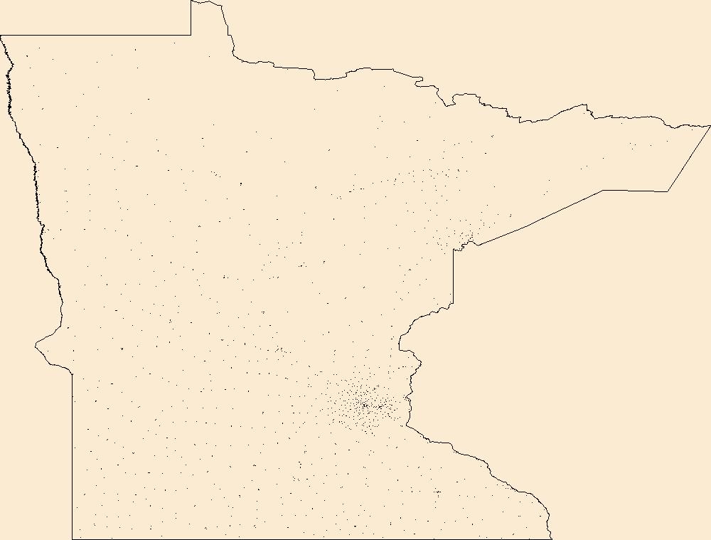
The Geographic Names Information System (GNIS) is the Federal standard for geographic nomenclature. The U.S. Geological Survey developed the GNIS for the U.S. Board on Geographic Names, a Federal inter-agency body chartered by public law to maintain uniform feature name usage throughout the Government and to promulgate standard names to the public. The GNIS is the official repository of domestic geographic names data; the official vehicle for geographic names use by all departments of the Federal Government; and the source for applying geographic names to Federal electronic and printed products of all types.
Tags: Aitkin,
Anoka,
Antarctica,
Antarctica,
BGN, All tags...
Becker,
Beltrami,
Benton,
Big Stone,
Blue Earth,
Board on Geographic Names,
Borough,
Brown,
Carlton,
Carver,
Cass,
Census Area,
Chippewa,
Chisago,
Clay,
Clearwater,
Commonwealth,
Cook,
Cottonwood,
County,
Crow Wing,
Dakota,
District,
Dodge,
Douglas,
Downloadable Data,
Faribault,
Feature class,
Feature coordinates,
Feature county,
Feature description,
Feature designation,
Feature history,
Feature indentification,
Feature name,
Feature state,
Fillmore,
Freeborn,
GNIS,
Geographic Names,
Geographic Names Federal Codes,
Geographic Names Information System,
Geographic feature,
Geographic name,
Geographical feature,
Geographical name,
Goodhue,
Grant,
Hennepin,
Houston,
Hubbard,
Isanti,
Itasca,
Jackson,
Kanabec,
Kandiyohi,
Kittson,
Koochiching,
Lac qui Parle,
Lake,
Lake of the Woods,
Le Sueur,
Lincoln,
Lyon,
MN,
Mahnomen,
Marshall,
Martin,
McLeod,
Meeker,
Mille Lacs,
Minnesota,
Morrison,
Mower,
Municipio,
Murray,
National Geographic Names Information System (GNIS),
National Geographic Names Information System (GNIS),
Nicollet,
Nobles,
Norman,
Official feature name,
Olmsted,
Otter Tail,
Outlying Area,
Parish,
Pennington,
Pine,
Pipestone,
Place name,
Polk,
Pope,
Populated Place,
Ramsey,
Red Lake,
Redwood,
Renville,
Rice,
Rock,
Roseau,
Scott,
Sherburne,
Sibley,
St. Louis,
State,
Stearns,
Steele,
Stevens,
Swift,
TXT (pipes),
Territories,
Territory,
Todd,
Topographic Map,
Traverse,
U.S. Board on Geographic Names,
U.S. Geological Survey,
US,
USA,
USBGN,
USGS,
UTF-8 Pipe Delimited Text File nan,
United States,
United States,
United States,
Variant name,
Wabasha,
Wadena,
Waseca,
Washington,
Watonwan,
Wilkin,
Winona,
Wright,
Yellow Medicine,
antarctic,
database,
economy,
environment,
feature,
gazetteer,
geographic,
geographic names,
geographical,
geography,
geospatial,
imageryBaseMapsEarthCover,
inlandWaters,
location,
map,
name,
place,
placename,
society,
structure,
topographic map,
toponymy, Fewer tags
This data represents the map extent for current and historical USGS topographic maps for the United States and Territories, including 1 X 2 Degree, 1 X 1 Degree, 30 X 60 Minute, 15 X 15 Minute, 7.5 X 7.5 Minute, and 3.75 X 3.75 Minute. The grid was generated using ESRI ArcInfo GIS software.
Types: Citation;
Tags: Aitkin,
Anoka,
Becker,
Beltrami,
Benton, All tags...
Big Stone,
Blue Earth,
Boundaries,
Brown,
Carlton,
Carver,
Cass,
Chippewa,
Chisago,
Clay,
Clearwater,
Cook,
Cottonwood,
Crow Wing,
Dakota,
Dodge,
Douglas,
Downloadable Data,
Esri Shapefile nan,
Faribault,
Fillmore,
Freeborn,
Goodhue,
Grant,
Hennepin,
Houston,
Hubbard,
Isanti,
Itasca,
Jackson,
Kanabec,
Kandiyohi,
Kittson,
Koochiching,
Lac qui Parle,
Lake,
Lake of the Woods,
Le Sueur,
Lincoln,
Lyon,
MN,
Mahnomen,
Map Indices,
Map Indices,
Map Indices,
Marshall,
Martin,
McLeod,
Meeker,
Mille Lacs,
Minnesota,
Morrison,
Mower,
Murray,
Nicollet,
Nobles,
Norman,
Olmsted,
Otter Tail,
Pennington,
Pine,
Pipestone,
Polk,
Pope,
Ramsey,
Red Lake,
Redwood,
Renville,
Rice,
Rock,
Roseau,
Scott,
Shapefile,
Sherburne,
Sibley,
St. Louis,
State,
State,
Stearns,
Steele,
Stevens,
Swift,
Todd,
Traverse,
US,
United States,
United States of America,
Wabasha,
Wadena,
Waseca,
Washington,
Watonwan,
Wilkin,
Winona,
Wright,
Yellow Medicine,
cells,
map indices,
polygon grid, Fewer tags
The National Hydrography Dataset (NHD) is a feature-based database that interconnects and uniquely identifies the stream segments or reaches that make up the nation's surface water drainage system. NHD data was originally developed at 1:100,000-scale and exists at that scale for the whole country. This high-resolution NHD, generally developed at 1:24,000/1:12,000 scale, adds detail to the original 1:100,000-scale NHD. (Data for Alaska, Puerto Rico and the Virgin Islands was developed at high-resolution, not 1:100,000 scale.) Local resolution NHD is being developed where partners and data exist. The NHD contains reach codes for networked features, flow direction, names, and centerline representations for areal water...
Tags: Adair,
Administrative watershed units,
Administrative watershed units,
Appanoose,
Area of Complex Channels, All tags...
Area to be submerged,
Audubon,
Basin,
Basin,
Bay/Inlet,
Boone,
Boundaries,
Boundary,
Bridge,
Buena Vista,
Calhoun,
Canal/Ditch,
Carroll,
Clark,
Clarke,
Clay,
Coastline,
Connector,
Cottonwood,
Dallas,
Dam/Weir,
Davis,
Dickinson,
Downloadable Data,
Drainage areas for surface water,
Drainageway,
Emmet,
Esri Shapefile nan,
Estuary,
Flow direction network,
Flume,
ForeShore,
Gaging Station,
Gate,
Greene,
Guthrie,
HU-4,
HU-4 Subregion,
HU10,
HU12,
HU14,
HU16,
HU2,
HU4,
HU4_0710,
HU6,
HU8,
HUC,
Hamilton,
Hancock,
Hazard Zone,
Humboldt,
Hydrographic,
Hydrography,
Hydrography,
Hydrography,
Hydrologic Unit Code,
Hydrologic Units,
IA,
Ice mass,
Inundation Area,
Iowa,
Jackson,
Jasper,
Jefferson,
Kossuth,
Lee,
Levee,
Line,
Lock Chamber,
Lucas,
Lyon,
MN,
MO,
Madison,
Mahaska,
Marion,
Marsh,
Martin,
Minnesota,
Missouri,
Monroe,
Murray,
National Hydrography Dataset (NHD),
National Hydrography Dataset (NHD) Best Resolution,
National Hydrography Dataset (NHD) Best Resolution,
Nobles,
Nonearthen Shore,
Orthoimage,
Palo Alto,
Pipestone,
Playa,
Pocahontas,
Point,
PointEvent,
Polk,
Pond,
Rapids,
Rapids,
Reach,
Reach code,
Reef,
Region,
Reservoir,
Rock,
Sac,
Sea/Ocean,
Shapefile,
Sink/Rise,
Sounding Datum Line,
Special Use Zone,
Special Use Zone Limit,
Spillway,
Story,
Stream,
Stream/River,
Sub-basin,
Sub-region,
Subbasin,
Submerged Stream,
Subregion,
Subwatershed,
Surface water systems,
Swamp,
Topographic,
Tunnel,
US,
Underground Conduit,
Union,
United States,
Van Buren,
WBD,
WBD,
Wall,
Wapello,
Warren,
Wash,
Water Intake Outflow,
Waterfall,
Watershed,
Watershed Boundaries,
Watershed Boundary Dataset,
Watershed Boundary Dataset,
Webster,
Well,
Winnebago,
Wright,
artificial path,
boundaries,
dams,
drainage systems and characteristics,
inlandWaters,
lakes,
ngda,
rivers, Fewer tags
|
|

