Filters
Date Range
Extensions
Types
Contacts
Categories
Tag Types
Tag Schemes
|
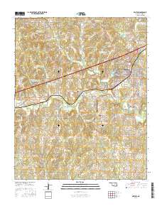
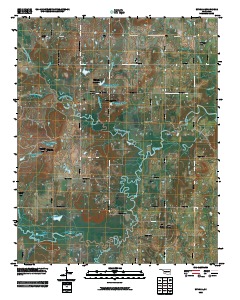
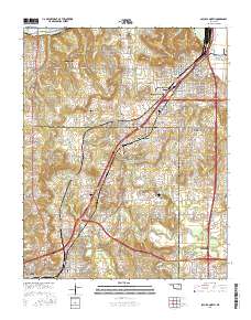
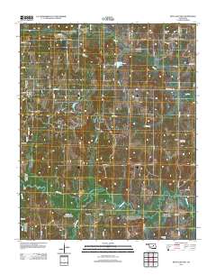
Layered GeoPDF 7.5 Minute Quadrangle Map. Layers of geospatial data include orthoimagery, roads, grids, geographic names, elevation contours, hydrography, and other selected map features.
Tags: 7.5 x 7.5 minute,
Bristow, OK,
Creek,
Downloadable Data,
EarthCover, All tags...
GeoPDF,
Imagery and Base Maps,
Map,
Oklahoma,
Public Land Survey System,
U.S. National Grid,
US,
US Topo,
US Topo Historical,
United States,
boundary,
contour,
geographic names,
hydrography,
imageryBaseMapsEarthCover,
orthoimage,
structures,
topographic,
transportation,
woodland, Fewer tags
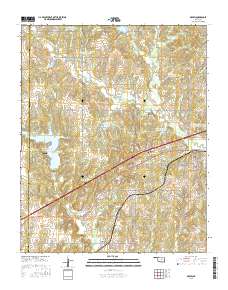
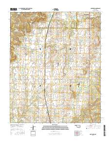
Layered GeoPDF 7.5 Minute Quadrangle Map. Layers of geospatial data include orthoimagery, roads, grids, geographic names, elevation contours, hydrography, and other selected map features.
Tags: 7.5 x 7.5 minute,
Creek,
Depew, OK,
Downloadable Data,
EarthCover, All tags...
GeoPDF,
Imagery and Base Maps,
Lincoln,
Map,
Oklahoma,
Public Land Survey System,
U.S. National Grid,
US,
US Topo,
US Topo Historical,
United States,
boundary,
contour,
geographic names,
hydrography,
imageryBaseMapsEarthCover,
orthoimage,
structures,
topographic,
transportation,
woodland, Fewer tags
The Geographic Names Information System (GNIS) is the Federal standard for geographic nomenclature. The U.S. Geological Survey developed the GNIS for the U.S. Board on Geographic Names, a Federal inter-agency body chartered by public law to maintain uniform feature name usage throughout the Government and to promulgate standard names to the public. The GNIS is the official repository of domestic geographic names data; the official vehicle for geographic names use by all departments of the Federal Government; and the source for applying geographic names to Federal electronic and printed products of all types.
Tags: Adair,
Alfalfa,
Antarctica,
Antarctica,
Atoka, All tags...
BGN,
Beaver,
Beckham,
Blaine,
Board on Geographic Names,
Borough,
Bryan,
Caddo,
Canadian,
Carter,
Census Area,
Cherokee,
Choctaw,
Cimarron,
Cleveland,
Coal,
Comanche,
Commonwealth,
Cotton,
County,
Craig,
Creek,
Custer,
Delaware,
Dewey,
District,
Downloadable Data,
Ellis,
Feature class,
Feature coordinates,
Feature county,
Feature description,
Feature designation,
Feature history,
Feature indentification,
Feature name,
Feature state,
GNIS,
Garfield,
Garvin,
Geographic Names,
Geographic Names Domestic Names,
Geographic Names Information System,
Geographic feature,
Geographic name,
Geographical feature,
Geographical name,
Grady,
Grant,
Greer,
Harmon,
Harper,
Haskell,
Hughes,
Jackson,
Jefferson,
Johnston,
Kay,
Kingfisher,
Kiowa,
Latimer,
Le Flore,
Lincoln,
Logan,
Love,
Major,
Marshall,
Mayes,
McClain,
McCurtain,
McIntosh,
Municipio,
Murray,
Muskogee,
National Geographic Names Information System (GNIS),
National Geographic Names Information System (GNIS),
Noble,
Nowata,
OK,
Official feature name,
Okfuskee,
Oklahoma,
Oklahoma,
Okmulgee,
Osage,
Ottawa,
Outlying Area,
Parish,
Pawnee,
Payne,
Pittsburg,
Place name,
Pontotoc,
Populated Place,
Pottawatomie,
Pushmataha,
Roger Mills,
Rogers,
Seminole,
Sequoyah,
State,
Stephens,
TXT (pipes),
Territories,
Territory,
Texas,
Tillman,
Topographic Map,
Tulsa,
U.S. Board on Geographic Names,
U.S. Geological Survey,
US,
USA,
USBGN,
USGS,
UTF-8 Pipe Delimited Text File nan,
United States,
United States,
United States,
Variant name,
Wagoner,
Washington,
Washita,
Woods,
Woodward,
antarctic,
database,
economy,
environment,
feature,
gazetteer,
geographic,
geographic names,
geographical,
geography,
geospatial,
imageryBaseMapsEarthCover,
inlandWaters,
location,
map,
name,
place,
placename,
society,
structure,
topographic map,
toponymy, Fewer tags
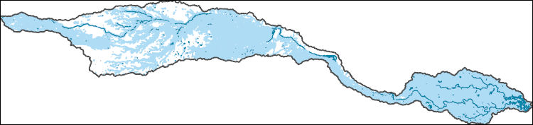
The Watershed Boundary Dataset (WBD) is a comprehensive aggregated collection of hydrologic unit data consistent with the national criteria for delineation and resolution. It defines the areal extent of surface water drainage to a point except in coastal or lake front areas where there could be multiple outlets as stated by the "Federal Standards and Procedures for the National Watershed Boundary Dataset (WBD)" "Standard" (https://pubs.usgs.gov/tm/11/a3/). Watershed boundaries are determined solely upon science-based hydrologic principles, not favoring any administrative boundaries or special projects, nor particular program or agency. This dataset represents the hydrologic unit boundaries to the 12-digit (6th level)...
Tags: 10-digit,
12-digit,
14-digit,
16-digit,
2-digit, All tags...
4-digit,
6-digit,
8-digit,
AR,
Adair,
Alamosa,
Alfalfa,
Allen,
Anderson,
Archer,
Arkansas,
Armstrong,
Atoka,
Baca,
Barber,
Barry,
Barton,
Basin,
Baxter,
Baylor,
Beaver,
Beckham,
Bent,
Benton,
Bienville,
Blaine,
Boone,
Bossier,
Bourbon,
Bowie,
Briscoe,
Bryan,
Butler,
CO,
Caddo,
Camp,
Canadian,
Carroll,
Carson,
Carter,
Cass,
Castro,
Chaffee,
Chase,
Chautauqua,
Cherokee,
Cheyenne,
Childress,
Choctaw,
Christian,
Cimarron,
Claiborne,
Clark,
Clay,
Cleburne,
Cleveland,
Coal,
Coffey,
Colfax,
Collingsworth,
Colorado,
Columbia,
Comanche,
Conway,
Cooke,
Costilla,
Cottle,
Cotton,
Cowley,
Craig,
Crawford,
Creek,
Crosby,
Crowley,
Curry,
Custer,
Dade,
Dallam,
De Soto,
Deaf Smith,
Delaware,
Delta,
Dent,
Dewey,
Dickens,
Donley,
Douglas,
Downloadable Data,
Eagle,
Edwards,
El Paso,
Elbert,
Elk,
Ellis,
Ellsworth,
Fannin,
Faulkner,
Finney,
Floyd,
Foard,
Ford,
Franklin,
Fremont,
Fulton,
Garfield,
Garland,
Garvin,
GeoPackage,
Grady,
Grant,
Gray,
Grayson,
Greeley,
Greene,
Greenwood,
Greer,
Gregg,
Guadalupe,
Gunnison,
HU-2,
HU-2 Region,
HU2_11,
HUC,
Hale,
Hall,
Hamilton,
Hansford,
Hardeman,
Harding,
Harmon,
Harper,
Harrison,
Hartley,
Harvey,
Haskell,
Hemphill,
Hempstead,
Hodgeman,
Hopkins,
Howard,
Howell,
Huerfano,
Hughes,
Hunt,
Hutchinson,
Hydrography,
Hydrologic Unit Code,
Hydrologic Units,
Independence,
Iron,
Izard,
Jackson,
Jasper,
Jefferson,
Johnson,
Johnston,
KS,
Kansas,
Kay,
Kearny,
King,
Kingfisher,
Kingman,
Kiowa,
Kit Carson,
Knox,
LA,
Labette,
Lafayette,
Lake,
Lamar,
Lane,
Las Animas,
Latimer,
Lawrence,
Le Flore,
Lincoln,
Lipscomb,
Little River,
Logan,
Lonoke,
Louisiana,
Love,
Lyon,
MO,
Madison,
Major,
Marion,
Marshall,
Mayes,
McClain,
McCurtain,
McDonald,
McIntosh,
McPherson,
Meade,
Miller,
Missouri,
Montague,
Montgomery,
Moore,
Mora,
Morris,
Morton,
Motley,
Murray,
Muskogee,
NM,
Natchitoches,
National Watershed Boundary Dataset (WBD),
National Watershed Boundary Dataset (WBD),
Neosho,
Ness,
Nevada,
New Mexico,
Newton,
Noble,
Nowata,
OK,
Ochiltree,
Okfuskee,
Oklahoma,
Oklahoma,
Okmulgee,
Oldham,
Open Geospatial Consortium GeoPackage 1.2,
Oregon,
Osage,
Otero,
Ottawa,
Ozark,
Panola,
Park,
Parmer,
Pawnee,
Payne,
Perry,
Pike,
Pitkin,
Pittsburg,
Polk,
Pontotoc,
Pope,
Pottawatomie,
Potter,
Pratt,
Prowers,
Pueblo,
Pulaski,
Pushmataha,
Quay,
Randall,
Randolph,
Rapides,
Red River,
Region,
Reno,
Reynolds,
Rice,
Rio Arriba,
Ripley,
Roberts,
Roger Mills,
Rogers,
Rush,
Sabine,
Saguache,
Saline,
San Miguel,
Scott,
Searcy,
Sebastian,
Sedgwick,
Seminole,
Sequoyah,
Sevier,
Seward,
Shannon,
Sharp,
Sherman,
Stafford,
Stanton,
Stephens,
Stevens,
Stone,
Sub-basin,
Sub-region,
Subwatershed,
Summit,
Sumner,
Swisher,
TX,
Taney,
Taos,
Teller,
Texas,
Texas,
Tillman,
Titus,
Tulsa,
US,
Union,
United States,
Upshur,
Van Buren,
Vernon,
WBD,
Wabaunsee,
Wagoner,
Washington,
Washita,
Watershed,
Watershed Boundary Dataset,
Wayne,
Webster,
Wheeler,
White,
Wichita,
Wilbarger,
Wilson,
Winn,
Wood,
Woodruff,
Woods,
Woodson,
Woodward,
Wright,
Yell,
Young,
inlandWaters, Fewer tags
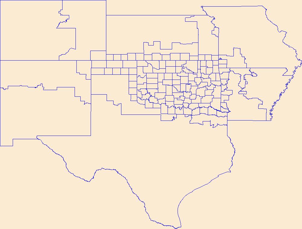
Geospatial data is comprised of government boundaries.
Tags: Adair,
Alfalfa,
Atoka,
Beaver,
Beckham, All tags...
Blaine,
Boundaries,
Bryan,
Caddo,
Canadian,
Carter,
Cherokee,
Choctaw,
Cimarron,
Cleveland,
Coal,
Comanche,
Cotton,
County or Equivalent,
Craig,
Creek,
Custer,
Delaware,
Dewey,
Downloadable Data,
Ellis,
Esri Shapefile nan,
Garfield,
Garvin,
Grady,
Grant,
Greer,
Harmon,
Harper,
Haskell,
Hughes,
Incorporated Place,
Jackson,
Jefferson,
Johnston,
Jurisdictional,
Kay,
Kingfisher,
Kiowa,
Latimer,
Le Flore,
Lincoln,
Logan,
Love,
Major,
Marshall,
Mayes,
McClain,
McCurtain,
McIntosh,
Minor Civil Division,
Murray,
Muskogee,
National Boundary Dataset (NBD),
National Boundary Dataset (NBD),
Native American Area,
Noble,
Nowata,
OK,
Okfuskee,
Oklahoma,
Oklahoma,
Okmulgee,
Osage,
Ottawa,
PLSS First Division,
PLSS Special Survey,
PLSS Township,
Pawnee,
Payne,
Pittsburg,
Pontotoc,
Pottawatomie,
Public Land Survey System,
Pushmataha,
Reserve,
Roger Mills,
Rogers,
Seminole,
Sequoyah,
Shapefile,
State,
State,
State or Territory,
Stephens,
Texas,
Tillman,
Tulsa,
U.S. National Grid,
US,
Unincorporated Place,
United States,
Wagoner,
Washington,
Washita,
Woods,
Woodward,
boundaries,
boundary,
cadastral surveys,
geographic names,
land ownership,
land use maps,
legal land descriptions,
political and administrative boundaries,
zoning maps, Fewer tags
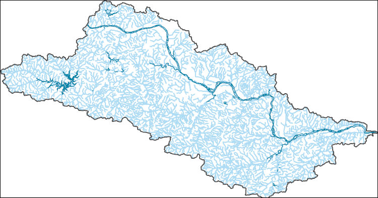
The National Hydrography Dataset (NHD) is a feature-based database that interconnects and uniquely identifies the stream segments or reaches that make up the nation's surface water drainage system. NHD data was originally developed at 1:100,000-scale and exists at that scale for the whole country. This high-resolution NHD, generally developed at 1:24,000/1:12,000 scale, adds detail to the original 1:100,000-scale NHD. (Data for Alaska, Puerto Rico and the Virgin Islands was developed at high-resolution, not 1:100,000 scale.) Local resolution NHD is being developed where partners and data exist. The NHD contains reach codes for networked features, flow direction, names, and centerline representations for areal water...
Tags: Administrative watershed units,
Administrative watershed units,
Area of Complex Channels,
Area to be submerged,
Basin, All tags...
Basin,
Bay/Inlet,
Boundaries,
Boundary,
Bridge,
Canal/Ditch,
Coastline,
Connector,
Creek,
Dam/Weir,
Downloadable Data,
Drainage areas for surface water,
Drainageway,
Esri File GeoDatabase 10,
Estuary,
FileGDB,
Flow direction network,
Flume,
ForeShore,
Gaging Station,
Gate,
HU-8,
HU-8 Subbasin,
HU10,
HU12,
HU14,
HU16,
HU2,
HU4,
HU6,
HU8,
HU8_11110101,
HUC,
Hazard Zone,
Hydrographic,
Hydrography,
Hydrography,
Hydrography,
Hydrologic Unit Code,
Hydrologic Units,
Ice mass,
Inundation Area,
Levee,
Line,
Lock Chamber,
Marsh,
Muskogee,
National Hydrography Dataset (NHD),
National Hydrography Dataset (NHD) Best Resolution,
National Hydrography Dataset (NHD) Best Resolution,
Nonearthen Shore,
OK,
Oklahoma,
Okmulgee,
Orthoimage,
Osage,
Playa,
Point,
PointEvent,
Pond,
Rapids,
Rapids,
Reach,
Reach code,
Reef,
Region,
Reservoir,
Rock,
Sea/Ocean,
Sink/Rise,
Sounding Datum Line,
Special Use Zone,
Special Use Zone Limit,
Spillway,
Stream,
Stream/River,
Sub-basin,
Sub-region,
Subbasin,
Submerged Stream,
Subregion,
Subwatershed,
Surface water systems,
Swamp,
Topographic,
Tulsa,
Tunnel,
US,
Underground Conduit,
United States,
WBD,
WBD,
Wagoner,
Wall,
Wash,
Water Intake Outflow,
Waterfall,
Watershed,
Watershed Boundaries,
Watershed Boundary Dataset,
Watershed Boundary Dataset,
Well,
artificial path,
boundaries,
dams,
drainage systems and characteristics,
inlandWaters,
lakes,
ngda,
rivers, Fewer tags
The National Hydrography Dataset (NHD) is a feature-based database that interconnects and uniquely identifies the stream segments or reaches that make up the nation's surface water drainage system. NHD data was originally developed at 1:100,000-scale and exists at that scale for the whole country. This high-resolution NHD, generally developed at 1:24,000/1:12,000 scale, adds detail to the original 1:100,000-scale NHD. (Data for Alaska, Puerto Rico and the Virgin Islands was developed at high-resolution, not 1:100,000 scale.) Local resolution NHD is being developed where partners and data exist. The NHD contains reach codes for networked features, flow direction, names, and centerline representations for areal water...
Tags: Adair,
Administrative watershed units,
Administrative watershed units,
Alfalfa,
Area of Complex Channels, All tags...
Area to be submerged,
Atoka,
Basin,
Basin,
Bay/Inlet,
Beaver,
Beckham,
Blaine,
Boundaries,
Boundary,
Bridge,
Bryan,
Caddo,
Canadian,
Canal/Ditch,
Carter,
Cherokee,
Choctaw,
Cimarron,
Cleveland,
Coal,
Coastline,
Comanche,
Connector,
Cotton,
Craig,
Creek,
Custer,
Dam/Weir,
Delaware,
Dewey,
Downloadable Data,
Drainage areas for surface water,
Drainageway,
Ellis,
Esri File GeoDatabase 10,
Estuary,
FileGDB,
Flow direction network,
Flume,
ForeShore,
Gaging Station,
Garfield,
Garvin,
Gate,
Grady,
Grant,
Greer,
HU10,
HU12,
HU14,
HU16,
HU2,
HU4,
HU6,
HU8,
HUC,
Harmon,
Harper,
Haskell,
Hazard Zone,
Hughes,
Hydrographic,
Hydrography,
Hydrography,
Hydrography,
Hydrologic Unit Code,
Hydrologic Units,
Ice mass,
Inundation Area,
Jackson,
Jefferson,
Johnston,
Kay,
Kingfisher,
Kiowa,
Latimer,
Le Flore,
Levee,
Lincoln,
Line,
Lock Chamber,
Logan,
Love,
Major,
Marsh,
Marshall,
Mayes,
McClain,
McCurtain,
McIntosh,
Murray,
Muskogee,
National Hydrography Dataset (NHD),
National Hydrography Dataset (NHD) Best Resolution,
National Hydrography Dataset (NHD) Best Resolution,
Noble,
Nonearthen Shore,
Nowata,
OK,
Okfuskee,
Oklahoma,
Oklahoma,
Okmulgee,
Orthoimage,
Osage,
Ottawa,
Pawnee,
Payne,
Pittsburg,
Playa,
Point,
PointEvent,
Pond,
Pontotoc,
Pottawatomie,
Pushmataha,
Rapids,
Rapids,
Reach,
Reach code,
Reef,
Region,
Reservoir,
Rock,
Roger Mills,
Rogers,
Sea/Ocean,
Seminole,
Sequoyah,
Sink/Rise,
Sounding Datum Line,
Special Use Zone,
Special Use Zone Limit,
Spillway,
State,
State,
State_Oklahoma,
Stephens,
Stream,
Stream/River,
Sub-basin,
Sub-region,
Subbasin,
Submerged Stream,
Subregion,
Subwatershed,
Surface water systems,
Swamp,
Texas,
Tillman,
Topographic,
Tulsa,
Tunnel,
US,
Underground Conduit,
United States,
WBD,
WBD,
Wagoner,
Wall,
Wash,
Washington,
Washita,
Water Intake Outflow,
Waterfall,
Watershed,
Watershed Boundaries,
Watershed Boundary Dataset,
Watershed Boundary Dataset,
Well,
Woods,
Woodward,
artificial path,
boundaries,
dams,
drainage systems and characteristics,
inlandWaters,
lakes,
ngda,
rivers, Fewer tags
The National Hydrography Dataset (NHD) is a feature-based database that interconnects and uniquely identifies the stream segments or reaches that make up the nation's surface water drainage system. NHD data was originally developed at 1:100,000-scale and exists at that scale for the whole country. This high-resolution NHD, generally developed at 1:24,000/1:12,000 scale, adds detail to the original 1:100,000-scale NHD. (Data for Alaska, Puerto Rico and the Virgin Islands was developed at high-resolution, not 1:100,000 scale.) Local resolution NHD is being developed where partners and data exist. The NHD contains reach codes for networked features, flow direction, names, and centerline representations for areal water...
Tags: Administrative watershed units,
Administrative watershed units,
Area of Complex Channels,
Area to be submerged,
Basin, All tags...
Basin,
Bay/Inlet,
Beaver,
Blaine,
Boundaries,
Boundary,
Bridge,
Canadian,
Canal/Ditch,
Cimarron,
Cleveland,
Coastline,
Connector,
Creek,
Dallam,
Dam/Weir,
Dewey,
Downloadable Data,
Drainage areas for surface water,
Drainageway,
Ellis,
Esri File GeoDatabase 10,
Estuary,
FileGDB,
Flow direction network,
Flume,
ForeShore,
Gaging Station,
Gate,
HU-4,
HU-4 Subregion,
HU10,
HU12,
HU14,
HU16,
HU2,
HU4,
HU4_1110,
HU6,
HU8,
HUC,
Hansford,
Harper,
Hartley,
Hazard Zone,
Hemphill,
Hughes,
Hutchinson,
Hydrographic,
Hydrography,
Hydrography,
Hydrography,
Hydrologic Unit Code,
Hydrologic Units,
Ice mass,
Inundation Area,
KS,
Kansas,
Levee,
Lincoln,
Line,
Lipscomb,
Lock Chamber,
Logan,
Major,
Marsh,
McIntosh,
Moore,
Muskogee,
NM,
National Hydrography Dataset (NHD),
National Hydrography Dataset (NHD) Best Resolution,
National Hydrography Dataset (NHD) Best Resolution,
New Mexico,
Nonearthen Shore,
OK,
Ochiltree,
Okfuskee,
Oklahoma,
Oklahoma,
Okmulgee,
Orthoimage,
Playa,
Point,
PointEvent,
Pond,
Pottawatomie,
Rapids,
Rapids,
Reach,
Reach code,
Reef,
Region,
Reservoir,
Rock,
Sea/Ocean,
Seminole,
Seward,
Sherman,
Sink/Rise,
Sounding Datum Line,
Special Use Zone,
Special Use Zone Limit,
Spillway,
Stevens,
Stream,
Stream/River,
Sub-basin,
Sub-region,
Subbasin,
Submerged Stream,
Subregion,
Subwatershed,
Surface water systems,
Swamp,
TX,
Texas,
Texas,
Topographic,
Tunnel,
US,
Underground Conduit,
Union,
United States,
WBD,
WBD,
Wall,
Wash,
Water Intake Outflow,
Waterfall,
Watershed,
Watershed Boundaries,
Watershed Boundary Dataset,
Watershed Boundary Dataset,
Well,
Woodward,
artificial path,
boundaries,
dams,
drainage systems and characteristics,
inlandWaters,
lakes,
ngda,
rivers, Fewer tags
Layers of geospatial data include roads, airports, trails, and railroads.
Tags: Adair,
Airport Complex,
Airport Point,
Airport Runway,
Airports, All tags...
Airstrips,
Alfalfa,
Atoka,
Beaver,
Beckham,
Blaine,
Bryan,
Caddo,
Canadian,
Carter,
Cherokee,
Choctaw,
Cimarron,
Cleveland,
Coal,
Comanche,
Cotton,
Craig,
Creek,
Custer,
Delaware,
Dewey,
Downloadable Data,
Ellis,
Esri Shapefile nan,
Garfield,
Garvin,
Geographic names,
Grady,
Grant,
Greer,
Harmon,
Harper,
Haskell,
Hughes,
Jackson,
Jefferson,
Johnston,
Kay,
Kingfisher,
Kiowa,
Latimer,
Le Flore,
Lincoln,
Logan,
Love,
Major,
Marshall,
Mayes,
McClain,
McCurtain,
McIntosh,
Murray,
Muskogee,
National Transportation Dataset (NTD),
National Transportation Dataset (NTD),
Noble,
Nowata,
OK,
Okfuskee,
Oklahoma,
Oklahoma,
Okmulgee,
Osage,
Ottawa,
Pawnee,
Payne,
Pittsburg,
Pontotoc,
Pottawatomie,
Pushmataha,
Railways,
Roads,
Roger Mills,
Rogers,
Seminole,
Sequoyah,
Shapefile,
State,
State,
Stephens,
Texas,
Tillman,
Trail,
Trails,
Transportation,
Transportation,
Tulsa,
US,
United States,
Wagoner,
Washington,
Washita,
Waterway,
Woods,
Woodward,
transportation, Fewer tags

Layered GeoPFD 7.5 Minute Quadrangle Map. Layers of geospatial data include orthoimagery, roads, grids, geographic names, elevation contours, hydrography, and other selected map features.
Tags: 7.5 x 7.5 minute,
Creek,
Downloadable Data,
EarthCover,
GeoPDF, All tags...
Imagery and Base Maps,
Keystone Dam, OK,
Map,
Oklahoma,
Pawnee,
U.S. National Grid,
US,
US Topo,
US Topo Historical,
United States,
contour,
geographic names,
hydrography,
orthoimage,
topographic,
transportation, Fewer tags
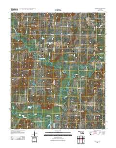
Layered GeoPFD 7.5 Minute Quadrangle Map. Layers of geospatial data include orthoimagery, roads, grids, geographic names, elevation contours, hydrography, and other selected map features.
Tags: 7.5 x 7.5 minute,
Creek,
Downloadable Data,
EarthCover,
GeoPDF, All tags...
Imagery and Base Maps,
Map,
Nuyaka, OK,
Oklahoma,
Okmulgee,
U.S. National Grid,
US,
US Topo,
US Topo Historical,
United States,
contour,
geographic names,
hydrography,
orthoimage,
topographic,
transportation, Fewer tags
Layered GeoPDF 7.5 Minute Quadrangle Map. Layers of geospatial data include orthoimagery, roads, grids, geographic names, elevation contours, hydrography, and other selected map features.
Tags: 7.5 x 7.5 minute,
Creek,
Downloadable Data,
EarthCover,
GeoPDF, All tags...
Imagery and Base Maps,
Map,
Nuyaka, OK,
Okfuskee,
Oklahoma,
Okmulgee,
Public Land Survey System,
U.S. National Grid,
US,
US Topo,
US Topo Historical,
United States,
boundary,
contour,
geographic names,
hydrography,
imageryBaseMapsEarthCover,
orthoimage,
structures,
topographic,
transportation,
woodland, Fewer tags
Layered GeoPFD 7.5 Minute Quadrangle Map. Layers of geospatial data include orthoimagery, roads, grids, geographic names, elevation contours, hydrography, and other selected map features.
Tags: 7.5 x 7.5 minute,
Creek,
Downloadable Data,
EarthCover,
GeoPDF, All tags...
Imagery and Base Maps,
Map,
Oklahoma,
Sapulpa North, OK,
Tulsa,
U.S. National Grid,
US,
US Topo,
US Topo Historical,
United States,
contour,
geographic names,
hydrography,
orthoimage,
topographic,
transportation, Fewer tags
Layered GeoPDF 7.5 Minute Quadrangle Map. Layers of geospatial data include orthoimagery, roads, grids, geographic names, elevation contours, hydrography, and other selected map features.
Tags: 7.5 x 7.5 minute,
Creek,
Downloadable Data,
EarthCover,
GeoPDF, All tags...
Imagery and Base Maps,
Map,
Oklahoma,
Public Land Survey System,
Sapulpa North, OK,
Tulsa,
U.S. National Grid,
US,
US Topo,
US Topo Historical,
United States,
boundary,
contour,
geographic names,
hydrography,
imageryBaseMapsEarthCover,
orthoimage,
structures,
topographic,
transportation,
woodland, Fewer tags

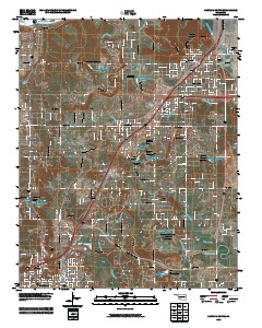
Layered GeoPDF 7.5 Minute Quadrangle Map. Layers of geospatial data include orthoimagery, roads, grids, geographic names, elevation contours, hydrography, and other selected map features.
Tags: 7.5 x 7.5 minute,
Creek,
Downloadable Data,
Drumright, OK,
EarthCover, All tags...
GeoPDF,
Imagery and Base Maps,
Lincoln,
Map,
Oklahoma,
Payne,
Public Land Survey System,
U.S. National Grid,
US,
US Topo,
US Topo Historical,
United States,
boundary,
contour,
geographic names,
hydrography,
imageryBaseMapsEarthCover,
orthoimage,
structures,
topographic,
transportation,
woodland, Fewer tags
Layered GeoPDF 7.5 Minute Quadrangle Map. Layers of geospatial data include orthoimagery, roads, grids, geographic names, elevation contours, hydrography, and other selected map features.
Tags: 7.5 x 7.5 minute,
Creek,
Downloadable Data,
EarthCover,
GeoPDF, All tags...
Imagery and Base Maps,
Lake Boren, OK,
Map,
Oklahoma,
Okmulgee,
Public Land Survey System,
Tulsa,
U.S. National Grid,
US,
US Topo,
US Topo Historical,
United States,
boundary,
contour,
geographic names,
hydrography,
imageryBaseMapsEarthCover,
orthoimage,
structures,
topographic,
transportation,
woodland, Fewer tags
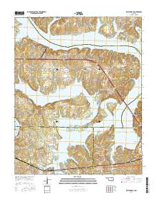
Layered GeoPDF 7.5 Minute Quadrangle Map. Layers of geospatial data include orthoimagery, roads, grids, geographic names, elevation contours, hydrography, and other selected map features.
Tags: 7.5 x 7.5 minute,
Creek,
Downloadable Data,
EarthCover,
GeoPDF, All tags...
Imagery and Base Maps,
Keystone Dam, OK,
Map,
Oklahoma,
Osage,
Pawnee,
Public Land Survey System,
Tulsa,
U.S. National Grid,
US,
US Topo,
US Topo Historical,
United States,
boundary,
contour,
geographic names,
hydrography,
imageryBaseMapsEarthCover,
orthoimage,
structures,
topographic,
transportation,
woodland, Fewer tags
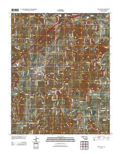
Layered GeoPDF 7.5 Minute Quadrangle Map. Layers of geospatial data include orthoimagery, roads, grids, geographic names, elevation contours, hydrography, and other selected map features.
Tags: 7.5 x 7.5 minute,
Creek,
Downloadable Data,
EarthCover,
GeoPDF, All tags...
Imagery and Base Maps,
Kellyville, OK,
Map,
Oklahoma,
Public Land Survey System,
U.S. National Grid,
US,
US Topo,
US Topo Historical,
United States,
boundary,
contour,
geographic names,
hydrography,
imageryBaseMapsEarthCover,
orthoimage,
structures,
topographic,
transportation,
woodland, Fewer tags

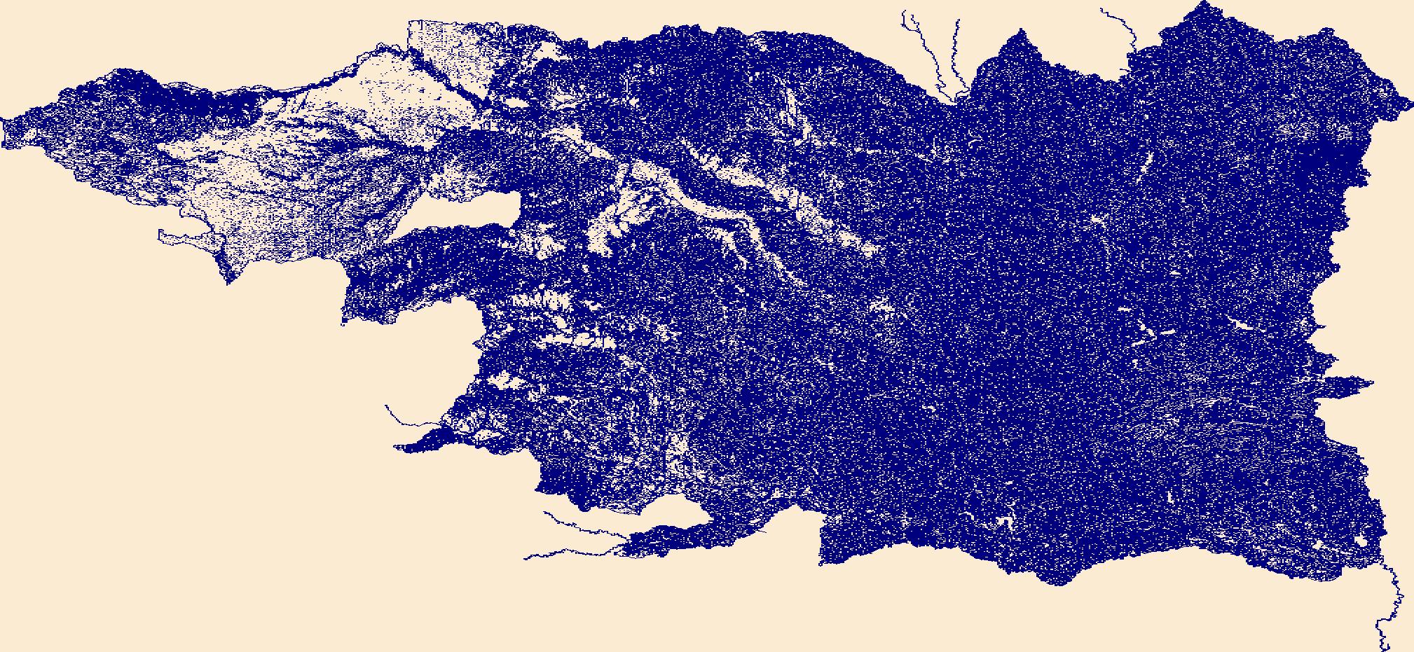
This data set represents the extent, approximate location and type of wetlands and deepwater habitats in the Alaska, United States. These data delineate the areal extent of wetlands and surface waters as defined by Cowardin et al. (1979). Certain wetland habitats are excluded from the National mapping program because of the limitations of aerial imagery as the primary data source used to detect wetlands. These habitats include seagrasses or submerged aquatic vegetation that are found in the intertidal and subtidal zones of estuaries and near shore coastal waters. Some deepwater reef communities (coral or tuberficid worm reefs) have also been excluded from the inventory. These habitats, because of their depth, go...
Tags: Alaska,
Alaska,
NPLCC,
North Pacific Landscape Conservation Cooperative,
United States, All tags...
United States,
bogs,
bogs,
creek,
creek,
creeks,
creeks,
fens,
fens,
hydrographic,
hydrographic,
hydrography,
hydrography,
lake,
lake,
lakes,
lakes,
marshes,
marshes,
nwi,
nwi,
pond,
pond,
ponds,
ponds,
river,
river,
rivers,
rivers,
stream,
stream,
streams,
streams,
swamps,
swamps,
water,
water,
wetlands,
wetlands, Fewer tags
Layered GeoPDF 7.5 Minute Quadrangle Map. Layers of geospatial data include orthoimagery, roads, grids, geographic names, elevation contours, hydrography, and other selected map features.
Tags: 7.5 x 7.5 minute,
Creek,
Downloadable Data,
EarthCover,
GeoPDF, All tags...
Imagery and Base Maps,
Lincoln,
Map,
Okfuskee,
Oklahoma,
Public Land Survey System,
Ritts Junction, OK,
U.S. National Grid,
US,
US Topo,
US Topo Historical,
United States,
boundary,
contour,
geographic names,
hydrography,
imageryBaseMapsEarthCover,
orthoimage,
structures,
topographic,
transportation,
woodland, Fewer tags
|
|

