Filters: Tags: reservoir (X) > Extensions: ArcGIS REST Service (X)
4 results (9ms)|
Filters
Date Range
Types Contacts
Categories Tag Types Tag Schemes |

The Watershed Boundary Dataset (WBD) from The National Map (TNM) defines the perimeter of drainage areas formed by the terrain and other landscape characteristics. The drainage areas are nested within each other so that a large drainage area, such as the Upper Mississippi River, will be composed of multiple smaller drainage areas, such as the Wisconsin River. Each of these smaller areas can further be subdivided into smaller and smaller drainage areas. The WBD uses six different levels in this hierarchy, with the smallest averaging about 30,000 acres. The WBD is made up of polygons nested into six levels of data respectively defined by Regions, Subregions, Basins, Subbasins, Watersheds, and Subwatersheds. For additional...
ANTECEDENTES La Ley de Aguas Nacionales, que entró en vigor el 2 de diciembre de 1992, refuerza el marco institucional para la administración del recurso y consolida a la Comisión Nacional del Agua (CONAGUA) como autoridad federal única en materia de cantidad y calidad del recurso hidráulico nacional, superficial y subterráneo. Dentro de este Marco Institucional es que en 1992 se propone el desarrollo de un Sistema de Información Geográfica del Agua (SIGA) que se constituyera en una herramienta que permitiera integrar, consultar, analizar y desplegar la información georreferenciada para que las unidades de la CONAGUA realizaran con mayor eficiencia las labores de planeación y administración del agua. OBJETIVOS...
Categories: Data;
Types: ArcGIS REST Map Service,
Map Service,
OGC WFS Layer,
OGC WMS Layer,
OGC WMS Service;
Tags: GIS,
Mexico,
climate,
groundwater,
map,

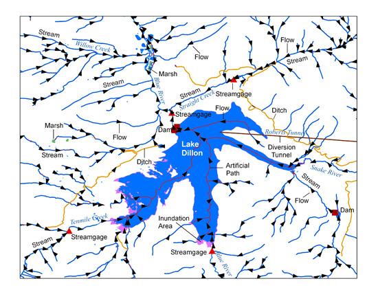
The USGS National Hydrography Dataset (NHD) service from The National Map (TNM) is a comprehensive set of digital spatial data that encodes information about naturally occurring and constructed bodies of surface water (lakes, ponds, and reservoirs), paths through which water flows (canals, ditches, streams, and rivers), and related entities such as point features (springs, wells, stream gages, and dams). The information encoded about these features includes classification and other characteristics, delineation, geographic name, position and related measures, a "reach code" through which other information can be related to the NHD, and the direction of water flow. The network of reach codes delineating water and...
Categories: Data;
Types: ArcGIS REST Map Service,
Map Service;
Tags: HU,
Hydrography,
NGP-TNM,
NHD,
Overlay Map Service,
NPS is transforming the way park resource information is managed and delivered to parks, partners, and the public. IRMA (Integrated Resource Management Applications) is the name given to the project that has guided this transformation, and to the web portal that is its end result. View or download the IRMA project brief (.pdf). IRMA is a portfolio of tools and applications, and the beginnings of a "one-stop" for data and information on park-related resources. From IRMA you can search for, view, and download documents, reports, publications, data sets, and park species lists. You can get information on park visitor numbers, park projects, and apply for a park research permit. Park staff can navigate to certain internal...
Categories: Data;
Types: ArcGIS REST Map Service,
Map Service,
OGC WFS Layer,
OGC WMS Layer,
OGC WMS Service;
Tags: Chihuahuan Desert,
English,
GIS,
Madrean,
Mojave Desert,
|

|