U.S. Geological Survey, 2022, 5 Meter Alaska Digital Elevation Models (DEMs) - USGS National Map 3DEP Downloadable Data Collection: U.S. Geological Survey.
Summary
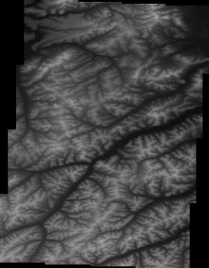
This is a tiled collection of the 3D Elevation Program (3DEP) covering Alaska only, and is 5-meter resolution. The 3DEP data holdings serve as the elevation layer of The National Map, and provide foundational elevation information for earth science studies and mapping applications in the United States. Scientists and resource managers use 3DEP data for hydrologic modeling, resource monitoring, mapping and visualization, and many other applications. The elevations in this DEM represent the topographic bare-earth surface. USGS standard 5-meter DEMs are produced exclusively from interferometric synthetic aperture radar (Ifsar) source data of 5-meter or higher resolution. Five-meter DEM surfaces are seamless within collection projects, [...]
Summary
This is a tiled collection of the 3D Elevation Program (3DEP) covering Alaska only, and is 5-meter resolution. The 3DEP data holdings serve as the elevation layer of The National Map, and provide foundational elevation information for earth science studies and mapping applications in the United States. Scientists and resource managers use 3DEP data for hydrologic modeling, resource monitoring, mapping and visualization, and many other applications. The elevations in this DEM represent the topographic bare-earth surface. USGS standard 5-meter DEMs are produced exclusively from interferometric synthetic aperture radar (Ifsar) source data of 5-meter or higher resolution. Five-meter DEM surfaces are seamless within collection projects, but, not necessarily seamless across projects. This DEM is delivered in the original resolution, with the original spatial reference. All elevation units have been converted to meters. These data may be used as the source of updates to the seamless 1/3 arc-second DEM layer, which serves as the elevation layer of the National Map. Other 3DEP products are nationally seamless DEMs in resolutions of 1 and 2 arc seconds. These seamless DEMs were referred to as the National Elevation Dataset (NED) from about 2000 through 2015 at which time they became the seamless DEM layers under the 3DEP program and the NED name and system were retired. Other 3DEP products in Alaska include lidar point cloud and interferometric synthetic aperture radar (Ifsar) digital surface models and intensity images. All 3DEP products are public domain.
These data can be used to provide basic elevation information for earth science studies and mapping applications in the United States. The data are utilized by the scientific and resource management communities for global change research, hydrologic modeling, resource monitoring, mapping and visualization applications.