Filters: Tags: {"scheme":"Geographic Names Information System","name":"united states"} (X) > Types: Map Service (X)
49 results (200ms)|
Filters
Date Range
Extensions
Types Contacts
Categories Tag Types Tags (with Scheme=Geographic Names Information System) |
This dataset is a polygon coverage of the Fire Clay coal zone that represents the areas in which resources were calculated and is only part of the full outcrop of the coal zone. Parts of the boundaries of the resource areas represent the 14-inch thickness isoline of the Fre Clay coal or the sub-crop limits of data availability; other parts of the boundaries are actual outcrop. The file has been generalized from detailed geologic coverages found elsewhere in Professional Paper 1625-C. This resource model for the Fire Clay coal zone must be considered provisional, because the correlation of the zone continues to be evaluated in West Virginia.
Categories: Data,
pre-SM502.8;
Types: Downloadable,
Map Service,
OGC WFS Layer,
OGC WMS Layer,
Shapefile;
Tags: Appalachians,
BELL County,
BOONE County,
BREATHITT County,
CLAY County,
Groundwater-quality data collected between 1993 and 2015 were compiled from the U.S. Geological Survey (USGS) National Water Information System (NWIS) database for 722 wells in the San Joaquin Valley (SJV). Groundwater-quality data retrieved included lab analyses of complete major ion data (calcium, magnesium, sodium, potassium, chloride, sulfate, nitrate, alkalinity, bicarbonate, carbonate, silica, and TDS) for 613 samples, and an additional 109 samples with measured values of specific conductance. Most of these wells were sampled as part of the California Groundwater Ambient Monitoring and Assessment (GAMA) Program Priority Basin Project or the USGS National Water Quality Assessment (NAWQA) Program. In addition...
Categories: Data;
Types: Citation,
Map Service,
OGC WFS Layer,
OGC WMS Layer,
OGC WMS Service;
Tags: Agriculture,
California,
Central Valley,
Environment,
GAMA,

The Watershed Boundary Dataset (WBD) from The National Map (TNM) defines the perimeter of drainage areas formed by the terrain and other landscape characteristics. The drainage areas are nested within each other so that a large drainage area, such as the Upper Mississippi River, will be composed of multiple smaller drainage areas, such as the Wisconsin River. Each of these smaller areas can further be subdivided into smaller and smaller drainage areas. The WBD uses six different levels in this hierarchy, with the smallest averaging about 30,000 acres. The WBD is made up of polygons nested into six levels of data respectively defined by Regions, Subregions, Basins, Subbasins, Watersheds, and Subwatersheds. For additional...
This dataset is a point coverage of attributes on data location, thickness of the Fire Clay coal zone, and its elevation, in feet. This resource model for the Fire Clay coal zone must be considered provisional, because the correlation of the zone continues to be evaluated in West Virginia. The file is also found as an ASCII Appendix of Chapter F, Disc 1 found elsewhere in Professional Paper 1625-C.
Categories: Data,
pre-SM502.8;
Types: Downloadable,
Map Service,
OGC WFS Layer,
OGC WMS Layer,
Shapefile;
Tags: Appalachians,
BELL County,
BOONE County,
BREATHITT County,
CLAY County,

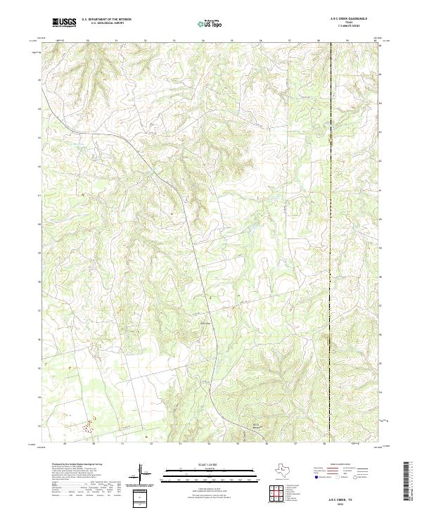
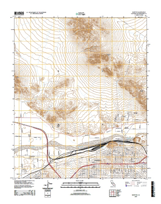
Layered geospatial PDF 7.5 Minute Quadrangle Map. Layers of geospatial data include orthoimagery, roads, grids, geographic names, elevation contours, hydrography, boundaries, and other selected map features. This map depicts geographic features on the surface of the earth. One intended purpose is to support emergency response at all levels of government. The geospatial data in this map are from selected National Map data holdings and other government sources.
Categories: Collection;
Types: Map Service,
OGC WFS Layer,
OGC WMS Layer,
OGC WMS Service;
Tags: Public Land Survey System,
U.S. National Grid,
US,
USGS:6d94af68-1f05-4f9e-9b5a-63f7a05d258b,
United States,
Ecological assessment data from the USGS National Water-Quality Assessment Program and the USEPA National River and Stream Assessment were reviewed and records were retained from sampling sites co-located with active USGS stream gages. A limited amount of ancillary data, including location, physical watershed features, and basic water chemistry data for each site were also retained.
Categories: Data;
Types: Citation,
Map Service,
OGC WFS Layer,
OGC WMS Layer,
OGC WMS Service;
Tags: Aquatic Biology,
Ecology,
National Water Quality Program,
USGS Science Data Catalog (SDC),
United States,
The U.S. Geological Survey (USGS) computed rasters of pre-solved values for the watersheds draining to the pixel delineation point representing the watershed's mean maximum and minimum January temperature from PRISM 1981-2010 4km data (resampled to 30m resolution). These values, which cover the conterminous United States, will be served in the National StreamStats Fire-Hydrology application to describe delineated watersheds (https://streamstats.usgs.gov/). The StreamStats application provides access to spatial analysis tools that are useful for water-resources planning and management, and for engineering and design purposes. The map-based user interface can be used to delineate drainage areas, to retrieve basin...
Categories: Data;
Types: Downloadable,
GeoTIFF,
Map Service,
OGC WFS Layer,
OGC WMS Layer,
OGC WMS Service,
Raster;
Tags: Hydrology,
USGS Science Data Catalog (SDC),
United States,
Water Quality,
Water Resources,
The U.S. Geological Survey (USGS) computed rasters of pre-solved values for the watersheds draining to the pixel delineation point representing the watershed's percent forested land cover from the National Land Cover Dataset (NLCD) 2016 data (land cover values 41-43). These values, which cover the conterminous United States at a scale of 30m pixel size, will be served in the National StreamStats Fire-Hydrology application to describe delineated watersheds ( https://streamstats.usgs.gov/ ). The StreamStats application provides access to spatial analysis tools that are useful for water-resources planning and management, and for engineering and design purposes. The map-based user interface can be used to delineate...
Categories: Data;
Types: Downloadable,
GeoTIFF,
Map Service,
OGC WFS Layer,
OGC WMS Layer,
OGC WMS Service,
Raster;
Tags: Forestry,
Geography,
Hydrology,
USGS Science Data Catalog (SDC),
United States,
This dataset is a polygon coverage of counties limited to the extent of the Fire Clay coal zone resource areas and attributed with original resources (millions of short tons) in aggregated reporting categories as described in USGS Circular 891. The file has been generalized from detailed geologic coverages found elsewhere in Professional Paper 1625-C. This resource model for the Fire Clay coal zone must be considered provisional, because the correlation of the zone continues to be evaluated in West Virginia.
Categories: Data,
pre-SM502.8;
Types: Downloadable,
Map Service,
OGC WFS Layer,
OGC WMS Layer,
Shapefile;
Tags: Appalachians,
BELL County,
BOONE County,
BREATHITT County,
CLAY County,
This dataset is a polygon coverage of counties limited to the extent of the Fire Clay coal zone resource areas and attributed with remaining resources (millions of short tons) in aggregated reporting categories as described in USGS Circular 891. The file has been generalized from detailed geologic coverages found elsewhere in Professional Paper 1625-C. This resource model for the Fire Clay coal zone must be considered provisional, because the correlation of the zone continues to be evaluated in West Virginia.
Categories: Data,
pre-SM502.8;
Types: Downloadable,
Map Service,
OGC WFS Layer,
OGC WMS Layer,
Shapefile;
Tags: Appalachians,
BELL County,
BOONE County,
BREATHITT County,
CLAY County,
The U.S. Geological Survey collected groundwater samples from 71 domestic wells and 4 springs in Nevada, Yuba, Sierra, and Placer Counties, California in 2015-2016. The sites were sampled for the Yuba and Bear Watersheds Shallow Aquifer Study Unit of the California State Water Resources Control Board Groundwater Ambient Monitoring and Assessment (GAMA) Program Priority Basin Project’s assessment of the quality of groundwater resources used for domestic drinking water supply. Domestic wells commonly are screened at shallower depths than are public-supply wells. The Yuba and Bear Watersheds Shallow Aquifer Study Unit includes the hard rock systems of the eastern Sierra Nevada in the Upper Yuba and Upper Bear watersheds....
Types: Citation,
Map Service,
OGC WFS Layer,
OGC WMS Layer,
OGC WMS Service;
Tags: California,
Environment,
GAMA,
Geochemistry,
Groundwater,

This is a tiled collection of the 3D Elevation Program (3DEP) and is 1 arc-second (approximately 30 m) resolution. The elevations in this Digital Elevation Model (DEM) represent the topographic bare-earth surface. The 3DEP data holdings serve as the elevation layer of The National Map, and provide foundational elevation information for earth science studies and mapping applications in the United States. Scientists and resource managers use 3DEP data for hydrologic modeling, resource monitoring, mapping and visualization, and many other applications.. The seamless 1 arc-second DEM layers are derived from diverse source data that are processed to a common coordinate system and unit of vertical measure. These data...
Types: Citation,
Map Service,
OGC WFS Layer,
OGC WMS Layer,
OGC WMS Service;
Tags: 1-Degree DEM,
3D Elevation Program,
3DEP,
Bare Earth,
Cartography,

This is a tiled collection of the 3D Elevation Program (3DEP) and is 2 arc-second (approximately 60 m) resolution covering Alaska. The elevations in this Digital Elevation Model (DEM) represent the topographic bare-earth surface. The 3DEP data holdings serve as the elevation layer of The National Map, and provide foundational elevation information for earth science studies and mapping applications in the United States. Scientists and resource managers use 3DEP data for hydrologic modeling, resource monitoring, mapping and visualization, and many other applications. The seamless 2 arc-second DEM layers are derived from diverse source data that are processed to a common coordinate system and unit of vertical measure....
Types: Citation,
Map Service,
OGC WFS Layer,
OGC WMS Layer,
OGC WMS Service;
Tags: 1-degree DEM,
2 arc-second DEM,
3DEP,
Bare Earth,
Cartography,
This dataset is a point coverage of attributes on data location, thickness of the Pond Creek coal bed main bench, and its elevation, in feet. The file is also found as an ASCII Appendix of Chapter G, Disc 1 found elsewhere in Professional Paper 1625-C.
Categories: Data,
pre-SM502.8;
Types: Downloadable,
Map Service,
OGC WFS Layer,
OGC WMS Layer,
Shapefile;
Tags: Appalachians,
BELL County,
BOONE County,
BREATHITT County,
BUCHANAN County,
This data release presents chemical and biological results from an investigation of the uptake of per- and polyfluoroalkyl substances (PFAS) from groundwater contaminated by fire training activities on Cape Cod, Massachusetts conducted from July to August 2019. An exposure experiment was conducted at an a PFAS contaminated site (FTA-1) near the fire training area (FTA). To assess the tissue-specific uptake characteristics of the mixture of PFAS present in the groundwater from the FTA-1 site, a 21-day mobile laboratory exposure experiment was conducted. Details for the groundwater sampling sites and well construction are presented (Table 1). The PFAS mixture concentrations and composition in groundwater and in fish...
Categories: Data;
Types: Map Service,
OGC WFS Layer,
OGC WMS Layer,
OGC WMS Service;
Tags: Biotic concentration,
Cape Cod,
Environmental Health,
Fathead minnows,
Fire training area,

The USGS Transportation service from The National Map (TNM) is based on TIGER/Line data provided through U.S. Census Bureau and supplemented with HERE road data to create tile cache base maps. Some of the TIGER/Line data includes limited corrections done by USGS. Transportation data consists of roads, railroads, trails, airports, and other features associated with the transport of people or commerce. The data include the name or route designator, classification, and location. Transportation data support general mapping and geographic information system technology analysis for applications such as traffic safety, congestion mitigation, disaster planning, and emergency response. The National Map transportation data...
Categories: Data;
Types: ArcGIS REST Map Service,
Map Service;
Tags: 4WD,
NGP-TNM,
Overlay Map Service,
REST,
Transportation,
This dataset is a polygon coverage of counties limited to the extent of the Pocahontas No. 3 coal bed resource areas and attributed with statistics on the thickness of the Pocahontas No. 3 coal bed, its elevation, and overburden thickness, in feet. The file has been generalized from detailed geologic coverages found elsewhere in Professional Paper 1625-C.
Categories: Data,
pre-SM502.8;
Types: Downloadable,
Map Service,
OGC WFS Layer,
OGC WMS Layer,
Shapefile;
Tags: Appalachians,
BUCHANAN County,
DICKENSON County,
Eastern Energy Team,
FAYETTE County,
Northeast SJV (NESJV), Southeast SJV (SESJV), Western SJV (WSJV), and Southern SJV (SSJV). These regions were primarily defined from the California Department of Water Resources SJV groundwater subbasins (CDWR, 2003); minor modifications were made to the CDWR defined subbasin boundaries to optimize separation of groundwater derived from the Sierra Nevada to the east and from the Coast Ranges to the west under predevelopment conditions. Each region was divided into equal-area grid cells, ranging from 280 km2 in the SESJV to 984 km2 in the SSJV, for a total of 88 cells. These cell sizes were the minimum sizes in each region for which 60% of the cells in the region would contain at least 1 well with full major ion...
Types: Citation,
Map Service,
OGC WFS Layer,
OGC WMS Layer,
OGC WMS Service;
Tags: Agriculture,
California,
Central Valley, California,
Environment,
GAMA,

Layers of geospatial data include contours, boundaries, land cover, hydrography, roads, transportation, geographic names, structures, and other selected map features.
The U.S. Geological Survey (USGS) computed rasters of pre-solved values for the watersheds draining to the pixel delineation point representing the watershed's mean maximum 30-minute precipitation occurring on average once in 2 years from NOAA Atlas 14. These values will be served in the National StreamStats Fire-Hydrology application to describe delineated watersheds ( https://streamstats.usgs.gov/ ). The StreamStats application provides access to spatial analysis tools that are useful for water-resources planning and management, and for engineering and design purposes. The map-based user interface can be used to delineate drainage areas, to retrieve basin characteristics, to estimate flow statistics, and more.
Categories: Data;
Types: Downloadable,
GeoTIFF,
Map Service,
OGC WFS Layer,
OGC WMS Layer,
OGC WMS Service,
Raster;
Tags: Alabama,
Arizona,
Arkansas,
California,
Climatology,
|

|