Filters
Date Types (for Date Range)
Extensions
Types
Contacts
Categories
Tag Types
Tag Schemes
|
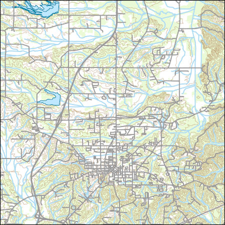
Layers of geospatial data include contours, boundaries, land cover, hydrography, roads, transportation, geographic names, structures, and other selected map features.
Types: Citation;
Tags: 7.5 x 7.5 minute,
7_5_Min,
Combined Vector,
Combined Vector,
Combined Vector, All tags...
Downloadable Data,
Esri Shapefile nan,
MS,
Mississippi,
Prentiss,
Public Land Survey System,
Shapefile,
Topo Map Vector Data,
US,
United States,
boundary,
contours,
geographic names,
hydrography,
structures,
transportation,
woodland, Fewer tags

The Watershed Boundary Dataset (WBD) is a comprehensive aggregated collection of hydrologic unit data consistent with the national criteria for delineation and resolution. It defines the areal extent of surface water drainage to a point except in coastal or lake front areas where there could be multiple outlets as stated by the "Federal Standards and Procedures for the National Watershed Boundary Dataset (WBD)" "Standard" (https://pubs.usgs.gov/tm/11/a3/). Watershed boundaries are determined solely upon science-based hydrologic principles, not favoring any administrative boundaries or special projects, nor particular program or agency. This dataset represents the hydrologic unit boundaries to the 12-digit (6th level)...
Tags: 10-digit,
12-digit,
14-digit,
16-digit,
2-digit, All tags...
4-digit,
6-digit,
8-digit,
AL,
Abbeville,
Aiken,
Alabama,
Alachua,
Alamance,
Alexander,
Alleghany,
Allendale,
Anderson,
Anson,
Appling,
Appomattox,
Ashe,
Atkinson,
Attala,
Autauga,
Avery,
Bacon,
Baker,
Baldwin,
Bamberg,
Banks,
Barbour,
Barnwell,
Barrow,
Bartow,
Basin,
Bay,
Beaufort,
Bedford,
Ben Hill,
Berkeley,
Berrien,
Bertie,
Bibb,
Bladen,
Bleckley,
Blount,
Botetourt,
Bradford,
Bradley,
Brantley,
Brevard,
Brooks,
Broward,
Brunswick,
Bryan,
Bulloch,
Bullock,
Buncombe,
Burke,
Butler,
Butts,
Cabarrus,
Caldwell,
Calhoun,
Camden,
Campbell,
Candler,
Carroll,
Carteret,
Caswell,
Catawba,
Chambers,
Charleston,
Charlotte,
Charlton,
Chatham,
Chattahoochee,
Chattooga,
Cherokee,
Chesapeake,
Chester,
Chesterfield,
Chickasaw,
Chilton,
Choctaw,
Chowan,
Citrus,
Clarendon,
Clarke,
Clay,
Clayton,
Cleburne,
Cleveland,
Clinch,
Cobb,
Coffee,
Colleton,
Collier,
Colquitt,
Columbia,
Columbus,
Conecuh,
Cook,
Coosa,
Copiah,
Covington,
Coweta,
Craig,
Craven,
Crawford,
Crenshaw,
Crisp,
Cullman,
Cumberland,
Currituck,
Dade,
Dale,
Dallas,
Danville,
Dare,
Darlington,
Davidson,
Davie,
Dawson,
DeKalb,
DeSoto,
Decatur,
Dillon,
Dinwiddie,
Dixie,
Dodge,
Dooly,
Dorchester,
Dougherty,
Douglas,
Downloadable Data,
Duplin,
Durham,
Duval,
Early,
Echols,
Edgecombe,
Edgefield,
Effingham,
Elbert,
Elmore,
Emanuel,
Emporia,
Escambia,
Esri File GeoDatabase 10,
Etowah,
Evans,
FL,
Fairfield,
Fannin,
Fayette,
FileGDB,
Flagler,
Florence,
Florida,
Floyd,
Forrest,
Forsyth,
Franklin,
Fulton,
GA,
Gadsden,
Gaston,
Gates,
Geneva,
George,
Georgetown,
Georgia,
Gilchrist,
Gilmer,
Glades,
Glascock,
Glynn,
Gordon,
Grady,
Granville,
Grayson,
Greene,
Greensville,
Greenville,
Greenwood,
Guilford,
Gulf,
Gwinnett,
HU-2,
HU-2 Region,
HU2_03,
HUC,
Habersham,
Hale,
Halifax,
Hall,
Hamilton,
Hampton,
Hancock,
Haralson,
Hardee,
Harnett,
Harris,
Harrison,
Hart,
Heard,
Henderson,
Hendry,
Henry,
Hernando,
Hertford,
Highlands,
Hillsborough,
Hinds,
Hoke,
Holmes,
Horry,
Houston,
Hyde,
Hydrography,
Hydrologic Unit Code,
Hydrologic Units,
Indian River,
Iredell,
Irwin,
Isle of Wight,
Itawamba,
Jackson,
Jasper,
Jeff Davis,
Jefferson,
Jefferson Davis,
Jenkins,
Johnson,
Johnston,
Jones,
Kemper,
Kershaw,
LA,
Lafayette,
Lake,
Lamar,
Lancaster,
Lanier,
Lauderdale,
Laurens,
Lawrence,
Leake,
Lee,
Lenoir,
Leon,
Levy,
Lexington,
Liberty,
Lincoln,
Long,
Louisiana,
Lowndes,
Lumpkin,
Lunenburg,
MS,
Macon,
Madison,
Manatee,
Marengo,
Marion,
Marlboro,
Marshall,
Martin,
Martinsville,
McCormick,
McDowell,
McDuffie,
McIntosh,
Mecklenburg,
Meriwether,
Miami-Dade,
Miller,
Mississippi,
Mitchell,
Mobile,
Monroe,
Montgomery,
Moore,
Morgan,
Murray,
Muscogee,
NC,
Nash,
Nassau,
National Watershed Boundary Dataset (WBD),
National Watershed Boundary Dataset (WBD),
Neshoba,
New Hanover,
Newberry,
Newton,
North Carolina,
Northampton,
Nottoway,
Noxubee,
Oconee,
Oglethorpe,
Okaloosa,
Okeechobee,
Oktibbeha,
Onslow,
Orange,
Orangeburg,
Osceola,
Palm Beach,
Pamlico,
Pasco,
Pasquotank,
Patrick,
Paulding,
Peach,
Pearl River,
Pender,
Perquimans,
Perry,
Person,
Petersburg,
Pickens,
Pierce,
Pike,
Pinellas,
Pitt,
Pittsylvania,
Polk,
Pontotoc,
Prentiss,
Prince Edward,
Prince George,
Pulaski,
Putnam,
Quitman,
Rabun,
Randolph,
Rankin,
Region,
Richland,
Richmond,
Roanoke,
Robeson,
Rockdale,
Rockingham,
Rowan,
Russell,
Rutherford,
SC,
Salem,
Saluda,
Sampson,
Santa Rosa,
Sarasota,
Schley,
Scotland,
Scott,
Screven,
Seminole,
Shelby,
Simpson,
Smith,
South Carolina,
Southampton,
Spalding,
Spartanburg,
St. Bernard,
St. Clair,
St. Johns,
St. Lucie,
St. Tammany,
Stanly,
Stephens,
Stewart,
Stokes,
Stone,
Sub-basin,
Sub-region,
Subwatershed,
Suffolk,
Sumter,
Surry,
Sussex,
Suwannee,
TN,
Talbot,
Taliaferro,
Talladega,
Tallapoosa,
Tangipahoa,
Tattnall,
Taylor,
Telfair,
Tennessee,
Terrell,
Thomas,
Tift,
Tippah,
Tishomingo,
Toombs,
Towns,
Transylvania,
Treutlen,
Troup,
Turner,
Tuscaloosa,
Twiggs,
Tyrrell,
US,
Union,
United States,
Upson,
VA,
Vance,
Virginia,
Virginia Beach,
Volusia,
WBD,
Wake,
Wakulla,
Walker,
Walthall,
Walton,
Ware,
Warren,
Washington,
Watauga,
Watershed,
Watershed Boundary Dataset,
Wayne,
Webster,
Wheeler,
White,
Whitfield,
Wilcox,
Wilkes,
Wilkinson,
Williamsburg,
Wilson,
Winston,
Worth,
Yadkin,
Yancey,
York,
inlandWaters, Fewer tags

Forest Retention Index classes for the southeastern United States at 2040 were processed using the Forest Retention Decision Tree and rendered on a 30-meter by 30-meter grid. The Forest Retention Index is used only for current forestland, identified using National Land Cover Database 2011. Many datasets were used as inputs for the Forest Retention Decision Tree, and they can be grouped into five broad categories: Protected, Tier 1 Priority, Tier 2 Priority, Threats to Forest Retention, and Socio-Economic Value of Forests. Protected datasets include Protected Areas Database-United States, National Conservation Easement Database, state-maintained databases, and private datasets volunteered by conservation partners....
Categories: Data;
Types: ArcGIS REST Map Service,
ArcGIS Service Definition,
Downloadable,
Map Service;
Tags: Alabama,
Arkansas,
Florida,
Georgia,
Illinois, All tags...
Kentucky,
Louisiana,
Mississippi,
Missouri,
North Carolina,
Oklahoma,
South Carolina,
Southeast,
Tennessee,
Texas,
Virginia,
conservation,
forest,
landscape conservation,
landscape planning, Fewer tags
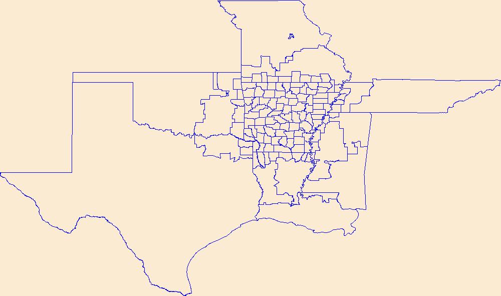
Geospatial data is comprised of government boundaries.
Tags: AR,
Arkansas,
Arkansas,
Ashley,
Baxter, All tags...
Benton,
Boone,
Boundaries,
Bradley,
Calhoun,
Carroll,
Chicot,
Clark,
Clay,
Cleburne,
Cleveland,
Columbia,
Conway,
County or Equivalent,
Craighead,
Crawford,
Crittenden,
Cross,
Dallas,
Desha,
Downloadable Data,
Drew,
Faulkner,
Franklin,
Fulton,
Garland,
GeoPackage,
Grant,
Greene,
Hempstead,
Hot Spring,
Howard,
Incorporated Place,
Independence,
Izard,
Jackson,
Jefferson,
Johnson,
Jurisdictional,
Lafayette,
Lawrence,
Lee,
Lincoln,
Little River,
Logan,
Lonoke,
Madison,
Marion,
Miller,
Minor Civil Division,
Mississippi,
Monroe,
Montgomery,
National Boundary Dataset (NBD),
National Boundary Dataset (NBD),
Native American Area,
Nevada,
Newton,
Open Geospatial Consortium GeoPackage 1.2,
Ouachita,
PLSS First Division,
PLSS Special Survey,
PLSS Township,
Perry,
Phillips,
Pike,
Poinsett,
Polk,
Pope,
Prairie,
Public Land Survey System,
Pulaski,
Randolph,
Reserve,
Saline,
Scott,
Searcy,
Sebastian,
Sevier,
Sharp,
St. Francis,
State,
State,
State or Territory,
Stone,
U.S. National Grid,
US,
Unincorporated Place,
Union,
United States,
Van Buren,
Washington,
White,
Woodruff,
Yell,
boundaries,
boundary,
cadastral surveys,
geographic names,
land ownership,
land use maps,
legal land descriptions,
political and administrative boundaries,
zoning maps, Fewer tags
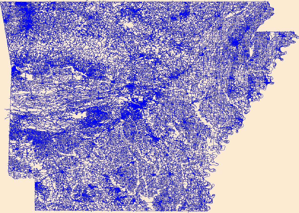
Layers of geospatial data include roads, airports, trails, and railroads.
Tags: AR,
Airport Complex,
Airport Point,
Airport Runway,
Airports, All tags...
Airstrips,
Arkansas,
Arkansas,
Ashley,
Baxter,
Benton,
Boone,
Bradley,
Calhoun,
Carroll,
Chicot,
Clark,
Clay,
Cleburne,
Cleveland,
Columbia,
Conway,
Craighead,
Crawford,
Crittenden,
Cross,
Dallas,
Desha,
Downloadable Data,
Drew,
Faulkner,
Franklin,
Fulton,
Garland,
GeoPackage,
Geographic names,
Grant,
Greene,
Hempstead,
Hot Spring,
Howard,
Independence,
Izard,
Jackson,
Jefferson,
Johnson,
Lafayette,
Lawrence,
Lee,
Lincoln,
Little River,
Logan,
Lonoke,
Madison,
Marion,
Miller,
Mississippi,
Monroe,
Montgomery,
National Transportation Dataset (NTD),
National Transportation Dataset (NTD),
Nevada,
Newton,
Open Geospatial Consortium GeoPackage 1.2,
Ouachita,
Perry,
Phillips,
Pike,
Poinsett,
Polk,
Pope,
Prairie,
Pulaski,
Railways,
Randolph,
Roads,
Saline,
Scott,
Searcy,
Sebastian,
Sevier,
Sharp,
St. Francis,
State,
State,
Stone,
Trail,
Trails,
Transportation,
Transportation,
US,
Union,
United States,
Van Buren,
Washington,
Waterway,
White,
Woodruff,
Yell,
transportation, Fewer tags

The Geographic Names Information System (GNIS) is the Federal standard for geographic nomenclature. The U.S. Geological Survey developed the GNIS for the U.S. Board on Geographic Names, a Federal inter-agency body chartered by public law to maintain uniform feature name usage throughout the Government and to promulgate standard names to the public. The GNIS is the official repository of domestic geographic names data; the official vehicle for geographic names use by all departments of the Federal Government; and the source for applying geographic names to Federal electronic and printed products of all types.
Tags: AK,
AL,
AR,
AS,
AZ, All tags...
Alabama,
Alaska,
American Samoa,
Antarctica,
Antarctica,
Arizona,
Arkansas,
BGN,
Board on Geographic Names,
Borough,
CA,
CO,
CT,
California,
Census Area,
Colorado,
Commonwealth,
Connecticut,
County,
DC,
DE,
Delaware,
District,
District of Columbia,
Downloadable Data,
Esri File GeoDatabase 10,
FL,
Feature class,
Feature coordinates,
Feature county,
Feature description,
Feature designation,
Feature history,
Feature indentification,
Feature name,
Feature state,
FileGDB,
Florida,
GA,
GNIS,
GU,
Geographic Names,
Geographic Names Full Model,
Geographic Names Information System,
Geographic feature,
Geographic name,
Geographical feature,
Geographical name,
Georgia,
Guam,
HI,
Hawaii,
IA,
ID,
IL,
IN,
Idaho,
Illinois,
Indiana,
Iowa,
KS,
KY,
Kansas,
Kentucky,
LA,
Louisiana,
MA,
MD,
ME,
MI,
MN,
MO,
MP,
MS,
MT,
Maine,
Maryland,
Massachusetts,
Michigan,
Minnesota,
Mississippi,
Missouri,
Montana,
Municipio,
NC,
ND,
NE,
NH,
NJ,
NM,
NV,
NY,
National,
National,
National Geographic Names Information System (GNIS),
National Geographic Names Information System (GNIS),
Nebraska,
Nevada,
New Hampshire,
New Jersey,
New Mexico,
New York,
North Carolina,
North Dakota,
Northern Mariana Islands,
OH,
OK,
OR,
Official feature name,
Ohio,
Oklahoma,
Oregon,
Outlying Area,
PA,
PR,
Parish,
Pennsylvania,
Place name,
Populated Place,
Puerto Rico,
RI,
Rhode Island,
SC,
SD,
South Carolina,
South Dakota,
TN,
TX,
Tennessee,
Territories,
Territory,
Texas,
Topographic Map,
U.S. Board on Geographic Names,
U.S. Geological Survey,
US,
USA,
USBGN,
USGS,
UT,
United States,
United States,
United States,
Utah,
VA,
VI,
VT,
Variant name,
Vermont,
Virgin Islands,
Virginia,
WA,
WI,
WV,
WY,
Washington,
West Virginia,
Wisconsin,
Wyoming,
antarctic,
database,
economy,
environment,
feature,
gazetteer,
geographic,
geographic names,
geographical,
geography,
geospatial,
imageryBaseMapsEarthCover,
inlandWaters,
location,
map,
name,
place,
placename,
society,
structure,
topographic map,
toponymy, Fewer tags

The Geographic Names Information System (GNIS) is the Federal standard for geographic nomenclature. The U.S. Geological Survey developed the GNIS for the U.S. Board on Geographic Names, a Federal inter-agency body chartered by public law to maintain uniform feature name usage throughout the Government and to promulgate standard names to the public. The GNIS is the official repository of domestic geographic names data; the official vehicle for geographic names use by all departments of the Federal Government; and the source for applying geographic names to Federal electronic and printed products of all types.
Tags: AR,
Antarctica,
Antarctica,
Arkansas,
Arkansas, All tags...
Ashley,
BGN,
Baxter,
Benton,
Board on Geographic Names,
Boone,
Borough,
Bradley,
Calhoun,
Carroll,
Census Area,
Chicot,
Clark,
Clay,
Cleburne,
Cleveland,
Columbia,
Commonwealth,
Conway,
County,
Craighead,
Crawford,
Crittenden,
Cross,
Dallas,
Desha,
District,
Downloadable Data,
Drew,
Faulkner,
Feature class,
Feature coordinates,
Feature county,
Feature description,
Feature designation,
Feature history,
Feature indentification,
Feature name,
Feature state,
Franklin,
Fulton,
GNIS,
Garland,
Geographic Names,
Geographic Names Federal Codes,
Geographic Names Information System,
Geographic feature,
Geographic name,
Geographical feature,
Geographical name,
Grant,
Greene,
Hempstead,
Hot Spring,
Howard,
Independence,
Izard,
Jackson,
Jefferson,
Johnson,
Lafayette,
Lawrence,
Lee,
Lincoln,
Little River,
Logan,
Lonoke,
Madison,
Marion,
Miller,
Mississippi,
Monroe,
Montgomery,
Municipio,
National Geographic Names Information System (GNIS),
National Geographic Names Information System (GNIS),
Nevada,
Newton,
Official feature name,
Ouachita,
Outlying Area,
Parish,
Perry,
Phillips,
Pike,
Place name,
Poinsett,
Polk,
Pope,
Populated Place,
Prairie,
Pulaski,
Randolph,
Saline,
Scott,
Searcy,
Sebastian,
Sevier,
Sharp,
St. Francis,
State,
Stone,
TXT (pipes),
Territories,
Territory,
Topographic Map,
U.S. Board on Geographic Names,
U.S. Geological Survey,
US,
USA,
USBGN,
USGS,
UTF-8 Pipe Delimited Text File nan,
Union,
United States,
United States,
United States,
Van Buren,
Variant name,
Washington,
White,
Woodruff,
Yell,
antarctic,
database,
economy,
environment,
feature,
gazetteer,
geographic,
geographic names,
geographical,
geography,
geospatial,
imageryBaseMapsEarthCover,
inlandWaters,
location,
map,
name,
place,
placename,
society,
structure,
topographic map,
toponymy, Fewer tags
The Geographic Names Information System (GNIS) is the Federal standard for geographic nomenclature. The U.S. Geological Survey developed the GNIS for the U.S. Board on Geographic Names, a Federal inter-agency body chartered by public law to maintain uniform feature name usage throughout the Government and to promulgate standard names to the public. The GNIS is the official repository of domestic geographic names data; the official vehicle for geographic names use by all departments of the Federal Government; and the source for applying geographic names to Federal electronic and printed products of all types.
Tags: AR,
Antarctica,
Antarctica,
Arkansas,
Arkansas, All tags...
Ashley,
BGN,
Baxter,
Benton,
Board on Geographic Names,
Boone,
Borough,
Bradley,
Calhoun,
Carroll,
Census Area,
Chicot,
Clark,
Clay,
Cleburne,
Cleveland,
Columbia,
Commonwealth,
Conway,
County,
Craighead,
Crawford,
Crittenden,
Cross,
Dallas,
Desha,
District,
Downloadable Data,
Drew,
Faulkner,
Feature class,
Feature coordinates,
Feature county,
Feature description,
Feature designation,
Feature history,
Feature indentification,
Feature name,
Feature state,
Franklin,
Fulton,
GNIS,
Garland,
Geographic Names,
Geographic Names Domestic Names,
Geographic Names Information System,
Geographic feature,
Geographic name,
Geographical feature,
Geographical name,
Grant,
Greene,
Hempstead,
Hot Spring,
Howard,
Independence,
Izard,
Jackson,
Jefferson,
Johnson,
Lafayette,
Lawrence,
Lee,
Lincoln,
Little River,
Logan,
Lonoke,
Madison,
Marion,
Miller,
Mississippi,
Monroe,
Montgomery,
Municipio,
National Geographic Names Information System (GNIS),
National Geographic Names Information System (GNIS),
Nevada,
Newton,
Official feature name,
Ouachita,
Outlying Area,
Parish,
Perry,
Phillips,
Pike,
Place name,
Poinsett,
Polk,
Pope,
Populated Place,
Prairie,
Pulaski,
Randolph,
Saline,
Scott,
Searcy,
Sebastian,
Sevier,
Sharp,
St. Francis,
State,
Stone,
TXT (pipes),
Territories,
Territory,
Topographic Map,
U.S. Board on Geographic Names,
U.S. Geological Survey,
US,
USA,
USBGN,
USGS,
UTF-8 Pipe Delimited Text File nan,
Union,
United States,
United States,
United States,
Van Buren,
Variant name,
Washington,
White,
Woodruff,
Yell,
antarctic,
database,
economy,
environment,
feature,
gazetteer,
geographic,
geographic names,
geographical,
geography,
geospatial,
imageryBaseMapsEarthCover,
inlandWaters,
location,
map,
name,
place,
placename,
society,
structure,
topographic map,
toponymy, Fewer tags

These data were released prior to the October 1, 2016 effective date for the USGS’s policy dictating the review, approval, and release of scientific data as referenced in USGS Survey Manual Chapter 502.8 Fundamental Science Practices: Review and Approval of Scientific Data for Release. This data set represents the extent of the Southeastern Coastal Plain aquifer system in Kentucky, Tennessee, Mississippi, Alabama, Georgia, and South Carolina.
Tags: Alabama,
Georgia,
Kentucky,
Mississippi,
NSDI, All tags...
Northern Florida,
South Carolina,
Tennessee,
USGS Science Data Catalog (SDC),
United States,
aquifer,
aquifer extent,
environment,
geoscientificInformation,
groundwater,
inlandWaters, Fewer tags

The Geographic Names Information System (GNIS) is the Federal standard for geographic nomenclature. The U.S. Geological Survey developed the GNIS for the U.S. Board on Geographic Names, a Federal inter-agency body chartered by public law to maintain uniform feature name usage throughout the Government and to promulgate standard names to the public. The GNIS is the official repository of domestic geographic names data; the official vehicle for geographic names use by all departments of the Federal Government; and the source for applying geographic names to Federal electronic and printed products of all types.
Tags: Adair,
Andrew,
Antarctica,
Antarctica,
Atchison, All tags...
Audrain,
BGN,
Barry,
Barton,
Bates,
Benton,
Board on Geographic Names,
Bollinger,
Boone,
Borough,
Buchanan,
Butler,
Caldwell,
Callaway,
Camden,
Cape Girardeau,
Carroll,
Carter,
Cass,
Cedar,
Census Area,
Chariton,
Christian,
Clark,
Clay,
Clinton,
Cole,
Commonwealth,
Cooper,
County,
Crawford,
Dade,
Dallas,
Daviess,
DeKalb,
Dent,
District,
Douglas,
Downloadable Data,
Dunklin,
Esri File GeoDatabase 10,
Feature class,
Feature coordinates,
Feature county,
Feature description,
Feature designation,
Feature history,
Feature indentification,
Feature name,
Feature state,
FileGDB,
Franklin,
GNIS,
Gasconade,
Gentry,
Geographic Names,
Geographic Names Full Model,
Geographic Names Information System,
Geographic feature,
Geographic name,
Geographical feature,
Geographical name,
Greene,
Grundy,
Harrison,
Henry,
Hickory,
Holt,
Howard,
Howell,
Iron,
Jackson,
Jasper,
Jefferson,
Johnson,
Knox,
Laclede,
Lafayette,
Lawrence,
Lewis,
Lincoln,
Linn,
Livingston,
MO,
Macon,
Madison,
Maries,
Marion,
McDonald,
Mercer,
Miller,
Mississippi,
Missouri,
Moniteau,
Monroe,
Montgomery,
Morgan,
Municipio,
National Geographic Names Information System (GNIS),
National Geographic Names Information System (GNIS),
New Madrid,
Newton,
Nodaway,
Official feature name,
Oregon,
Osage,
Outlying Area,
Ozark,
Parish,
Pemiscot,
Perry,
Pettis,
Phelps,
Pike,
Place name,
Platte,
Polk,
Populated Place,
Pulaski,
Putnam,
Ralls,
Randolph,
Ray,
Reynolds,
Ripley,
Saline,
Schuyler,
Scotland,
Scott,
Shannon,
Shelby,
St. Charles,
St. Clair,
St. Francois,
St. Louis,
State,
Ste. Genevieve,
Stoddard,
Stone,
Sullivan,
Taney,
Territories,
Territory,
Texas,
Topographic Map,
U.S. Board on Geographic Names,
U.S. Geological Survey,
US,
USA,
USBGN,
USGS,
United States,
United States,
United States,
Variant name,
Vernon,
Warren,
Washington,
Wayne,
Webster,
Worth,
Wright,
antarctic,
database,
economy,
environment,
feature,
gazetteer,
geographic,
geographic names,
geographical,
geography,
geospatial,
imageryBaseMapsEarthCover,
inlandWaters,
location,
map,
name,
place,
placename,
society,
structure,
topographic map,
toponymy, Fewer tags
The National Hydrography Dataset (NHD) is a feature-based database that interconnects and uniquely identifies the stream segments or reaches that make up the nation's surface water drainage system. NHD data was originally developed at 1:100,000-scale and exists at that scale for the whole country. This high-resolution NHD, generally developed at 1:24,000/1:12,000 scale, adds detail to the original 1:100,000-scale NHD. (Data for Alaska, Puerto Rico and the Virgin Islands was developed at high-resolution, not 1:100,000 scale.) Local resolution NHD is being developed where partners and data exist. The NHD contains reach codes for networked features, flow direction, names, and centerline representations for areal water...
Tags: AL,
Administrative watershed units,
Administrative watershed units,
Alabama,
Area of Complex Channels, All tags...
Area to be submerged,
Baldwin,
Basin,
Basin,
Bay/Inlet,
Boundaries,
Boundary,
Bridge,
Canal/Ditch,
Choctaw,
Clarke,
Coastline,
Connector,
Covington,
Dam/Weir,
Downloadable Data,
Drainage areas for surface water,
Drainageway,
Esri File GeoDatabase 10,
Estuary,
FileGDB,
Flow direction network,
Flume,
ForeShore,
Forrest,
Gaging Station,
Gate,
George,
Greene,
HU-4,
HU-4 Subregion,
HU10,
HU12,
HU14,
HU16,
HU2,
HU4,
HU4_0317,
HU6,
HU8,
HUC,
Hancock,
Harrison,
Hazard Zone,
Hydrographic,
Hydrography,
Hydrography,
Hydrography,
Hydrologic Unit Code,
Hydrologic Units,
Ice mass,
Inundation Area,
Jackson,
Jasper,
Jefferson Davis,
Jones,
Kemper,
LA,
Lamar,
Lauderdale,
Levee,
Line,
Lock Chamber,
Louisiana,
MS,
Marion,
Marsh,
Mississippi,
Mobile,
National Hydrography Dataset (NHD),
National Hydrography Dataset (NHD) Best Resolution,
National Hydrography Dataset (NHD) Best Resolution,
Neshoba,
Newton,
Nonearthen Shore,
Orthoimage,
Pearl River,
Perry,
Playa,
Point,
PointEvent,
Pond,
Rapids,
Rapids,
Reach,
Reach code,
Reef,
Region,
Reservoir,
Rock,
Scott,
Sea/Ocean,
Simpson,
Sink/Rise,
Smith,
Sounding Datum Line,
Special Use Zone,
Special Use Zone Limit,
Spillway,
St. Bernard,
St. Tammany,
Stone,
Stream,
Stream/River,
Sub-basin,
Sub-region,
Subbasin,
Submerged Stream,
Subregion,
Subwatershed,
Surface water systems,
Swamp,
Topographic,
Tunnel,
US,
Underground Conduit,
United States,
WBD,
WBD,
Wall,
Wash,
Washington,
Water Intake Outflow,
Waterfall,
Watershed,
Watershed Boundaries,
Watershed Boundary Dataset,
Watershed Boundary Dataset,
Wayne,
Well,
artificial path,
boundaries,
dams,
drainage systems and characteristics,
inlandWaters,
lakes,
ngda,
rivers, Fewer tags

Airborne electromagnetic (AEM), magnetic, and radiometric data were acquired in late February to early March 2018 along 2,364 line-kilometers in the Shellmound, Mississippi study area. Data were acquired by CGG Canada Services, Ltd. with three different helicopter-borne sensors: the CGG Canada Services, Ltd. RESOLVE frequency-domain AEM instrument that is used to map subsurface geologic structure at depths up to 100 meters, depending on the subsurface resistivity; a Scintrex CS-3 cesium vapor magnetometer that detects changes in deep (hundreds of meters to kilometers) geologic structure based on variations in the magnetic properties of different formations; and a Radiation Solutions RS-500 spectrometer that detects...
Categories: Data;
Tags: GGGSC,
Geology, Geophysics, and Geochemistry Science Center,
Greenwood,
Leflore County,
MRVA, All tags...
Mississippi,
Mississippi Alluvial Plain,
Mississippi River Valley Alluvial aquifer,
Shellmound,
Sunflower County,
Tallahatchie River,
aeromagnetic surveying,
aeroradiometric surveying,
electromagnetic surveying,
electromagnetics,
engineering sciences,
environment,
geophysics,
geoscientificInformation,
geospatial datasets,
groundwater,
hydrogeology,
magnetic anomaly maps,
magnetic field,
magnetics,
radiometrics,
resistivity,
water resources, Fewer tags

We provide genetic and distribution data for the Louisiana Pigtoe, Pleurobema riddellii, to guide decisions related to federal protection for the species under the U.S. Endangered Species Act. Our final dataset includes 125 COI sequences generated as part of our study representing P. riddellii from eight North American river basins. This includes the COI sequence we generated from a museum specimen collected from the Trinity River in the late 1900s, which is the first genetic confirmation of P. riddellii in the Trinity River basin. Also included are sequences from specimens initially identified as Fusconaia cerina (n=3) Fusconaia flava (n=1), Fusconaia sp. (n=5), Pleurobema sintoxia (n=10), and Pustulosa pustulosa...
Categories: Data;
Tags: Amite River,
Aquatic Biology,
Arkansas,
Calcasieu River,
Genetics, All tags...
Lake Pontchartrain,
Little River,
Louisiana,
Mississippi,
Neches River,
Oklahoma,
Ouachita River,
Pearl River,
Sabine River,
Saline River,
San Jacinto River,
Texas,
Trinity River,
USGS Science Data Catalog (SDC),
biota,
conservation,
endangered species,
freshwater mussels,
genetics,
range extension,
species status assessment, Fewer tags
This data represents the map extent for current and historical USGS topographic maps for the United States and Territories, including 1 X 2 Degree, 1 X 1 Degree, 30 X 60 Minute, 15 X 15 Minute, 7.5 X 7.5 Minute, and 3.75 X 3.75 Minute. The grid was generated using ESRI ArcInfo GIS software.
Tags: Adams,
Alcorn,
Amite,
Attala,
Benton, All tags...
Bolivar,
Boundaries,
Calhoun,
Carroll,
Chickasaw,
Choctaw,
Claiborne,
Clarke,
Clay,
Coahoma,
Copiah,
Covington,
DeSoto,
Downloadable Data,
Esri File GeoDatabase 10,
FileGDB,
Forrest,
Franklin,
George,
Greene,
Grenada,
Hancock,
Harrison,
Hinds,
Holmes,
Humphreys,
Issaquena,
Itawamba,
Jackson,
Jasper,
Jefferson,
Jefferson Davis,
Jones,
Kemper,
Lafayette,
Lamar,
Lauderdale,
Lawrence,
Leake,
Lee,
Leflore,
Lincoln,
Lowndes,
MS,
Madison,
Map Indices,
Map Indices,
Map Indices,
Marion,
Marshall,
Mississippi,
Monroe,
Montgomery,
Neshoba,
Newton,
Noxubee,
Oktibbeha,
Panola,
Pearl River,
Perry,
Pike,
Pontotoc,
Prentiss,
Quitman,
Rankin,
Scott,
Sharkey,
Simpson,
Smith,
State,
State,
Stone,
Sunflower,
Tallahatchie,
Tate,
Tippah,
Tishomingo,
Tunica,
US,
Union,
United States,
United States of America,
Walthall,
Warren,
Washington,
Wayne,
Webster,
Wilkinson,
Winston,
Yalobusha,
Yazoo,
cells,
map indices,
polygon grid, Fewer tags
The National Hydrography Dataset (NHD) is a feature-based database that interconnects and uniquely identifies the stream segments or reaches that make up the nation's surface water drainage system. NHD data was originally developed at 1:100,000-scale and exists at that scale for the whole country. This high-resolution NHD, generally developed at 1:24,000/1:12,000 scale, adds detail to the original 1:100,000-scale NHD. (Data for Alaska, Puerto Rico and the Virgin Islands was developed at high-resolution, not 1:100,000 scale.) Local resolution NHD is being developed where partners and data exist. The NHD contains reach codes for networked features, flow direction, names, and centerline representations for areal water...
Tags: Administrative watershed units,
Administrative watershed units,
Area of Complex Channels,
Area to be submerged,
Basin, All tags...
Basin,
Bay/Inlet,
Boundaries,
Boundary,
Bridge,
Canal/Ditch,
Coastline,
Connector,
Dam/Weir,
Downloadable Data,
Drainage areas for surface water,
Drainageway,
East Baton Rouge,
East Feliciana,
Esri Shapefile nan,
Estuary,
Flow direction network,
Flume,
ForeShore,
Gaging Station,
Gate,
HU-8,
HU-8 Subbasin,
HU10,
HU12,
HU14,
HU16,
HU2,
HU4,
HU6,
HU8,
HU8_08070201,
HUC,
Hazard Zone,
Hydrographic,
Hydrography,
Hydrography,
Hydrography,
Hydrologic Unit Code,
Hydrologic Units,
Ice mass,
Inundation Area,
LA,
Levee,
Line,
Lock Chamber,
Louisiana,
MS,
Marsh,
Mississippi,
National Hydrography Dataset (NHD),
National Hydrography Dataset (NHD) Best Resolution,
National Hydrography Dataset (NHD) Best Resolution,
Nonearthen Shore,
Orthoimage,
Playa,
Point,
PointEvent,
Pond,
Rapids,
Rapids,
Reach,
Reach code,
Reef,
Region,
Reservoir,
Rock,
Sea/Ocean,
Shapefile,
Sink/Rise,
Sounding Datum Line,
Special Use Zone,
Special Use Zone Limit,
Spillway,
Stream,
Stream/River,
Sub-basin,
Sub-region,
Subbasin,
Submerged Stream,
Subregion,
Subwatershed,
Surface water systems,
Swamp,
Topographic,
Tunnel,
US,
Underground Conduit,
United States,
WBD,
WBD,
Wall,
Wash,
Water Intake Outflow,
Waterfall,
Watershed,
Watershed Boundaries,
Watershed Boundary Dataset,
Watershed Boundary Dataset,
Well,
West Feliciana,
Wilkinson,
artificial path,
boundaries,
dams,
drainage systems and characteristics,
inlandWaters,
lakes,
ngda,
rivers, Fewer tags
The National Hydrography Dataset (NHD) is a feature-based database that interconnects and uniquely identifies the stream segments or reaches that make up the nation's surface water drainage system. NHD data was originally developed at 1:100,000-scale and exists at that scale for the whole country. This high-resolution NHD, generally developed at 1:24,000/1:12,000 scale, adds detail to the original 1:100,000-scale NHD. (Data for Alaska, Puerto Rico and the Virgin Islands was developed at high-resolution, not 1:100,000 scale.) Local resolution NHD is being developed where partners and data exist. The NHD contains reach codes for networked features, flow direction, names, and centerline representations for areal water...
Tags: Administrative watershed units,
Administrative watershed units,
Area of Complex Channels,
Area to be submerged,
Basin, All tags...
Basin,
Bay/Inlet,
Bolivar,
Boundaries,
Boundary,
Bridge,
Canal/Ditch,
Coastline,
Connector,
Dam/Weir,
Downloadable Data,
Drainage areas for surface water,
Drainageway,
Esri Shapefile nan,
Estuary,
Flow direction network,
Flume,
ForeShore,
Gaging Station,
Gate,
HU-8,
HU-8 Subbasin,
HU10,
HU12,
HU14,
HU16,
HU2,
HU4,
HU6,
HU8,
HU8_08030209,
HUC,
Hazard Zone,
Hydrographic,
Hydrography,
Hydrography,
Hydrography,
Hydrologic Unit Code,
Hydrologic Units,
Ice mass,
Inundation Area,
Issaquena,
LA,
Levee,
Line,
Lock Chamber,
Louisiana,
MS,
Madison,
Marsh,
Mississippi,
National Hydrography Dataset (NHD),
National Hydrography Dataset (NHD) Best Resolution,
National Hydrography Dataset (NHD) Best Resolution,
Nonearthen Shore,
Orthoimage,
Playa,
Point,
PointEvent,
Pond,
Rapids,
Rapids,
Reach,
Reach code,
Reef,
Region,
Reservoir,
Rock,
Sea/Ocean,
Shapefile,
Sharkey,
Sink/Rise,
Sounding Datum Line,
Special Use Zone,
Special Use Zone Limit,
Spillway,
Stream,
Stream/River,
Sub-basin,
Sub-region,
Subbasin,
Submerged Stream,
Subregion,
Subwatershed,
Surface water systems,
Swamp,
Topographic,
Tunnel,
US,
Underground Conduit,
United States,
WBD,
WBD,
Wall,
Warren,
Wash,
Washington,
Water Intake Outflow,
Waterfall,
Watershed,
Watershed Boundaries,
Watershed Boundary Dataset,
Watershed Boundary Dataset,
Well,
artificial path,
boundaries,
dams,
drainage systems and characteristics,
inlandWaters,
lakes,
ngda,
rivers, Fewer tags
The National Hydrography Dataset (NHD) is a feature-based database that interconnects and uniquely identifies the stream segments or reaches that make up the nation's surface water drainage system. NHD data was originally developed at 1:100,000-scale and exists at that scale for the whole country. This high-resolution NHD, generally developed at 1:24,000/1:12,000 scale, adds detail to the original 1:100,000-scale NHD. (Data for Alaska, Puerto Rico and the Virgin Islands was developed at high-resolution, not 1:100,000 scale.) Local resolution NHD is being developed where partners and data exist. The NHD contains reach codes for networked features, flow direction, names, and centerline representations for areal water...
Tags: Administrative watershed units,
Administrative watershed units,
Area of Complex Channels,
Area to be submerged,
Basin, All tags...
Basin,
Bay/Inlet,
Boundaries,
Boundary,
Bridge,
Canal/Ditch,
Coastline,
Connector,
Dam/Weir,
Downloadable Data,
Drainage areas for surface water,
Drainageway,
Esri Shapefile nan,
Estuary,
Flow direction network,
Flume,
ForeShore,
Gaging Station,
Gate,
George,
Greene,
HU-8,
HU-8 Subbasin,
HU10,
HU12,
HU14,
HU16,
HU2,
HU4,
HU6,
HU8,
HU8_03170006,
HUC,
Hazard Zone,
Hydrographic,
Hydrography,
Hydrography,
Hydrography,
Hydrologic Unit Code,
Hydrologic Units,
Ice mass,
Inundation Area,
Jackson,
Levee,
Line,
Lock Chamber,
MS,
Marsh,
Mississippi,
National Hydrography Dataset (NHD),
National Hydrography Dataset (NHD) Best Resolution,
National Hydrography Dataset (NHD) Best Resolution,
Nonearthen Shore,
Orthoimage,
Perry,
Playa,
Point,
PointEvent,
Pond,
Rapids,
Rapids,
Reach,
Reach code,
Reef,
Region,
Reservoir,
Rock,
Sea/Ocean,
Shapefile,
Sink/Rise,
Sounding Datum Line,
Special Use Zone,
Special Use Zone Limit,
Spillway,
Stream,
Stream/River,
Sub-basin,
Sub-region,
Subbasin,
Submerged Stream,
Subregion,
Subwatershed,
Surface water systems,
Swamp,
Topographic,
Tunnel,
US,
Underground Conduit,
United States,
WBD,
WBD,
Wall,
Wash,
Water Intake Outflow,
Waterfall,
Watershed,
Watershed Boundaries,
Watershed Boundary Dataset,
Watershed Boundary Dataset,
Well,
artificial path,
boundaries,
dams,
drainage systems and characteristics,
inlandWaters,
lakes,
ngda,
rivers, Fewer tags
The National Hydrography Dataset (NHD) is a feature-based database that interconnects and uniquely identifies the stream segments or reaches that make up the nation's surface water drainage system. NHD data was originally developed at 1:100,000-scale and exists at that scale for the whole country. This high-resolution NHD, generally developed at 1:24,000/1:12,000 scale, adds detail to the original 1:100,000-scale NHD. (Data for Alaska, Puerto Rico and the Virgin Islands was developed at high-resolution, not 1:100,000 scale.) Local resolution NHD is being developed where partners and data exist. The NHD contains reach codes for networked features, flow direction, names, and centerline representations for areal water...
Tags: Administrative watershed units,
Administrative watershed units,
Area of Complex Channels,
Area to be submerged,
Basin, All tags...
Basin,
Bay/Inlet,
Boundaries,
Boundary,
Bridge,
Calhoun,
Canal/Ditch,
Carroll,
Chickasaw,
Coastline,
Connector,
Dam/Weir,
Downloadable Data,
Drainage areas for surface water,
Drainageway,
Esri Shapefile nan,
Estuary,
Flow direction network,
Flume,
ForeShore,
Gaging Station,
Gate,
Grenada,
HU-8,
HU-8 Subbasin,
HU10,
HU12,
HU14,
HU16,
HU2,
HU4,
HU6,
HU8,
HU8_08030205,
HUC,
Hazard Zone,
Hydrographic,
Hydrography,
Hydrography,
Hydrography,
Hydrologic Unit Code,
Hydrologic Units,
Ice mass,
Inundation Area,
Lafayette,
Leflore,
Levee,
Line,
Lock Chamber,
MS,
Marsh,
Mississippi,
Montgomery,
National Hydrography Dataset (NHD),
National Hydrography Dataset (NHD) Best Resolution,
National Hydrography Dataset (NHD) Best Resolution,
Nonearthen Shore,
Orthoimage,
Playa,
Point,
PointEvent,
Pond,
Pontotoc,
Rapids,
Rapids,
Reach,
Reach code,
Reef,
Region,
Reservoir,
Rock,
Sea/Ocean,
Shapefile,
Sink/Rise,
Sounding Datum Line,
Special Use Zone,
Special Use Zone Limit,
Spillway,
Stream,
Stream/River,
Sub-basin,
Sub-region,
Subbasin,
Submerged Stream,
Subregion,
Subwatershed,
Surface water systems,
Swamp,
Tallahatchie,
Topographic,
Tunnel,
US,
Underground Conduit,
United States,
WBD,
WBD,
Wall,
Wash,
Water Intake Outflow,
Waterfall,
Watershed,
Watershed Boundaries,
Watershed Boundary Dataset,
Watershed Boundary Dataset,
Webster,
Well,
Yalobusha,
artificial path,
boundaries,
dams,
drainage systems and characteristics,
inlandWaters,
lakes,
ngda,
rivers, Fewer tags
The National Hydrography Dataset (NHD) is a feature-based database that interconnects and uniquely identifies the stream segments or reaches that make up the nation's surface water drainage system. NHD data was originally developed at 1:100,000-scale and exists at that scale for the whole country. This high-resolution NHD, generally developed at 1:24,000/1:12,000 scale, adds detail to the original 1:100,000-scale NHD. (Data for Alaska, Puerto Rico and the Virgin Islands was developed at high-resolution, not 1:100,000 scale.) Local resolution NHD is being developed where partners and data exist. The NHD contains reach codes for networked features, flow direction, names, and centerline representations for areal water...
Tags: AL,
Administrative watershed units,
Administrative watershed units,
Alabama,
Area of Complex Channels, All tags...
Area to be submerged,
Basin,
Basin,
Bay/Inlet,
Boundaries,
Boundary,
Bridge,
Canal/Ditch,
Choctaw,
Clarke,
Coastline,
Connector,
Dam/Weir,
Downloadable Data,
Drainage areas for surface water,
Drainageway,
Esri File GeoDatabase 10,
Estuary,
FileGDB,
Flow direction network,
Flume,
ForeShore,
Gaging Station,
Gate,
HU-8,
HU-8 Subbasin,
HU10,
HU12,
HU14,
HU16,
HU2,
HU4,
HU6,
HU8,
HU8_03170002,
HUC,
Hazard Zone,
Hydrographic,
Hydrography,
Hydrography,
Hydrography,
Hydrologic Unit Code,
Hydrologic Units,
Ice mass,
Inundation Area,
Jasper,
Lauderdale,
Levee,
Line,
Lock Chamber,
MS,
Marsh,
Mississippi,
National Hydrography Dataset (NHD),
National Hydrography Dataset (NHD) Best Resolution,
National Hydrography Dataset (NHD) Best Resolution,
Newton,
Nonearthen Shore,
Orthoimage,
Playa,
Point,
PointEvent,
Pond,
Rapids,
Rapids,
Reach,
Reach code,
Reef,
Region,
Reservoir,
Rock,
Sea/Ocean,
Sink/Rise,
Sounding Datum Line,
Special Use Zone,
Special Use Zone Limit,
Spillway,
Stream,
Stream/River,
Sub-basin,
Sub-region,
Subbasin,
Submerged Stream,
Subregion,
Subwatershed,
Surface water systems,
Swamp,
Topographic,
Tunnel,
US,
Underground Conduit,
United States,
WBD,
WBD,
Wall,
Wash,
Washington,
Water Intake Outflow,
Waterfall,
Watershed,
Watershed Boundaries,
Watershed Boundary Dataset,
Watershed Boundary Dataset,
Wayne,
Well,
artificial path,
boundaries,
dams,
drainage systems and characteristics,
inlandWaters,
lakes,
ngda,
rivers, Fewer tags
The National Hydrography Dataset (NHD) is a feature-based database that interconnects and uniquely identifies the stream segments or reaches that make up the nation's surface water drainage system. NHD data was originally developed at 1:100,000-scale and exists at that scale for the whole country. This high-resolution NHD, generally developed at 1:24,000/1:12,000 scale, adds detail to the original 1:100,000-scale NHD. (Data for Alaska, Puerto Rico and the Virgin Islands was developed at high-resolution, not 1:100,000 scale.) Local resolution NHD is being developed where partners and data exist. The NHD contains reach codes for networked features, flow direction, names, and centerline representations for areal water...
Tags: Administrative watershed units,
Administrative watershed units,
Area of Complex Channels,
Area to be submerged,
Basin, All tags...
Basin,
Bay/Inlet,
Boundaries,
Boundary,
Bridge,
Canal/Ditch,
Clarke,
Coastline,
Connector,
Dam/Weir,
Downloadable Data,
Drainage areas for surface water,
Drainageway,
Esri File GeoDatabase 10,
Estuary,
FileGDB,
Flow direction network,
Flume,
ForeShore,
Gaging Station,
Gate,
HU-8,
HU-8 Subbasin,
HU10,
HU12,
HU14,
HU16,
HU2,
HU4,
HU6,
HU8,
HU8_03170001,
HUC,
Hazard Zone,
Hydrographic,
Hydrography,
Hydrography,
Hydrography,
Hydrologic Unit Code,
Hydrologic Units,
Ice mass,
Inundation Area,
Kemper,
Lauderdale,
Levee,
Line,
Lock Chamber,
MS,
Marsh,
Mississippi,
National Hydrography Dataset (NHD),
National Hydrography Dataset (NHD) Best Resolution,
National Hydrography Dataset (NHD) Best Resolution,
Neshoba,
Newton,
Nonearthen Shore,
Orthoimage,
Playa,
Point,
PointEvent,
Pond,
Rapids,
Rapids,
Reach,
Reach code,
Reef,
Region,
Reservoir,
Rock,
Sea/Ocean,
Sink/Rise,
Sounding Datum Line,
Special Use Zone,
Special Use Zone Limit,
Spillway,
Stream,
Stream/River,
Sub-basin,
Sub-region,
Subbasin,
Submerged Stream,
Subregion,
Subwatershed,
Surface water systems,
Swamp,
Topographic,
Tunnel,
US,
Underground Conduit,
United States,
WBD,
WBD,
Wall,
Wash,
Water Intake Outflow,
Waterfall,
Watershed,
Watershed Boundaries,
Watershed Boundary Dataset,
Watershed Boundary Dataset,
Well,
artificial path,
boundaries,
dams,
drainage systems and characteristics,
inlandWaters,
lakes,
ngda,
rivers, Fewer tags
|
|

