Filters: Tags: NHD (X) > partyWithName: U.S. Geological Survey (X) > Categories: Data (X)
4 results (54ms)|
Filters
Date Range
Extensions Types
Contacts
Categories Tag Types Tag Schemes |

The Watershed Boundary Dataset (WBD) from The National Map (TNM) defines the perimeter of drainage areas formed by the terrain and other landscape characteristics. The drainage areas are nested within each other so that a large drainage area, such as the Upper Mississippi River, will be composed of multiple smaller drainage areas, such as the Wisconsin River. Each of these smaller areas can further be subdivided into smaller and smaller drainage areas. The WBD uses six different levels in this hierarchy, with the smallest averaging about 30,000 acres. The WBD is made up of polygons nested into six levels of data respectively defined by Regions, Subregions, Basins, Subbasins, Watersheds, and Subwatersheds. For additional...

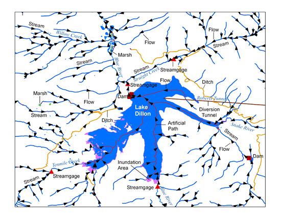
The USGS National Hydrography Dataset (NHD) service from The National Map (TNM) is a comprehensive set of digital spatial data that encodes information about naturally occurring and constructed bodies of surface water (lakes, ponds, and reservoirs), paths through which water flows (canals, ditches, streams, and rivers), and related entities such as point features (springs, wells, stream gages, and dams). The information encoded about these features includes classification and other characteristics, delineation, geographic name, position and related measures, a "reach code" through which other information can be related to the NHD, and the direction of water flow. The network of reach codes delineating water and...
Categories: Data;
Types: ArcGIS REST Map Service,
Map Service;
Tags: HU,
Hydrography,
NGP-TNM,
NHD,
Overlay Map Service,
Landforms along the Pacific, Gulf of Mexico, and Atlantic coastlines for the conterminous United States are attributed with the relative vulnerability of horizontal erosion due to sea-level rise to characterize coastal zone stability. The position and extent of landforms are geospatially indexed as line-events where these coastal zone features are intersected by the linear-referenced 2013 - 2014 U.S. Geological Survey National Hydrography Dataset Coastline, which corresponds to the National Oceanic and Atmospheric Administration (NOAA) 2013 - 2014 mean high water level datum delineated in intertidal zones open to oceans, behind barrier coasts in bays, lagoons, and estuaries, and sometimes where tidal currents reach...
Point Events are data that USGS has linked to the NHD. These include USGS stream gages, dams, hydrologic unit outlets, stream flow alterations, and water quality stations.
Categories: Data;
Types: ArcGIS REST Map Service,
ArcGIS Service Definition,
Citation,
Downloadable,
Map Service,
OGC WFS Layer,
OGC WMS Layer,
Shapefile;
Tags: Dams,
Dams,
Divergences,
Divergences,
Gaging station,
|

|