Filters: Tags: agricultural (X)
27 results (26ms)|
Filters
Contacts
(Less)
|
This table contains information about the amount of each threat analysis attribute, indicator and metric quantified for the 6th level Hydrological Unit (HUC12). These attributes were calculated for the entire HUC 12, the streams within the HUC 12, or the riparian corridor within the HUC 12. The attributes were calculated using ArcMap Tools These data are provided by Bureau of Land Management (BLM) "as is" and may contain errors or omissions. The User assumes the entire risk associated with its use of these data and bears all responsibility in determining whether these data are fit for the User's intended use. The User is encouraged to carefully consider the content of the metadata file associated with these data.
This dataset contains reclassified GAP land cover data and suitable agricultural soils derived from STATSGO. The new data layer is the future agricultural risk layer. These data are provided by Bureau of Land Management (BLM) "as is" and may contain errors or omissions. The User assumes the entire risk associated with its use of these data and bears all responsibility in determining whether these data are fit for the User's intended use. The User is encouraged to carefully consider the content of the metadata file associated with these data.
These data are provided by Bureau of Land Management (BLM) "as is" and may contain errors or omissions. The User assumes the entire risk associated with its use of these data and bears all responsibility in determining whether these data are fit for the User's intended use. The User is encouraged to carefully consider the content of the metadata file associated with these data.
Note: this data release has been deprecated. Please see new data release here: https://doi.org/10.5066/P9IGSRCV. Artificial drainage has major ecosystem impacts through the development of extensive ditch networks that reduce storage and induce large-scale vegetation changes. This has been a widespread practice of water table management for agriculture in Eastern North Carolina. However, these features are challenging to identify because the structure has been determined by non-natural factors. A dataset of open ditches was processed by calculating terrain (also, positive) openness – a value based on a line-of-sight approach to measure the surrounding eight zenith angles as viewed above the landscape surface. The...

These data were released prior to the October 1, 2016 effective date for the USGS’s policy dictating the review, approval, and release of scientific data as referenced in USGS Survey Manual Chapter 502.8 Fundamental Science Practices: Review and Approval of Scientific Data for Release. This spatial dataset consists of 219 1-kilometer (km) resolution grids depicting estimated agricultural use of 219 pesticides in 1997 for the conterminous United States. Each grid cell value in the national grids of this dataset is the estimated total kilograms (kg) of a pesticide applied to row crops, small grain crops and fallow land, pasture and hay crops, and orchard and vineyard crops within the 1- by 1-km area. Nonagricultural...

This spatial dataset consists of 199 1-kilometer (km) resolution grids depicting estimated agricultural use of 199 pesticides in 1992 for the conterminous United States. Each grid cell value in the national grids of this dataset is the estimated total kilograms (kg) of a pesticide applied to row crops, small grain crops and fallow land, pasture and hay crops, and orchard and vineyard crops within the 1- by 1-km area. Nonagricultural uses of pesticides are not included in this dataset. Of the 199 pesticides represented in the grids, 92 are herbicides, 58 are insecticides, and 32 are fungicides. The remaining 17 grids are composed of the category "other pesticides", which consists of fumigants, growth regulators,...
This table contains information about the amount of each threat analysis attribute, indicator and metric quantified for the 6th level Hydrological Unit (HUC12). These attributes were calculated for the entire HUC 12, the streams within the HUC 12, or the riparian corridor within the HUC 12. The attributes were calculated using ArcMap Tools. These data are provided by Bureau of Land Management (BLM) "as is" and may contain errors or omissions. The User assumes the entire risk associated with its use of these data and bears all responsibility in determining whether these data are fit for the User's intended use. The User is encouraged to carefully consider the content of the metadata file associated with these data.
These data are provided by Bureau of Land Management (BLM) "as is" and may contain errors or omissions. The User assumes the entire risk associated with its use of these data and bears all responsibility in determining whether these data are fit for the User's intended use. The User is encouraged to carefully consider the content of the metadata file associated with these data.
This dataset was combined by CBI from 219 1-kilometer (km) resolution grids depicting estimated agricultural use of 219 pesticides in 1997 for the conterminous United States produced by the USGS. CBI selected those pesticides that had nonzero values within this ecoregion. CBI created an additional attribute "PEST_SUM" that represents a value weighted sum across all pesticides, produced by summing together the proportion of the value for a particular pesticide for a given pixel to the total amount of that pesticide observed within this ecoregion. This sum approaches a greater number where more of the pesticides are applied at higher quantities relative within this ecoregion. This attribute has not been approved by...
This dataset was combined by CBI from 219 1-kilometer (km) resolution grids depicting estimated agricultural use of 219 pesticides in 1997 for the conterminous United States produced by the USGS. CBI selected those pesticides that had nonzero values within this ecoregion. CBI created an additional attribute "PEST_SUM" that represents a value weighted sum across all pesticides, produced by summing together the proportion of the value for a particular pesticide for a given pixel to the total amount of that pesticide observed within this ecoregion. This sum approaches a greater number where more of the pesticides are applied at higher quantities relative within this ecoregion. This attribute has not been approved by...
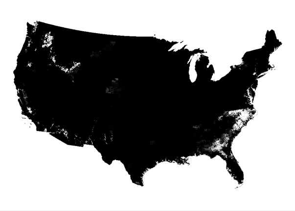
This spatial dataset consists of 219 1-kilometer (km) resolution grids depicting estimated agricultural use of 219 pesticides in 1997 for the conterminous United States. Each grid cell value in the national grids of this dataset is the estimated total kilograms (kg) of a pesticide applied to row crops, small grain crops and fallow land, pasture and hay crops, and orchard and vineyard crops within the 1- by 1-km area. Nonagricultural uses of pesticides are not included in this dataset. Of the 219 pesticidesrepresented in the grids, 96 are herbicides, 65 are insecticides, and 37 are fungicides. The remaining 21 compounds are composed of the category "other pesticides", which consist of fumigants, growth regulators,...
In this project on future sustainable transport alternatives a two-step search process has been followed. First an analysis of critical success and failure factors of new technological options in passenger transport is made. These factors are found in the spatial, institutional, economic and social/psychological environment of the transport system. Next, systematically structured and expert based scenarios are con- structed in order to achieve a sustainable transport system in the year 2030 in which possible, expected and desired developments in the distinct fields are analyzed. Finally some policy conclusions are drawn.
Categories: Publication;
Types: Citation;
Tags: Conversion,
Europe,
Integrating,
agricultural,
energy crops,
Improved understanding of the innovative pathways of renewable energy technologies is vital if we are to make the transition to a low carbon economy. This study presents new evidence on innovation and industry dynamics in concentrating solar power (CSP) technologies. Though CSP is undergoing a renaissance, existing innovation studies have explored innovative activity in solar technologies in general, ignoring the major differences between solar photovoltaic and CSP technologies. This study, based on patent data, examines the level and dynamics of innovative activity in CSP between 1978 and 2004. Our unique contribution, based on engineering expertise and detailed datawork, is a classification system mapping CSP...
Categories: Publication;
Types: Citation;
Tags: Farmer,
agricultural,
benefits,
bioenergy,
community,
This table contains information about the amount of each threat analysis attribute, indicator and metric quantified for the 6th level Hydrological Unit (HUC12). These attributes were calculated for the entire HUC 12, the streams within the HUC 12, or the riparian corridor within the HUC 12. The attributes were calculated using ArcMap Tools These data are provided by Bureau of Land Management (BLM) "as is" and may contain errors or omissions. The User assumes the entire risk associated with its use of these data and bears all responsibility in determining whether these data are fit for the User's intended use. The User is encouraged to carefully consider the content of the metadata file associated with these data.

These data were released prior to the October 1, 2016 effective date for the USGS’s policy dictating the review, approval, and release of scientific data as referenced in USGS Survey Manual Chapter 502.8 Fundamental Science Practices: Review and Approval of Scientific Data for Release. This spatial dataset consists of 199 1-kilometer (km) resolution grids depicting estimated agricultural use of 199 pesticides in 1992 for the conterminous United States. Each grid cell value in the national grids of this dataset is the estimated total kilograms (kg) of a pesticide applied to row crops, small grain crops and fallow land, pasture and hay crops, and orchard and vineyard crops within the 1- by 1-km area. Nonagricultural...
Encyclopedia of Water Science provides instant access to the most effective procedures in agricultural water engineering, unveiling a wide spectrum of design concepts, methodologies, and solutions for enhanced performance of water quality, treatment, conservation, and irrigation methods, as well as improved water efficiency in agricultural programs. Online version features quarterly updates, keyword searchability, color graphics, and customized content views.
Categories: Publication;
Types: Citation;
Tags: Agricultural,
Groundwater,
Hydrology,
Irrigation efficiency,
Nature / Animals / Fish,
This project helps the Central Valley Joint Venture (CVJV) track gains and losses of key bird and waterfowl habitats at a landscape scale. This will allow the CVJV to effectively monitor and evaluate habitats essential to conservation planning for wildlife species. This work is important for identifying, assembling, and analyzing data for key habitats of concern and will provide a foundation for future monitoring.
Categories: Data,
Project;
Tags: 2010,
Agricultural,
CA,
CA Central Valley,
California Central Valley,
These data sets contain the attributes and indicators associated with aquatic EI and were categorized by size, landscape context, and conditionset in the Northwestern Plains Ecoregion. The data for the Aquatic EI used information from the Aquatic Threat analysis performed by the Missouri River Assesment Program (MoRAP). The MoRAP aquatic threat analysis contains information about each threat analysis attribute, indicator and metric arbitrarily quantified (1,2,3) for the 6th level Hydrological Unit (HUC12). These attributes were calculated for the entire HUC 12, the streams within the HUC 12, or the riparian corridor within the HUC 12. For this analysis MoRAP used arbitrary values were assigned good =3, fair =2 and...
Types: Live Data;
Tags: Agricultural,
Agriculture,
Aquatic Ecological Intactness,
BLM,
Bureau of Land Management,
Urban and Agricultural Lands extracted from ReGAP and Landfire Imagery. These data are provided by Bureau of Land Management (BLM) "as is" and may contain errors or omissions. The User assumes the entire risk associated with its use of these data and bears all responsibility in determining whether these data are fit for the User's intended use. These data may not have the accuracy, resolution, completeness, timeliness, or other characteristics appropriate for applications that potential users of the data may contemplate. The User is encouraged to carefully consider the content of the metadata file associated with these data. The BLM should be cited as the data source in any products derived from these data.
This geodatabse set contains the attributes and indicators associated with aquatic EI were categorized by size, landscape context, and conditionset in the Northwestern Plains Ecoregion. The data for the Aquatic EI used information from the Aquatic Threat analysis performed by the Missouri River Assesment Program (MoRAP). The MoRAP aquatic threat analysis contains information about each threat analysis attribute, indicator and metric arbitrarily quantified (1,2,3) for the 6th level Hydrological Unit (HUC12). These attributes were calculated for the entire HUC 12, the streams within the HUC 12, or the riparian corridor within the HUC 12. For this analysis MoRAP used arbitrary values were assigned good =3, fair =2...
Types: Live Data;
Tags: Agricultural,
Agriculture,
Aquatic Ecological Intactness,
BLM,
Bureau of Land Management,
|

|
