Filters: Tags: great lakes (X) > partyWithName: U.S. Geological Survey (X)
66 results (46ms)|
Filters
Contacts
(Less)
|
This dataset provides results of a targeted bacterial community metagenomic analysis of surface water, groundwater, and sand samples at Jeorse Park on Lake Michigan in East Chicago, Indiana. Seventy-two samples were collected from 6 sites in 2017. Samples were analyzed for the 16S ribosomal RNA (16S rRNA) gene (the S in 16S refers to the rate of sedimentation, in Svedberg units, of the RNA molecule in a centrifugal field), and one sample was excluded because it produced too few reads. The 16S rRNA gene is the most conserved of three rRNA genes (16S, 23S, and 5S) and is considered the most reliable for identification and taxonomic classification of bacterial species (Bouchet and others, 2008). Taxonomic analysis...
This Benthic Invertebrate Community Analysis dataset, a conceptual subgroup of the Lake Erie Ecological Investigations (LEEI) dataset, focuses on the benthic invertebrates sampled at Areas of Concern (AOCs) on Lake Erie. Per the Quality Assurance Project Plan (QAPP), the invertebrate samples were taken from sediments remaining from the sediment analysis. Identification of the invertebrates was completed by the same invertebrate taxonomist for both the 1998-2000 evaluation and 1986-87 historical evaluation (Smith et al. 1994) for increased consistency. Oligochaetes were identified to species if possible, chironomids were identified to genus, as adult specimens are needed for specific identification, and other taxa...
Zebra and quagga mussel veligers were exposed to eleven distinct cultures (isolates) of cyanobacteria representing Anabaena, Aphanizomenon, Dolichospermum, Microcystis, and Planktothrix species and the cyanotoxin microcystin to determine the lethality of cyanobacteria on dreissenid veligers. Six-day laboratory bioassays were performed in microplates using dreissenid veligers collected from the Detroit River, Michigan, USA. Veligers were exposed to increasing concentrations of cyanobacteria and microcystin using the green algae Chlorella minutissima as a control. Raw data were fit to dose response curves formulated from a Probit model to calculate LC50 values. This data release presents the raw data summarized and...
Well-established conservation planning principles and techniques framed by geodesign were used to assess the restorability of areas that historically supported coastal wetlands along the U.S. shore of Saginaw Bay. The resulting analysis supported planning efforts to identify, prioritize, and track wetland restoration opportunity and investment in the region. To accomplish this, publicly available data, criteria derived from the regional managers and local stakeholders, and geospatial analysis were used to form an ecological model for spatial prioritization.
This dataset contains all the layers associated with U.S. Geological Survey (USGS) Great Lakes Coastal Wetland Restoration Assessment (GLCWRA) initiative for the Upper Peninsula Restoration Assessment (UPRA) which aims to identify and rank coastal areas with the greatest potential for wetland habitat restoration. Each layer has a unique contribution to the identification of restorable wetlands. The 7 parameters (Parameter 0: Mask, Parameter 1: Hydroperiod, Parameter 2: Wetland Soils, Parameter 3: Flowlines, Parameter 4: Conservation and Recreation Lands, Parameter 5: Impervious Surfaces, and Parameter 6: Land Use) and Index Composite directly correlate to areas that are recommended for restoration. The dikes, degree...
Categories: Data Release - Revised;
Types: GeoTIFF,
Map Service,
OGC WFS Layer,
OGC WMS Layer,
OGC WMS Service;
Tags: Chippewa,
Great Lakes,
Holocene,
Lake Huron,
Lake Michigan,
OBIS-USA brings together marine biological occurrence data – recorded observations of identifiable marine species at a known time and place, collected primarily from U.S. Waters or with U.S. funding. Coordinated by the Science Analytics and Synthesis (SAS) Program of the United States Geological Survey (USGS), OBIS-USA, strives to meet national data integration and dissemination needs for marine data about organisms and ecosystems. OBIS-USA is part of an international data sharing network (Ocean Biodiversity Information System, OBIS) coordinated by the Intergovernmental Oceanographic Commission, of UNESCO (United Nations Educational, Science and Cultural Organization) International Oceanographic Data and Information...
Note: this data release has been superseded by version 5.0, available here: https://doi.org/10.5066/F7HT2NNP Ice breakup dates of Chequamegon Bay, Lake Superior from 1911 to 2021 were compiled by Lori Evrard (USGS, GLSC, Lake Superior Biological Station, Ashland, WI). Ice breakup date is the day in spring when winter ice cover substantially leaves a water body. Local residents deem "ice breakup" as when the ice moves northeast of a line straight across Chequamegon Bay out from Ellis Avenue (State highway 13). Another way ice breakup was determined has been if you could drive a boat from the outlet of Fish Creek to Houghton Point. The ice may move back and forth over that line but the ice is breaking up, moving...
Categories: Data,
Data Release - Revised;
Tags: Ashland,
Chequamegon Bay,
Climatology,
Great Lakes,
Lake Superior,
This dataset is the output of a python script/ArcGIS model that identifes dikes as having a difference in elevation above a certain threshold. If the elevation difference was below a certain threshold the area was not considered a dike; however, if the difference in elevation between two points was significantly high then the area was marked as a dike. Areas continuous with eachother were considered part of the same dike. Post processing occured. Users examined the data output, comparing the proposed dike locations to aerial imagery, flowline data, and the DEM. Dikes that appeared to be false positives were deleted from the data set.
Categories: Data;
Types: Citation,
Downloadable,
Map Service,
OGC WFS Layer,
OGC WMS Layer,
Shapefile;
Tags: Great Lakes,
LIDAR,
Lake Erie,
biogeography,
coastal ecosystems,
These data were collected as part of the Great Lakes Restoration Initiative (GLRI) project template 678-1 entitled “Evaluate immediate and long-term BMP effectiveness of GLRI restoration efforts at urban beaches on Southern and Western Lake Michigan”. This project is evaluating the effectiveness of projects that are closely associated with restoration of local habitat and contact recreational activities at two GLRI funded sites in Southern Lake Michigan and one non-GLRI site in Western Lake Michigan. Evaluation of GLRI projects will assess whether goals of recipients are on track and identify any developing unforeseen consequences. Including a third, non-GLRI project site in the evaluation allows comparison between...
This dataset is the output of a python script/ArcGIS model that identifes dikes as having a difference in elevation above a certain threshold. If the elevation difference was below a certain threshold the area was not considered a dike; however, if the difference in elevation between two points was significantly high then the area was marked as a dike. Areas continuous with eachother were considered part of the same dike. Post processing occured. Users examined the data output, comparing the proposed dike locations to aerial imagery, flowline data, and the DEM. Dikes that appeared to be false positives were deleted from the data set.
Categories: Data;
Types: Citation,
Downloadable,
Map Service,
OGC WFS Layer,
OGC WMS Layer,
Shapefile;
Tags: Detroit River,
Great Lakes,
LIDAR,
Lake St. Clair,
St. Clair River,
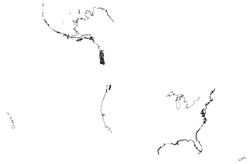
This map layer portrays the coastline of the United States, Puerto Rico, and the U.S. Virgin Islands. The United States shoreline of the Great Lakes is also included. This is a revised version of the July 2012 map layer.
These data were collected as part of the Great Lakes Restoration Initiative (GLRI) project template 678-1 entitled “Evaluate immediate and long-term BMP effectiveness of GLRI restoration efforts at urban beaches on Southern and Western Lake Michigan”. This project is evaluating the effectiveness of projects that are closely associated with restoration of local habitat and contact recreational activities at two GLRI funded sites in Southern Lake Michigan and one non-GLRI site in Western Lake Michigan. Evaluation of GLRI projects will assess whether goals of recipients are on track and identify any developing unforeseen consequences. Including a third, non-GLRI project site in the evaluation allows comparison between...
These data were collected as part of the Great Lakes Restoration Initiative (GLRI) project template 678-1 entitled "Evaluate immediate and long-term BMP effectiveness of GLRI restoration efforts at urban beaches on Southern and Western Lake Michigan". This project is evaluating the effectiveness of projects that are closely associated with restoration of local habitat and contact recreational activities at two GLRI funded sites in Southern Lake Michigan and one non-GLRI site in Western Lake Michigan. Evaluation of GLRI projects will assess whether goals of recipients are on track and identify any developing unforeseen consequences. Including a third, non-GLRI project site in the evaluation allows comparison between...
These data were collected as part of the Great Lakes Restoration Initiative (GLRI) project template 678-1 entitled 'Evaluate immediate and long-term BMP effectiveness of GLRI restoration efforts at urban beaches on Southern and Western Lake Michigan'. This project is evaluating the effectiveness of projects that are closely associated with restoration of local habitat and contact recreational activities at two GLRI funded sites in Southern Lake Michigan and one non-GLRI site in Western Lake Michigan. Evaluation of GLRI projects will assess whether goals of recipients are on track and identify any developing unforeseen consequences. Including a third, non-GLRI project site in the evaluation allows comparison between...
Groundwater and surface-water samples were collected and analyzed for microbial source tracking markers to identify the primary sources of fecal bacteria at a Lake Michigan beach in Northwestern Indiana.
This Sediment Analysis dataset, a conceptual subgroup of the Lake Erie Ecological Investigations (LEEI) dataset, focuses on the sediments sampled at Areas of Concern (AOCs) on Lake Erie. Per the Quality Assurance Project Plan (QAPP), sediment collections were a composite of at least five randomly selected samples collected from each site. Per an internal summary report, sediment samples were collected using a stainless steel Eckman dredge. Analytical methods and QA/QC were directed by the Patuxent Analytical Control Facility (PACF) of the US Fish and Wildlife Service. Per Dora Passino-Reader, the Geochemical & Environmental Research Group at Texas A&M University, College Station performed the analytical chemistry...
Monitoring of vitamin B1 (thiamine) in the eggs of lake trout (Salvelinus namaycush) collected from lakes Huron and Michigan has been conducted by the U.S. Geological Survey since the mid-1990’s. The results of this monitoring effort have been used by natural resource management agencies and native American tribes within the Great Lakes basin to evaluate the reproductive health of lake trout. The data in this release are the thiamine concentrations measured in lake trout collected from 1996-2018. Results are reported as total thiamine (nmol/g-egg), collection site, lake, year collected, and reference to the analysis methods.
Categories: Data;
Tags: Canada,
EMS,
Early Mortality Syndrome,
Fish,
Fish Spawning and Larval Aggregation,
Note: this data release has been superseded by version 4.0, available here: https://doi.org/10.5066/F7HT2NNP. Ice breakup dates of Chequamegon Bay, Lake Superior from 1911 to 2020 were compiled by Lori Evrard (USGS, GLSC, Lake Superior Biological Station, Ashland, WI). Ice breakup date is the day in spring when winter ice cover substantially leaves a water body. Local residents deem "ice breakup" as when the ice moves northeast of a line straight across Chequamegon Bay out from Ellis Avenue (State highway 13). Another way ice breakup was determined has been if you could drive a boat from the outlet of Fish Creek to Houghton Point. The ice may move back and forth over that line but the ice is breaking up, moving...
Categories: Data,
Data Release - Revised;
Tags: Ashland,
Chequamegon Bay,
Climatology,
Great Lakes,
Lake Superior,
This data release presents part of historical fisheries-dependent data for Cisco (Coregonus artedi) in Green Bay of Lake Michigan and Saginaw Bay of Lake Huron collected by scientists from U.S. Geological Survey's Great Lakes Science Center, including three tables for monthly Cisco-catch and fishing-effort data and two tables for biological data of Cisco individuals. The monthly Cisco-catch and fishing-effort data tables are for small-mesh gill-net fisheries in Green Bay and Saginaw Bay (GBSB_GN.csv), pound-net fisheries in Green Bay and Saginaw Bay (GBSB_PD.csv), and shallow trap-net fishery in Saginaw Bay (SB_ST.csv) in the period 1929–1970. The biological data of Cisco individuals are from historical Saginaw...

A previously developed three-dimensional groundwater-flow model that used the MODFLOW-NWT code was updated to simulate the effects of various proposed drainage modifications aimed at reducing discharge to a sanitary sewer system near Long Lake in Indiana Dunes National Lakeshore, near Gary, Indiana. The original steady-state model documented in the USGS report (https://pubs.usgs.gov/sir/2013/5003/) and data release (https://doi.org/10.5066/F7D21VS2) was calibrated to a low groundwater level/dry weather condition of October 2002 and a high groundwater level/wet weather condition of March 2011. For this study the 2002 and 2011 simulations were updated with elevation data collected from a 2017 survey of primary surface-water...
|

|
