Filters
Date Types (for Date Range)
Extensions
Types
Contacts
Categories
Tag Types
Tag Schemes
|

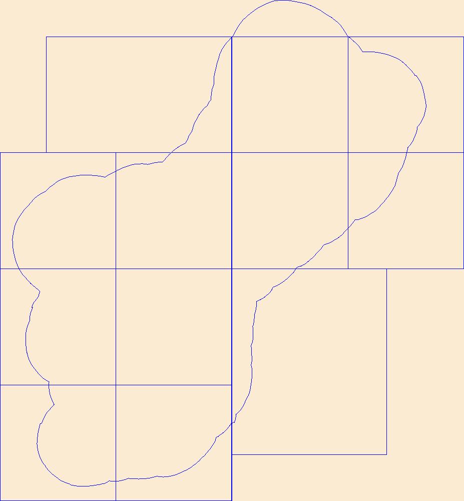
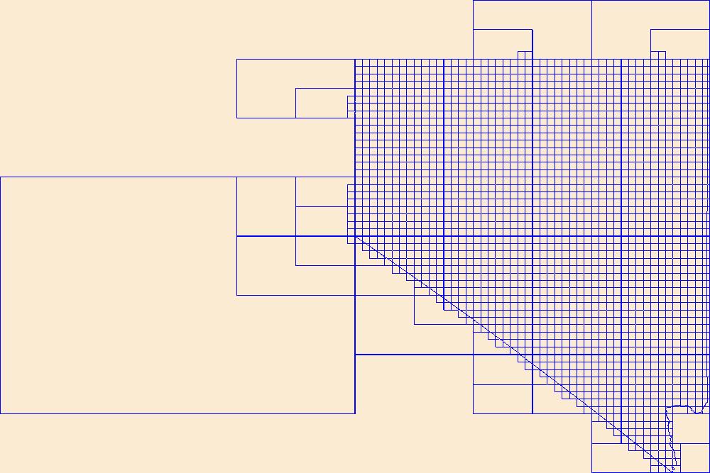
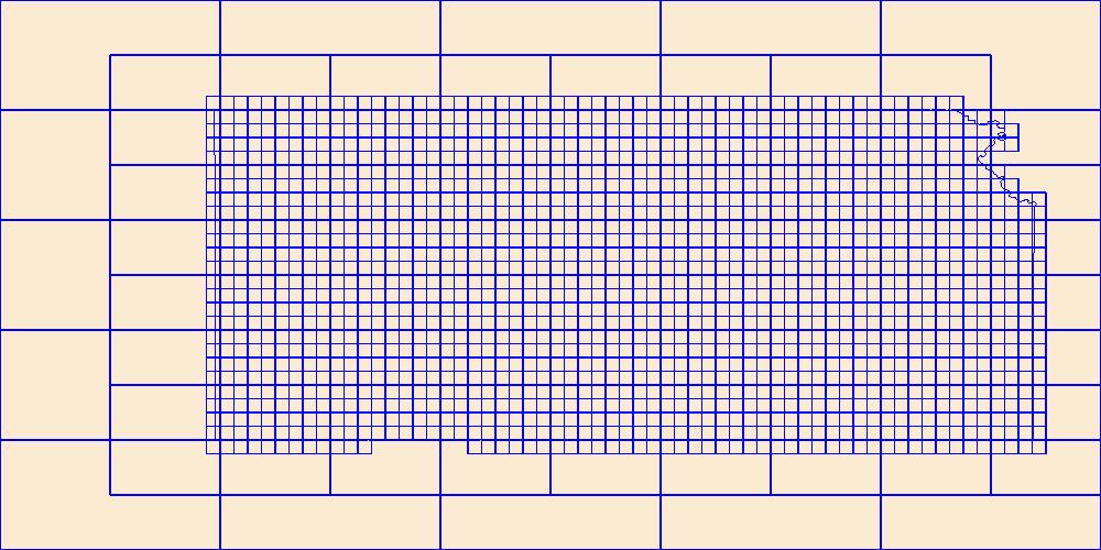
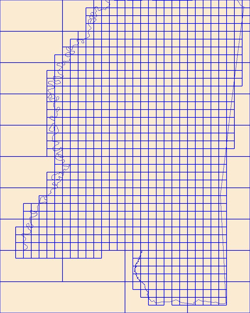
This data represents the map extent for current and historical USGS topographic maps for the United States and Territories, including 1 X 2 Degree, 1 X 1 Degree, 30 X 60 Minute, 15 X 15 Minute, 7.5 X 7.5 Minute, and 3.75 X 3.75 Minute. The grid was generated using ESRI ArcInfo GIS software.
Tags: Adjuntas,
Aguada,
Aguadilla,
Aguas Buenas,
Aibonito, All tags...
Arecibo,
Arroyo,
Añasco,
Barceloneta,
Barranquitas,
Bayamón,
Boundaries,
Cabo Rojo,
Caguas,
Camuy,
Canóvanas,
Carolina,
Cataño,
Cayey,
Ceiba,
Ciales,
Cidra,
Coamo,
Comerío,
Corozal,
Culebra,
Dorado,
Downloadable Data,
Esri File GeoDatabase 10,
Fajardo,
FileGDB,
Florida,
Guayama,
Guayanilla,
Guaynabo,
Gurabo,
Guánica,
Hatillo,
Hormigueros,
Humacao,
Isabela,
Jayuya,
Juana Díaz,
Juncos,
Lajas,
Lares,
Las Marías,
Las Piedras,
Loíza,
Luquillo,
Manatí,
Map Indices,
Map Indices,
Map Indices,
Maricao,
Maunabo,
Mayagüez,
Moca,
Morovis,
Naguabo,
Naranjito,
Orocovis,
PR,
Patillas,
Peñuelas,
Ponce,
Puerto Rico,
Quebradillas,
Rincón,
Río Grande,
Sabana Grande,
Salinas,
San Germán,
San Juan,
San Lorenzo,
San Sebastián,
Santa Isabel,
State,
State,
Toa Alta,
Toa Baja,
Trujillo Alto,
US,
United States,
United States of America,
Utuado,
Vega Alta,
Vega Baja,
Vieques,
Villalba,
Yabucoa,
Yauco,
cells,
map indices,
polygon grid, Fewer tags
This data represents the map extent for current and historical USGS topographic maps for the United States and Territories, including 1 X 2 Degree, 1 X 1 Degree, 30 X 60 Minute, 15 X 15 Minute, 7.5 X 7.5 Minute, and 3.75 X 3.75 Minute. The grid was generated using ESRI ArcInfo GIS software.
Tags: Boundaries,
Downloadable Data,
Esri File GeoDatabase 10,
FileGDB,
GU, All tags...
Guam,
Guam,
Map Indices,
Map Indices,
Map Indices,
State,
State,
US,
United States,
United States of America,
cells,
map indices,
polygon grid, Fewer tags
This data represents the map extent for current and historical USGS topographic maps for the United States and Territories, including 1 X 2 Degree, 1 X 1 Degree, 30 X 60 Minute, 15 X 15 Minute, 7.5 X 7.5 Minute, and 3.75 X 3.75 Minute. The grid was generated using ESRI ArcInfo GIS software.
Tags: Boundaries,
Carson City,
Churchill,
Clark,
Douglas, All tags...
Downloadable Data,
Elko,
Esmeralda,
Esri File GeoDatabase 10,
Eureka,
FileGDB,
Humboldt,
Lander,
Lincoln,
Lyon,
Map Indices,
Map Indices,
Map Indices,
Mineral,
NV,
Nevada,
Nye,
Pershing,
State,
State,
Storey,
US,
United States,
United States of America,
Washoe,
White Pine,
cells,
map indices,
polygon grid, Fewer tags
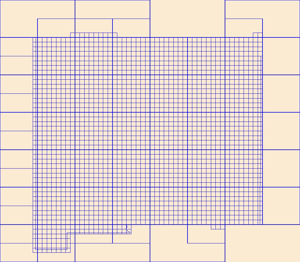
This data represents the map extent for current and historical USGS topographic maps for the United States and Territories, including 1 X 2 Degree, 1 X 1 Degree, 30 X 60 Minute, 15 X 15 Minute, 7.5 X 7.5 Minute, and 3.75 X 3.75 Minute. The grid was generated using ESRI ArcInfo GIS software.
Tags: Allen,
Anderson,
Atchison,
Barber,
Barton, All tags...
Boundaries,
Bourbon,
Brown,
Butler,
Chase,
Chautauqua,
Cherokee,
Cheyenne,
Clark,
Clay,
Cloud,
Coffey,
Comanche,
Cowley,
Crawford,
Decatur,
Dickinson,
Doniphan,
Douglas,
Downloadable Data,
Edwards,
Elk,
Ellis,
Ellsworth,
Esri File GeoDatabase 10,
FileGDB,
Finney,
Ford,
Franklin,
Geary,
Gove,
Graham,
Grant,
Gray,
Greeley,
Greenwood,
Hamilton,
Harper,
Harvey,
Haskell,
Hodgeman,
Jackson,
Jefferson,
Jewell,
Johnson,
KS,
Kansas,
Kearny,
Kingman,
Kiowa,
Labette,
Lane,
Leavenworth,
Lincoln,
Linn,
Logan,
Lyon,
Map Indices,
Map Indices,
Map Indices,
Marion,
Marshall,
McPherson,
Meade,
Miami,
Mitchell,
Montgomery,
Morris,
Morton,
Nemaha,
Neosho,
Ness,
Norton,
Osage,
Osborne,
Ottawa,
Pawnee,
Phillips,
Pottawatomie,
Pratt,
Rawlins,
Reno,
Republic,
Rice,
Riley,
Rooks,
Rush,
Russell,
Saline,
Scott,
Sedgwick,
Seward,
Shawnee,
Sheridan,
Sherman,
Smith,
Stafford,
Stanton,
State,
State,
Stevens,
Sumner,
Thomas,
Trego,
US,
United States,
United States of America,
Wabaunsee,
Wallace,
Washington,
Wichita,
Wilson,
Woodson,
Wyandotte,
cells,
map indices,
polygon grid, Fewer tags
This data represents the map extent for current and historical USGS topographic maps for the United States and Territories, including 1 X 2 Degree, 1 X 1 Degree, 30 X 60 Minute, 15 X 15 Minute, 7.5 X 7.5 Minute, and 3.75 X 3.75 Minute. The grid was generated using ESRI ArcInfo GIS software.
Tags: Adams,
Alcorn,
Amite,
Attala,
Benton, All tags...
Bolivar,
Boundaries,
Calhoun,
Carroll,
Chickasaw,
Choctaw,
Claiborne,
Clarke,
Clay,
Coahoma,
Copiah,
Covington,
DeSoto,
Downloadable Data,
Esri File GeoDatabase 10,
FileGDB,
Forrest,
Franklin,
George,
Greene,
Grenada,
Hancock,
Harrison,
Hinds,
Holmes,
Humphreys,
Issaquena,
Itawamba,
Jackson,
Jasper,
Jefferson,
Jefferson Davis,
Jones,
Kemper,
Lafayette,
Lamar,
Lauderdale,
Lawrence,
Leake,
Lee,
Leflore,
Lincoln,
Lowndes,
MS,
Madison,
Map Indices,
Map Indices,
Map Indices,
Marion,
Marshall,
Mississippi,
Monroe,
Montgomery,
Neshoba,
Newton,
Noxubee,
Oktibbeha,
Panola,
Pearl River,
Perry,
Pike,
Pontotoc,
Prentiss,
Quitman,
Rankin,
Scott,
Sharkey,
Simpson,
Smith,
State,
State,
Stone,
Sunflower,
Tallahatchie,
Tate,
Tippah,
Tishomingo,
Tunica,
US,
Union,
United States,
United States of America,
Walthall,
Warren,
Washington,
Wayne,
Webster,
Wilkinson,
Winston,
Yalobusha,
Yazoo,
cells,
map indices,
polygon grid, Fewer tags

This data represents the map extent for current and historical USGS topographic maps for the United States and Territories, including 1 X 2 Degree, 1 X 1 Degree, 30 X 60 Minute, 15 X 15 Minute, 7.5 X 7.5 Minute, and 3.75 X 3.75 Minute. The grid was generated using ESRI ArcInfo GIS software.
Types: Citation;
Tags: Adams,
Ashland,
Barron,
Bayfield,
Boundaries, All tags...
Brown,
Buffalo,
Burnett,
Calumet,
Chippewa,
Clark,
Columbia,
Crawford,
Dane,
Dodge,
Door,
Douglas,
Downloadable Data,
Dunn,
Eau Claire,
Esri Shapefile nan,
Florence,
Fond du Lac,
Forest,
Grant,
Green,
Green Lake,
Iowa,
Iron,
Jackson,
Jefferson,
Juneau,
Kenosha,
Kewaunee,
La Crosse,
Lafayette,
Langlade,
Lincoln,
Manitowoc,
Map Indices,
Map Indices,
Map Indices,
Marathon,
Marinette,
Marquette,
Menominee,
Milwaukee,
Monroe,
Oconto,
Oneida,
Outagamie,
Ozaukee,
Pepin,
Pierce,
Polk,
Portage,
Price,
Racine,
Richland,
Rock,
Rusk,
Sauk,
Sawyer,
Shapefile,
Shawano,
Sheboygan,
St. Croix,
State,
State,
Taylor,
Trempealeau,
US,
United States,
United States of America,
Vernon,
Vilas,
WI,
Walworth,
Washburn,
Washington,
Waukesha,
Waupaca,
Waushara,
Winnebago,
Wisconsin,
Wood,
cells,
map indices,
polygon grid, Fewer tags
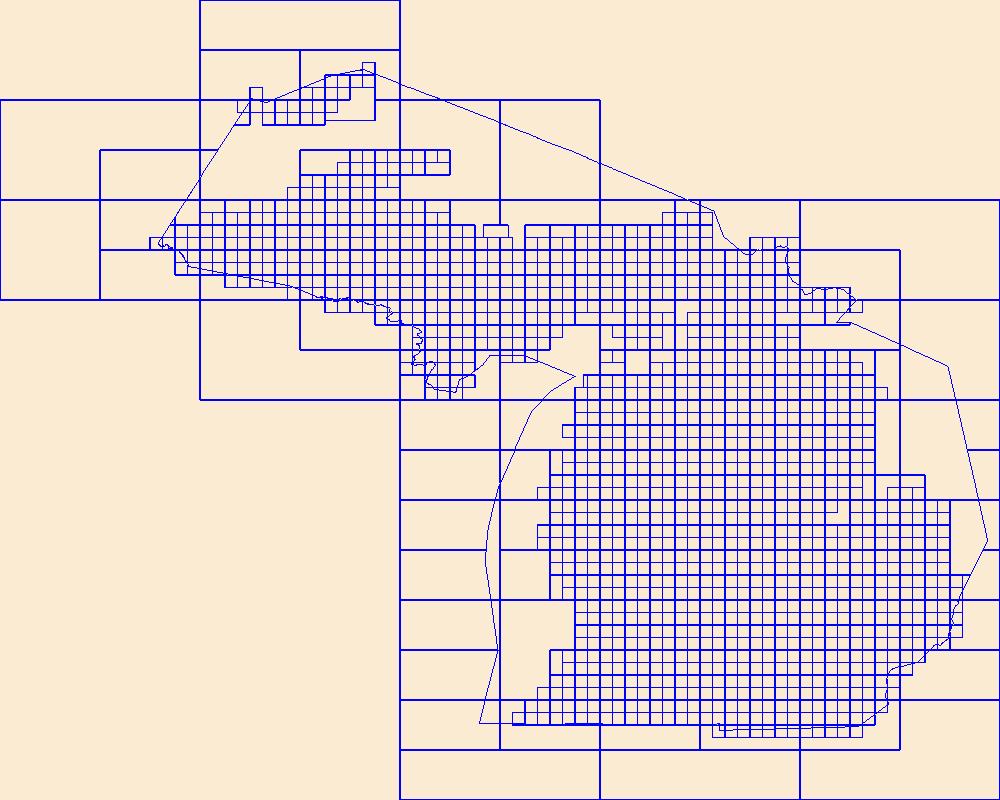
This data represents the map extent for current and historical USGS topographic maps for the United States and Territories, including 1 X 2 Degree, 1 X 1 Degree, 30 X 60 Minute, 15 X 15 Minute, 7.5 X 7.5 Minute, and 3.75 X 3.75 Minute. The grid was generated using ESRI ArcInfo GIS software.
Tags: Alcona,
Alger,
Allegan,
Alpena,
Antrim, All tags...
Arenac,
Baraga,
Barry,
Bay,
Benzie,
Berrien,
Boundaries,
Branch,
Calhoun,
Cass,
Charlevoix,
Cheboygan,
Chippewa,
Clare,
Clinton,
Crawford,
Delta,
Dickinson,
Downloadable Data,
Eaton,
Emmet,
Esri File GeoDatabase 10,
FileGDB,
Genesee,
Gladwin,
Gogebic,
Grand Traverse,
Gratiot,
Hillsdale,
Houghton,
Huron,
Ingham,
Ionia,
Iosco,
Iron,
Isabella,
Jackson,
Kalamazoo,
Kalkaska,
Kent,
Keweenaw,
Lake,
Lapeer,
Leelanau,
Lenawee,
Livingston,
Luce,
MI,
Mackinac,
Macomb,
Manistee,
Map Indices,
Map Indices,
Map Indices,
Marquette,
Mason,
Mecosta,
Menominee,
Michigan,
Midland,
Missaukee,
Monroe,
Montcalm,
Montmorency,
Muskegon,
Newaygo,
Oakland,
Oceana,
Ogemaw,
Ontonagon,
Osceola,
Oscoda,
Otsego,
Ottawa,
Presque Isle,
Roscommon,
Saginaw,
Sanilac,
Schoolcraft,
Shiawassee,
St. Clair,
St. Joseph,
State,
State,
Tuscola,
US,
United States,
United States of America,
Van Buren,
Washtenaw,
Wayne,
Wexford,
cells,
map indices,
polygon grid, Fewer tags
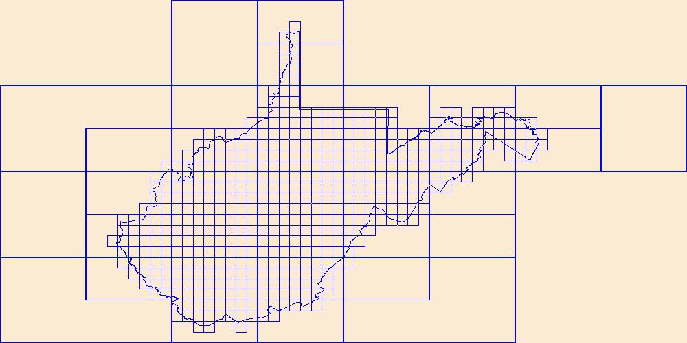
This data represents the map extent for current and historical USGS topographic maps for the United States and Territories, including 1 X 2 Degree, 1 X 1 Degree, 30 X 60 Minute, 15 X 15 Minute, 7.5 X 7.5 Minute, and 3.75 X 3.75 Minute. The grid was generated using ESRI ArcInfo GIS software.
Types: Citation;
Tags: Barbour,
Berkeley,
Boone,
Boundaries,
Braxton, All tags...
Brooke,
Cabell,
Calhoun,
Clay,
Doddridge,
Downloadable Data,
Esri Shapefile nan,
Fayette,
Gilmer,
Grant,
Greenbrier,
Hampshire,
Hancock,
Hardy,
Harrison,
Jackson,
Jefferson,
Kanawha,
Lewis,
Lincoln,
Logan,
Map Indices,
Map Indices,
Map Indices,
Marion,
Marshall,
Mason,
McDowell,
Mercer,
Mineral,
Mingo,
Monongalia,
Monroe,
Morgan,
Nicholas,
Ohio,
Pendleton,
Pleasants,
Pocahontas,
Preston,
Putnam,
Raleigh,
Randolph,
Ritchie,
Roane,
Shapefile,
State,
State,
Summers,
Taylor,
Tucker,
Tyler,
US,
United States,
United States of America,
Upshur,
WV,
Wayne,
Webster,
West Virginia,
Wetzel,
Wirt,
Wood,
Wyoming,
cells,
map indices,
polygon grid, Fewer tags
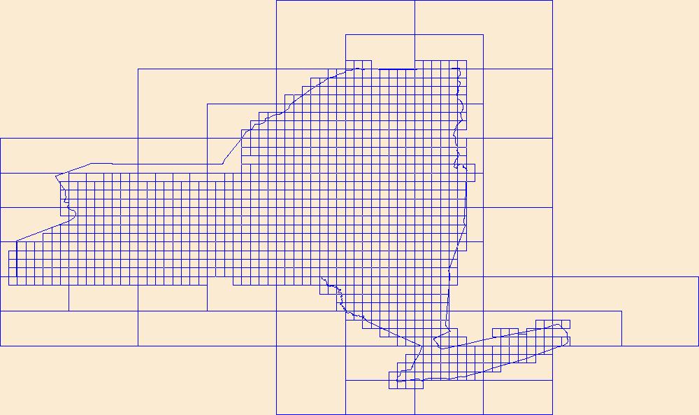
This data represents the map extent for current and historical USGS topographic maps for the United States and Territories, including 1 X 2 Degree, 1 X 1 Degree, 30 X 60 Minute, 15 X 15 Minute, 7.5 X 7.5 Minute, and 3.75 X 3.75 Minute. The grid was generated using ESRI ArcInfo GIS software.
Types: Citation;
Tags: Albany,
Allegany,
Boundaries,
Bronx,
Broome, All tags...
Cattaraugus,
Cayuga,
Chautauqua,
Chemung,
Chenango,
Clinton,
Columbia,
Cortland,
Delaware,
Downloadable Data,
Dutchess,
Erie,
Esri Shapefile nan,
Essex,
Franklin,
Fulton,
Genesee,
Greene,
Hamilton,
Herkimer,
Jefferson,
Kings,
Lewis,
Livingston,
Madison,
Map Indices,
Map Indices,
Map Indices,
Monroe,
Montgomery,
NY,
Nassau,
New York,
New York,
Niagara,
Oneida,
Onondaga,
Ontario,
Orange,
Orleans,
Oswego,
Otsego,
Putnam,
Queens,
Rensselaer,
Richmond,
Rockland,
Saratoga,
Schenectady,
Schoharie,
Schuyler,
Seneca,
Shapefile,
St. Lawrence,
State,
State,
Steuben,
Suffolk,
Sullivan,
Tioga,
Tompkins,
US,
Ulster,
United States,
United States of America,
Warren,
Washington,
Wayne,
Westchester,
Wyoming,
Yates,
cells,
map indices,
polygon grid, Fewer tags

This data represents the map extent for current and historical USGS topographic maps for the United States and Territories, including 1 X 2 Degree, 1 X 1 Degree, 30 X 60 Minute, 15 X 15 Minute, 7.5 X 7.5 Minute, and 3.75 X 3.75 Minute. The grid was generated using ESRI ArcInfo GIS software.
Tags: AS,
American Samoa,
Boundaries,
Downloadable Data,
Eastern, All tags...
Esri Shapefile nan,
Manu'a,
Map Indices,
Map Indices,
Map Indices,
Rose Island,
Shapefile,
State,
State,
Swains Island,
US,
United States,
United States of America,
Western,
cells,
map indices,
polygon grid, Fewer tags

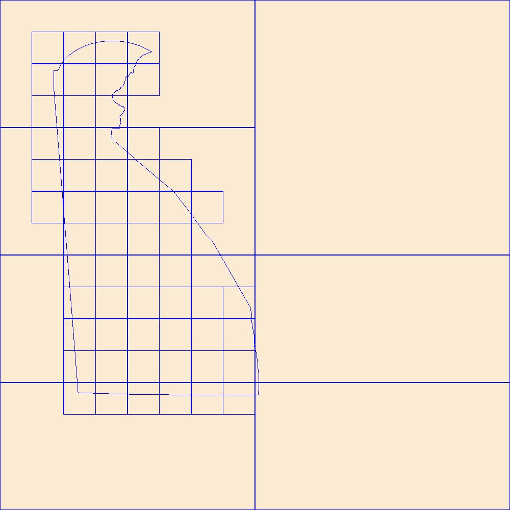
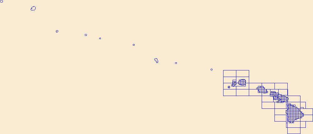
This data represents the map extent for current and historical USGS topographic maps for the United States and Territories, including 1 X 2 Degree, 1 X 1 Degree, 30 X 60 Minute, 15 X 15 Minute, 7.5 X 7.5 Minute, and 3.75 X 3.75 Minute. The grid was generated using ESRI ArcInfo GIS software.
Tags: Boundaries,
Downloadable Data,
Esri File GeoDatabase 10,
FileGDB,
HI, All tags...
Hawaii,
Hawaii,
Honolulu,
Kalawao,
Kauai,
Map Indices,
Map Indices,
Map Indices,
Maui,
State,
State,
US,
United States,
United States of America,
cells,
map indices,
polygon grid, Fewer tags

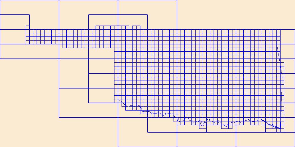
Cell maps for each oil and gas assessment unit were created by the USGS as a method for illustrating the degree of exploration, type of production, and distribution of production in an assessment unit or province. Each cell represents a quarter-mile square of the land surface, and the cells are coded to represent whether the wells included within the cell are predominantly oil-producing, gas-producing, both oil and gas-producing, dry, or the type of production of the wells located within the cell is unknown. The well information was initially retrieved from the IHS Energy Group, PI/Dwights PLUS Well Data on CD-ROM, which is a proprietary, commercial database containing information for most oil and gas wells in the...
Categories: Data,
pre-SM502.8;
Tags: 506701 = Conasauga-Rome/Conasauga,
50670101 = Rome Trough,
506702 = Sevier-Knox Trenton,
50670201 = Lower Paleozoic Carbonates,
506703 = Utica-Lower Paleozoic, All tags...
50670301 = Lower Paleozoic Carbonates in Thrust Belt,
50670302 = Knox Unconformity,
50670303 = Black River-Trenton Hydrothermal Dolomite,
50670304 = Lockport Dolomite,
50670361 = Clinton-Medina Basin Center,
50670362 = Clinton-Medina Transitional Northeast,
50670363 = Clinton-Medina Transitional,
50670364 = Tuscarora Basin Center,
506704 = Devonian Shale-Middle and Upper Paleozoic,
50670401 = Oriskany Sandstone-Structural,
50670402 = Oriskany Sandstone-Stratigraphic,
50670403 = Greenbrier Limestone,
50670404 = Mississippian Sandstones,
50670461 = Greater Big Sandy,
50670462 = Northwestern Ohio Shale,
50670463 = Devonian Siltstone and Shale,
50670464 = Marcellus Shale,
50670465 = Catskill Sandstones and Siltstone,
50670466 = Berea Sandstone,
506705 = Carboniferous Coal-Bed Gas,
50670581 = Pocahontas Basin,
50670582 = East Dunkard (Folded),
50670583 = West Dunkard (Unfolded),
50670584 = Central Appalachian Shelf,
50670585 = Appalachain Anthracite and Semi-Anthracite,
506706 = Pottsville Coal-Bed Gas,
50670681 = Cahaba Basin,
67 = Appalachian Basin,
AL,
Appalachian Basin,
Assessment Unit,
Cells,
Coalbed methane resources,
Earth Science,
Economic geology,
Energy Resources,
GA,
Gas hydrate resources,
Geology,
KY,
MD,
Milici, Robert C.,
NC,
NJ,
NY,
National Assessment of Oil and Gas,
Natural Gas,
Natural Resources,
Natural gas resources,
OH,
Oil,
Oil sand resources,
Oil shale resources,
PA,
Resource Assessment,
TN,
U.S. Geological Survey,
US01 = Alabama,
US13 = Georgia,
US21 = Kentucky,
US24 = Maryland,
US34 = New Jersey,
US36 = New York,
US37 = North Carolina,
US39 = Ohio,
US42 = Pennsylvania,
US47 = Tennessee,
US51 = Virginia,
US54 = West Virginia,
USGS,
USGS Science Data Catalog (SDC),
USGS World Energy Region 5,
USGS World Energy Region 5,
United States,
VA,
WV,
geoscientificInformation, Fewer tags
This data represents the map extent for current and historical USGS topographic maps for the United States and Territories, including 1 X 2 Degree, 1 X 1 Degree, 30 X 60 Minute, 15 X 15 Minute, 7.5 X 7.5 Minute, and 3.75 X 3.75 Minute. The grid was generated using ESRI ArcInfo GIS software.
Types: Citation;
Tags: Boundaries,
DE,
Delaware,
Downloadable Data,
Esri Shapefile nan, All tags...
Kent,
Map Indices,
Map Indices,
Map Indices,
New Castle,
Shapefile,
State,
State,
Sussex,
US,
United States,
United States of America,
cells,
map indices,
polygon grid, Fewer tags

This data represents the map extent for current and historical USGS topographic maps for the United States and Territories, including 1 X 2 Degree, 1 X 1 Degree, 30 X 60 Minute, 15 X 15 Minute, 7.5 X 7.5 Minute, and 3.75 X 3.75 Minute. The grid was generated using ESRI ArcInfo GIS software.
Tags: Barbour,
Berkeley,
Boone,
Boundaries,
Braxton, All tags...
Brooke,
Cabell,
Calhoun,
Clay,
Doddridge,
Downloadable Data,
Esri File GeoDatabase 10,
Fayette,
FileGDB,
Gilmer,
Grant,
Greenbrier,
Hampshire,
Hancock,
Hardy,
Harrison,
Jackson,
Jefferson,
Kanawha,
Lewis,
Lincoln,
Logan,
Map Indices,
Map Indices,
Map Indices,
Marion,
Marshall,
Mason,
McDowell,
Mercer,
Mineral,
Mingo,
Monongalia,
Monroe,
Morgan,
Nicholas,
Ohio,
Pendleton,
Pleasants,
Pocahontas,
Preston,
Putnam,
Raleigh,
Randolph,
Ritchie,
Roane,
State,
State,
Summers,
Taylor,
Tucker,
Tyler,
US,
United States,
United States of America,
Upshur,
WV,
Wayne,
Webster,
West Virginia,
Wetzel,
Wirt,
Wood,
Wyoming,
cells,
map indices,
polygon grid, Fewer tags
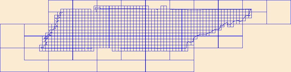
This data represents the map extent for current and historical USGS topographic maps for the United States and Territories, including 1 X 2 Degree, 1 X 1 Degree, 30 X 60 Minute, 15 X 15 Minute, 7.5 X 7.5 Minute, and 3.75 X 3.75 Minute. The grid was generated using ESRI ArcInfo GIS software.
Tags: Anderson,
Bedford,
Benton,
Bledsoe,
Blount, All tags...
Boundaries,
Bradley,
Campbell,
Cannon,
Carroll,
Carter,
Cheatham,
Chester,
Claiborne,
Clay,
Cocke,
Coffee,
Crockett,
Cumberland,
Davidson,
DeKalb,
Decatur,
Dickson,
Downloadable Data,
Dyer,
Esri File GeoDatabase 10,
Fayette,
Fentress,
FileGDB,
Franklin,
Gibson,
Giles,
Grainger,
Greene,
Grundy,
Hamblen,
Hamilton,
Hancock,
Hardeman,
Hardin,
Hawkins,
Haywood,
Henderson,
Henry,
Hickman,
Houston,
Humphreys,
Jackson,
Jefferson,
Johnson,
Knox,
Lake,
Lauderdale,
Lawrence,
Lewis,
Lincoln,
Loudon,
Macon,
Madison,
Map Indices,
Map Indices,
Map Indices,
Marion,
Marshall,
Maury,
McMinn,
McNairy,
Meigs,
Monroe,
Montgomery,
Moore,
Morgan,
Obion,
Overton,
Perry,
Pickett,
Polk,
Putnam,
Rhea,
Roane,
Robertson,
Rutherford,
Scott,
Sequatchie,
Sevier,
Shelby,
Smith,
State,
State,
Stewart,
Sullivan,
Sumner,
TN,
Tennessee,
Tipton,
Trousdale,
US,
Unicoi,
Union,
United States,
United States of America,
Van Buren,
Warren,
Washington,
Wayne,
Weakley,
White,
Williamson,
Wilson,
cells,
map indices,
polygon grid, Fewer tags
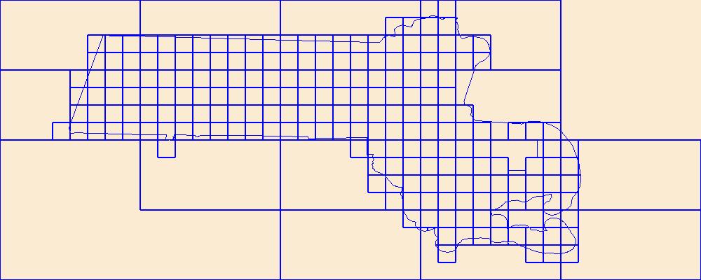
This data represents the map extent for current and historical USGS topographic maps for the United States and Territories, including 1 X 2 Degree, 1 X 1 Degree, 30 X 60 Minute, 15 X 15 Minute, 7.5 X 7.5 Minute, and 3.75 X 3.75 Minute. The grid was generated using ESRI ArcInfo GIS software.
Tags: Adair,
Alfalfa,
Atoka,
Beaver,
Beckham, All tags...
Blaine,
Boundaries,
Bryan,
Caddo,
Canadian,
Carter,
Cherokee,
Choctaw,
Cimarron,
Cleveland,
Coal,
Comanche,
Cotton,
Craig,
Creek,
Custer,
Delaware,
Dewey,
Downloadable Data,
Ellis,
Esri File GeoDatabase 10,
FileGDB,
Garfield,
Garvin,
Grady,
Grant,
Greer,
Harmon,
Harper,
Haskell,
Hughes,
Jackson,
Jefferson,
Johnston,
Kay,
Kingfisher,
Kiowa,
Latimer,
Le Flore,
Lincoln,
Logan,
Love,
Major,
Map Indices,
Map Indices,
Map Indices,
Marshall,
Mayes,
McClain,
McCurtain,
McIntosh,
Murray,
Muskogee,
Noble,
Nowata,
OK,
Okfuskee,
Oklahoma,
Oklahoma,
Okmulgee,
Osage,
Ottawa,
Pawnee,
Payne,
Pittsburg,
Pontotoc,
Pottawatomie,
Pushmataha,
Roger Mills,
Rogers,
Seminole,
Sequoyah,
State,
State,
Stephens,
Texas,
Tillman,
Tulsa,
US,
United States,
United States of America,
Wagoner,
Washington,
Washita,
Woods,
Woodward,
cells,
map indices,
polygon grid, Fewer tags
This data represents the map extent for current and historical USGS topographic maps for the United States and Territories, including 1 X 2 Degree, 1 X 1 Degree, 30 X 60 Minute, 15 X 15 Minute, 7.5 X 7.5 Minute, and 3.75 X 3.75 Minute. The grid was generated using ESRI ArcInfo GIS software.
Types: Citation;
Tags: Barnstable,
Berkshire,
Boundaries,
Bristol,
Downloadable Data, All tags...
Dukes,
Esri Shapefile nan,
Essex,
Franklin,
Hampden,
Hampshire,
MA,
Map Indices,
Map Indices,
Map Indices,
Massachusetts,
Middlesex,
Nantucket,
Norfolk,
Plymouth,
Shapefile,
State,
State,
Suffolk,
US,
United States,
United States of America,
Worcester,
cells,
map indices,
polygon grid, Fewer tags
This data represents the map extent for current and historical USGS topographic maps for the United States and Territories, including 1 X 2 Degree, 1 X 1 Degree, 30 X 60 Minute, 15 X 15 Minute, 7.5 X 7.5 Minute, and 3.75 X 3.75 Minute. The grid was generated using ESRI ArcInfo GIS software.
Tags: Bernalillo,
Boundaries,
Catron,
Chaves,
Cibola, All tags...
Colfax,
Curry,
De Baca,
Downloadable Data,
Doña Ana,
Eddy,
Esri File GeoDatabase 10,
FileGDB,
Grant,
Guadalupe,
Harding,
Hidalgo,
Lea,
Lincoln,
Los Alamos,
Luna,
Map Indices,
Map Indices,
Map Indices,
McKinley,
Mora,
NM,
New Mexico,
Otero,
Quay,
Rio Arriba,
Roosevelt,
San Juan,
San Miguel,
Sandoval,
Santa Fe,
Sierra,
Socorro,
State,
State,
Taos,
Torrance,
US,
Union,
United States,
United States of America,
Valencia,
cells,
map indices,
polygon grid, Fewer tags
This data represents the map extent for current and historical USGS topographic maps for the United States and Territories, including 1 X 2 Degree, 1 X 1 Degree, 30 X 60 Minute, 15 X 15 Minute, 7.5 X 7.5 Minute, and 3.75 X 3.75 Minute. The grid was generated using ESRI ArcInfo GIS software.
Types: Citation;
Tags: Boundaries,
Downloadable Data,
Esri Shapefile nan,
HI,
Hawaii, All tags...
Hawaii,
Honolulu,
Kalawao,
Kauai,
Map Indices,
Map Indices,
Map Indices,
Maui,
Shapefile,
State,
State,
US,
United States,
United States of America,
cells,
map indices,
polygon grid, Fewer tags
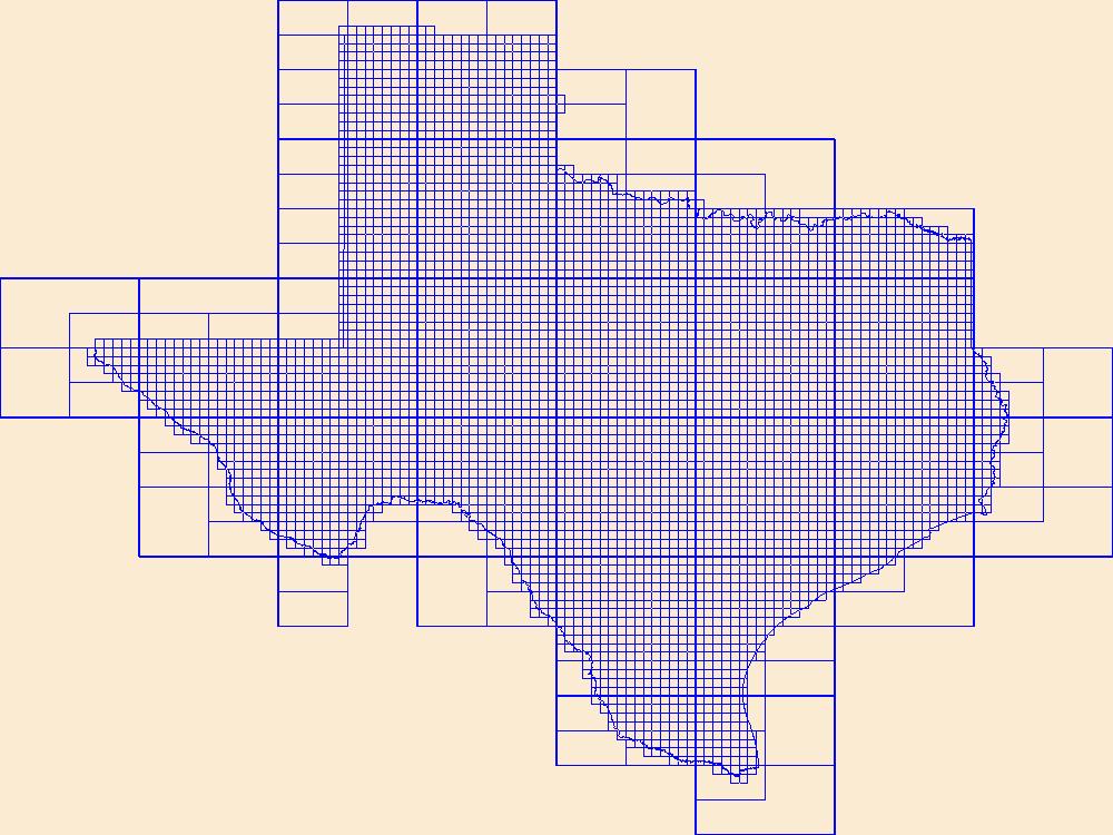
This data represents the map extent for current and historical USGS topographic maps for the United States and Territories, including 1 X 2 Degree, 1 X 1 Degree, 30 X 60 Minute, 15 X 15 Minute, 7.5 X 7.5 Minute, and 3.75 X 3.75 Minute. The grid was generated using ESRI ArcInfo GIS software.
Types: Citation;
Tags: Anderson,
Andrews,
Angelina,
Aransas,
Archer, All tags...
Armstrong,
Atascosa,
Austin,
Bailey,
Bandera,
Bastrop,
Baylor,
Bee,
Bell,
Bexar,
Blanco,
Borden,
Bosque,
Boundaries,
Bowie,
Brazoria,
Brazos,
Brewster,
Briscoe,
Brooks,
Brown,
Burleson,
Burnet,
Caldwell,
Calhoun,
Callahan,
Cameron,
Camp,
Carson,
Cass,
Castro,
Chambers,
Cherokee,
Childress,
Clay,
Cochran,
Coke,
Coleman,
Collin,
Collingsworth,
Colorado,
Comal,
Comanche,
Concho,
Cooke,
Coryell,
Cottle,
Crane,
Crockett,
Crosby,
Culberson,
Dallam,
Dallas,
Dawson,
DeWitt,
Deaf Smith,
Delta,
Denton,
Dickens,
Dimmit,
Donley,
Downloadable Data,
Duval,
Eastland,
Ector,
Edwards,
El Paso,
Ellis,
Erath,
Esri Shapefile nan,
Falls,
Fannin,
Fayette,
Fisher,
Floyd,
Foard,
Fort Bend,
Franklin,
Freestone,
Frio,
Gaines,
Galveston,
Garza,
Gillespie,
Glasscock,
Goliad,
Gonzales,
Gray,
Grayson,
Gregg,
Grimes,
Guadalupe,
Hale,
Hall,
Hamilton,
Hansford,
Hardeman,
Hardin,
Harris,
Harrison,
Hartley,
Haskell,
Hays,
Hemphill,
Henderson,
Hidalgo,
Hill,
Hockley,
Hood,
Hopkins,
Houston,
Howard,
Hudspeth,
Hunt,
Hutchinson,
Irion,
Jack,
Jackson,
Jasper,
Jeff Davis,
Jefferson,
Jim Hogg,
Jim Wells,
Johnson,
Jones,
Karnes,
Kaufman,
Kendall,
Kenedy,
Kent,
Kerr,
Kimble,
King,
Kinney,
Kleberg,
Knox,
La Salle,
Lamar,
Lamb,
Lampasas,
Lavaca,
Lee,
Leon,
Liberty,
Limestone,
Lipscomb,
Live Oak,
Llano,
Loving,
Lubbock,
Lynn,
Madison,
Map Indices,
Map Indices,
Map Indices,
Marion,
Martin,
Mason,
Matagorda,
Maverick,
McCulloch,
McLennan,
McMullen,
Medina,
Menard,
Midland,
Milam,
Mills,
Mitchell,
Montague,
Montgomery,
Moore,
Morris,
Motley,
Nacogdoches,
Navarro,
Newton,
Nolan,
Nueces,
Ochiltree,
Oldham,
Orange,
Palo Pinto,
Panola,
Parker,
Parmer,
Pecos,
Polk,
Potter,
Presidio,
Rains,
Randall,
Reagan,
Real,
Red River,
Reeves,
Refugio,
Roberts,
Robertson,
Rockwall,
Runnels,
Rusk,
Sabine,
San Augustine,
San Jacinto,
San Patricio,
San Saba,
Schleicher,
Scurry,
Shackelford,
Shapefile,
Shelby,
Sherman,
Smith,
Somervell,
Starr,
State,
State,
Stephens,
Sterling,
Stonewall,
Sutton,
Swisher,
TX,
Tarrant,
Taylor,
Terrell,
Terry,
Texas,
Throckmorton,
Titus,
Tom Green,
Travis,
Trinity,
Tyler,
US,
United States,
United States of America,
Upshur,
Upton,
Uvalde,
Val Verde,
Van Zandt,
Victoria,
Walker,
Waller,
Ward,
Washington,
Webb,
Wharton,
Wheeler,
Wichita,
Wilbarger,
Willacy,
Williamson,
Wilson,
Winkler,
Wise,
Wood,
Yoakum,
Young,
Zapata,
Zavala,
cells,
map indices,
polygon grid, Fewer tags
|
|

