Filters: Tags: canada (X)
899 results (51ms)|
Filters
Date Range
Extensions Types Contacts
Categories
Tag Types
|
The Geologic Map Index of Alaska (Map Index) is an online, interactive web mapping application that provides access to an actively growing geographic index of geology-related maps of Alaska and adjacent areas. This online research tool provides the locations and outlines of most DGGS and U.S. Geological Survey (USGS) geologic and geophysical maps of Alaska in a single, interactive web map. It allows searches of the map database by geographic area of interest, keywords, themes, publishing agency, dates, and other criteria. The search results provide links to DGGS's comprehensive, multi-agency publications database, where users may view and download publications for free. No other geographic index of Alaska geologic...
During 2009, the Alaska Division of Geological & Geophysical Surveys continued a program, begun in 2006, of reconnaissance mapping of surficial geology in the proposed natural-gas pipeline corridor through the upper Tanana River valley. The study area is a 12-mi-wide (19.3-km-wide) area that straddles the Alaska Highway from the western boundaries of the Tanacross B-3 and A-3 quadrangles near Tetlin Junction eastward to the eastern boundaries of the Nabesna D-1 and C-1 quadrangles along the Canada border. Mapping during 2008-2009 in the Tanacross and Nabesna quadrangles linked with the mapping completed in the Tanacross, Big Delta and Mt. Hayes quadrangles in 2006-2008. Surficial geology was initially mapped in...
Since the 1970s, Canada has formulated various strategy measures to accelerate the development of energy efficiency systems and renewable energy technologies and has made significant progress. "From 1990 to 2003, Canada's energy efficiency improved by an estimated 13%, or 883.3 petajoules, saving Canadians almost $13.4 billion in 2003 alone and reducing annual greenhouse gas emissions by 52.3 megatonnes". In 2000, about 17% of Canadian primary energy supply came from renewable sources (with hydroelectric, combustible renewables and waste). Canada is a leader in devising and implementing energy options for sustainable development. However, the nation still has great scope for furthering energy efficiency and more...
Categories: Publication;
Types: Citation;
Tags: Canada,
Energy efficiency,
Renewable energy,
Sustainable energy strategies
The 'REA Gold Corporation Corporate Profile and Annual Report 1983' file is part of the A. F. Budge Mining Ltd. Mining collection. A. F. Budge Mining Ltd., a British company owned by Tony Budge, controlled properties across several western U. S. states and northern Mexico. The company was active in Arizona during the 1980s and into the early 1990s. The collection consists of economic geologic information including maps, logs, reports and records. A few properties make up most of the collection: Vulture, United Verde Extension and Korn Kob.
These data represent simulated soil temperature and moisture conditions for current climate, and for future climate represented by all available climate models at two time periods during the 21st century. These data were used to: 1) quantify the direction and magnitude of expected changes in several measures of soil temperature and soil moisture, including the key variables used to distinguish the regimes used in the R and R categories; 2) assess how these changes will impact the geographic distribution of soil temperature and moisture regimes; and 3) explore the implications for using R and R categories for estimating future ecosystem resilience and resistance.

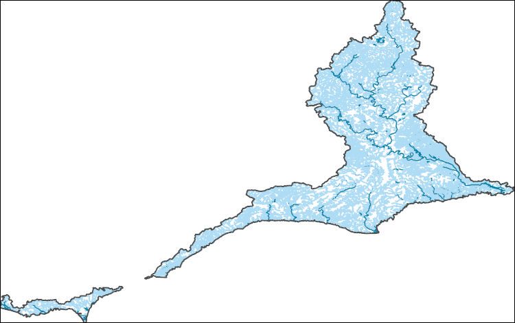
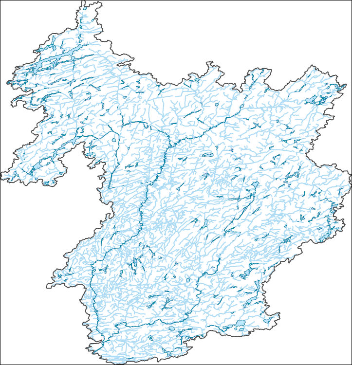
The National Hydrography Dataset (NHD) is a feature-based database that interconnects and uniquely identifies the stream segments or reaches that make up the nation's surface water drainage system. NHD data was originally developed at 1:100,000-scale and exists at that scale for the whole country. This high-resolution NHD, generally developed at 1:24,000/1:12,000 scale, adds detail to the original 1:100,000-scale NHD. (Data for Alaska, Puerto Rico and the Virgin Islands was developed at high-resolution, not 1:100,000 scale.) Local resolution NHD is being developed where partners and data exist. The NHD contains reach codes for networked features, flow direction, names, and centerline representations for areal water...

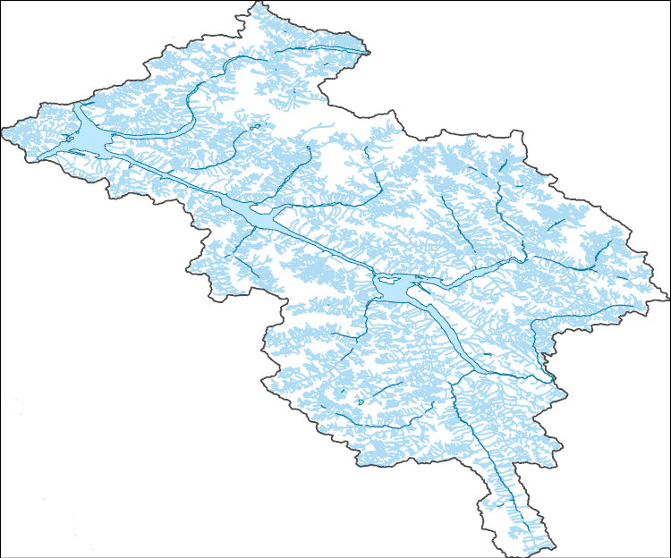
The National Hydrography Dataset (NHD) is a feature-based database that interconnects and uniquely identifies the stream segments or reaches that make up the nation's surface water drainage system. NHD data was originally developed at 1:100,000-scale and exists at that scale for the whole country. This high-resolution NHD, generally developed at 1:24,000/1:12,000 scale, adds detail to the original 1:100,000-scale NHD. (Data for Alaska, Puerto Rico and the Virgin Islands was developed at high-resolution, not 1:100,000 scale.) Local resolution NHD is being developed where partners and data exist. The NHD contains reach codes for networked features, flow direction, names, and centerline representations for areal water...

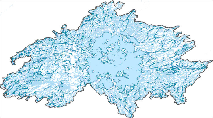
The National Hydrography Dataset (NHD) is a feature-based database that interconnects and uniquely identifies the stream segments or reaches that make up the nation's surface water drainage system. NHD data was originally developed at 1:100,000-scale and exists at that scale for the whole country. This high-resolution NHD, generally developed at 1:24,000/1:12,000 scale, adds detail to the original 1:100,000-scale NHD. (Data for Alaska, Puerto Rico and the Virgin Islands was developed at high-resolution, not 1:100,000 scale.) Local resolution NHD is being developed where partners and data exist. The NHD contains reach codes for networked features, flow direction, names, and centerline representations for areal water...
The Mohorovicic discontinuity or 'Moho' maps the boundary between the earth's crust and mantle and is defined by an abrupt change in seismic velocity due to changes in the density of rocks between the crust and mantle. GeoTIFF grids that map depth to Moho (crustal thickness) for the United States and Canada, and for Australia are provided in this report and were used as evidential layers in developing prospectivity models for basin-hosted Pb-Zn mineralization (Lawley and others, 2022). A composite grid of Moho depths across the United States and Canada was created using data from Shen and Ritzwoller (2016) for the conterminous United States, from Zhang and others (2019) for Alaska, and from Schetselaar and Snyder...
Climate change over the past century has altered vegetation community composition and species distributions across rangelands in the western United States. The scale and magnitude of climatic influences are largely unknown. We used fractional component cover data for rangeland functional groups and weather data from the 1985 to 2023 reference period in conjunction with soils and topography data to develop empirical models describing the spatio-temporal variation in component cover. To investigate the ramifications of future change across the western US, we extended models based on historical relationships over the reference period to model landscape effects based on future weather conditions from two emissions scenarios...
The National Hydrography Dataset (NHD) is a feature-based database that interconnects and uniquely identifies the stream segments or reaches that make up the nation's surface water drainage system. NHD data was originally developed at 1:100,000-scale and exists at that scale for the whole country. This high-resolution NHD, generally developed at 1:24,000/1:12,000 scale, adds detail to the original 1:100,000-scale NHD. (Data for Alaska, Puerto Rico and the Virgin Islands was developed at high-resolution, not 1:100,000 scale.) Local resolution NHD is being developed where partners and data exist. The NHD contains reach codes for networked features, flow direction, names, and centerline representations for areal water...
The National Hydrography Dataset (NHD) is a feature-based database that interconnects and uniquely identifies the stream segments or reaches that make up the nation's surface water drainage system. NHD data was originally developed at 1:100,000-scale and exists at that scale for the whole country. This high-resolution NHD, generally developed at 1:24,000/1:12,000 scale, adds detail to the original 1:100,000-scale NHD. (Data for Alaska, Puerto Rico and the Virgin Islands was developed at high-resolution, not 1:100,000 scale.) Local resolution NHD is being developed where partners and data exist. The NHD contains reach codes for networked features, flow direction, names, and centerline representations for areal water...
The USGS Upper Midwest Environmental Sciences Center developed a Monarch Relevant Land Cover data set covering the area of Canada. We used the 2010 land cover data set produced by the tri-national North American Land Change Monitoring System (NALCMS) and supported by the Commission for Environmental Cooperation (CEC) that depicts year 2010 land cover across North America at 30-meter spatial resolution, and incorporated additional spatially-explicit information to develop this land cover map. Additional sources of information included 2004 railroad data provided by The Atlas of Canada and the CEC, 2017 roads data provided by Statistics Canada, 2017 protected areas data provided by the CEC, and 2016 Canada provincial/territory...
At recent technical conferences, many coal geoscientists in academia and government institutions as well as in industry organizations have expressed concern about the dwindling number of students and young staff members interested in careers in coal geoscience. To better understand what is driving these trends and to identify potential ways that the community can increase interest and participation in coal geoscience, two different surveys were sent to 94 coal geoscientists who were current or past members of The Society of Organic Petrology (TSOP) in February 2020. As the trends and perceptions in industry and government organizations may be different than in universities, one distinct survey was sent to members...
These data were compiled using a new multivariate matching algorithm that transfers simulated soil moisture conditions (Bradford et al. 2020) from an original 10-km resolution to a 30-arcsec spatial resolution. Also, these data are a supplement to a previously published journal article (Bradford et al., 2020) and USGS data release (Bradford and Schlaepfer, 2020). The objectives of our study were to (1) characterize geographic patterns in ecological drought under historical climate, (2) quantify the direction and magnitude of projected responses in ecological drought under climate change, (3) identify areas and drought metrics with projected changes that are robust across climate models for a representative set of...
OBIS-USA brings together marine biological occurrence data – recorded observations of identifiable marine species at a known time and place, collected primarily from U.S. Waters or with U.S. funding. Coordinated by the Science Analytics and Synthesis (SAS) Program of the United States Geological Survey (USGS), OBIS-USA, strives to meet national data integration and dissemination needs for marine data about organisms and ecosystems. OBIS-USA is part of an international data sharing network (Ocean Biodiversity Information System, OBIS) coordinated by the Intergovernmental Oceanographic Commission, of UNESCO (United Nations Educational, Science and Cultural Organization) International Oceanographic Data and Information...
USGS Historical Quadrangle in GeoPDF.
False positive occupancy analysis predictions with model uncertainty based on summertime data provided to support the three bat species status assessment (SSA) for Myotis lucifigus (MYLU), Myotis septentrionalis (MYSE), and Perimyotis subflavus (PESU). The objectives outlined by the Fish and Wildlife Service's SSA team were to estimate summertime distributions across the entire species range. Statistical analysis included five types of response data requested from the North American Bat Monitoring Program database (NABat): automatically identified stationary acoustic calls, manually vetted stationary acoustic calls, automatically identified mobile acoustic calls, manually vetted mobile acoustic calls, and capture...
The National Hydrography Dataset (NHD) is a feature-based database that interconnects and uniquely identifies the stream segments or reaches that make up the nation's surface water drainage system. NHD data was originally developed at 1:100,000-scale and exists at that scale for the whole country. This high-resolution NHD, generally developed at 1:24,000/1:12,000 scale, adds detail to the original 1:100,000-scale NHD. (Data for Alaska, Puerto Rico and the Virgin Islands was developed at high-resolution, not 1:100,000 scale.) Local resolution NHD is being developed where partners and data exist. The NHD contains reach codes for networked features, flow direction, names, and centerline representations for areal water...
The National Hydrography Dataset (NHD) is a feature-based database that interconnects and uniquely identifies the stream segments or reaches that make up the nation's surface water drainage system. NHD data was originally developed at 1:100,000-scale and exists at that scale for the whole country. This high-resolution NHD, generally developed at 1:24,000/1:12,000 scale, adds detail to the original 1:100,000-scale NHD. (Data for Alaska, Puerto Rico and the Virgin Islands was developed at high-resolution, not 1:100,000 scale.) Local resolution NHD is being developed where partners and data exist. The NHD contains reach codes for networked features, flow direction, names, and centerline representations for areal water...
|

|
