Filters: Tags: inland (X) > partyWithName: U.S. Geological Survey (X)
3 results (46ms)|
Filters
Date Range
Extensions Types
Contacts
Categories Tag Types Tag Schemes |
Inland fishes provide important ecosystem services to communities worldwide and are especially vulnerable to the impacts of climate change. Fish respond to climate change in diverse and nuanced ways which creates challenges for practitioners of fish conservation, climate change adaptation, and management. Although climate change is known to affect fish globally, a comprehensive online, public database of how climate change has impacted inland fishes worldwide and adaptation or management practices that may address these impacts does not exist. We conducted an extensive, systematic primary literature review to identify peer-reviewed journal publications describing projected and documented examples of climate change...
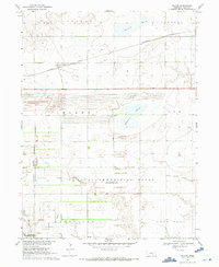
USGS Historical Quadrangle in GeoPDF.
The U.S. Geological Survey (USGS) Inland Bathymetric and Topobathymetric Survey Inventory, v. 3 includes a survey records inventory and dataset footprints (when available) for inland bathymetric and topobathymetric surveys published by the USGS for the conterminous US, Alaska, and Puerto Rico. Survey records include water feature, state, publication title, data vintage, mission, online linkage to reports and datasets, collection methods, survey and survey product resolution, datums, geoid, and accuracy information if known. This database, identified as the USGS Inland Bathymetric and Topobathymetric Survey Inventory, v.3, Update, has been approved for release by the U.S. Geological Survey (USGS). Although this database...
Categories: Data;
Types: ArcGIS REST Map Service,
ArcGIS Service Definition,
Downloadable,
Map Service,
OGC WFS Layer,
OGC WMS Layer,
OGC WMS Service,
Shapefile;
Tags: Acoustic Sonar,
Bathymetry,
Bathymetry,
Coastal Zone,
Conterminous United States (CONUS),
|

|
